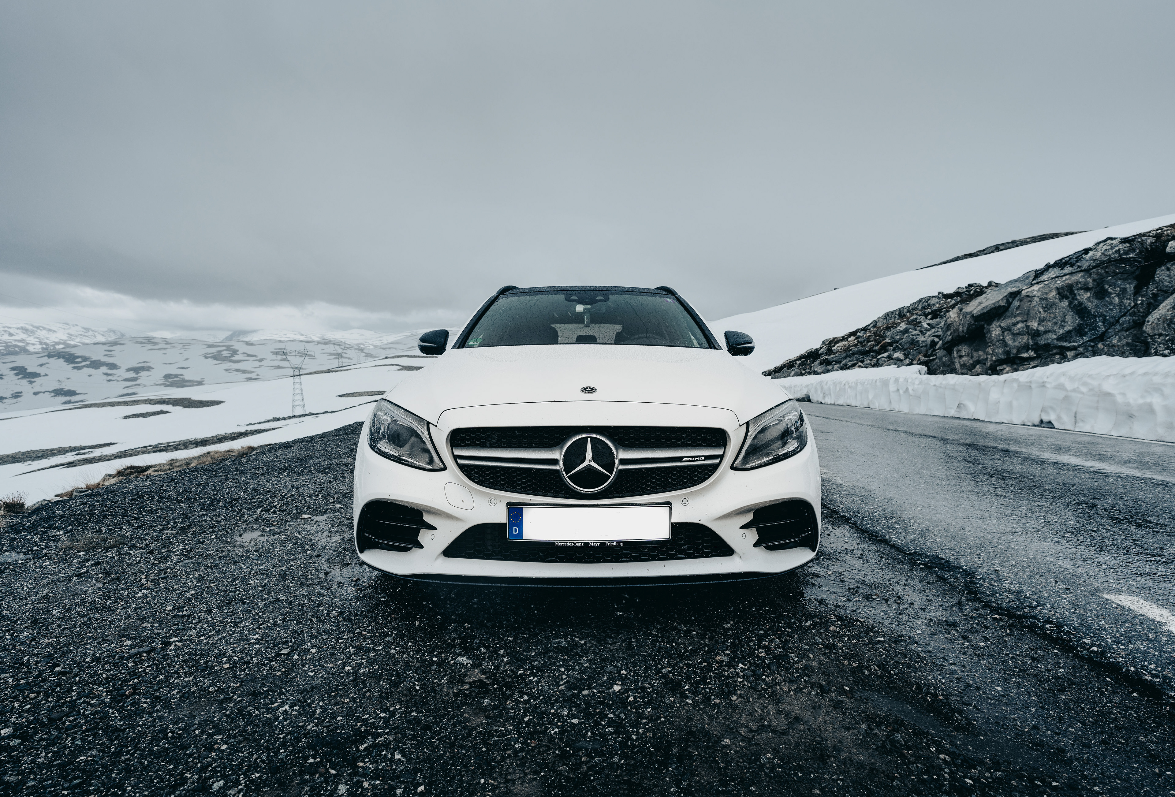
My car on the Aurlandsfjellet mountain pass in Norway
Trip Summary and Planning
Starting out in the North of the Netherlands, we took an overnight car ferry directly to the South of Norway before the actual real driving part of the road trip started. On this 2-week trip we covered approximately ∼4.500 kilometers / ∼2.800 miles, that's excluding at least 700 kilometers from the Netherlands to Germany. At the time, we took the ferry from Eemshaven, the Netherlands (overnight) to Kristiansand in Norway. On our first day we traveled to Stavanger and stayed there for 2 nights. We then continued to Odda, where we stayed for 3 nights. From Odda we drove to Bergen, where we stayed for 2 nights. We then continued North to near Flåm, where we also stayed 2 nights. From Flåm we drove further North to Stranda, where we stayed 3 nights. From Stranda we started our journey back South and then stayed 2 nights in Oslo. Via Sweden we drove to Copenhagen, Denmark, where we also stayed 2 nights. We then drove home to the South of Germany from Copenhagen on a single day.
Cities, towns and sights visited
Places visited listed by country and chronologically
Norway Denmark
Kristiansand Copenhagen
Lysebotn
Stavanger
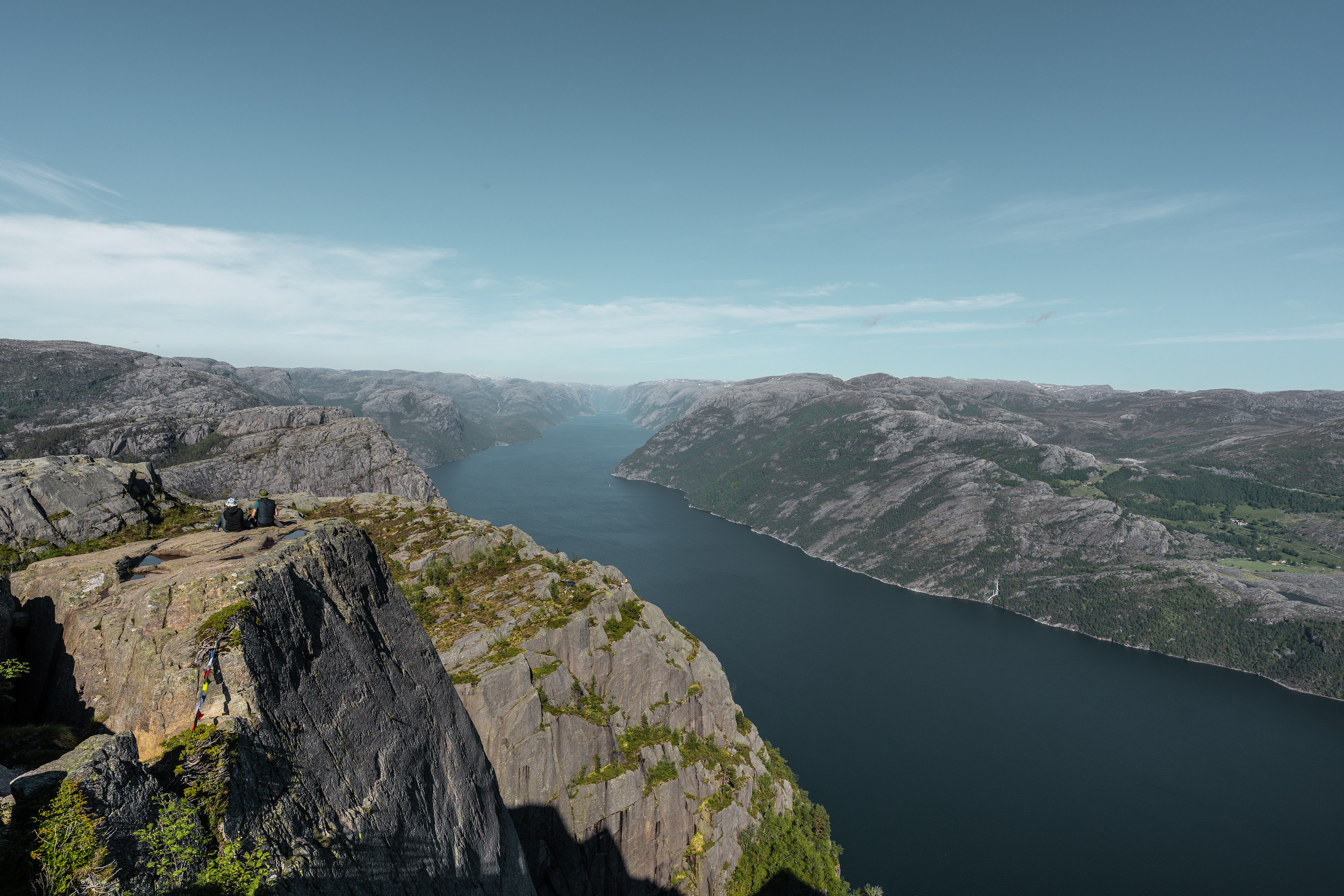
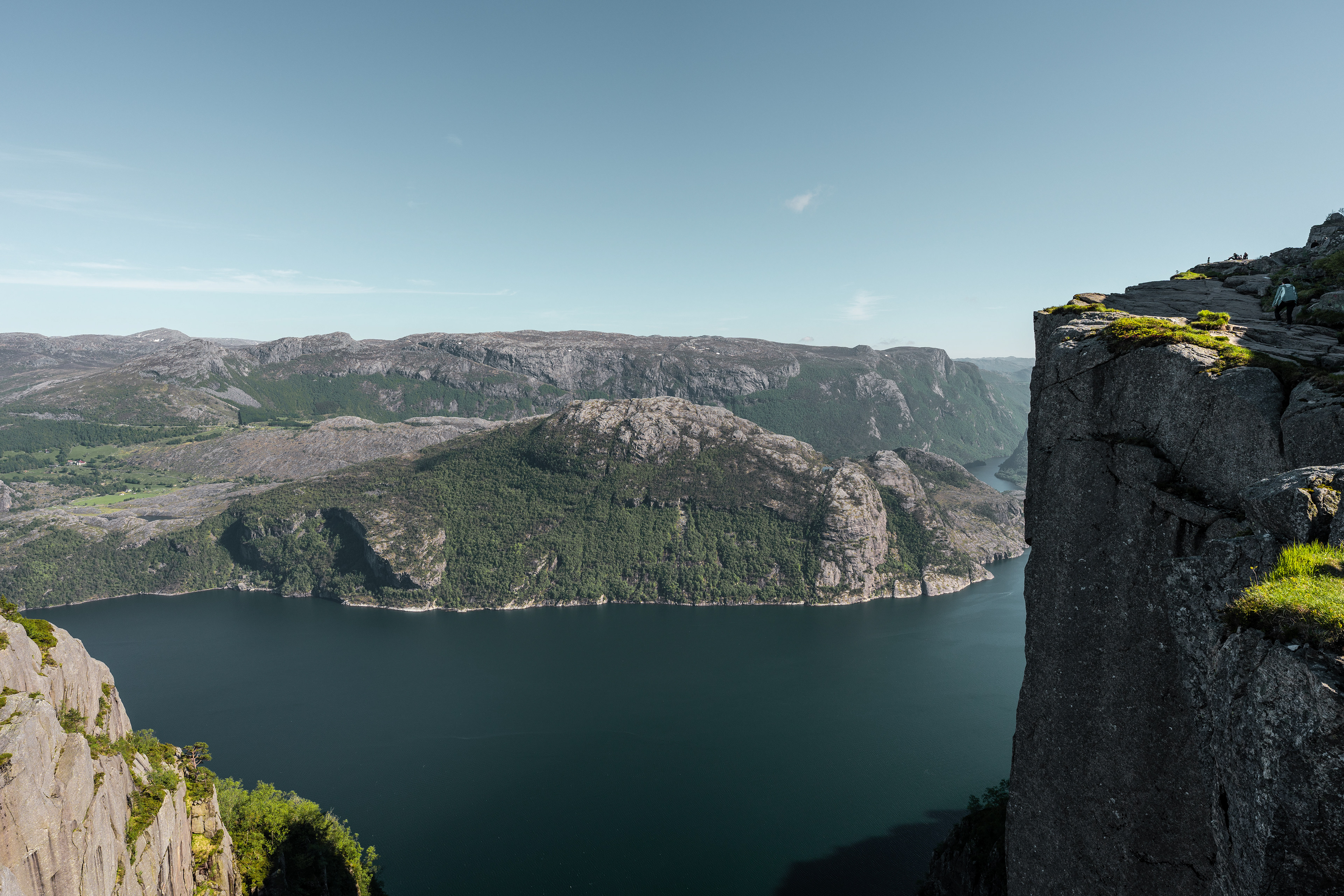
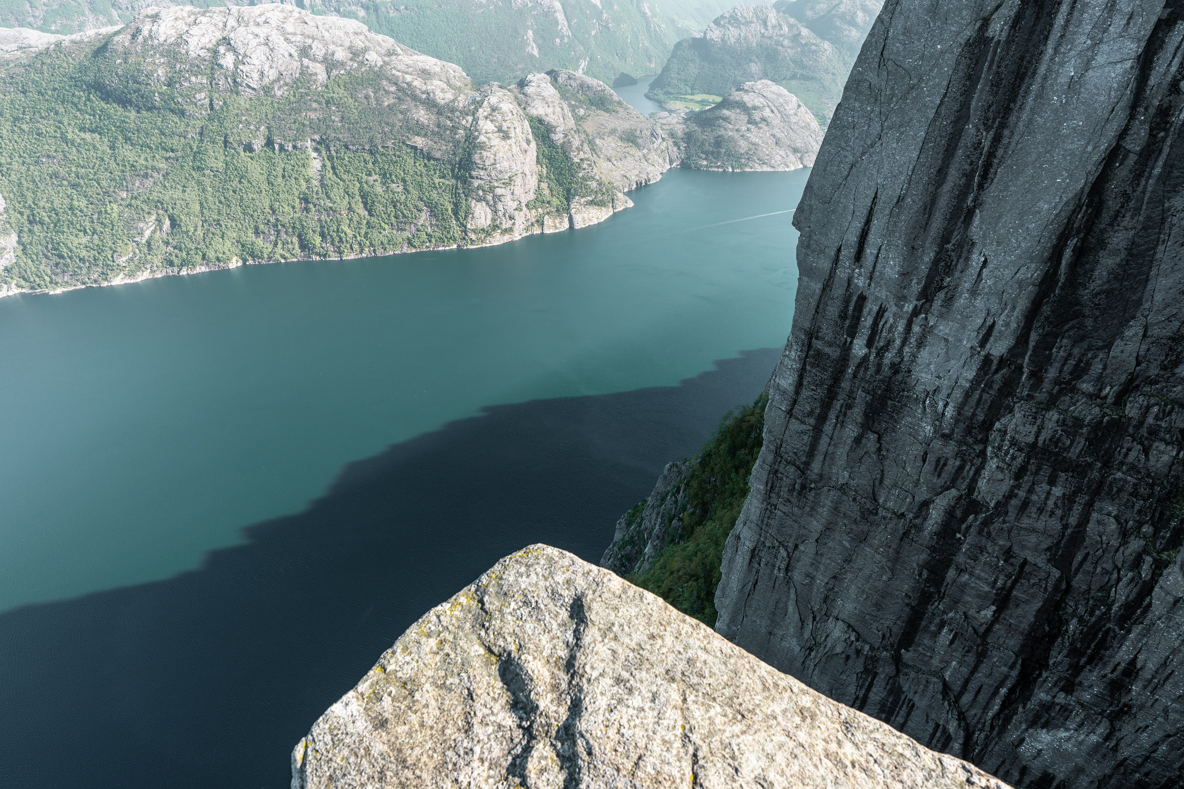
Preikestolen
Låtefossen
Odda
Trolltunga
Buarbreen Glacier
Eidfjord
Vøringsfossen
Skjervsfossen
Steinsdalsfossen
Bergen
Nærøyfjorden
Undredal
Flåm + Flåmbanen
Stegastein Viewpoint
Aurlandsfjellet
Lærdal
Borgund Stave Church
Bøyabreen Glacier
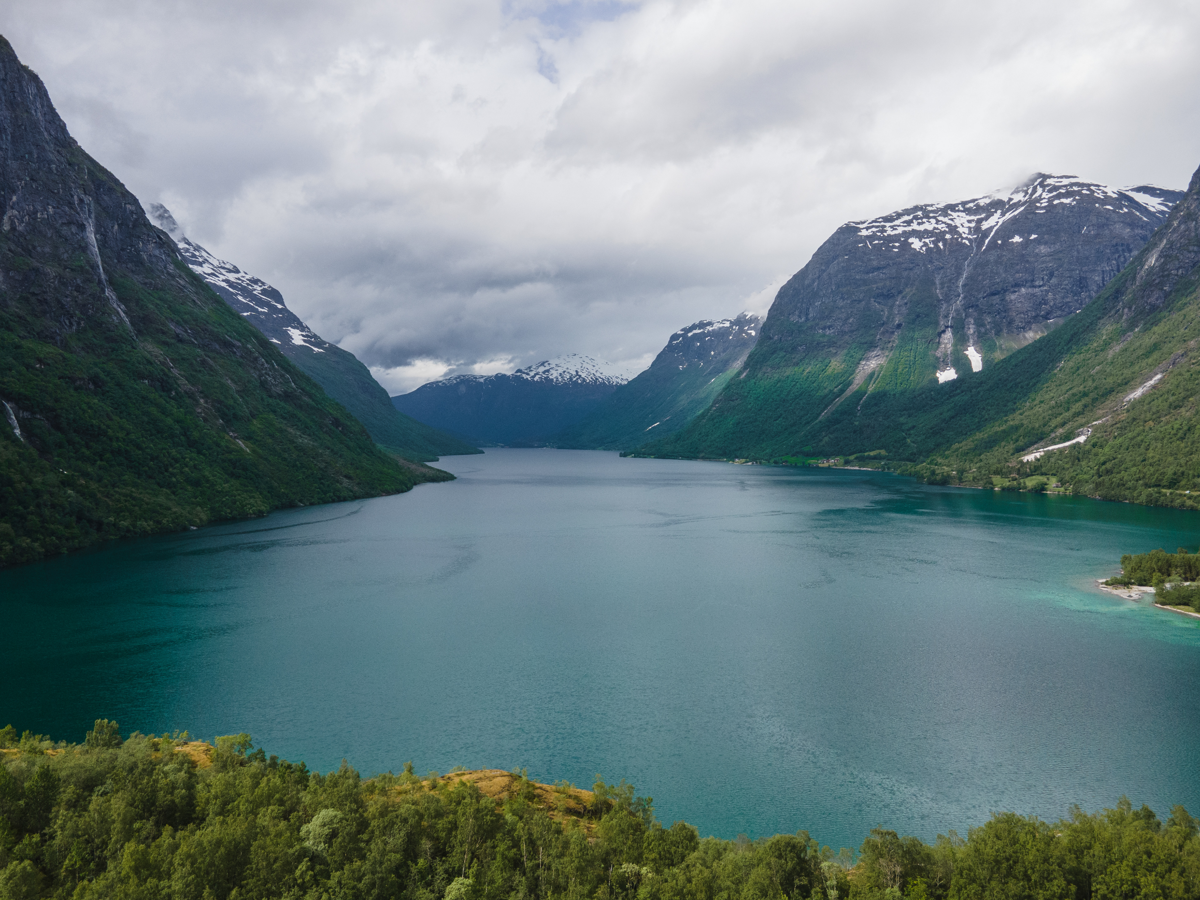
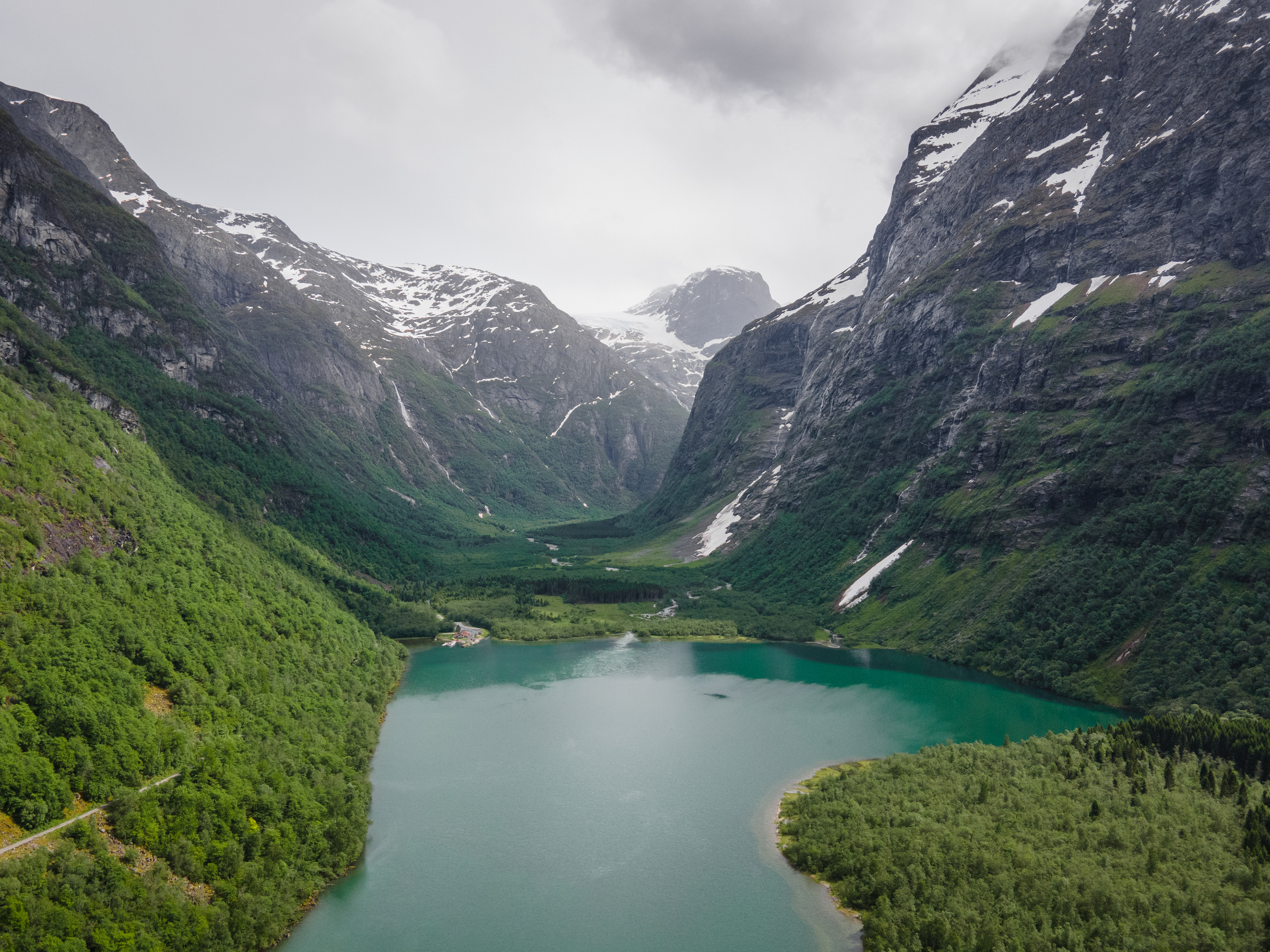
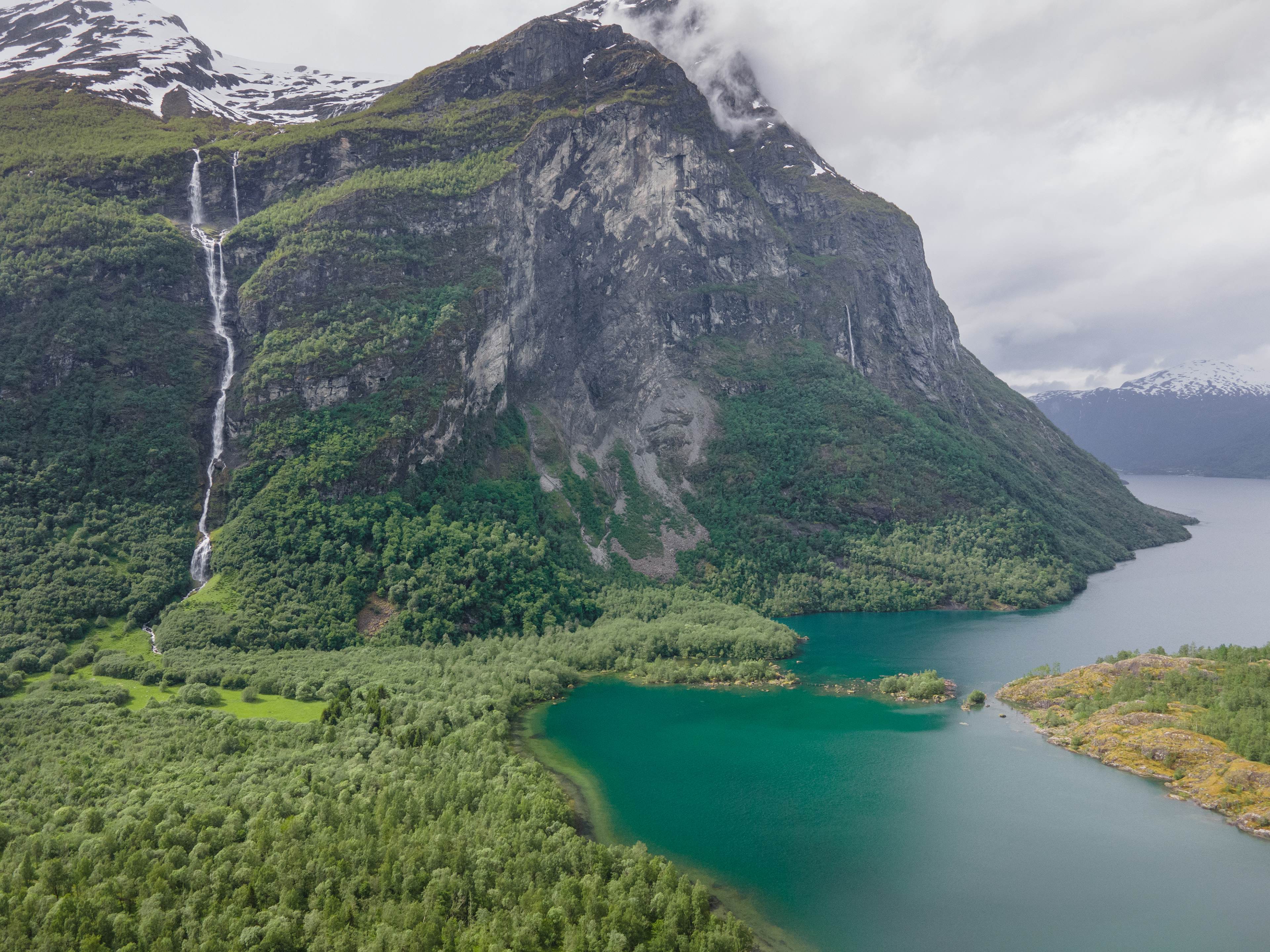
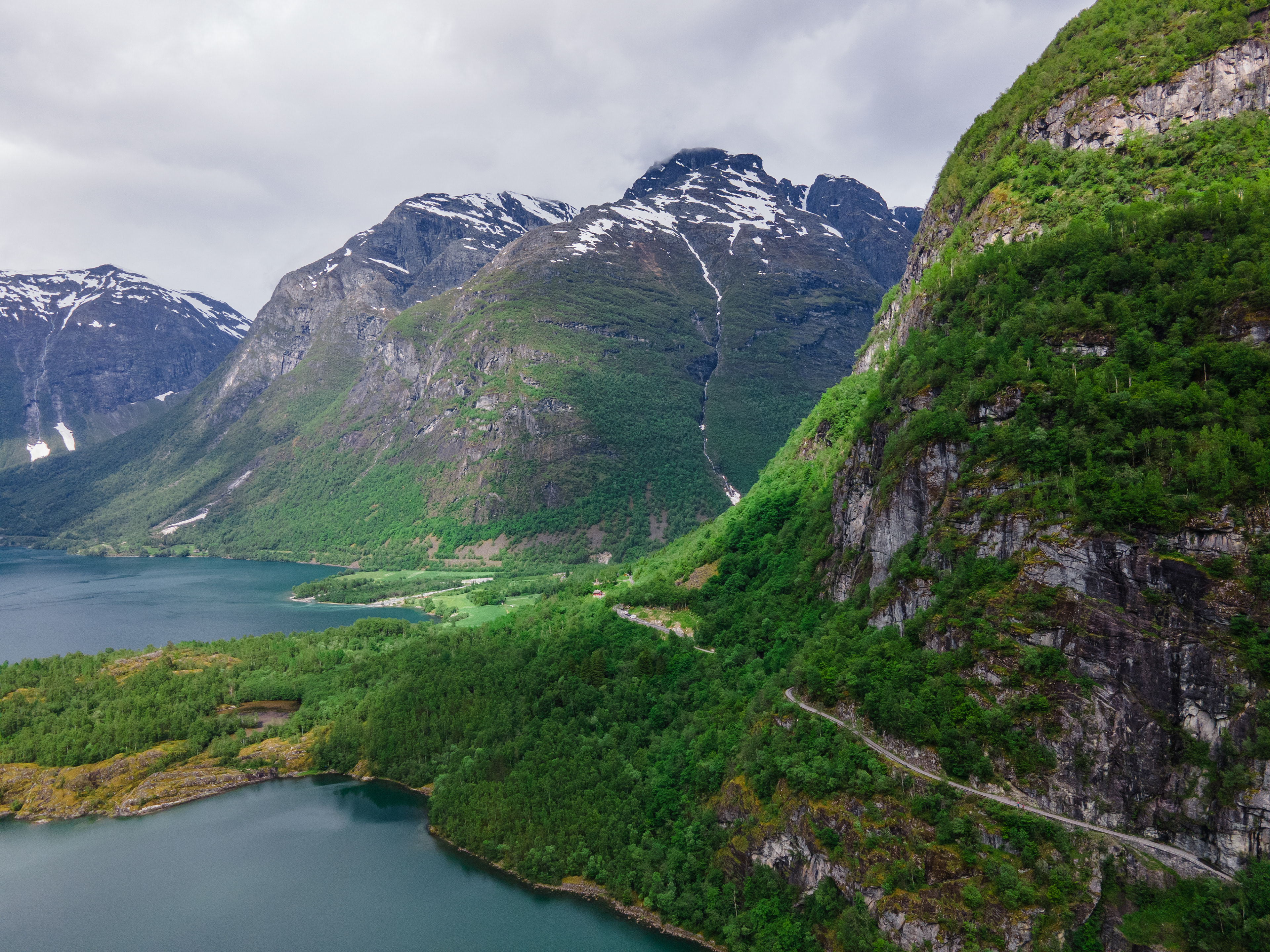
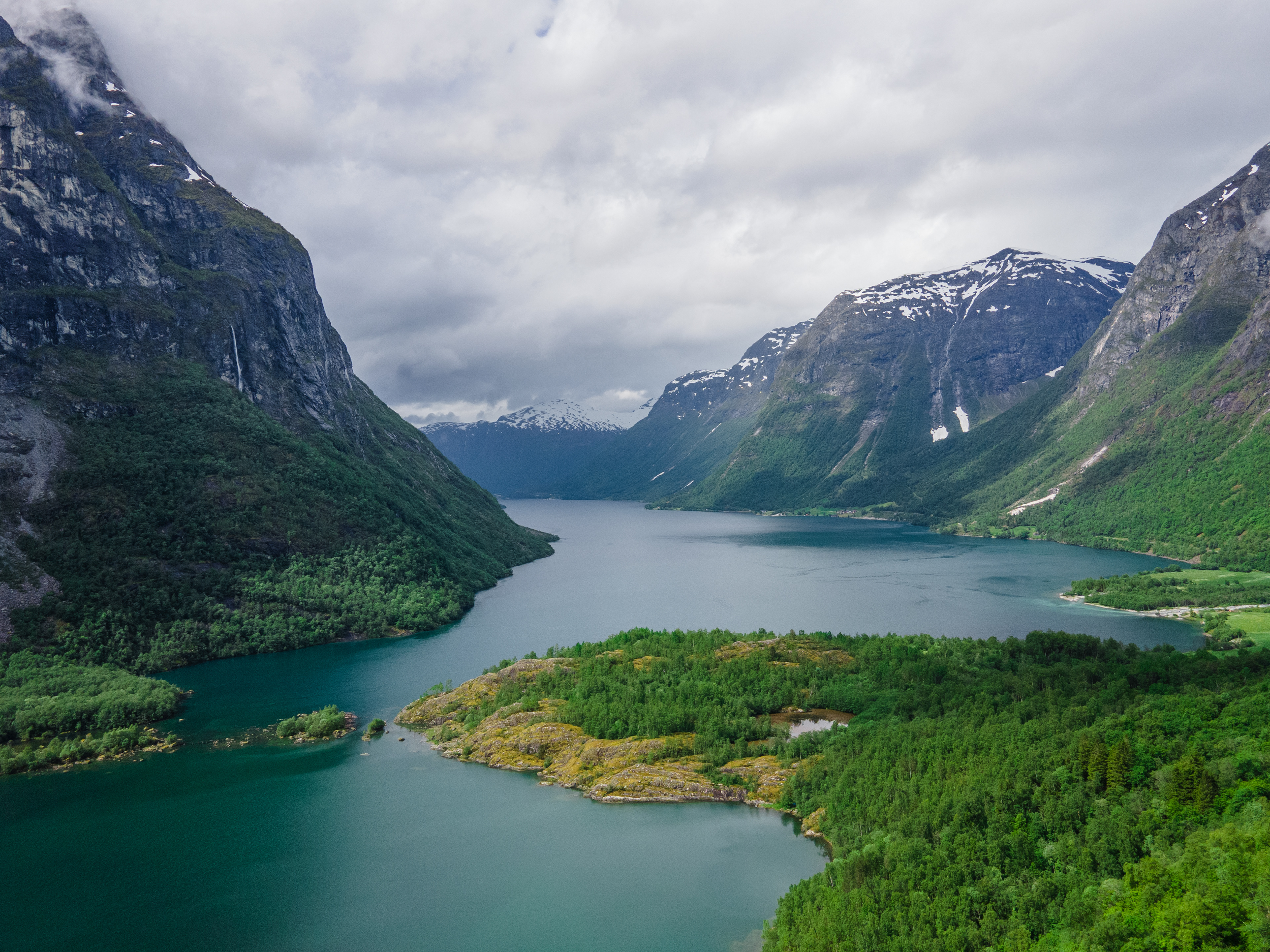
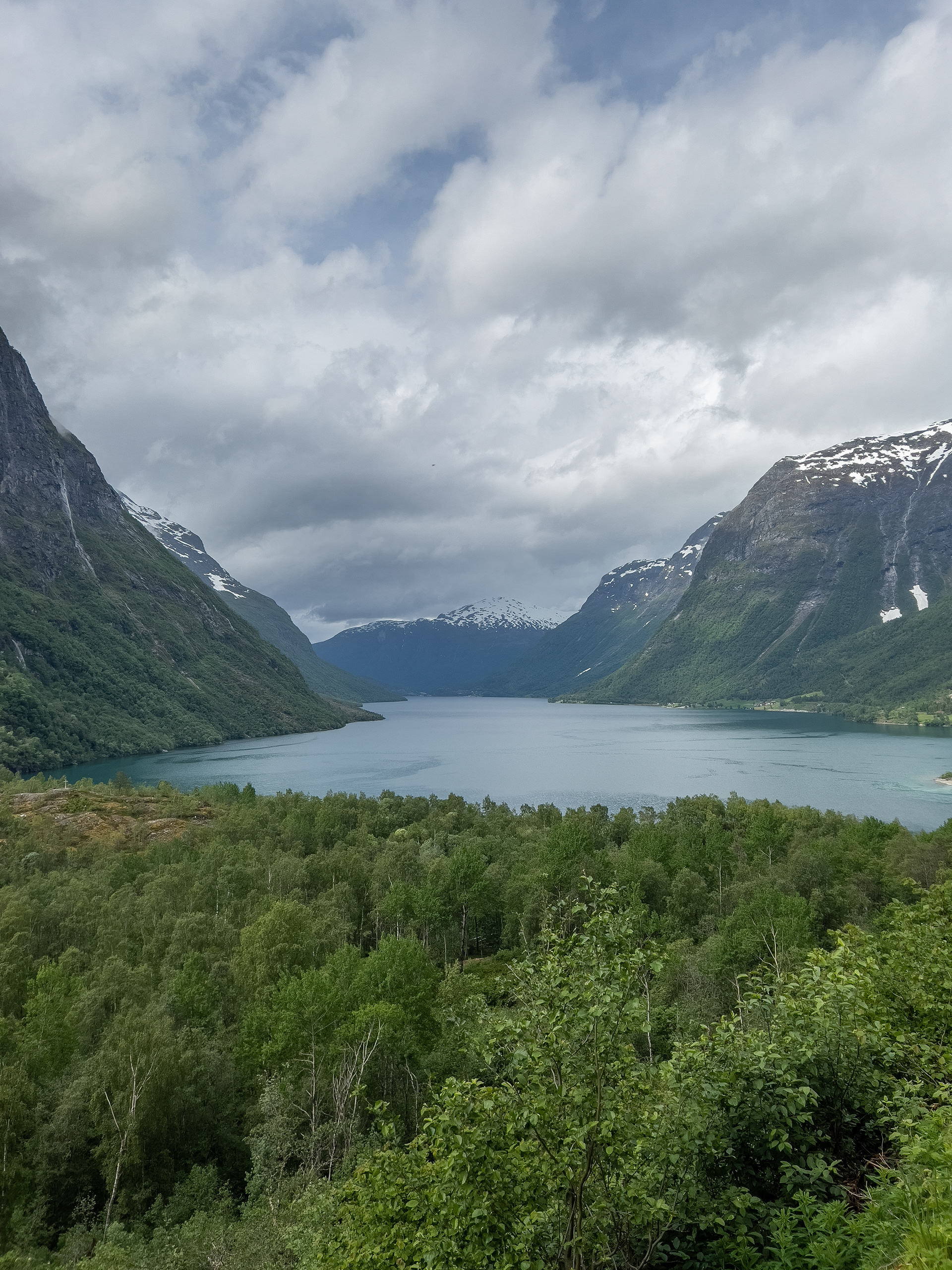
Lovatnet
Stranda
Ålesund
Geiranger
Djupvatnet
Øvstefossen
Geirangerfjord
Gudbrandsjuvet
Trollstigen
Oslo
Ferry to Kristiansand
The perfect way to start a trip to Norway
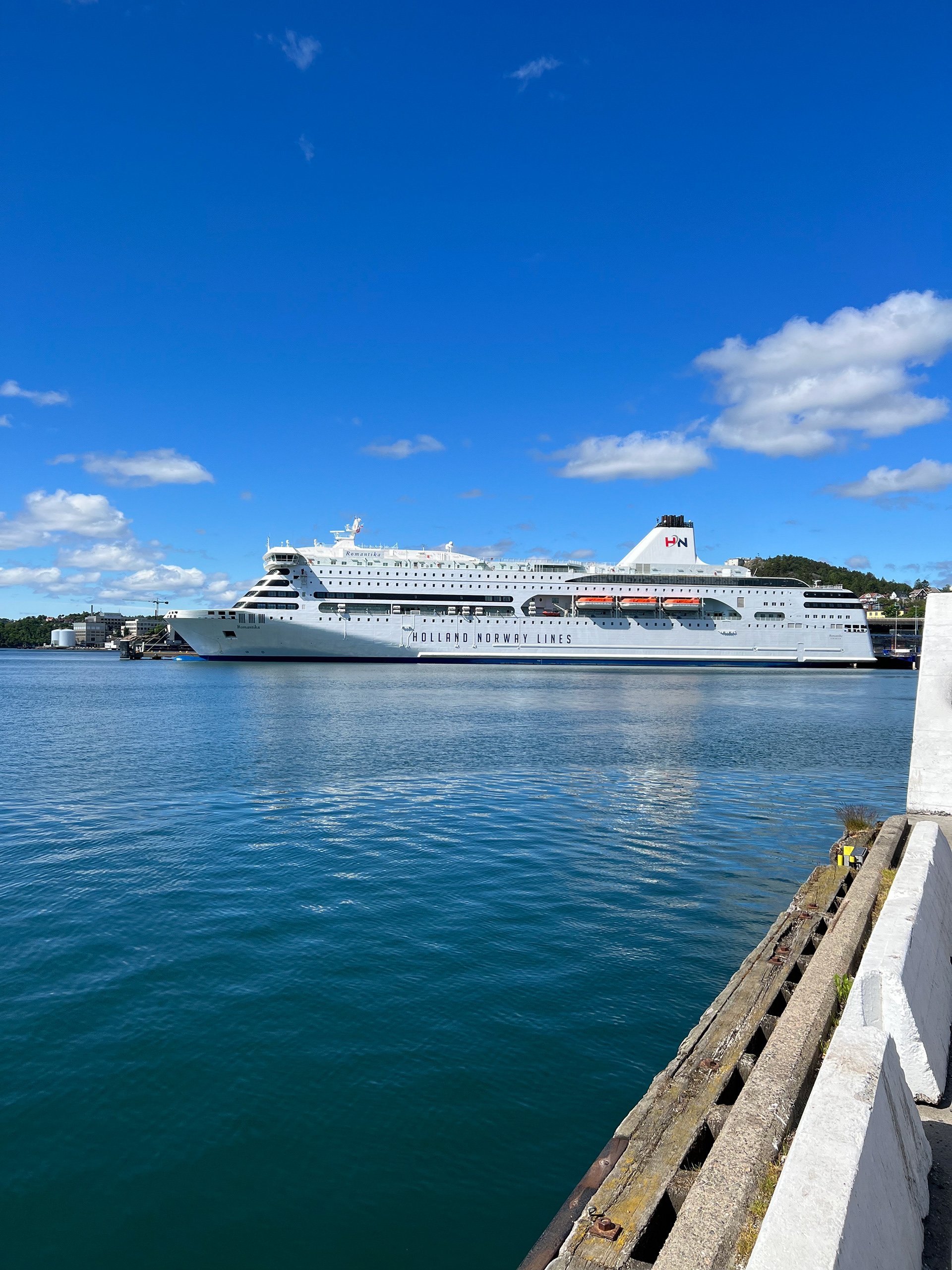
In the beginning of 2022 a new startup by the name of Holland-Norway Lines (possibly inspired by the Holland-America Lines) started service on a new route from the North of the Netherlands to the South of Norway. An overnight journey of 18 hours and a fantastic alternative to driving via Denmark and Sweden, given that the price is right. After a few hiccups, its maiden voyage finally started in April 2022, roughly 2 months before our trip would start. I had booked the tickets sometime in February that year for approximately €450 all-in. That includes 2 passengers, a standard cabin with bathroom as well as the car. To me a great concept, mainly also because it's overnight and you arrive the next day early in the morning ready to go. The price could definitely compete with driving there, especially for me personally having the car that we have and premium fuel prices need to be considered. Driving would have taken approximately the same amount of time and would include significant tolls and / or ferries. Expect to pay at least €65 for the Størebelt Bridge in Denmark, or save 350 kilometers of driving and take the ferry to Rødbyhavn which will set you back at least €99. Then there is the Øresund bridge between Denmark and Sweden, which also costs a minimum of €65 to cross one way. Then there are the tolls you need to consider on some of the roads in Norway. Roughly it would have amounted to the same price with the difference you have to drive all that yourself whereas with the ferry you arrive after a night sleep and a higher probability of being well-rested.
It's therefore all the more sad and disappointing that the ferry has already stopped service less than 2 years later. It kind of became a victim of its own success, in the sense that they had planned very short-term when it came to reserving docking space in the Eemshaven in the Netherlands. They sold well over a 100.000 tickets in 2022 but gradually lost the docking rights in the Eemshaven, causing them to move to different ports in the North of Germany. To be fair you'd expect for local authorities to kind of support this kind of initiative and expand Eemshaven or figure out some kind of solution, but the main reason for the port to be at capacity was the increased demand for LNG gas being shipped in. Long story short, one of the main benefits of this ferry connection was its location in the Netherlands. Although northern Germany is just a couple of hours further, honestly you might as well drive on to Hirtshals in Denmark at that point and take the ferry from there. So the ferry connection quickly lost its value in that sense, which is a pity. I'm still hoping it would return to Eemshaven in the future, because I would surely use it again.
You see, the experience was actually great. You could see the ship was a bit dated, it was bought from another company where it served as a car ferry between Tallinn, Estonia and Helsinki, Finland. The MS Romantica first entered service as early as 2002. But they did a good job renovating where it matters and it was a smooth journey overall. The checkin process was fine, boarding went smoothly and our cabin was reasonable in terms of comfort. We managed to sleep and also enjoy some of the entertainment the ship had to offer. Sure, expect to pay a premium for drinks and food on the ship, but that's to be expected. Off-boarding also went smoothly as we punctually arrived around 9 AM the next day in Kristiansand. And... the weather was amazing. To be honest, when planning to go to Norway you have to embrace the idea of rain, you're not going for the sunshine. So each day with great weather is a bonus and our trip started out in great fashion. Kristiansand is a peaceful small city that looks well-maintained. It's a nice mix between history and modernity, nicely exemplified through the contrast of the old stone fort and the modern apartment buildings in the background. We found the old district around the fish market to be especially charming and colorful. Not a fan of one of the strange fish cakes we tried at the market though ;-)
Kristiansand
Kristiansand
Kristiansand
Kristiansand
Kristiansand
Lysevegen
Our next stop would be Stavanger, where we would stay for 2 nights. The road from Kristiansand to Stavanger is quite straight-forward, following the E39. However, I had read about this mesmerizing road called the Lysevegen. A winding road descending towards Lysebotn on the Lysefjorden. To be honest it's quite of a detour when driving from Kristiansand to Stavanger, which should otherwise not be more than 3 hours. However, that's what roadtrips are for right, getting of the beaten path and exploring destinations on the way. It was a beautiful drive in order to get there and we also saw our first snow. Kind of odd in June, since altitudes weren't that crazy. But that's Norway, this would get crazier further on in the trip as we continued North.
Lysevegen is meanwhile a well-known destination for motorcyclists and scenic drive fans alike. It can get quite busy as there is also a popular hiking trail near the beginning of the road (from the top). There is a parking lot there but it can be quite pricy to park here. Since we got there later on the day and not with the intention to hike but just to take some photos, we were allowed to stand there for a few minutes without paying. We then descended to Lysebotn and took in all the beautiful views. Down in Lysebotn you can then take a direct ferry to Stavanger, which was the plan. However, the ferry was fully booked. I didn't know at that point you need to book certain ferries in advance. I didn't want to take the risk of waiting in case a spot was free anyway, since the drive to Stavanger from there was still quite significant and we didn't want to arrive at our Airbnb too late. So we opted to drive back up Lysevegen and then took the Fv450 road towards Ålgård. Actually this drive was unexpectedly beautiful, I wasn't aware of it since we didn't plan to drive the route. It was however tolled electronically, and here I am saying was since I read that in the beginning of 2024 the road became toll-free :-).
On the road to Lysevegen
Lysevegen
Lysevegen
Lysevegen
Fylkesvei 450 to Ålgård
Stavanger
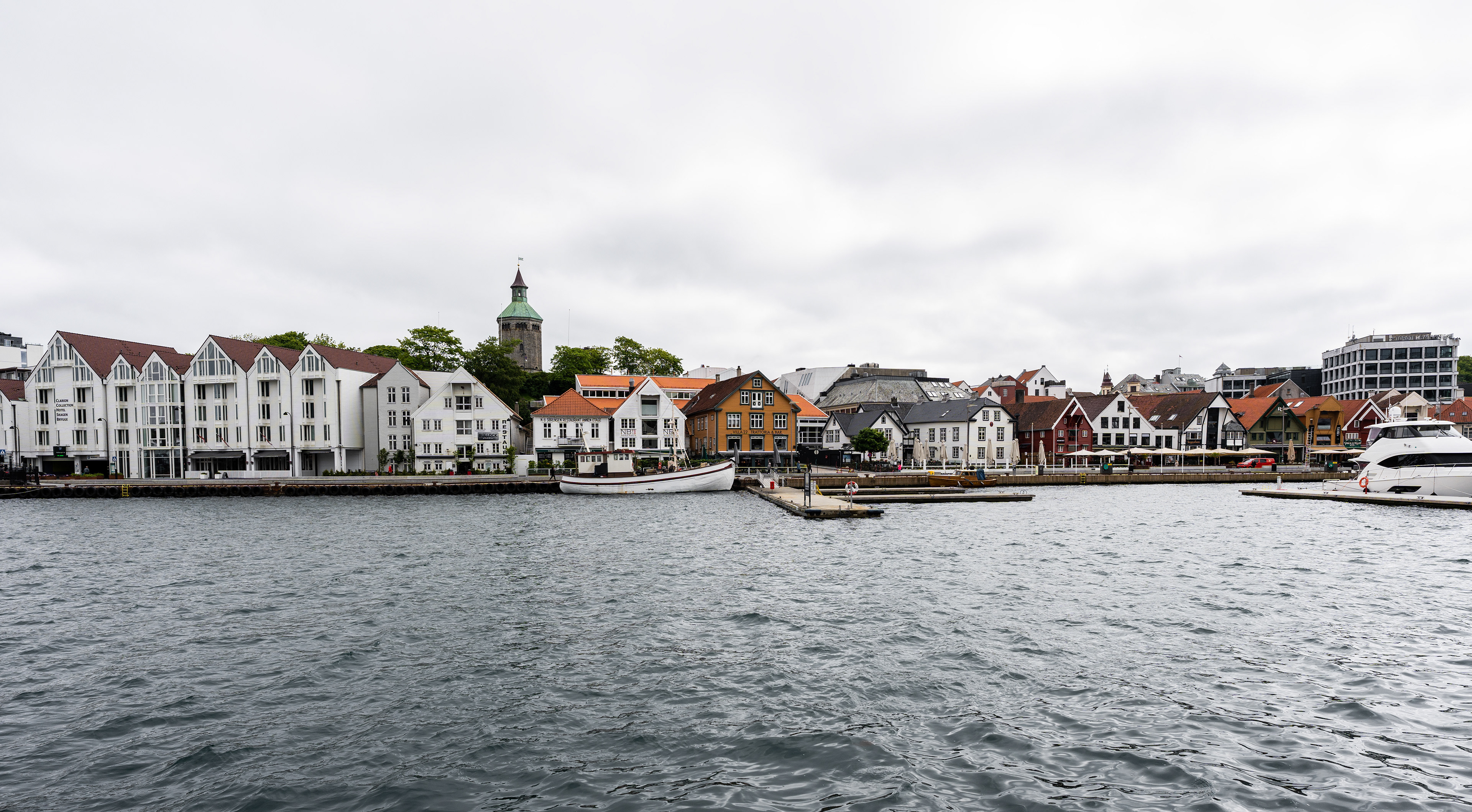
A view of Stavanger
Norway's oil capital
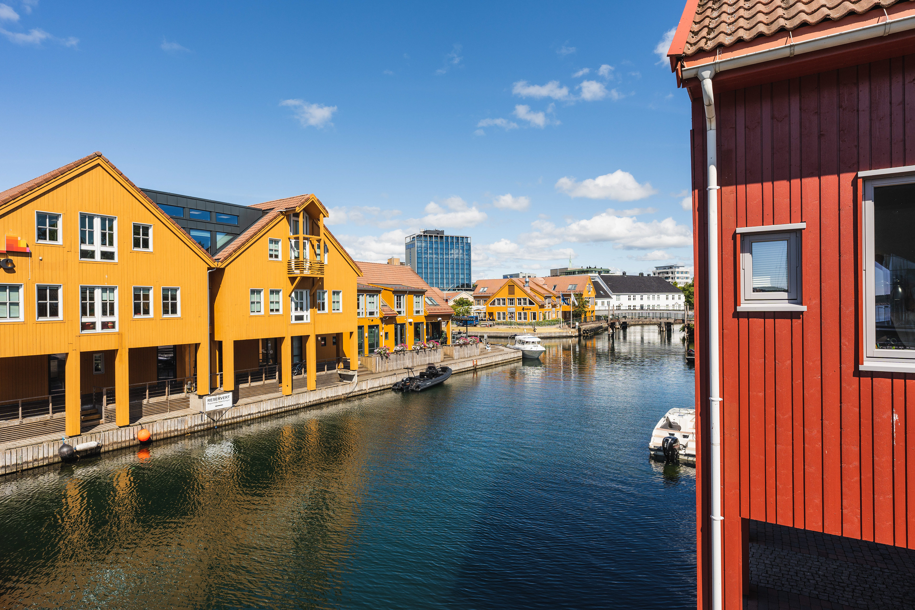
Although it's by no way noticeable, other than the presence of the Norwegian Petroleum Museum, Stavanger is known to be a hotspot of Norway's lucrative oil industry. The city is like many Norwegian cities we have visited a quite peaceful and boasts a great mix of old and modern architecture. There is definitely a certain ooze of prosperity in the air, whether it's the occasional Ferrari or some of the lavish residences we spotted. This is however not necessarily in direct relation to the large oil industry being in direct vicinity. The exploitation of oil fields in the North Sea is nationalized. You see, up until the 1960's Norwegians state of welfare was fairly moderate. This of course started to increase drastically upon the discovery of many oil and gas fields off the coast of Norway. But it's the nationalization and subsequent strategic way of exploitation that is so admirable. In contrast to some other oil rich countries on earth, Norway's relative spending was kept in bounds. No so-called air-castles or wild prestige projects to be found here, except for maybe a few infrastructure marvels. Knowing that we may be moving towards a society where oil will be less important, Norway strategically invested their excess income as a country in their sovereign wealth fund, benefitting future generations of Norwegians for many years to come.
Through a healthy democracy money is arguably also spent where it's needed most such as infrastructure for everyone. Stavanger is perhaps a great example of this, the roads and infrastructure around the city are something else. The main E39 highway has been put underground, allowing drivers to bypass the city through a complex tunnel system. It also connects to the impressive Ryfylketunnelen, currently still world's longest twin-tube undersea tunnel with 14.4 kilometers in length. When looking at the grand scheme of things, you'd have to consider that the metropolitan area of Stavanger has about 130.000 inhabitants only.
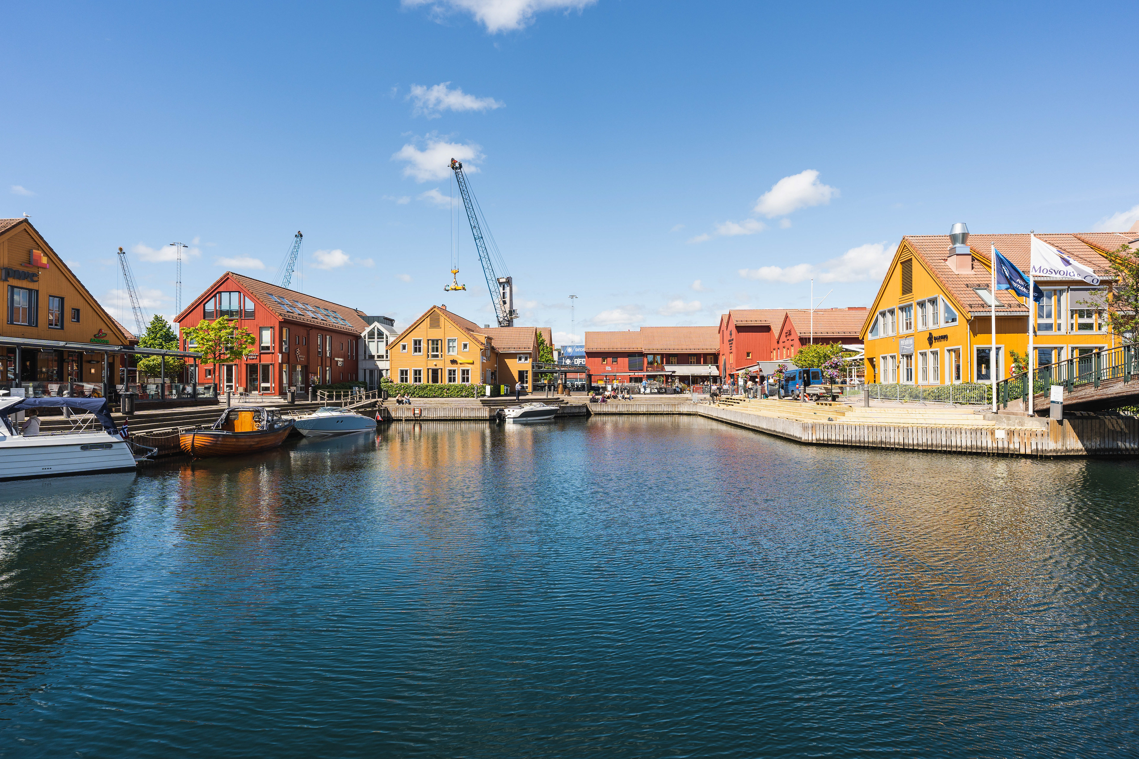
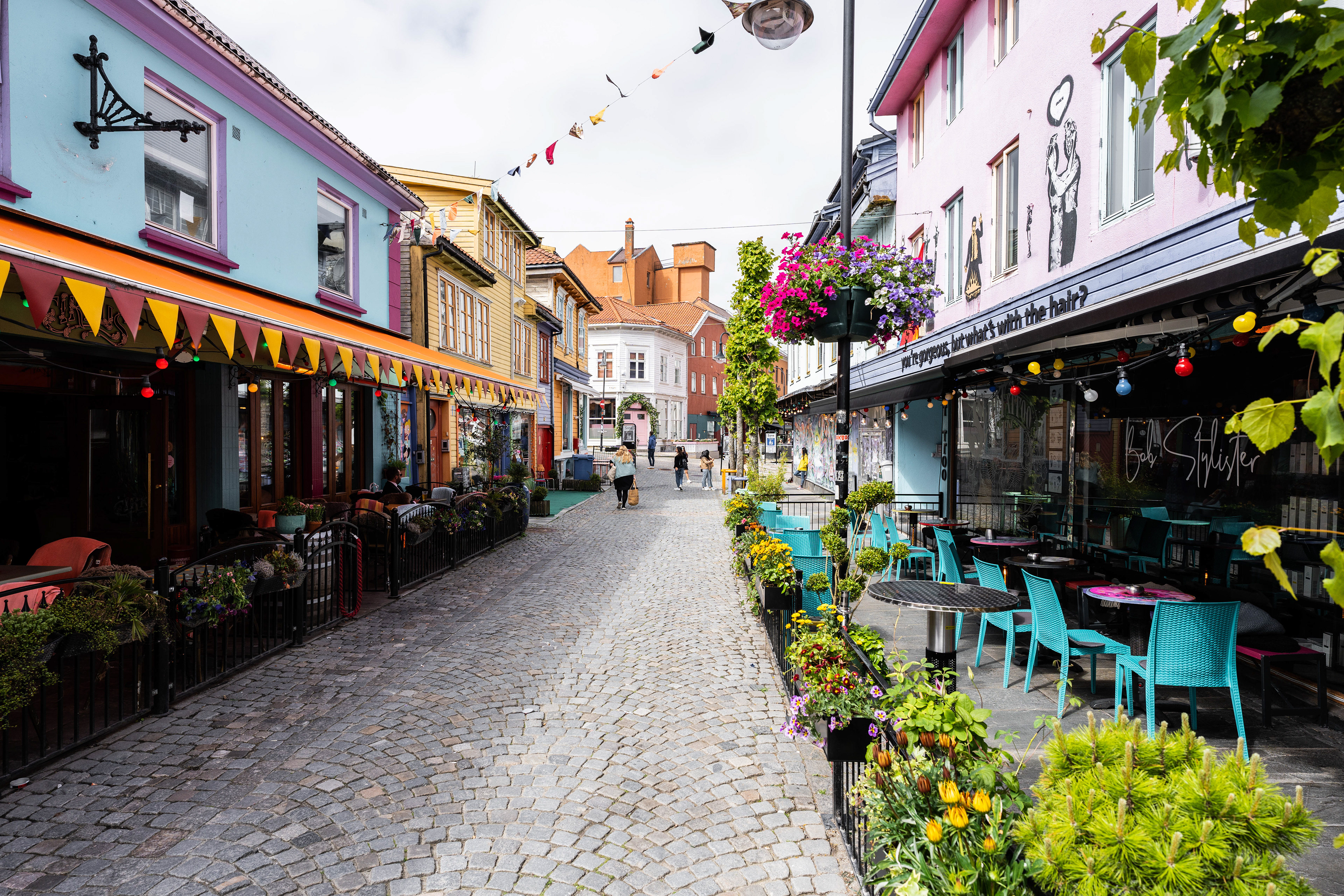
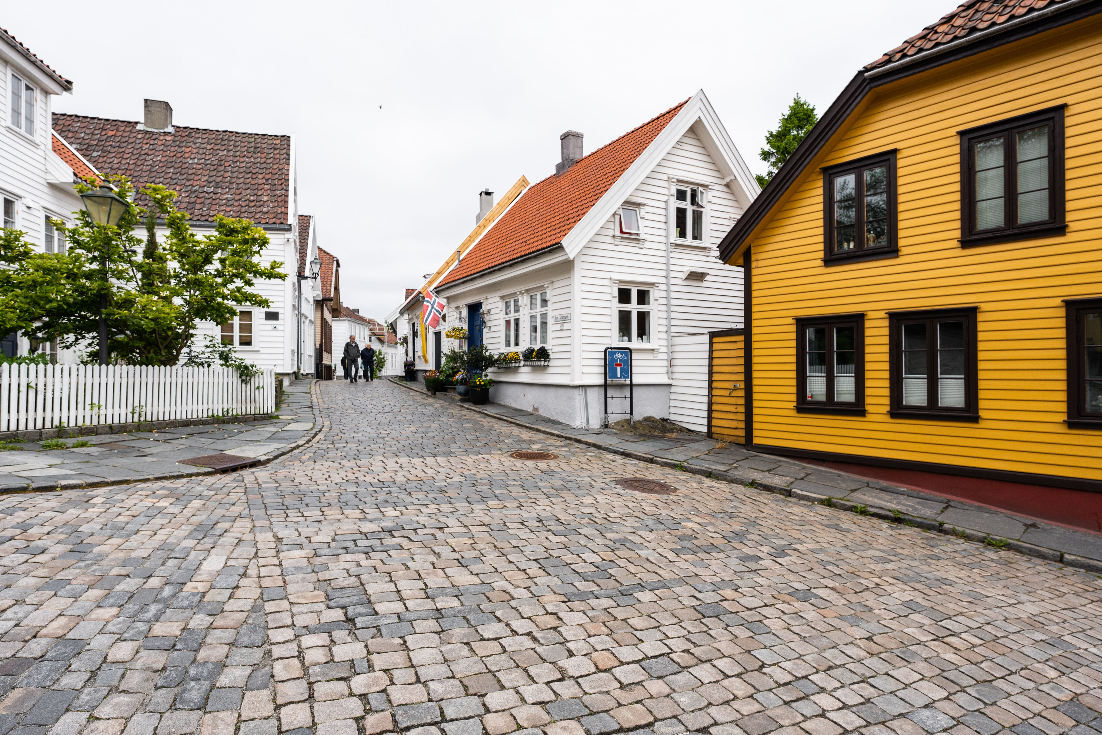
Back to the city, which can easily be covered in about 2-4 hours, depending on how long you like to dwell in certain areas. There was a particular small street and district with a lot of colorful wooden houses and retro stores that was quite nice. We also found a small viewing point across some parts of the city which may be worth walking up to. We opted not to visit any museums and drive out to Preikestolen instead for a hike. We stayed in the suburbs of the city in an Airbnb with a separate entrance (part of a larger house). We met the owners, an older retired couple, which were super friendly. They had originally emigrated to the USA like many other Scandinavians back in the 1950's and 1960's, but decided to return at some point. They had some great stories to tell that I could relate to since I lived in the USA myself. We paid about €75 a night for this stay which is great value for Norway. However, the place is not always available and the owners are definitely not in it for the money, they just offer it at their convenience.
Stavanger
Stavanger
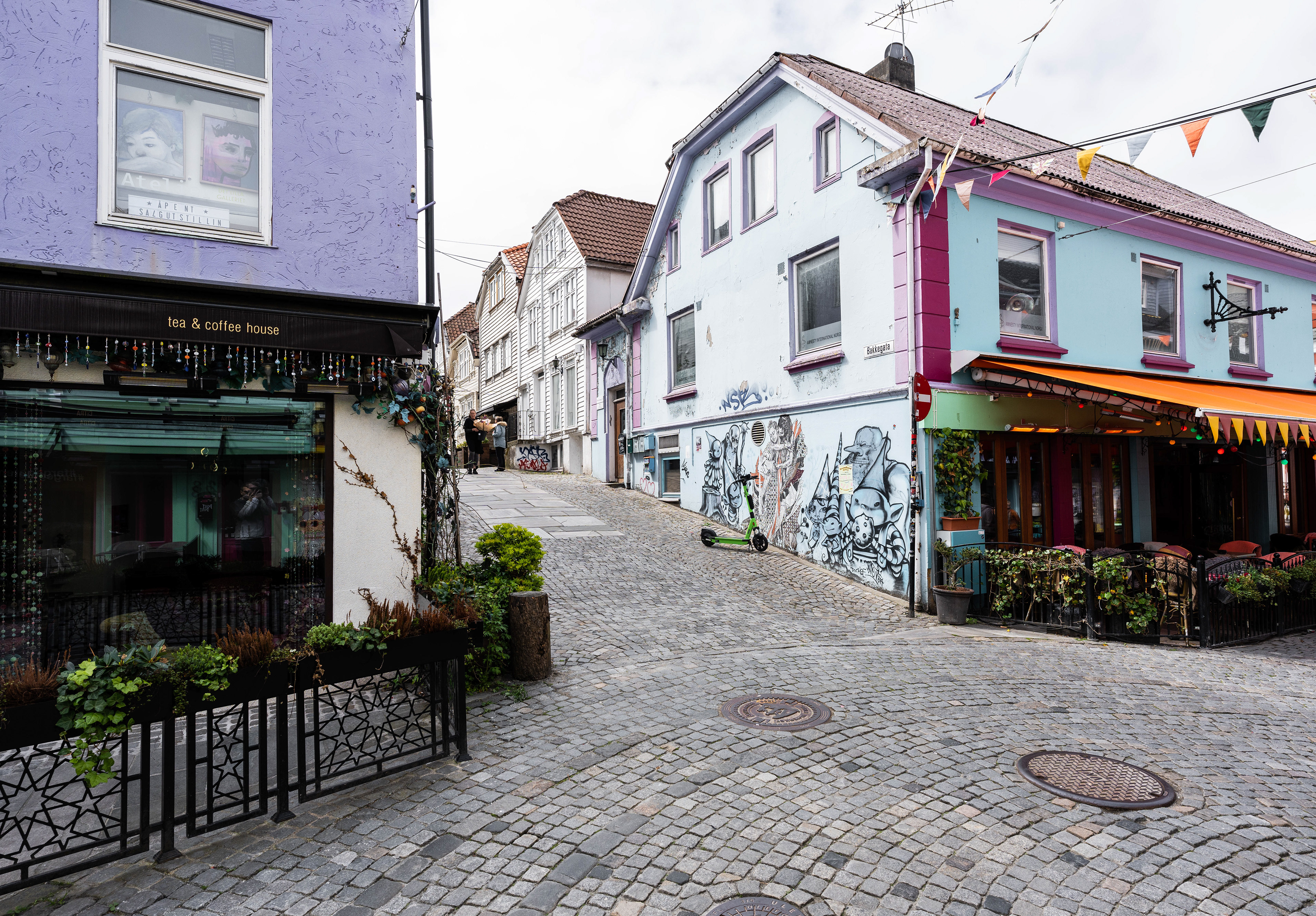
Stavanger
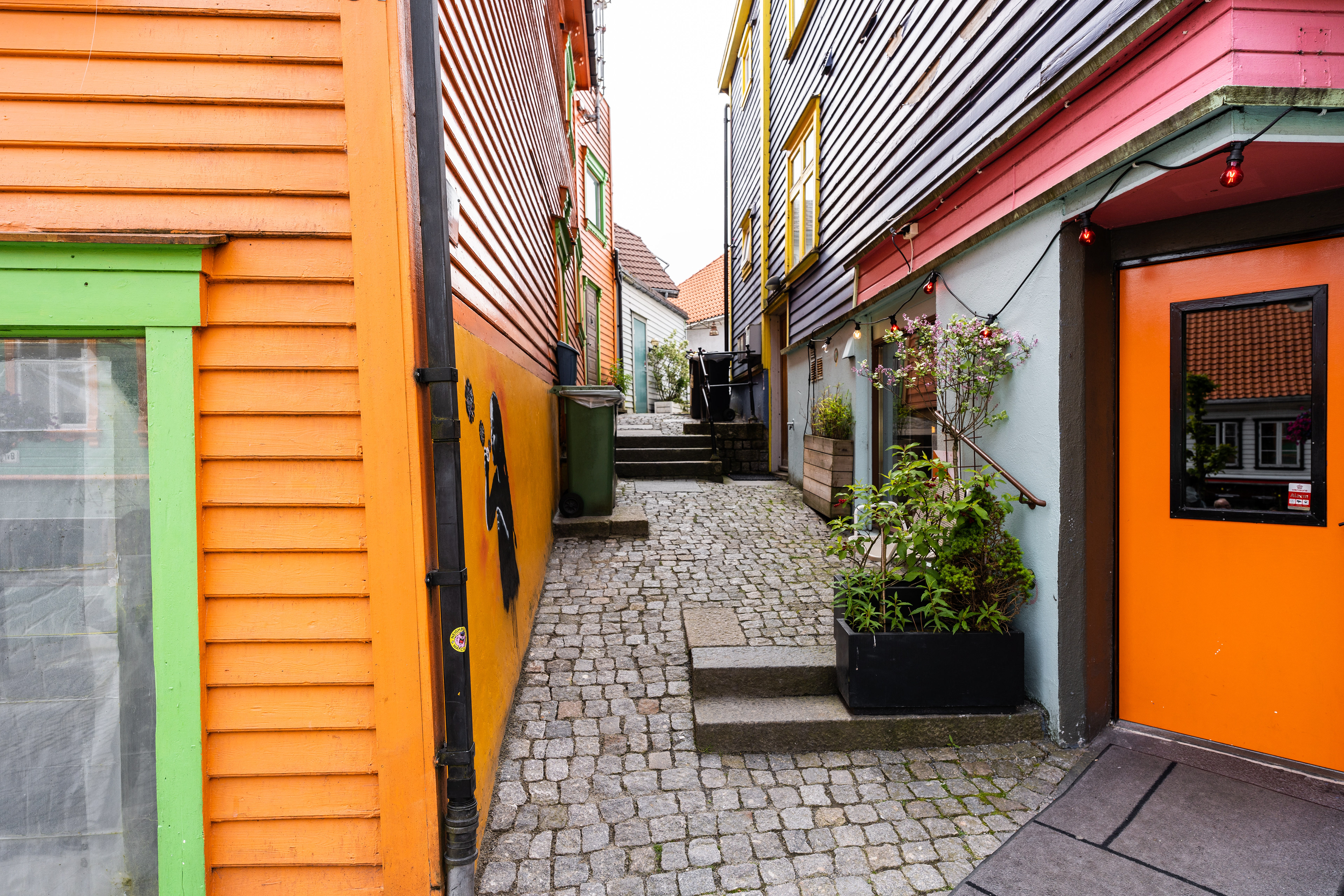
Stavanger
Stavanger
Stavanger
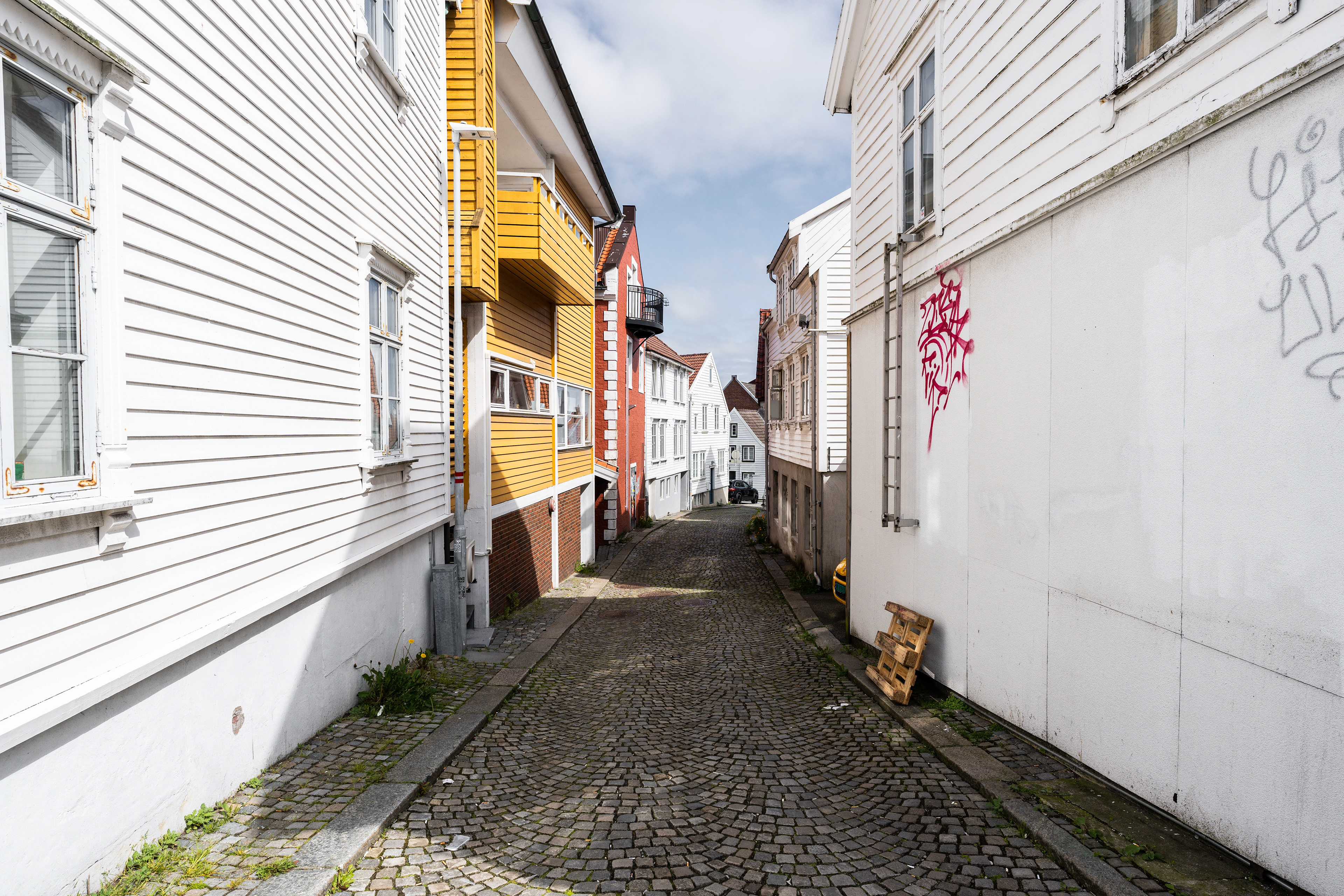
Stavanger

Stavanger
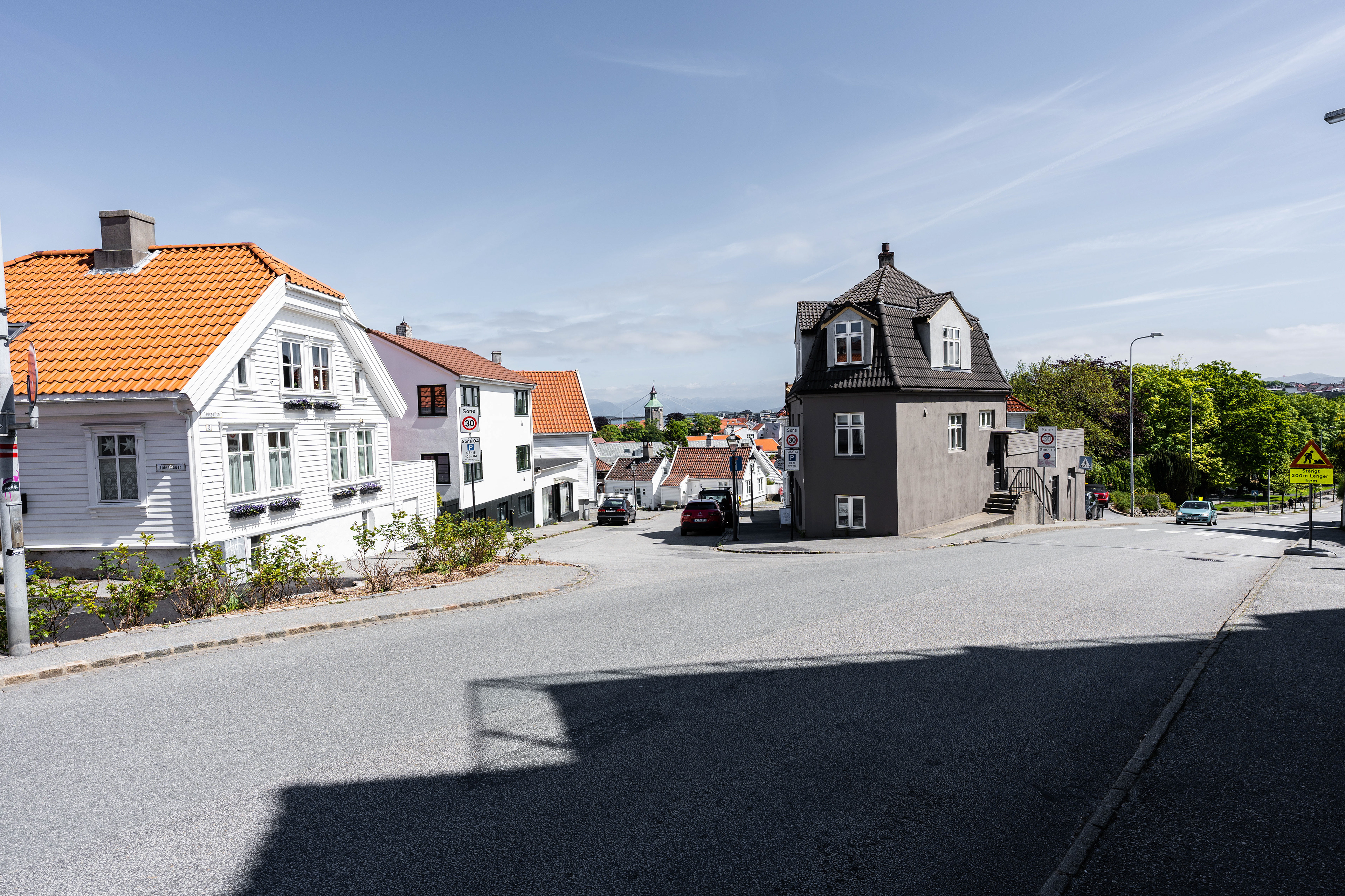
Stavanger
Stavanger
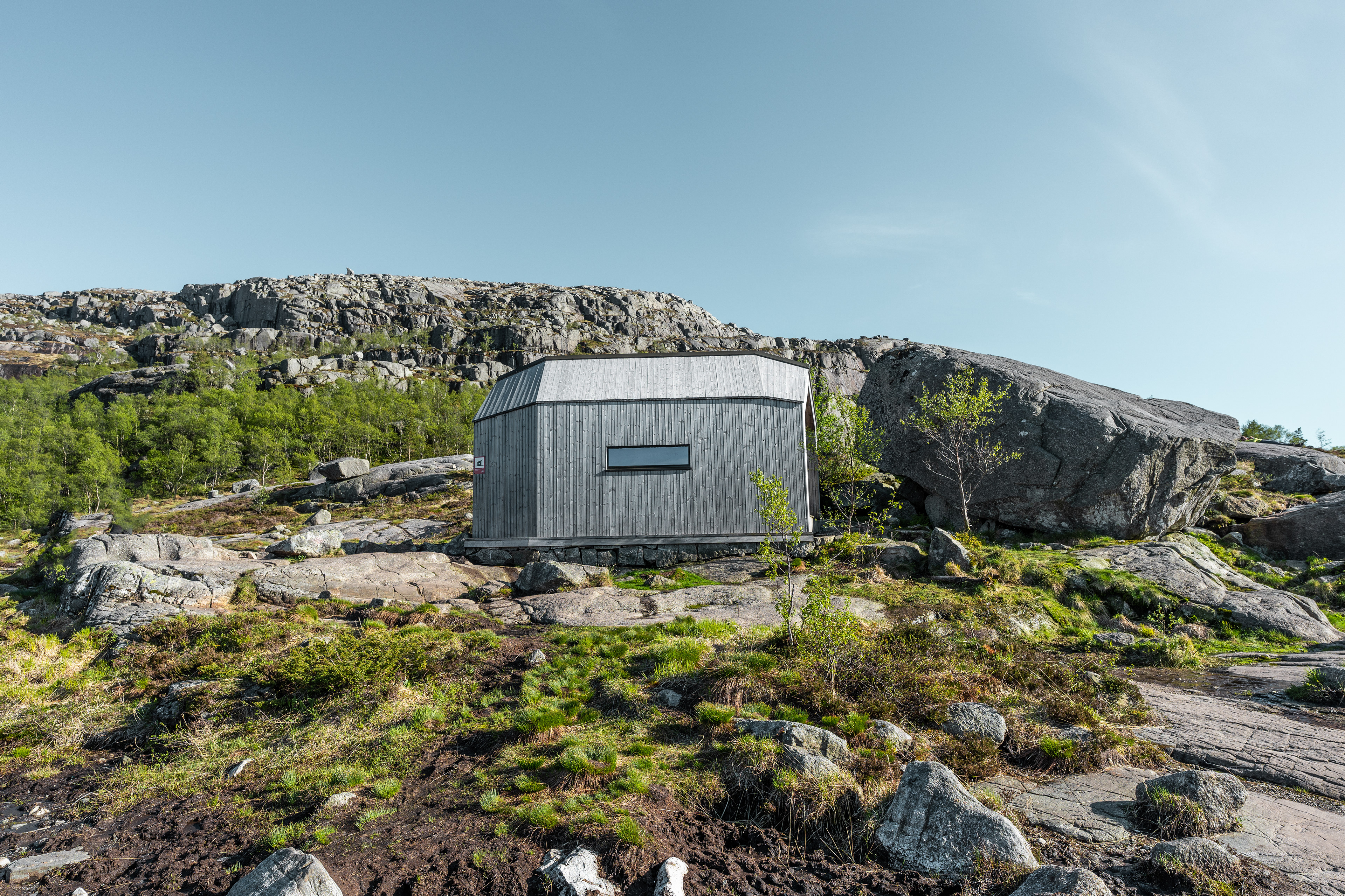
Preikestolen
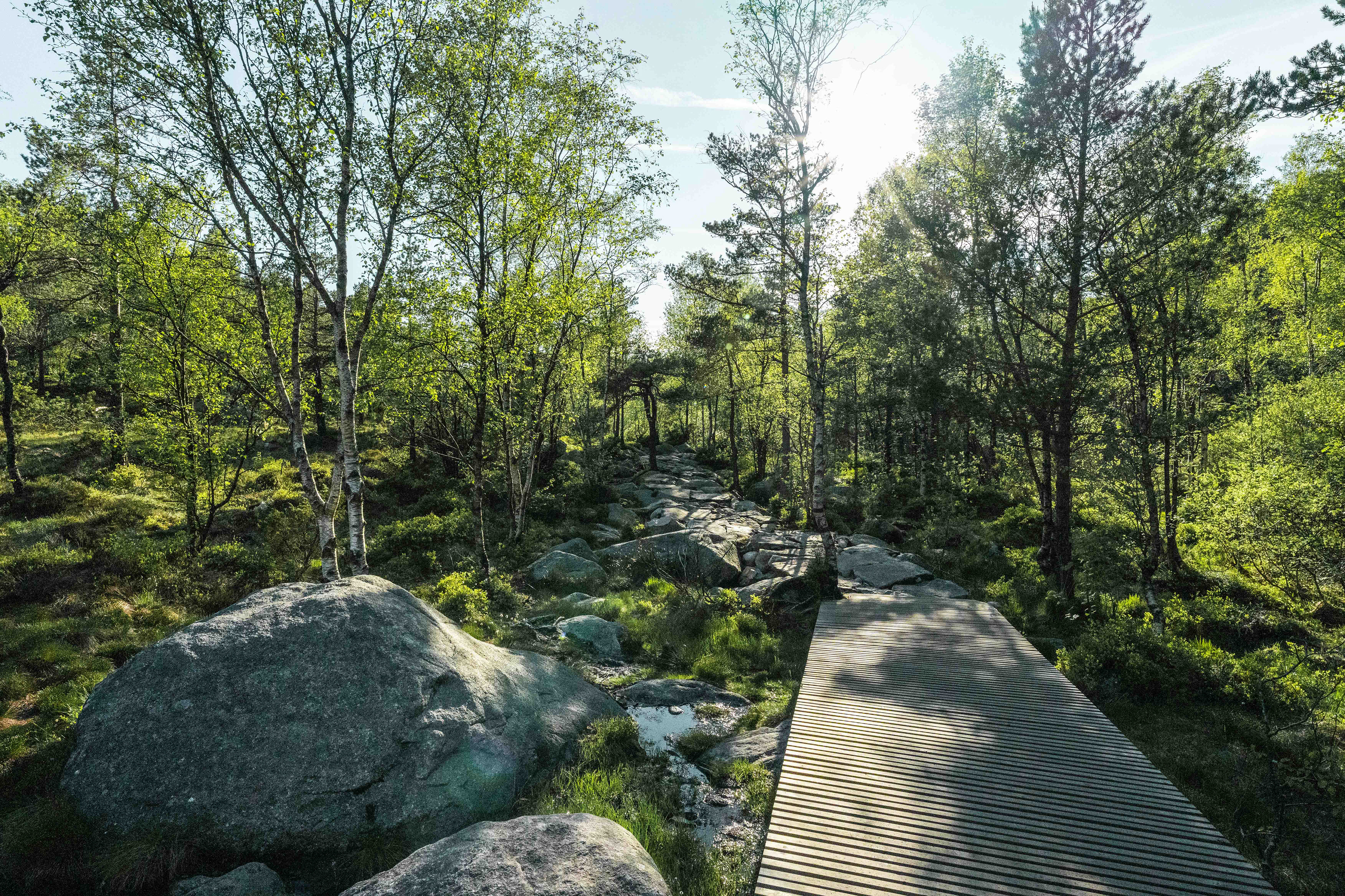
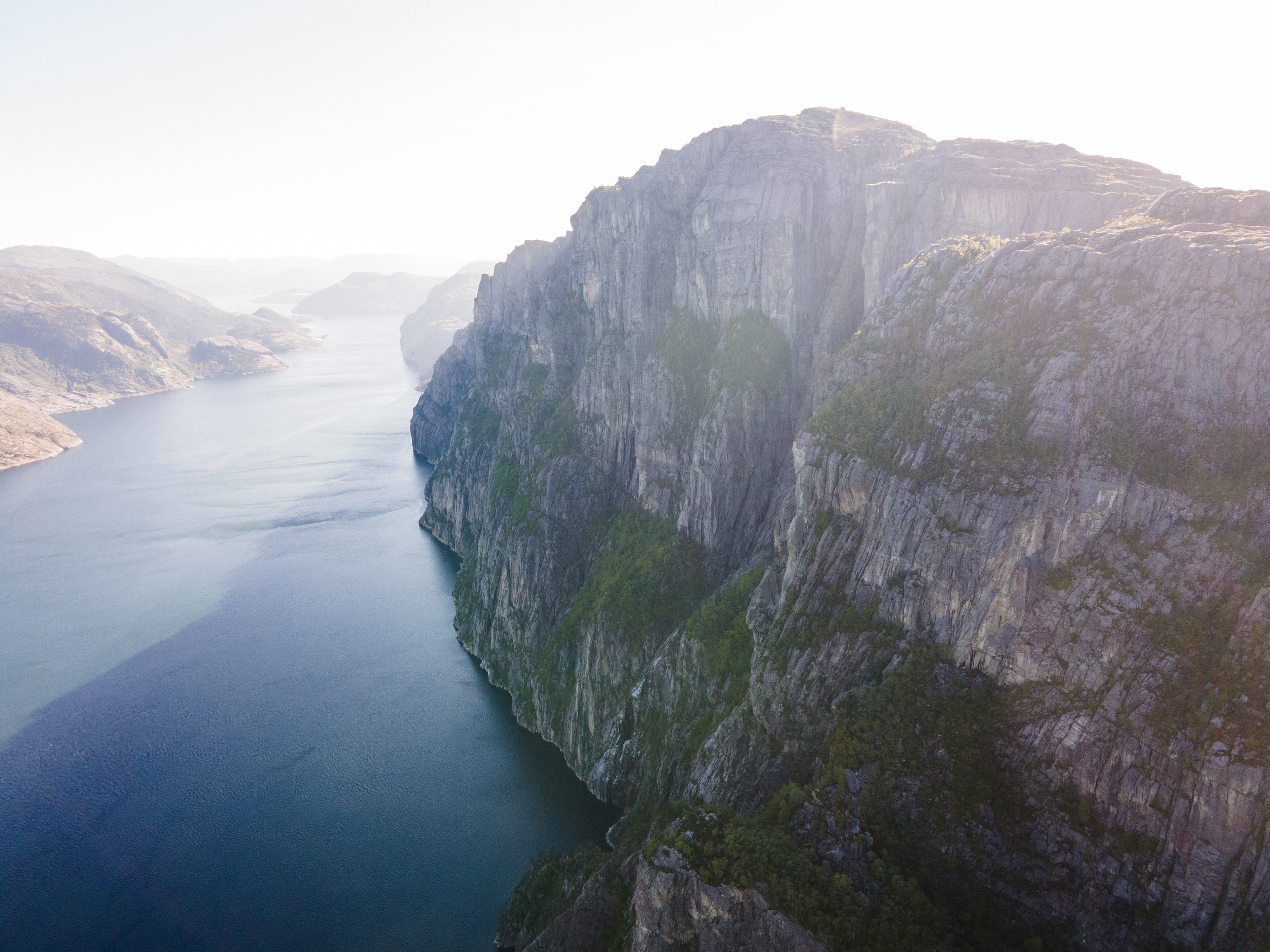
You may have heard of this hike, it's one of the more famous ones in Norway. It's a great hike with splendid views of the surrounding area and Lysefjord. If you are staying in Stavanger, it's really easy to get to. It's a 40-minute drive to Preikestolen basecamp thanks to the Ryfylketunnelen. You do have to pay tolls for the tunnel though. I'd recommend you either go really early or towards the end of the day (in summer), otherwise you may not be able to get a parking spot. We got there I believe around 14:00 - 15:00 and were barely able to get a parking spot, which also does not come cheap by the way. Expect to pay at least €25 for parking.
The hike itself is moderate in terms of difficulty. It's not that hard but I wouldn't underestimate it either based on the weather conditions. The total elevation gain is about 500 meters over 4 kilometers. Roundtrip the hike is about 8 kilometers in length and takes 4 hours on average. You can opt to start later during the summertime since it stays light much longer. The hike is a mix of well-maintained trails and wooden pathways. The end destination is of course Preikestolen (or Pulpit Rock), a rock that towers 604 meters above the Lysefjord. It's a popular place for a 'selfie', but do be careful in case of strong winds. There is no safety netting or fencing, whatsoever. Intentionally so to not take away from the natural beauty. Weather conditions for us were ideal and we really enjoyed this hike.
Preikestolen
View of the Lysefjord
View of the Lysefjord
View of the Lysefjord
Preikestolen hike
Preikestolen hike
Preikestolen hike
Lysefjord
Odda Region
The famous Trolltunga
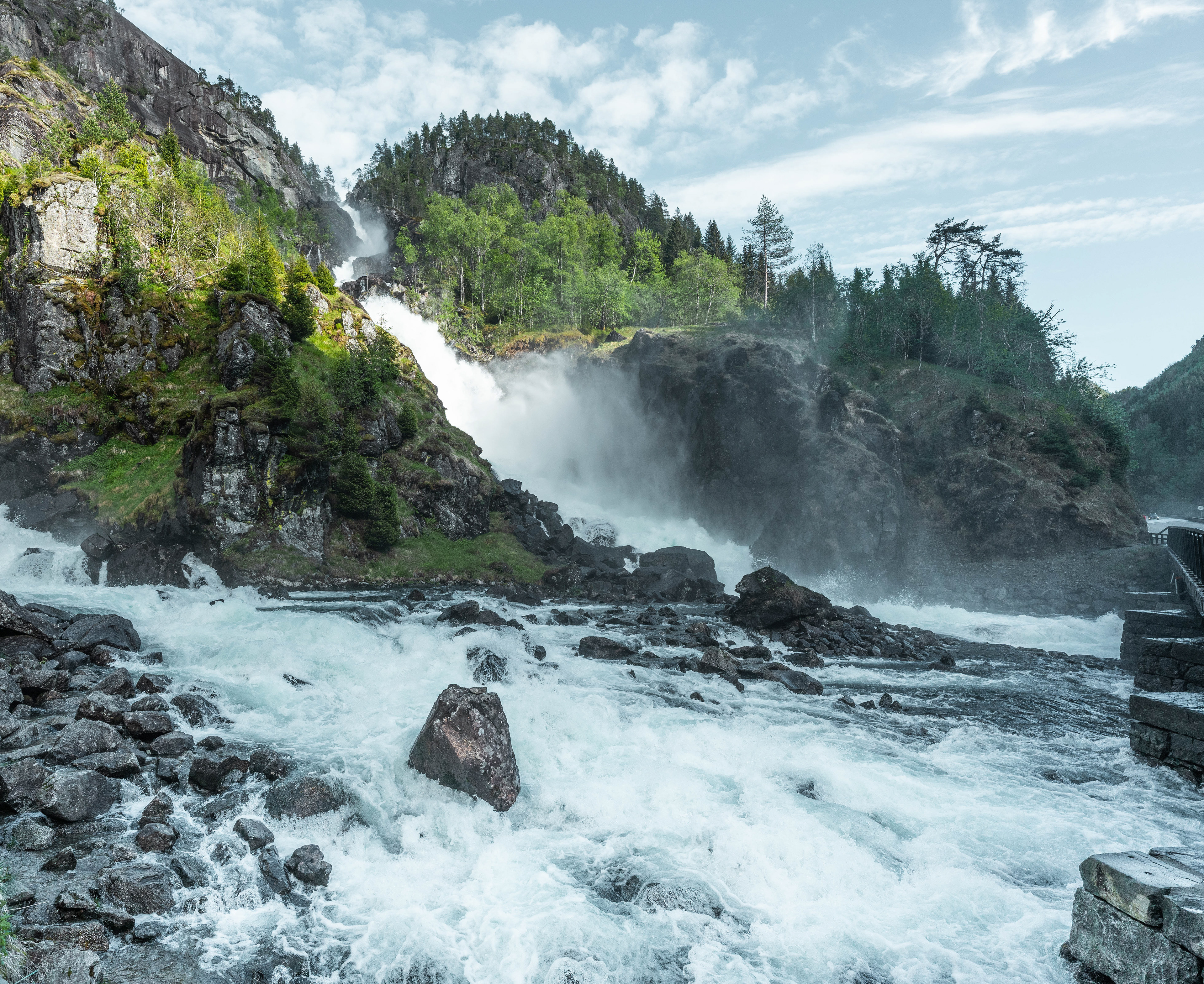
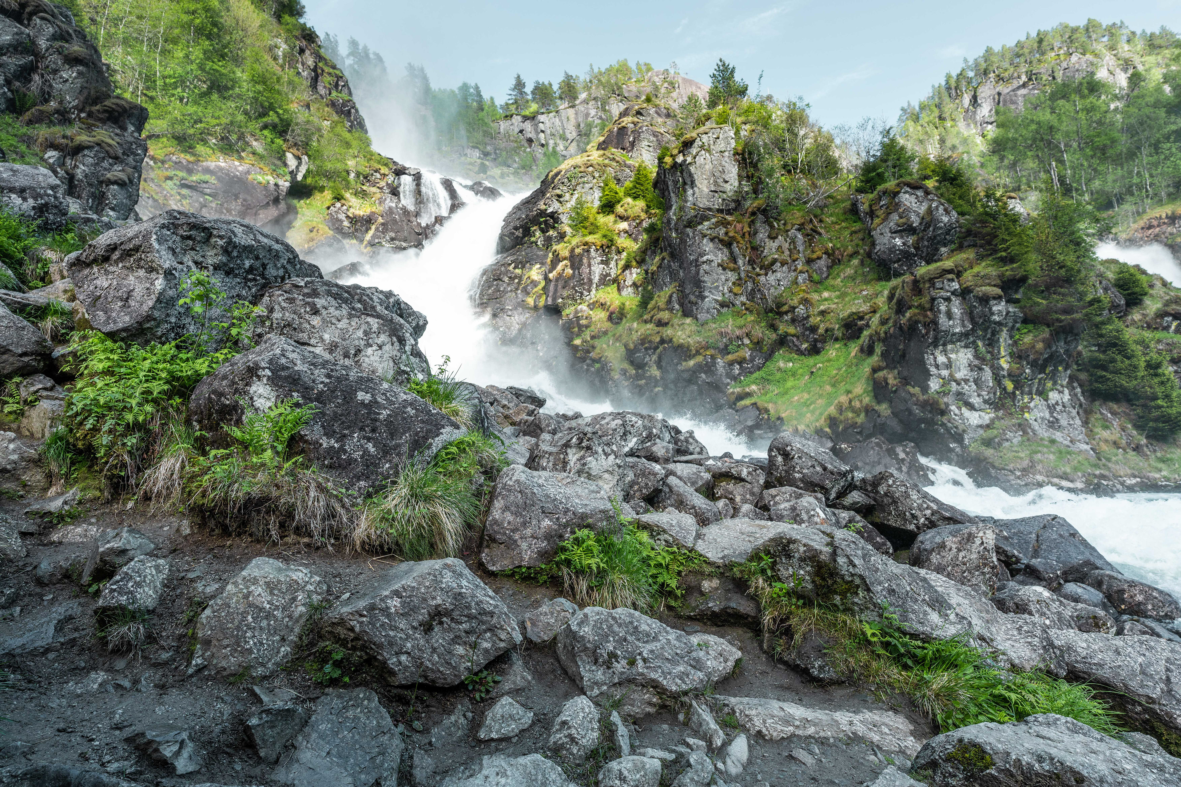
Riksvei 13 & Låtefossen
There are 2 ways to get from Stavanger to the Odda region. The fastest is North via the E39 and then E134. Arguably the more beautiful is via Riksvei 13 and Røldal, which takes about 45 minutes longer according to Google Maps. Riksvei 13 is known as the waterfall road, because it passes quite a few well-known waterfalls. It may therefore be worthwhile integrating it into your trip, especially if you are into waterfalls. The main one on this drive was Låtefossen, not too far South from Odda.
Generally the drive on Riksvei 13 is quite beautiful and we were again blessed with amazing weather as you can see from the pictures. We stopped quite a few times on the way to take in the scenery and see some waterfalls. Especially the drive along the Suldalsvatnet was very beautiful. You can of course ride along and see it on my youtube channel in case you are interested.
Låtefossen is a very intense waterfall and a very touristic one as well. It has a total drop of 165 meters and has been known to tourism since the 19th century. You can get really close to the waterfall if you like to take some pictures. When driving on Riksvei 13 and passing the waterfall, your windshield will definitely catch some of the mist from the waterfall as it's that close to the road.
A random waterfall on Riksvei 13
A random waterfall on Riksvei 13
A random waterfall on Riksvei 13
Espelandsfossen
Låtefossen
Låtefossen
A ferry connection on Riksvei 13
View from the ferry
One of the lakes on Riksvei 13
Låtefossen
Låtefossen
Sandvin
Worth mentioning is Sandvin, a very small farmer community just South of Odda. We booked our Airbnb here right off Riksvei 13. We stayed in a very traditional Norwegian 'worker's house', which was quite picturesque on its own. This was quite an amazing find on Airbnb if I do say so myself. It's a great base for exploring the best the Odda region has to offer but also very quiet and peaceful. We could see waterfalls from the kitchen window and had a large yard right on the water to relax in. The interior was also very traditional with a lot of wood, just really charming altogether. We stayed here for 3 nights and didn't pay more than €100 per night. I had the pleasure of meeting the owners that live next door. They have a herd of sheep that graze the surrounding lands and also a few Border Collies to help manage. As I grew up with Border Collies we got talking about it, I got a tour and of course also got to see the dogs. A really cool experience. In the direct surrounding area it's also possible to walk up to the Sandvevatnet, a nearby lake.
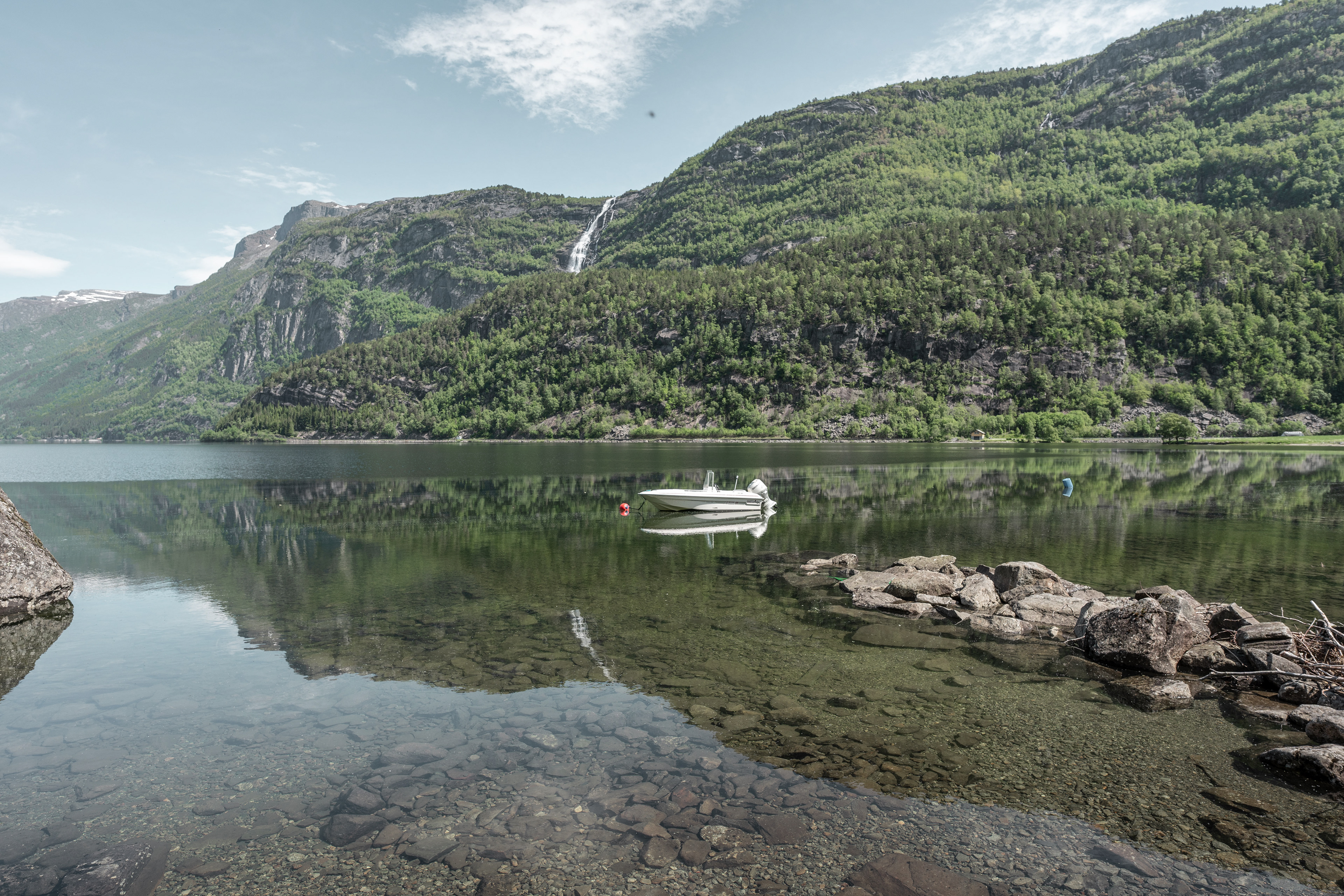
Sandvevatnet
Sandvevatnet
Sandvevatnet
Our Airbnb
Our Airbnb
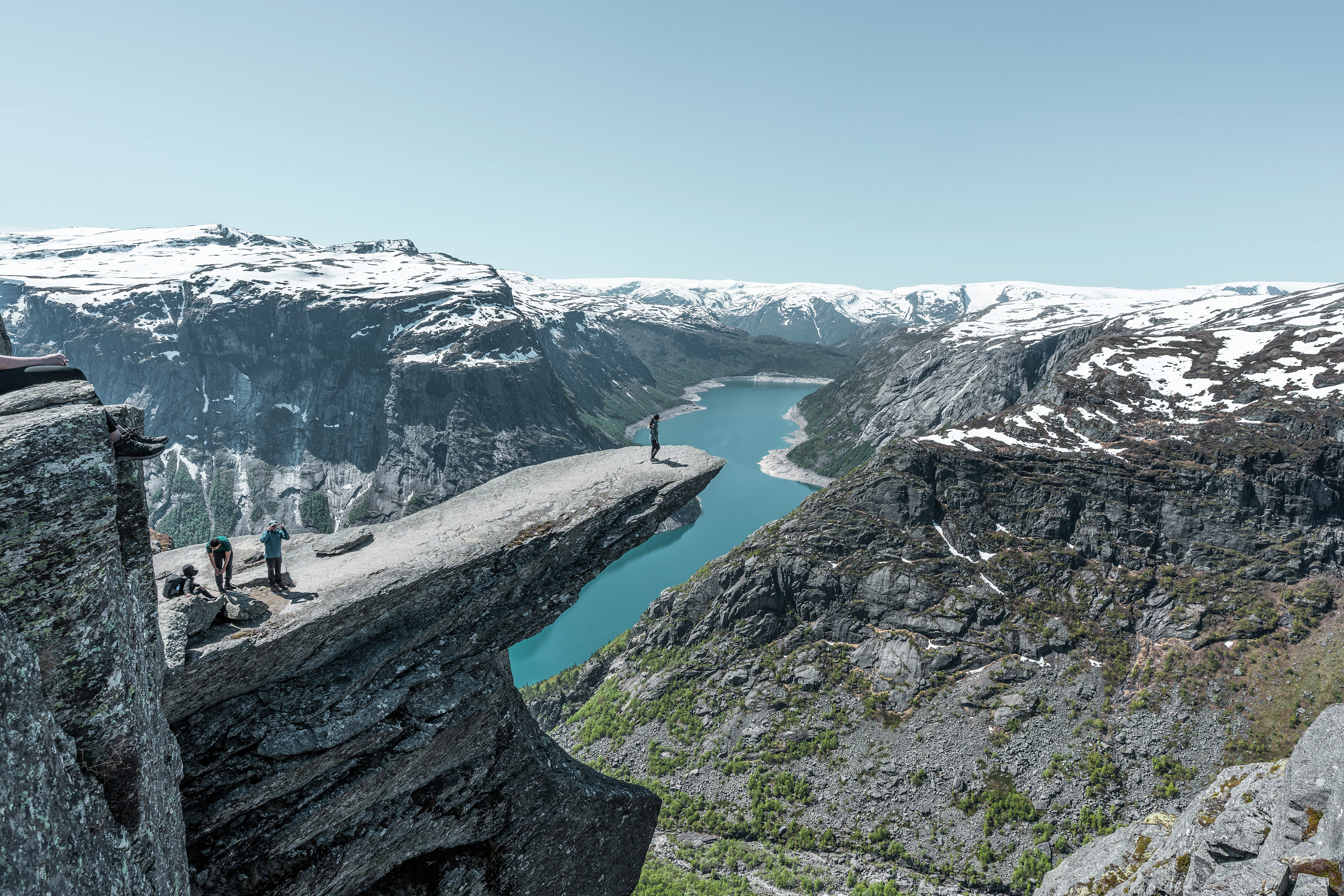
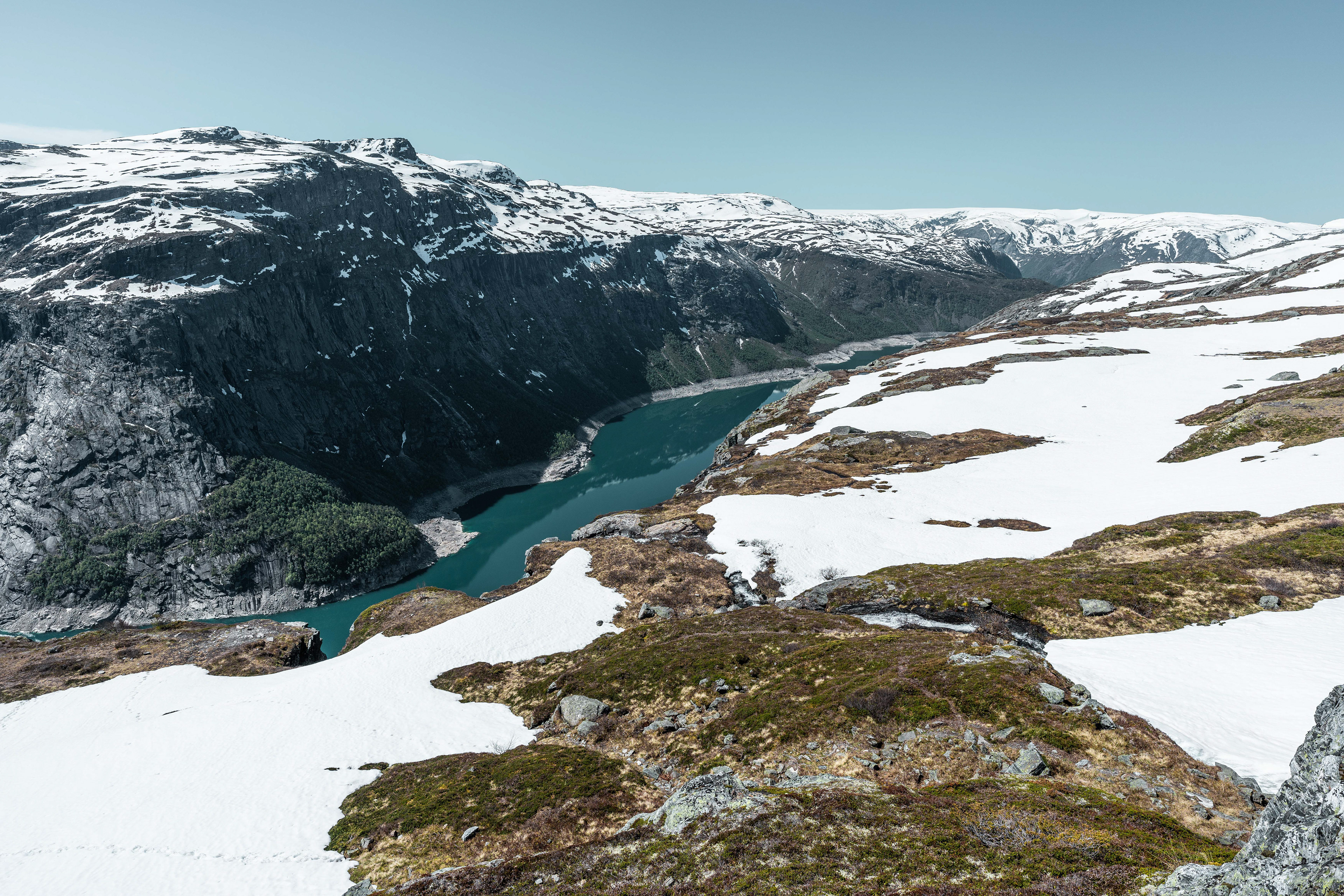
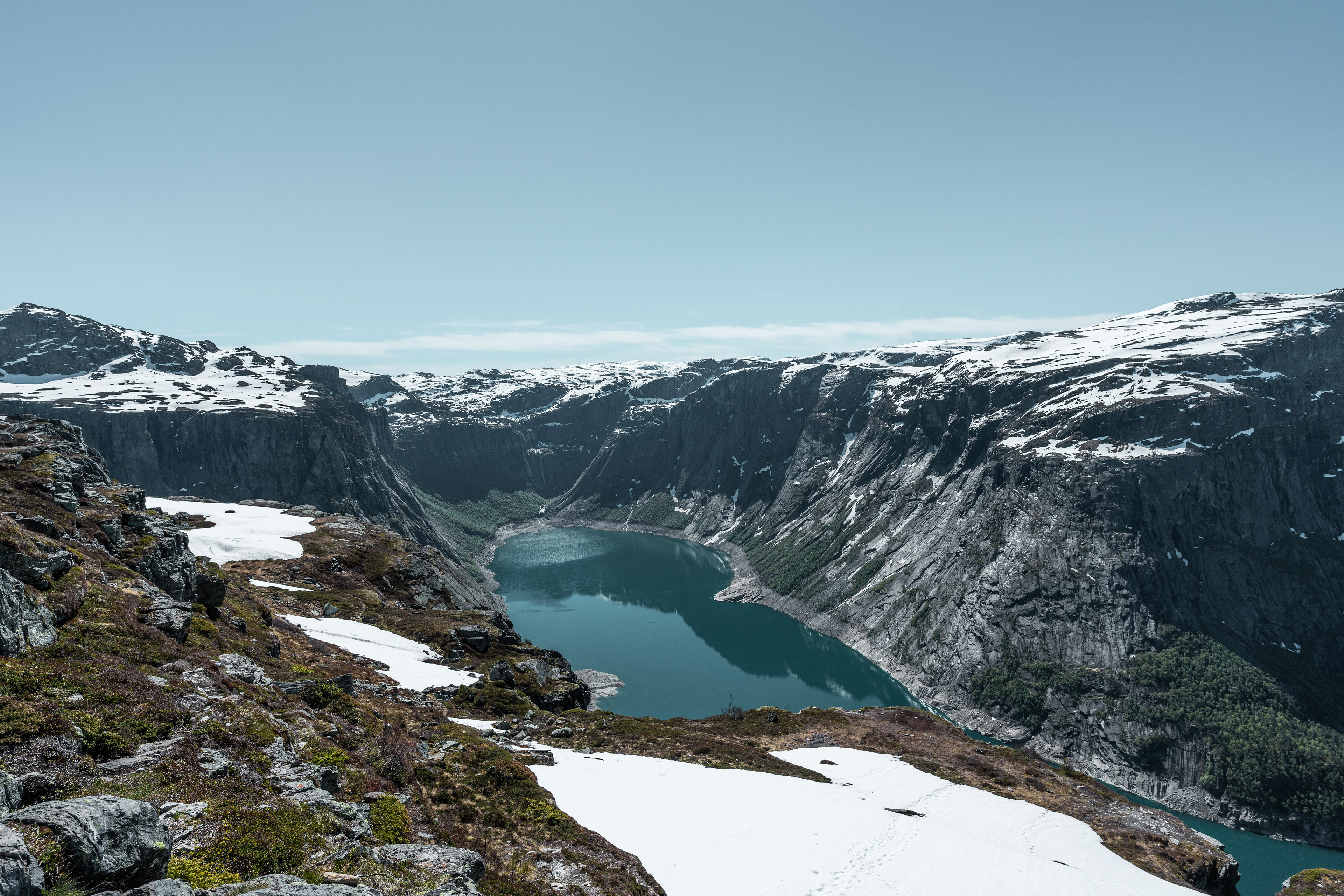
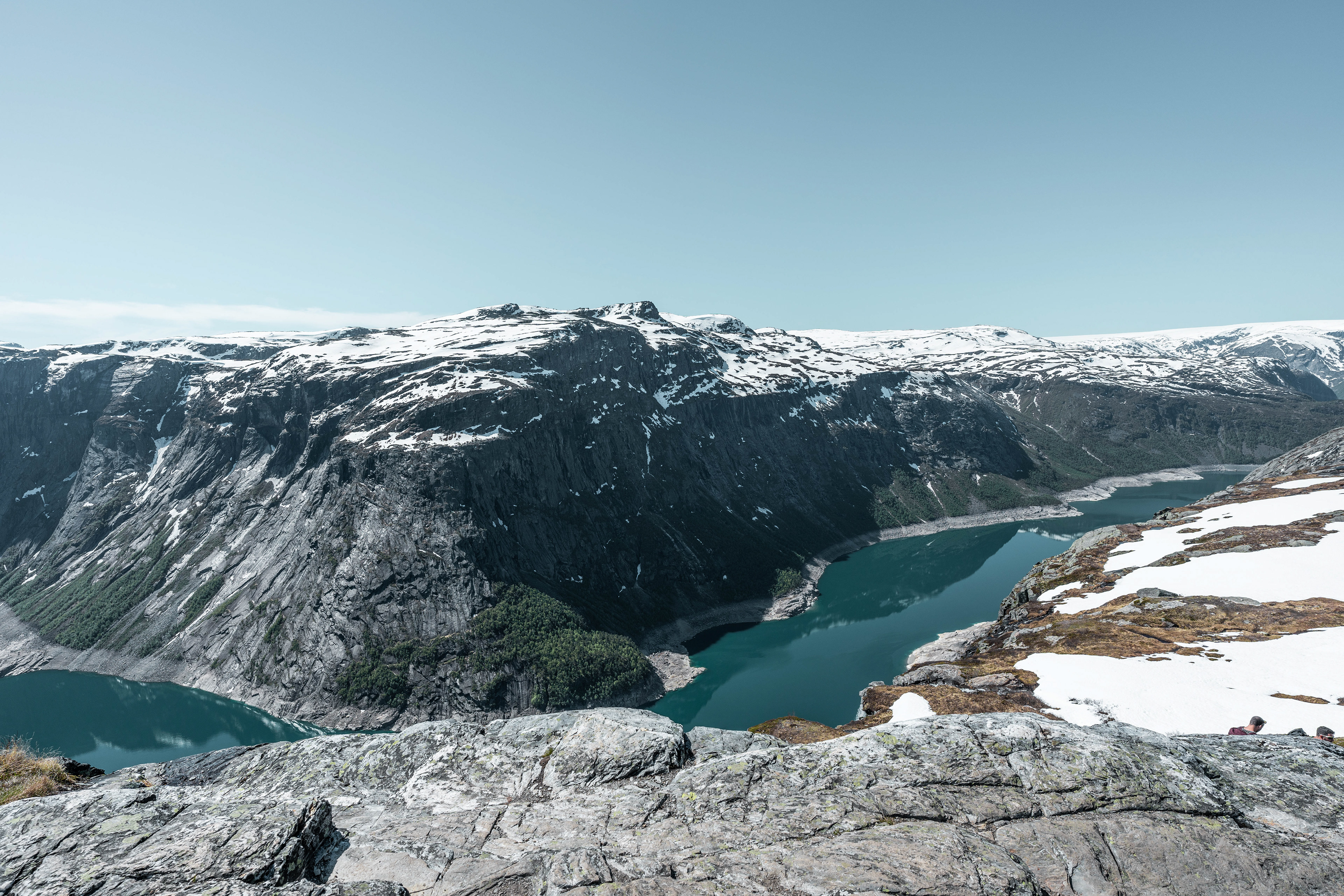
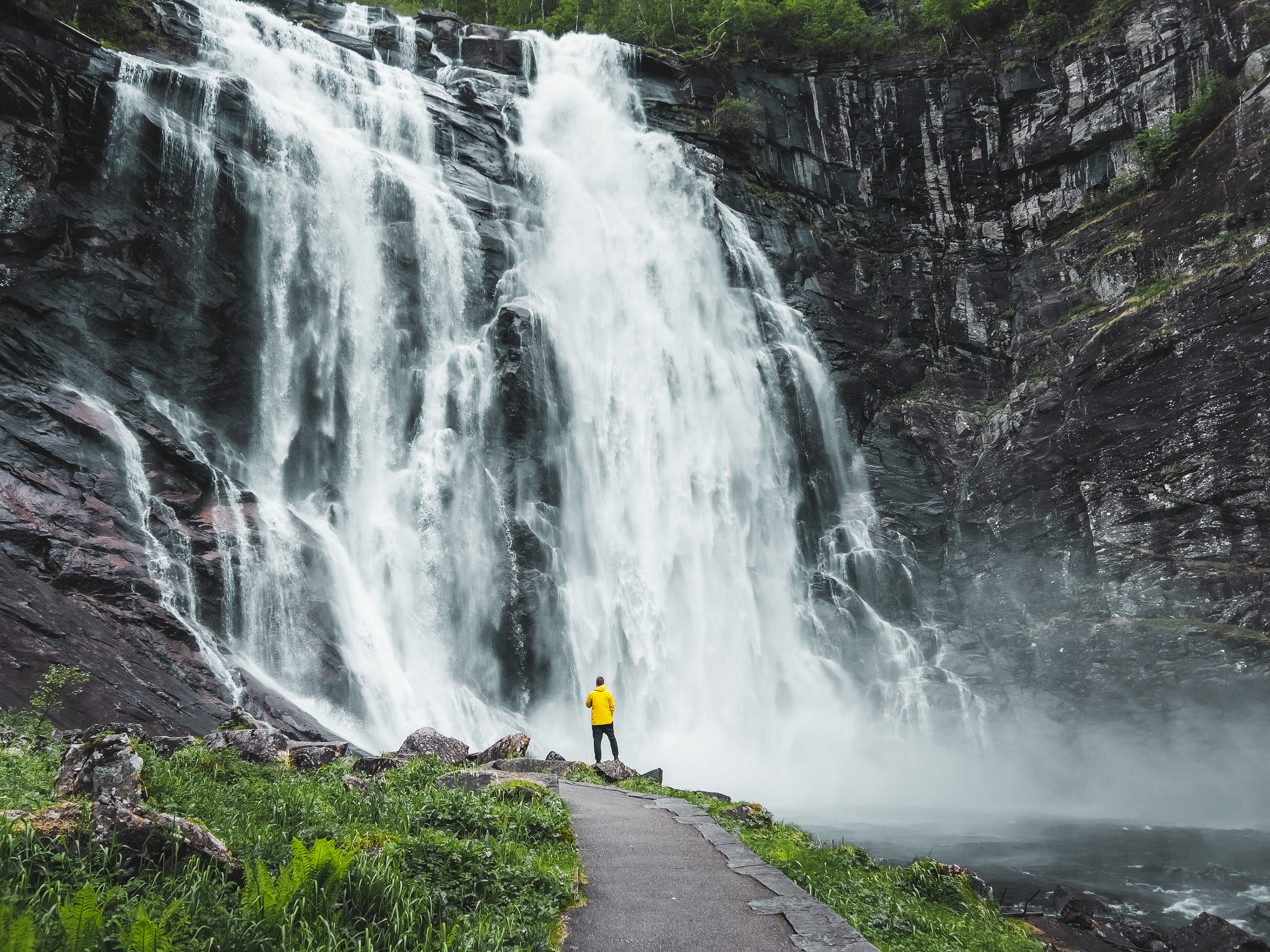
Trolltunga
This is probably the most well-known hike in Norway, popularized through social media in recent years. Unfortunately it also gives many the impression that this is an 'easy' and straight-forward hike to an instagrammable viewing point. Make no mistake, this is a hike that will eat your day and requires a bit of planning. It's a much longer and more intense hike compared to Preikestolen with more elevation gain. The conditions are also harsher, especially during early summer where there is still a lot of snow. Actually pretty much 80% of the hike was in snow (in June) so you need to bring appropriate gear. The hiking season actually starts June 1st and lasts until August 31st. You can hike outside the season but are highly recommended to bring a guide. In June most of the 'park rangers' were there on cross-country ski's.
The length of the hike kind of depends on where you start the hike. There are generally 2 options: from the Skjeggedal trailhead the hike takes 27 kilometers roundtrip (17 miles) with an elevation gain of 800 meters. Alternatively you can start from Mågelitopp trailhead, which makes the hike 20 kilometers long (12.5 miles) with an elevation gain of 320 meters. That's what we did, although like I said before, this requires planning. In order to get to this trailhead you need to drive on a toll road and then book a subsequent parking spot, which are very limited. The toll road was built by some Swiss contractor so that's where you reserve access as well. It's a bit tedious to be honest and it doesn't come cheap. You also forfeit any flexibility and need to get lucky with the weather basically. To drive and park up there will set you back at least €65. Know that the other trailhead is also not free of charge but just costs less, so it's up to you to decide if you want to walk the extra 3.5 kilometers and then 3.5 kilometers back. This trail is actually just alongside the asphalt road for all I could see. There is also a shuttle service from the other trailhead to the top trailhead, but this of course costs money and will either level the price or make it even more expensive than parking all the way up.
Anyway, as you can see from the photos below we got very lucky with the weather. Supposedly it was Norway's most beautiful day of the year ;-). It didn't make the hike less challenging, as the aforementioned elevation gains are absolute and do not count for the up and down elevations on the hike. You go up and down quite a bit so it's not like you reach a certain elevation and then it's flat all the way to Trolltunga. The up and down parts were especially challenging in the snow so you need the right shoes. We saw a lot of people that seemed to have randomly come here after seeing something on instagram, meaning in jeans and sneakers. Many of them didn't make it and had to return at some point. Also note that there is no bathrooms on the trail and there is pretty much no vegetation on this altitude here (all rock). Something to consider when starting a journey that may take up to 12 hours.
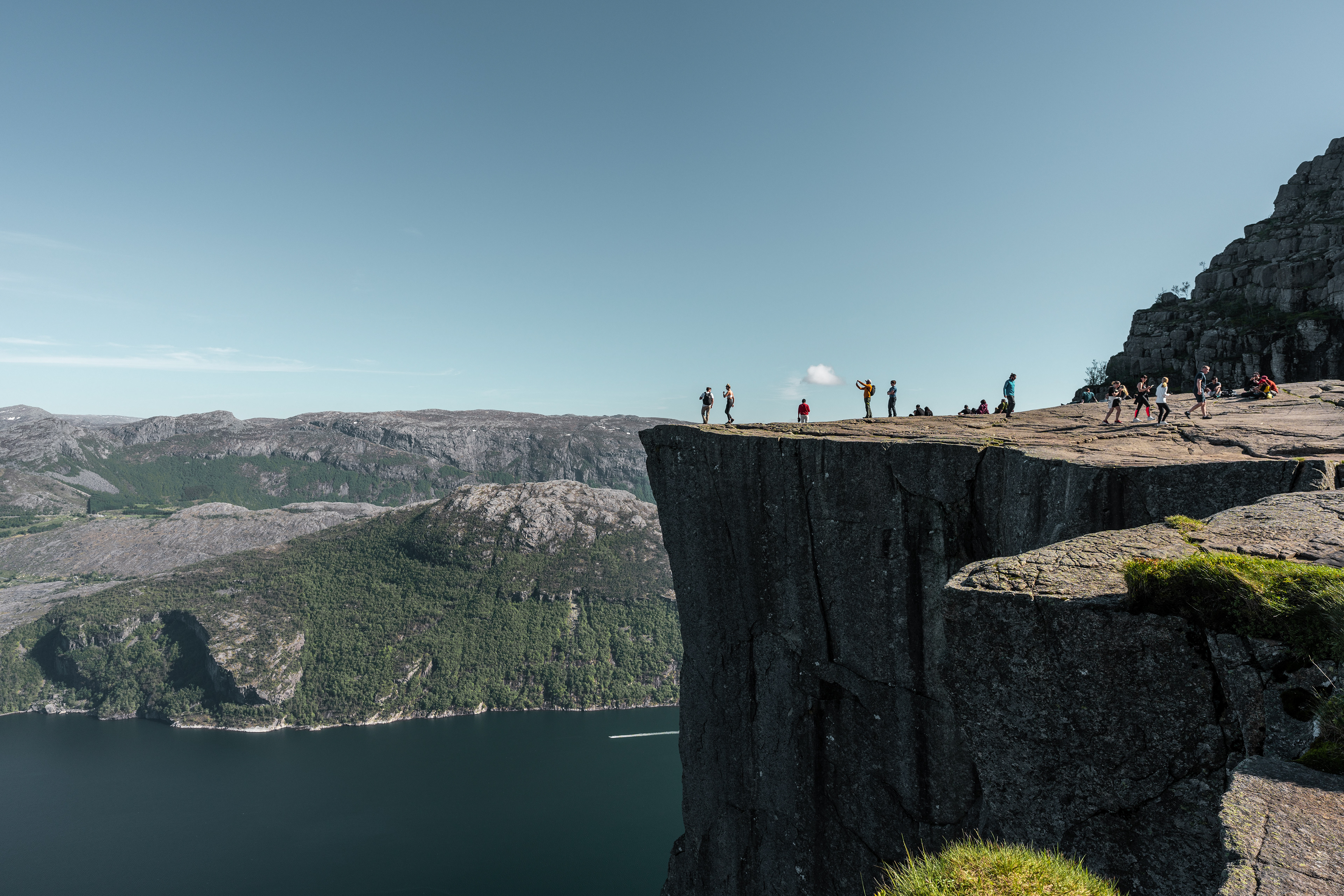
The views were breathtaking though and it was all the more rewarding once we reached the Trolltunga (or Troll's tung). It hovers about 700 meters above Ringedalsvatnet, a lake down below. The views are exceptional but you're gonna have to wait your turn to get on the rock and have your picture taken. Waiting times can be up to an hour depending on how busy it is, it's just something you have to accept when going on a touristic hike like this one. All-in-all glad we did it although it was very exhausting, especially the trip back can be mentally challenging as there seems to be no end to the up and down trail in the snow and it's hard to recognize certain areas or points of interest from the outward journey. Don't let that scare you away though. Also, bring sun screen and a hat to protect yourself on sunny days like ours.
Start of the trail
Start of the trail
Start of the trail
Trolltunga Trail
Trolltunga Trail
View of Ringedalsvatnet
View of Ringedalsvatnet
View of Ringedalsvatnet
Trolltunga Trail

Trolltunga
Trolltunga
Trolltunga Trail
Not recommended :)
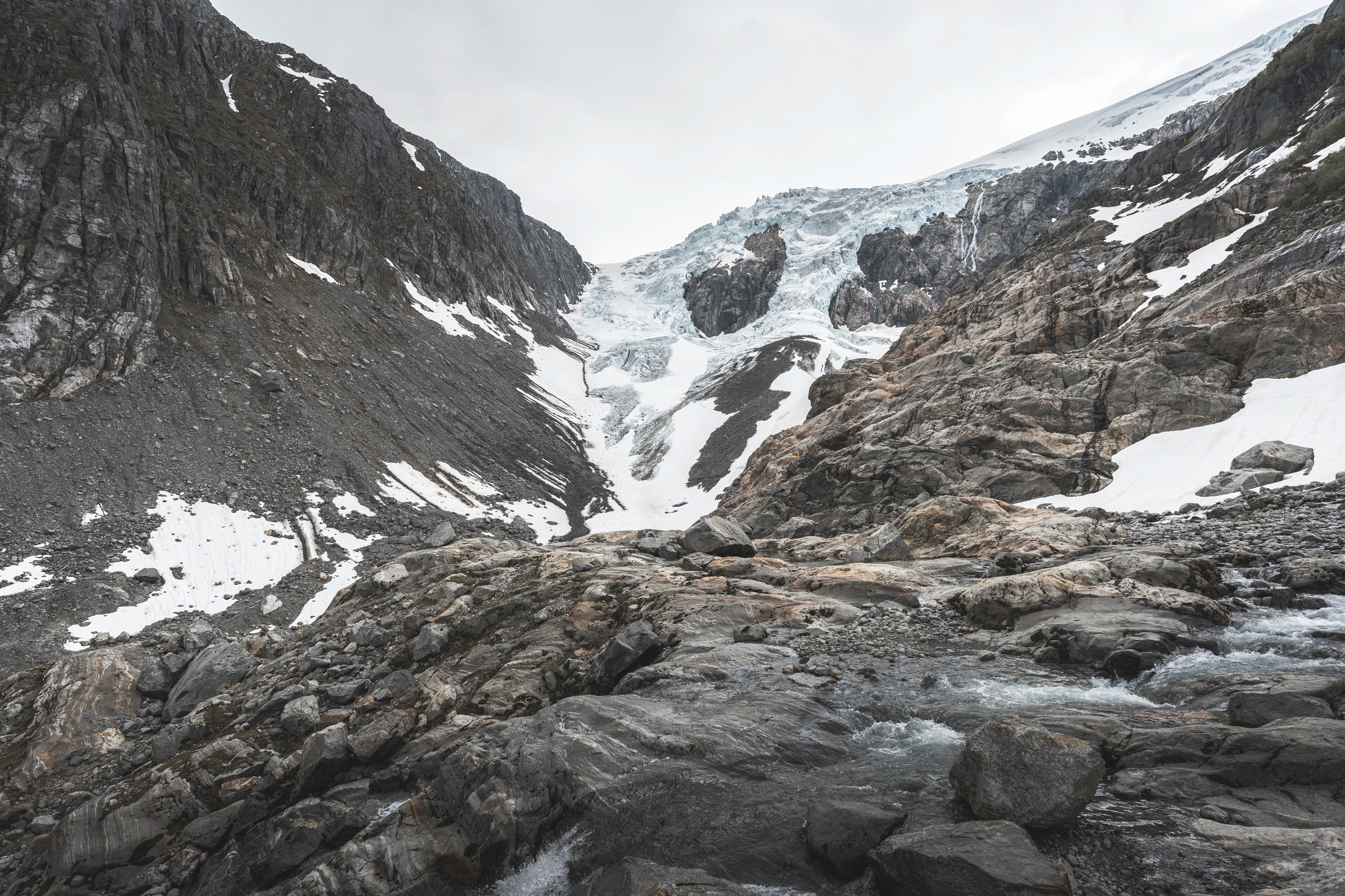
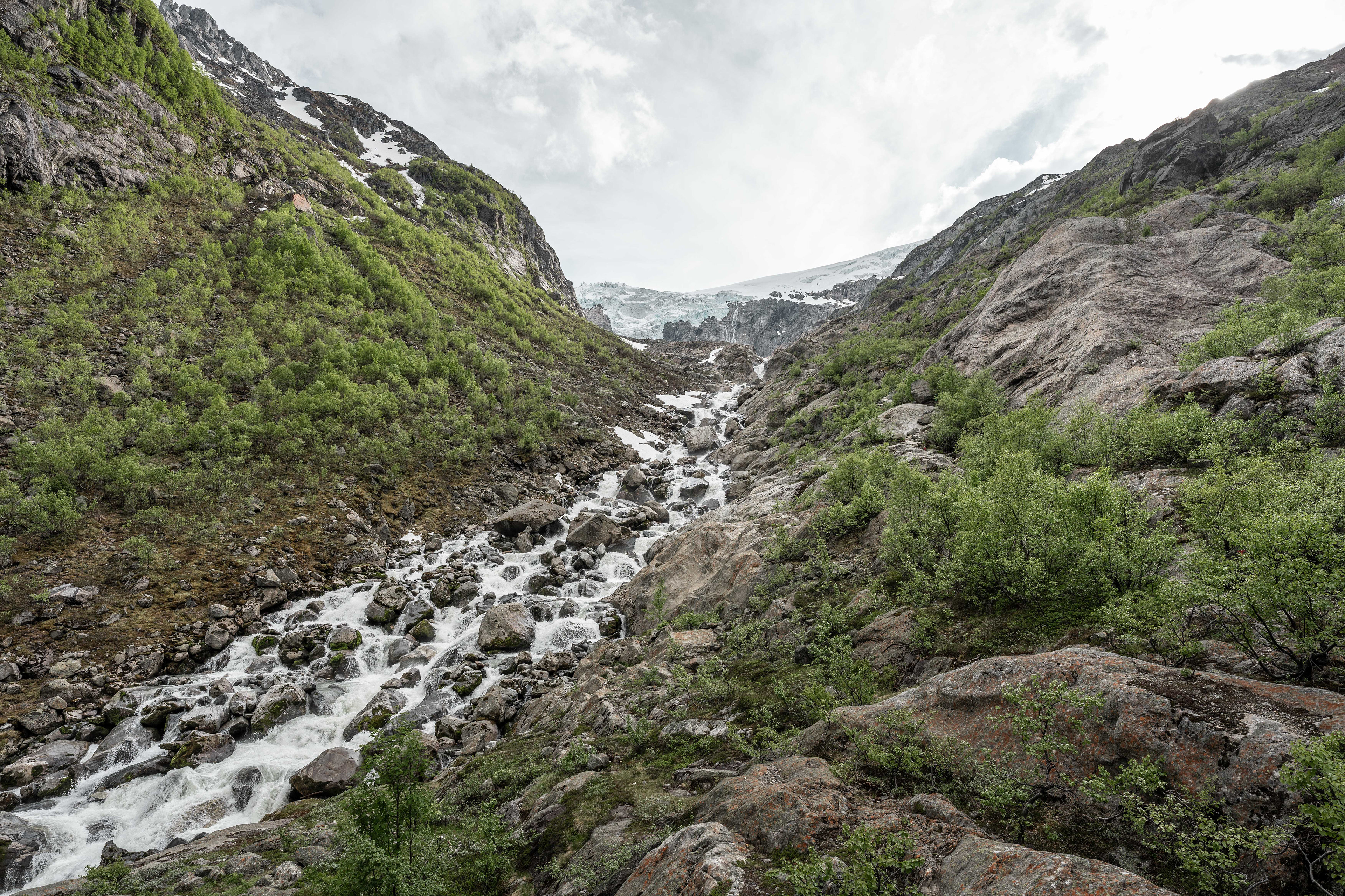
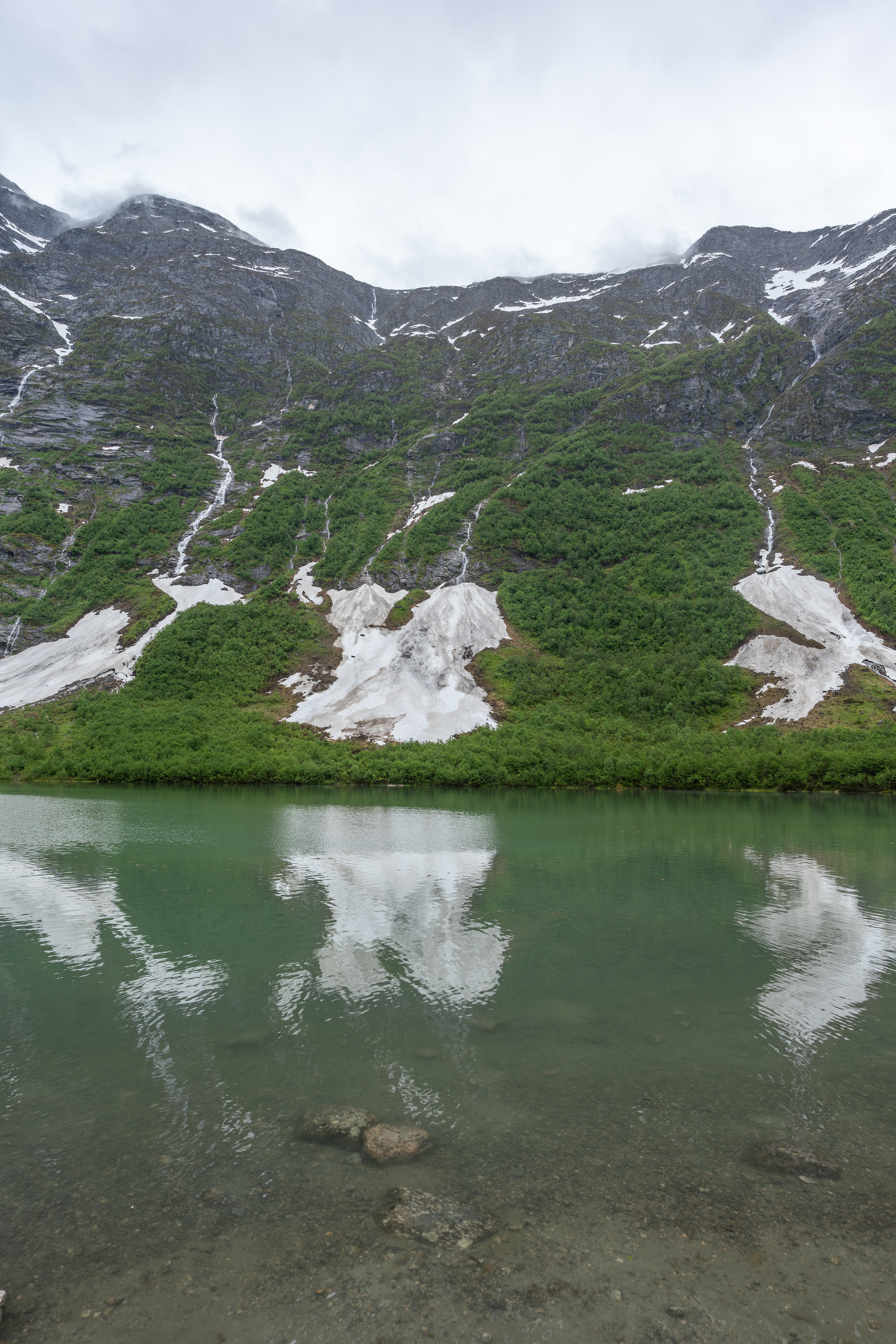
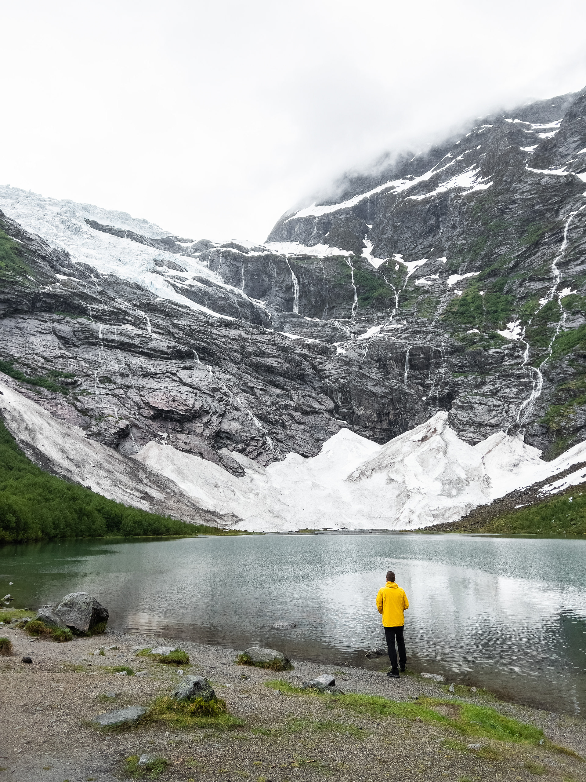
Buarbreen Glacier
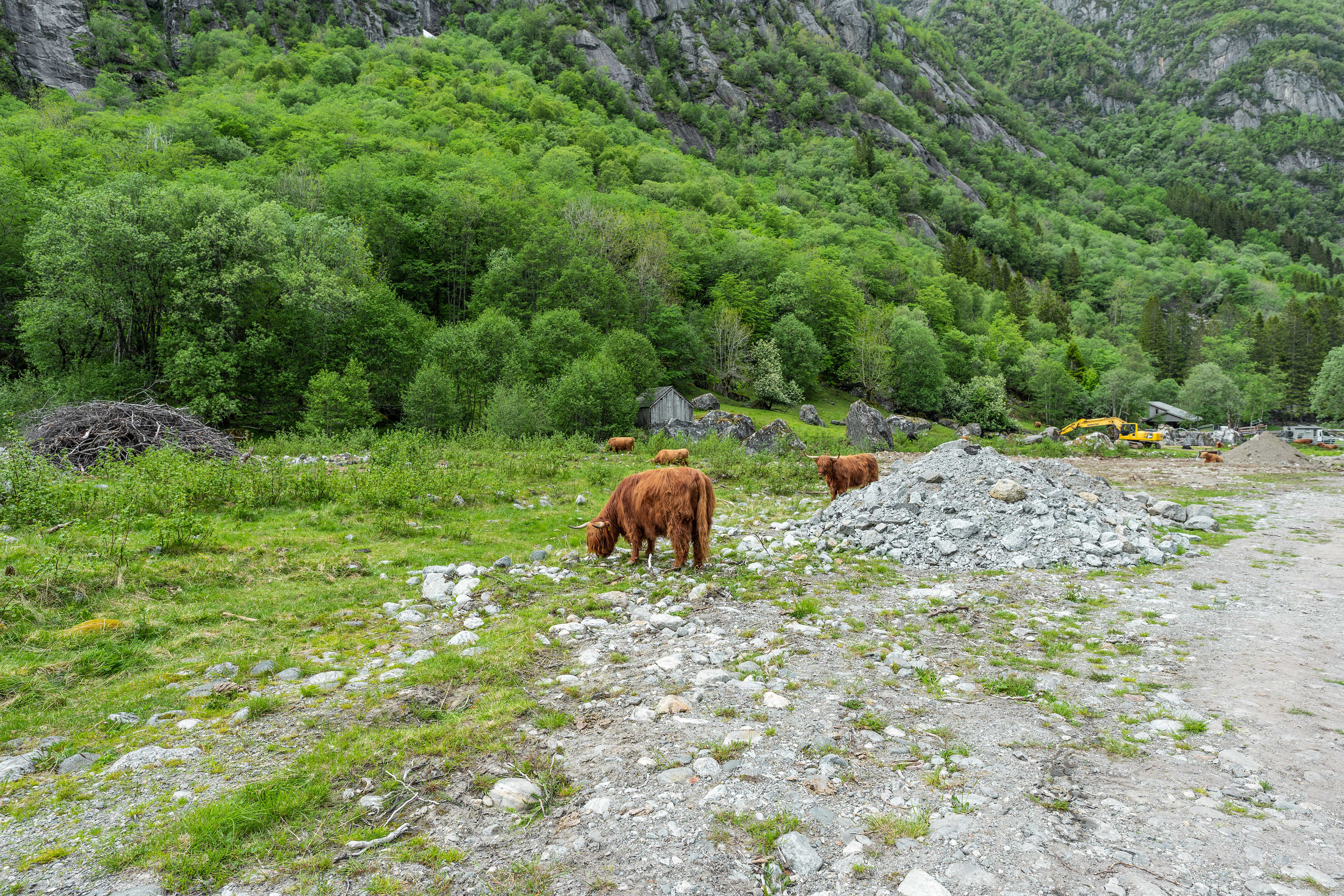
The day after the demanding Trolltunga hike we decided to spontaneously hike to the Buarbreen Glacier. I kind of left this day open to do whatever but then read up on this hike and it seemed like a lot of fun and not as crazy as Trolltunga. More on that later... It's easy to get to the trailhead from Odda, it's just West of Odda. When driving up towards the Trailhead you can actually see parts of the glacier from time to time. A part of this road is a gravel road which surprised me, do take that in mind when you decide to do this hike. Up at the trailhead is parking but I could see how that parking lot fills rather quickly depending on the time of day and the weather. I believe parking cost was around €15.
The hike starts out flat and passes a campsite and a field where you can see some cows grazing. It then starts to become more challenging rather quickly. This hike is about elevation and not so much the total distance, which is about 6 kilometers roundtrip (3.7 miles). When you enter the forest it pretty much only goes up from there. The trail is nice but don't expect rocks and other natural obstacles to be cleared away everywhere. There are some basic river crossings where you have to be careful not to fall in. Fairly quickly you start to notice the cold glacier wind coming down to the valley. This is actually quite refreshing as the hike is fairly intense but can also be quite cold, therefore again you need the proper gear to do this hike.
Then to my surprise we reached some very steep rocky parts where you need to use ropes in order to get up and down. I didn't do too much research on this hike so I was a bit surprised but it actually was quite fun. It's certainly not a walk in the park but anyone with moderate hiking experience can do it. We even saw people with dogs climbing up :) Once you are up, you are at the rocky base of the Buarbreen glacier. This is only a small part of the Folgafonna glacier, which is Norway's 3rd largest glacier by surface. I believe you can do guided glacier hikes to climb further up as well. That's not something we did.
Base of the trail
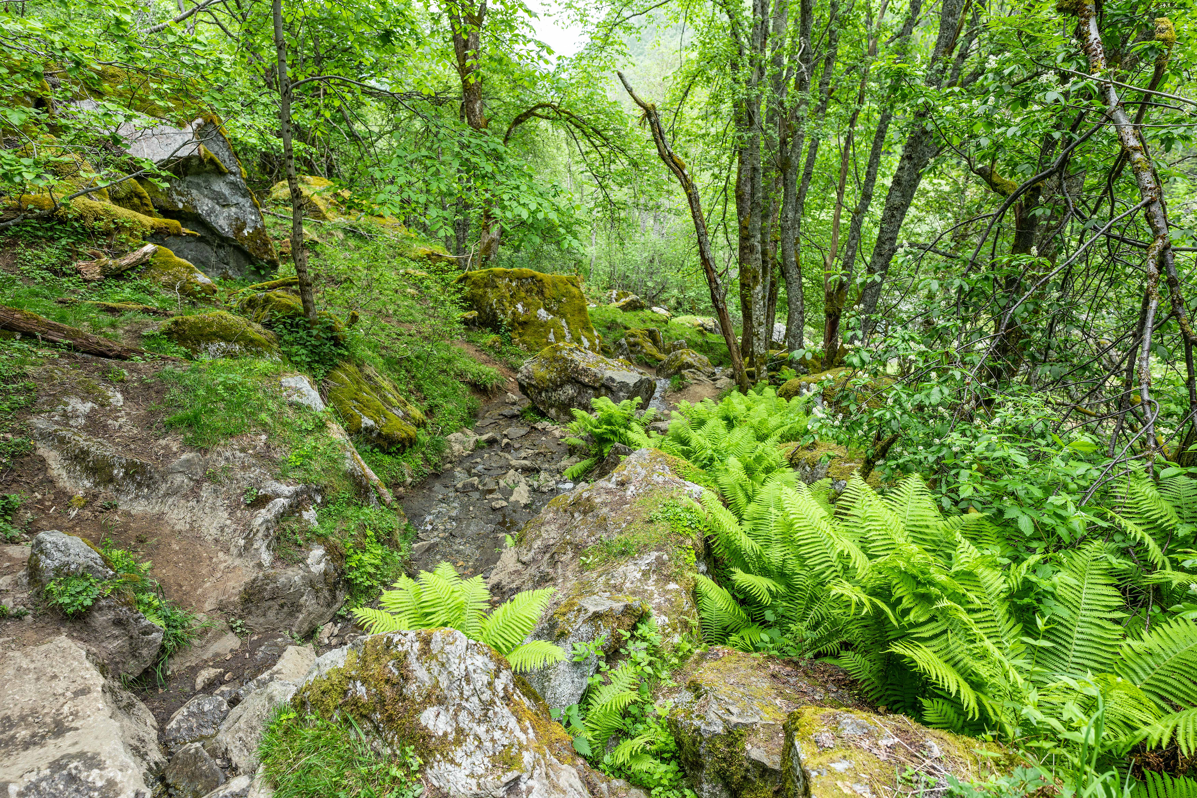
What the trail looks like in most places
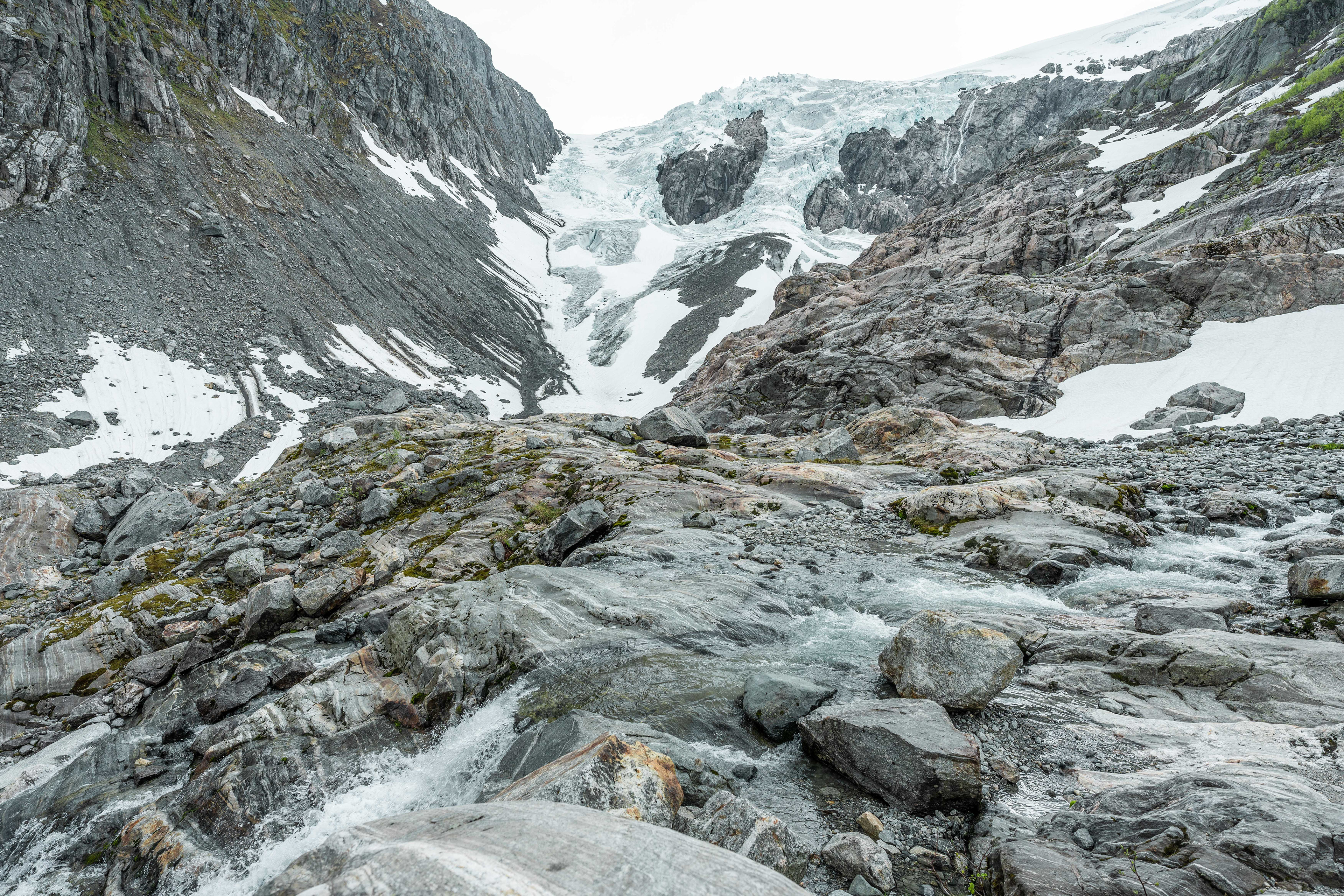
At the base of the glacier
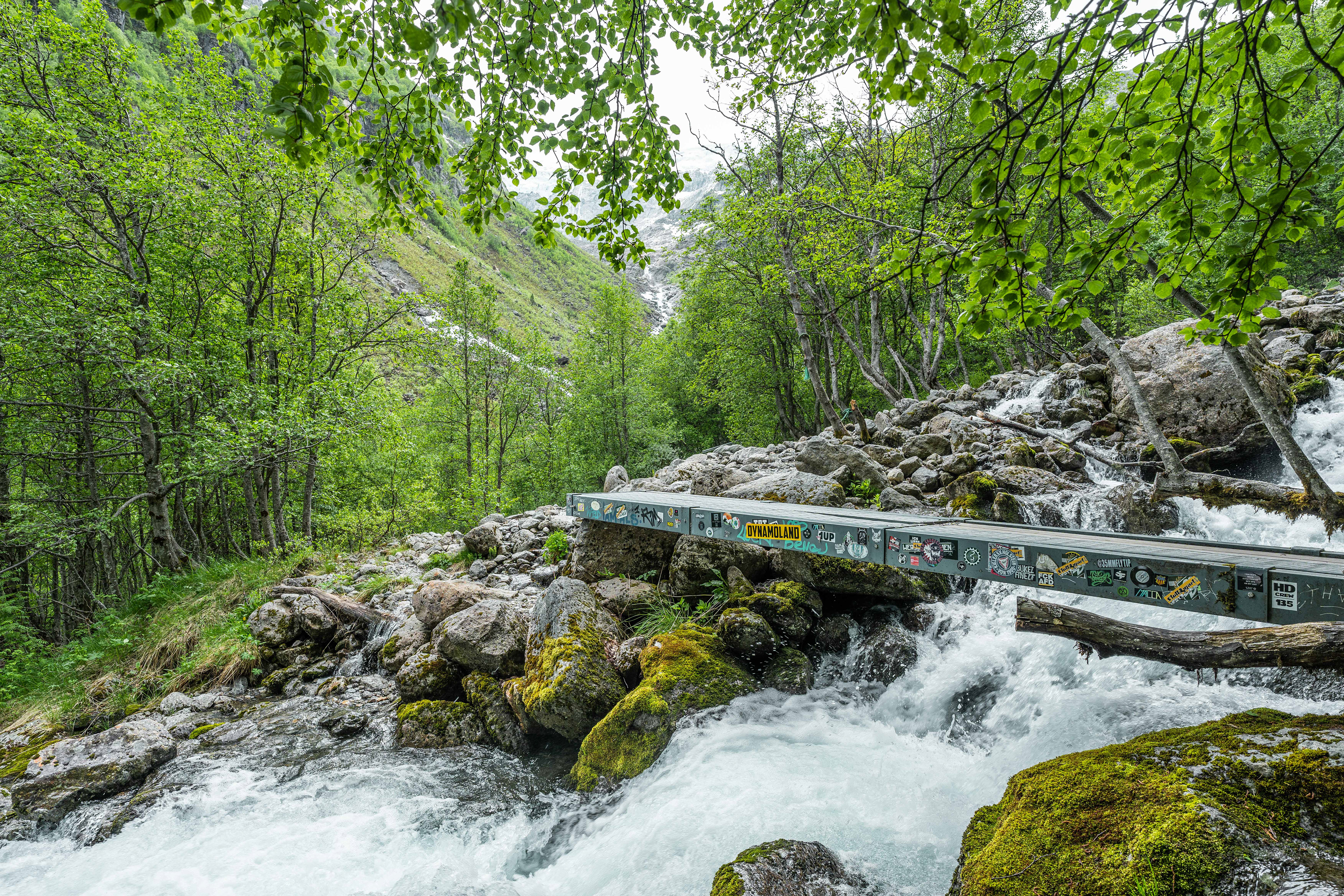
Crossing streams on the way up
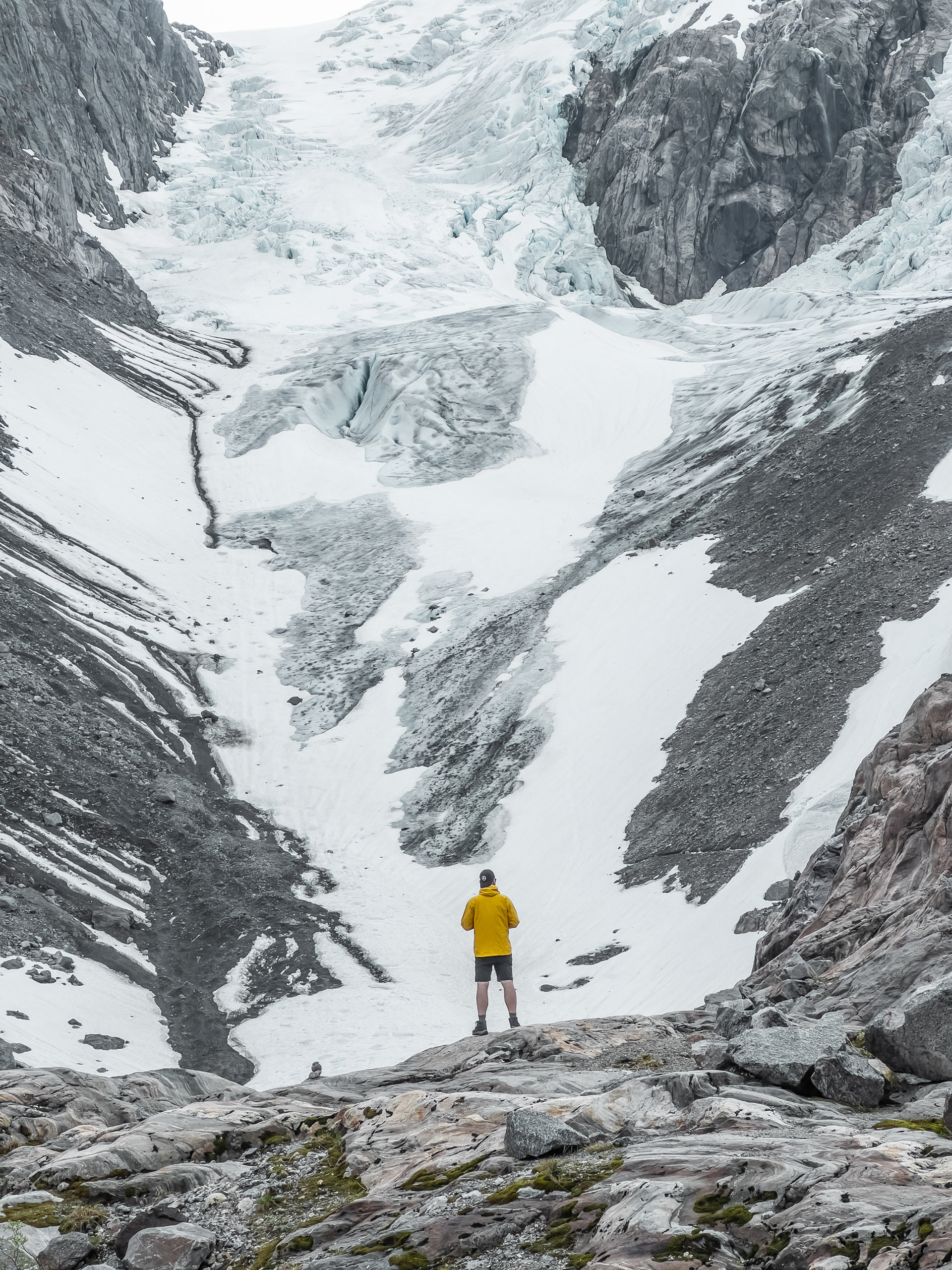
Me at the foot of Buarbreen Glacier
Buarbreen Glacier
A view up to the glacier
Bergen
A typical cityscape view of Bergen
The road to Bergen
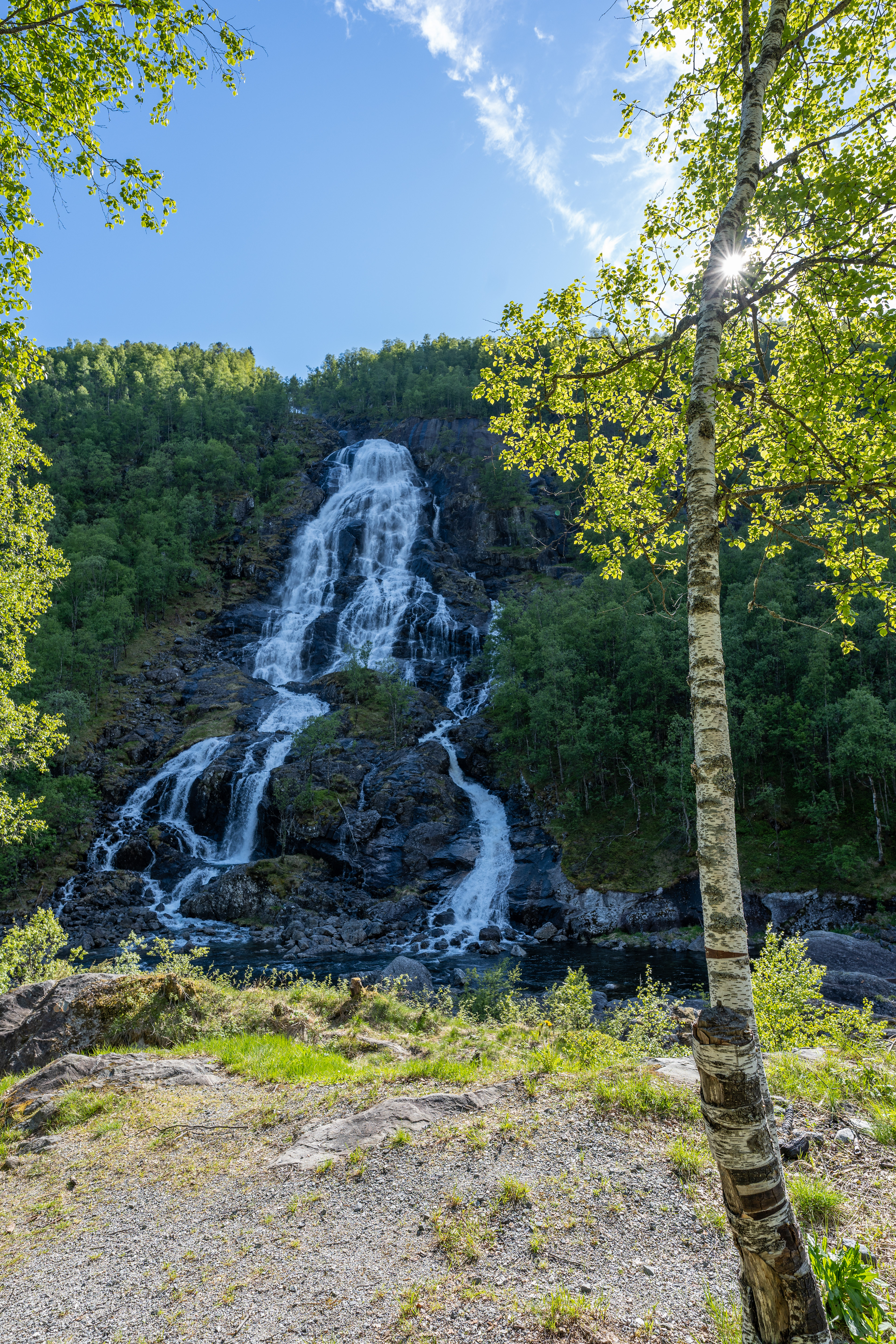
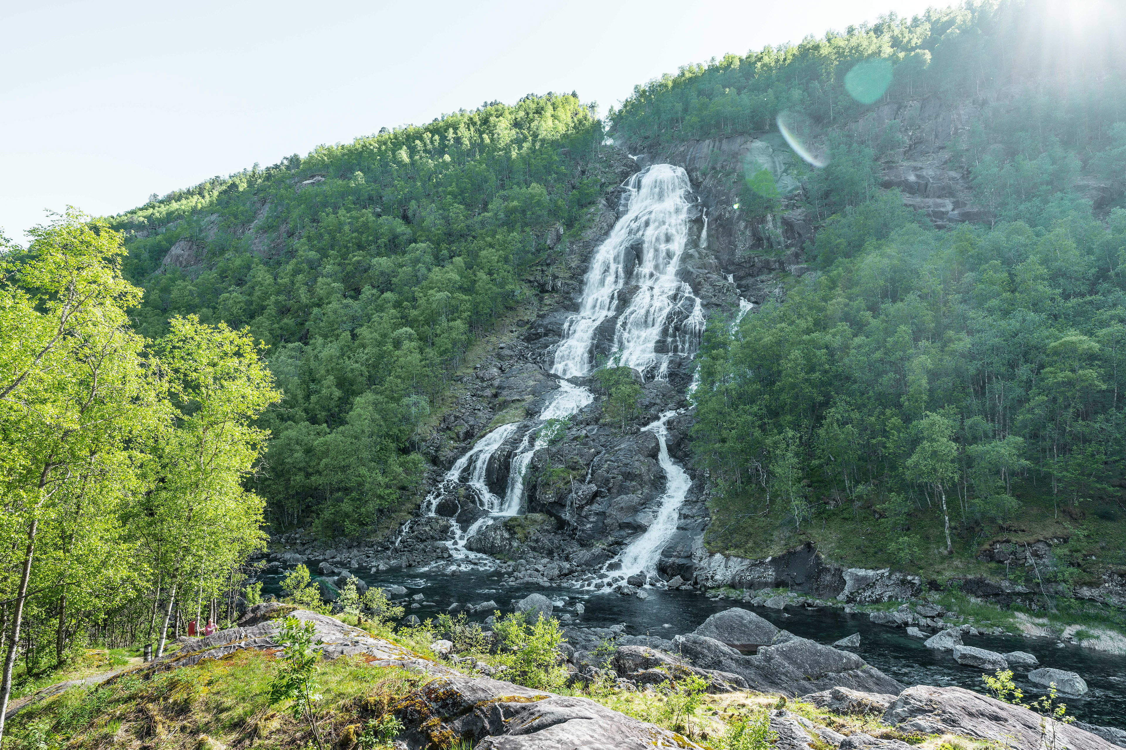
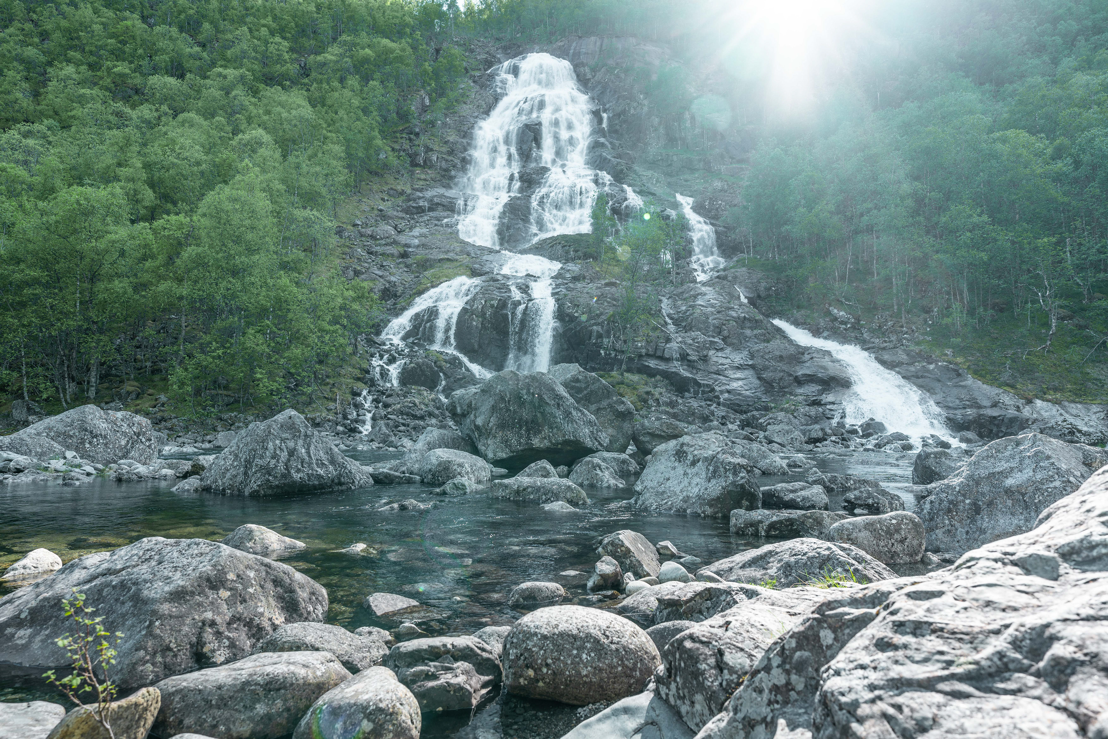
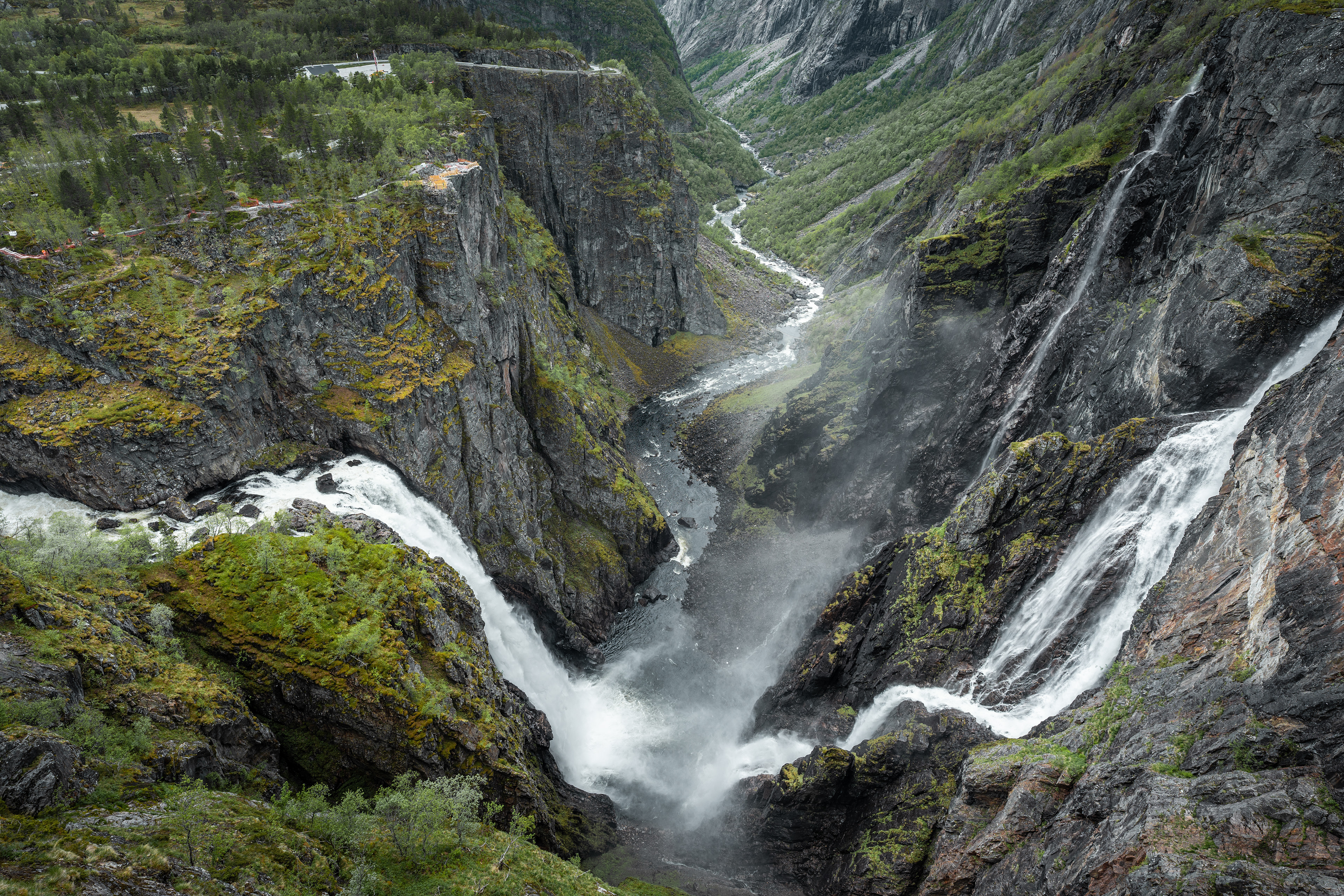
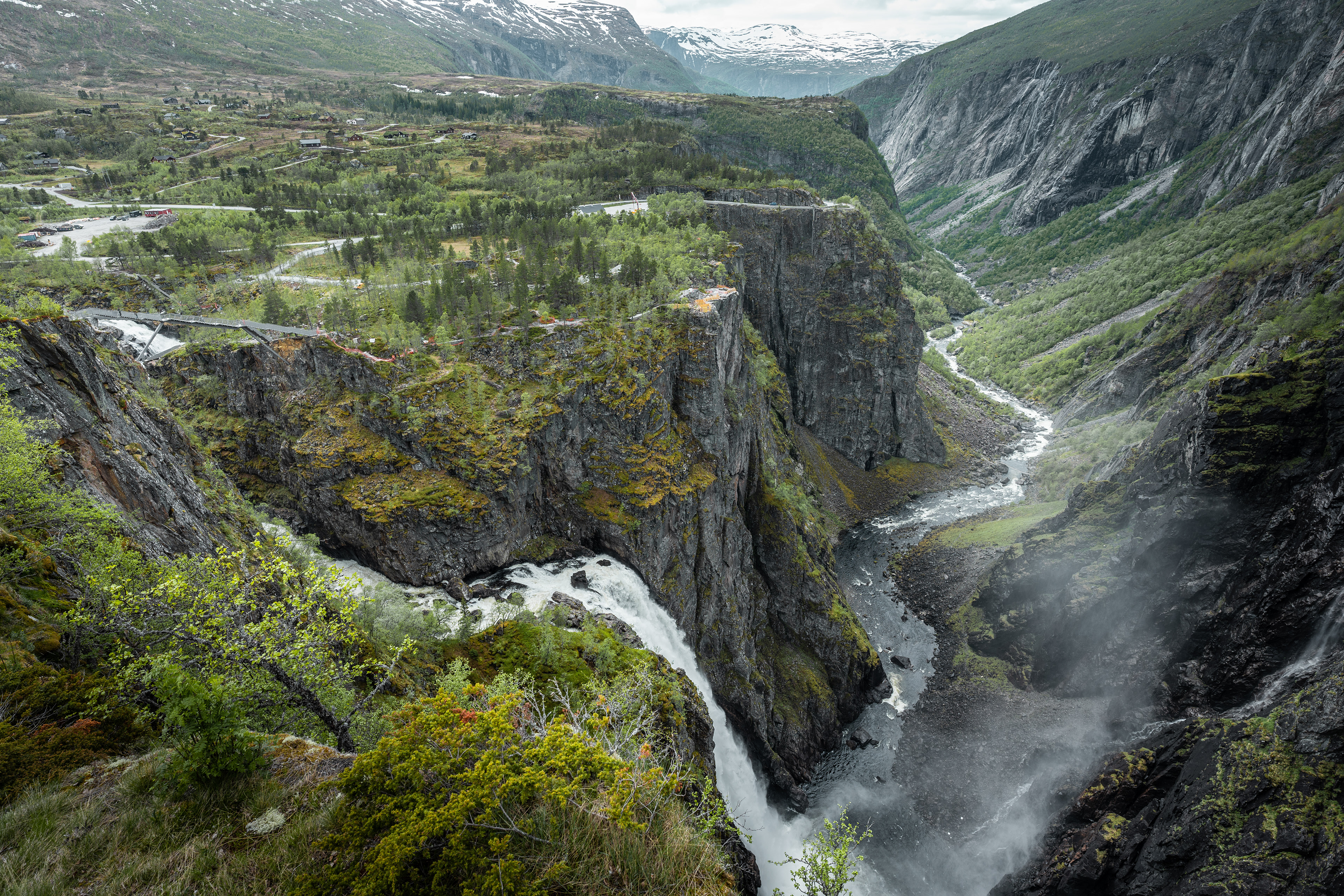
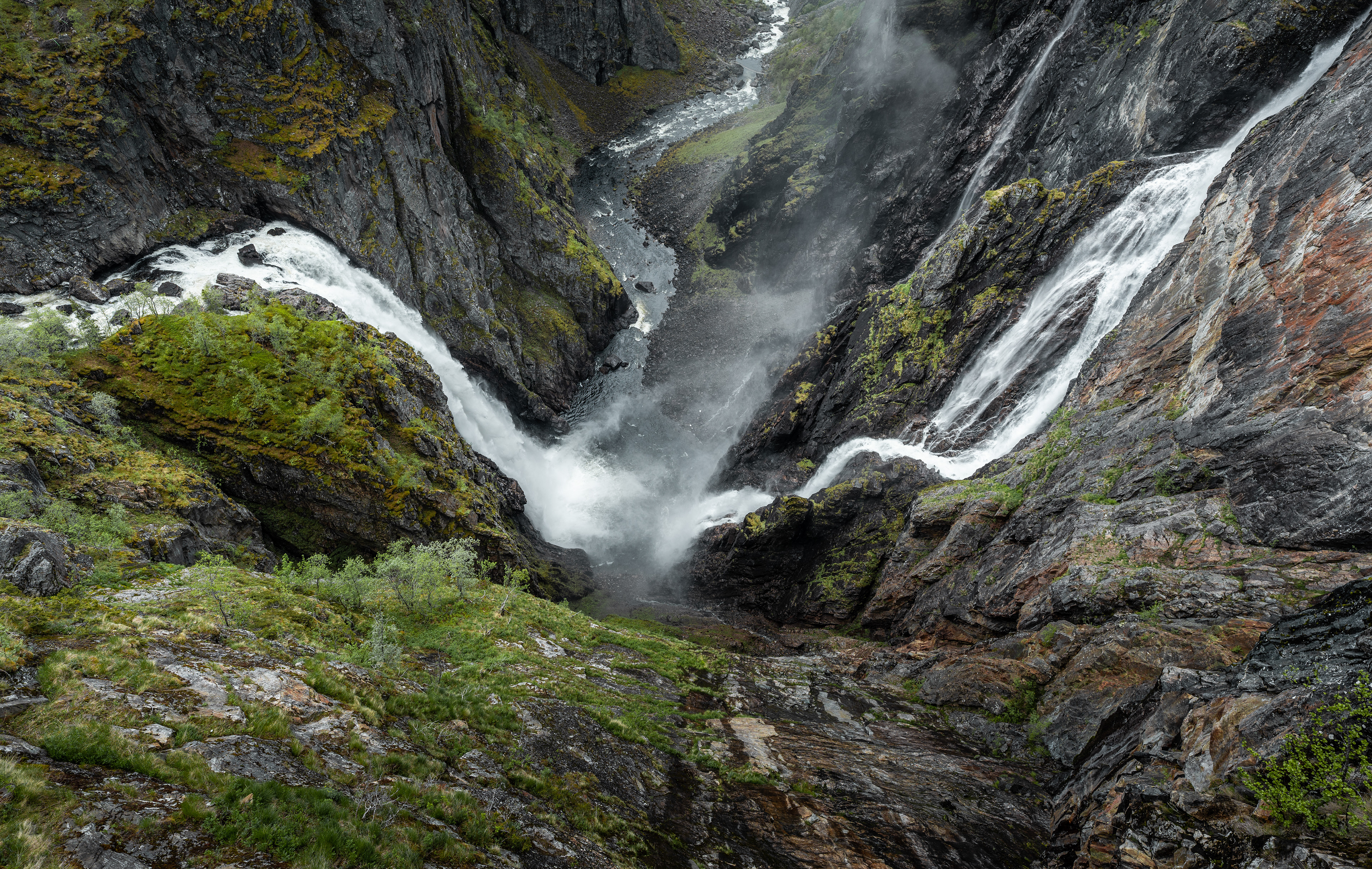
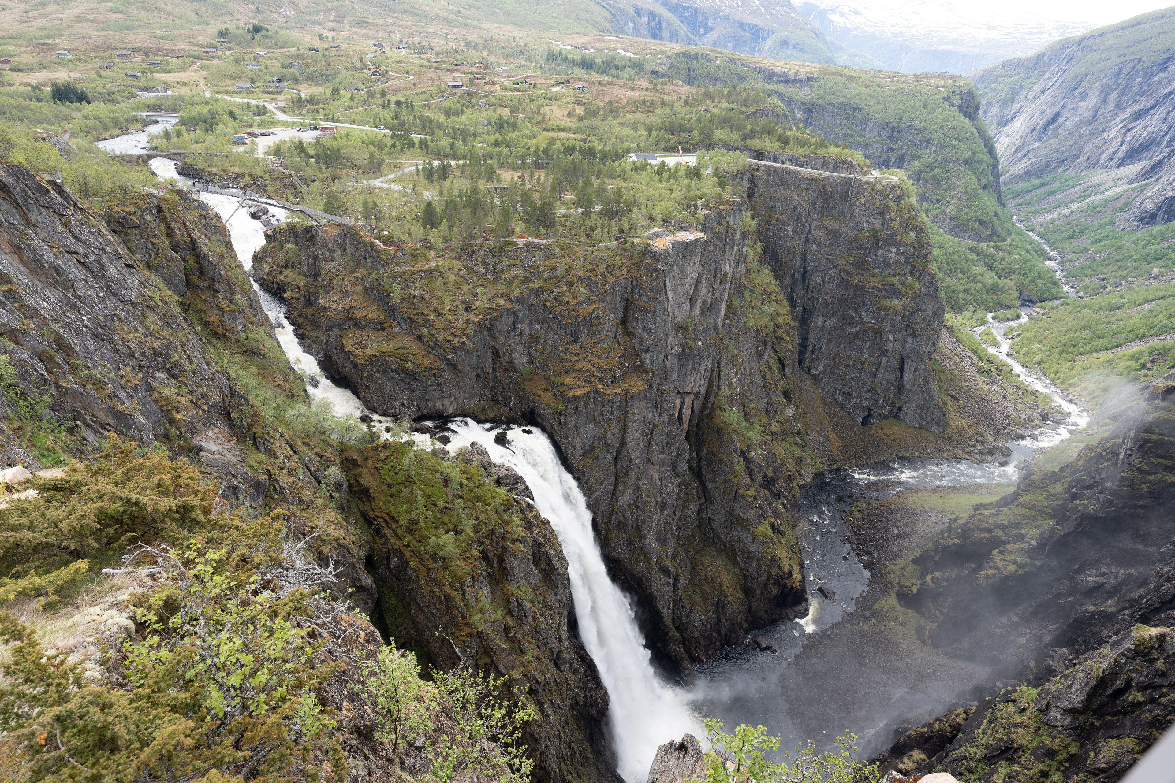
Vøringsfossen
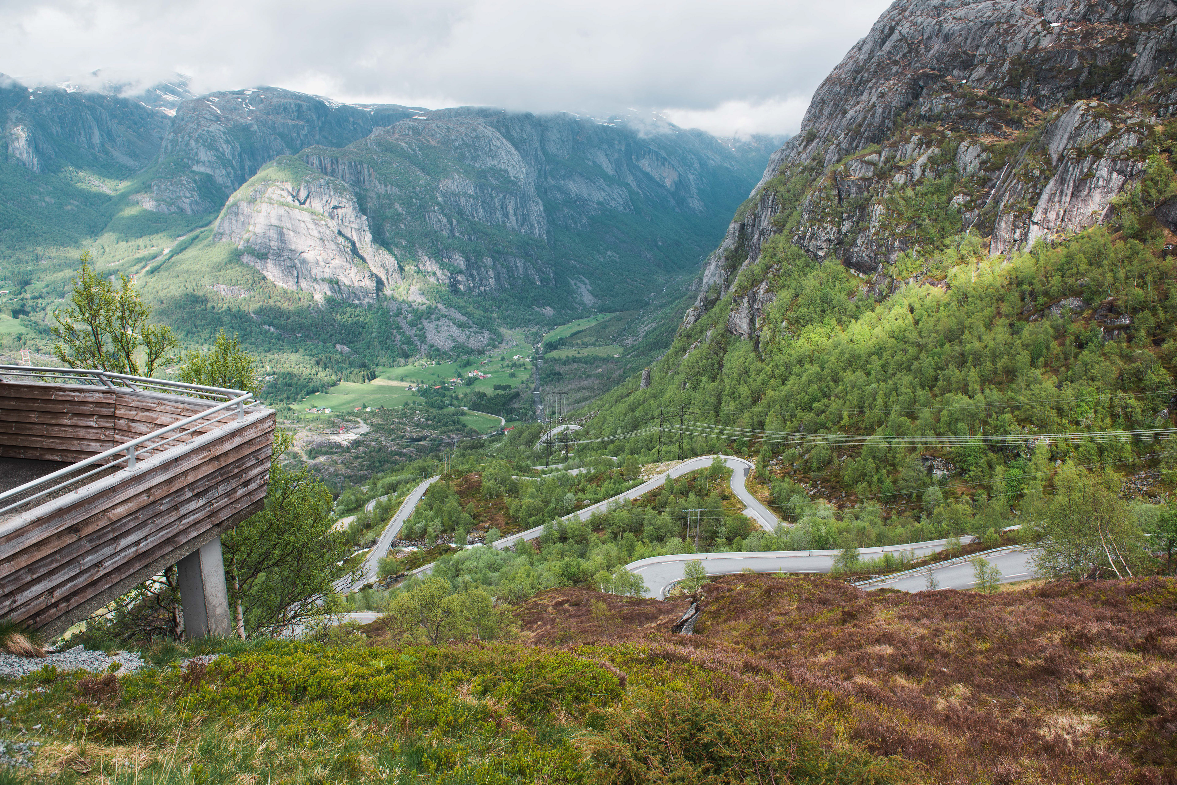
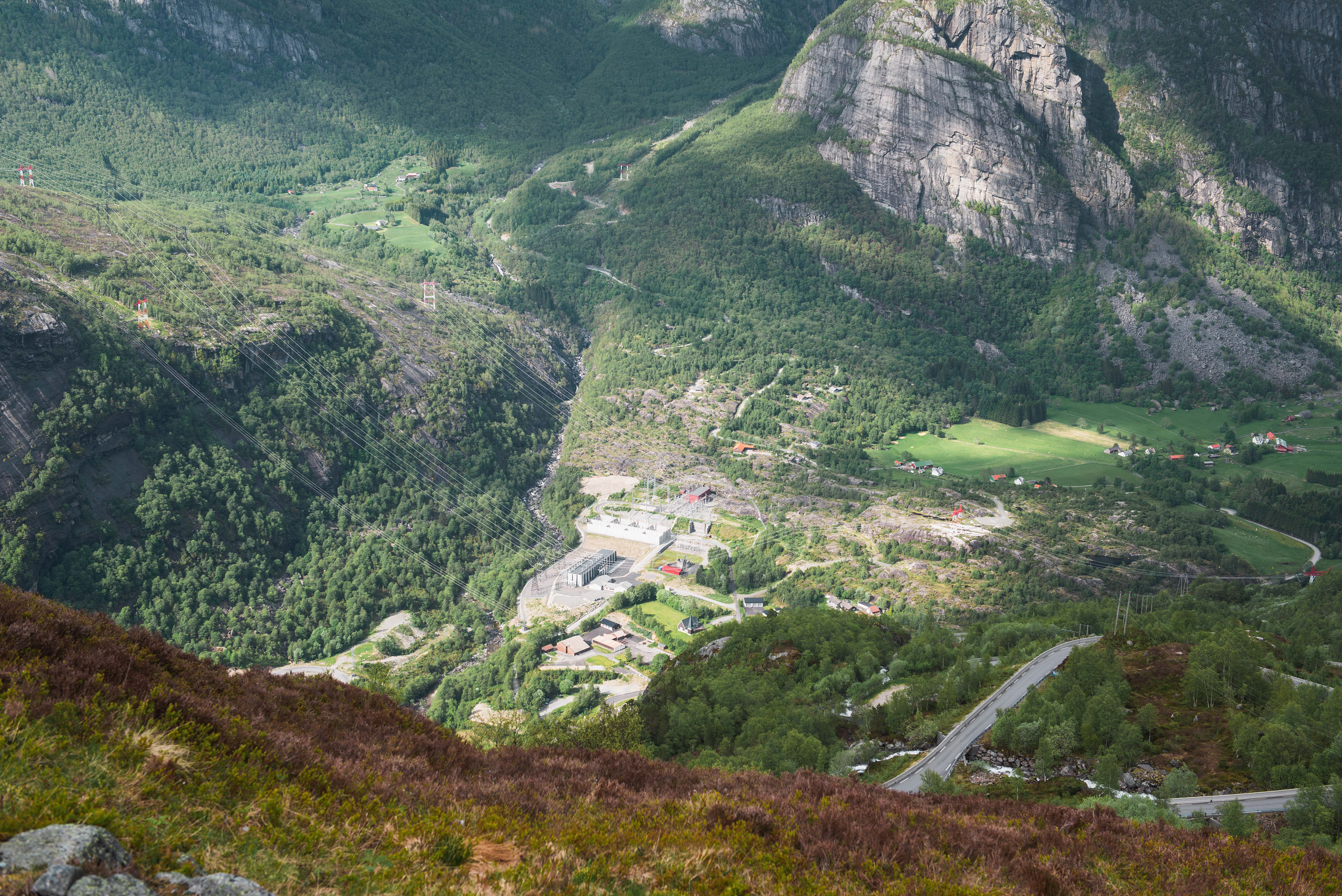
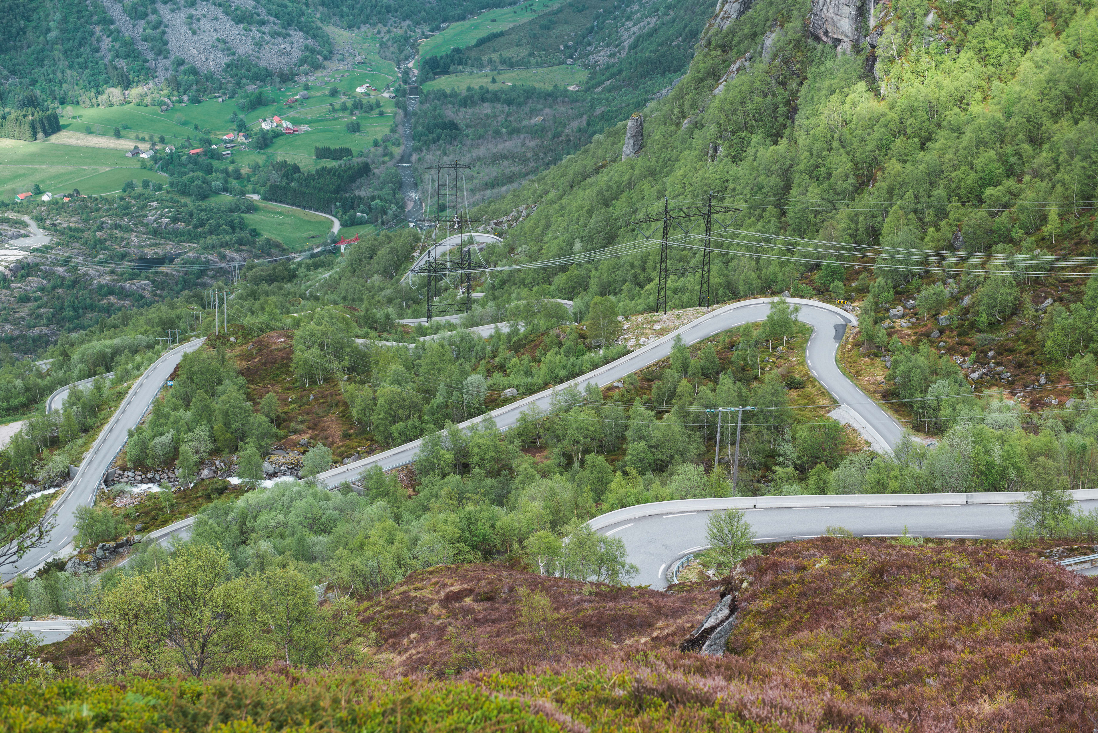
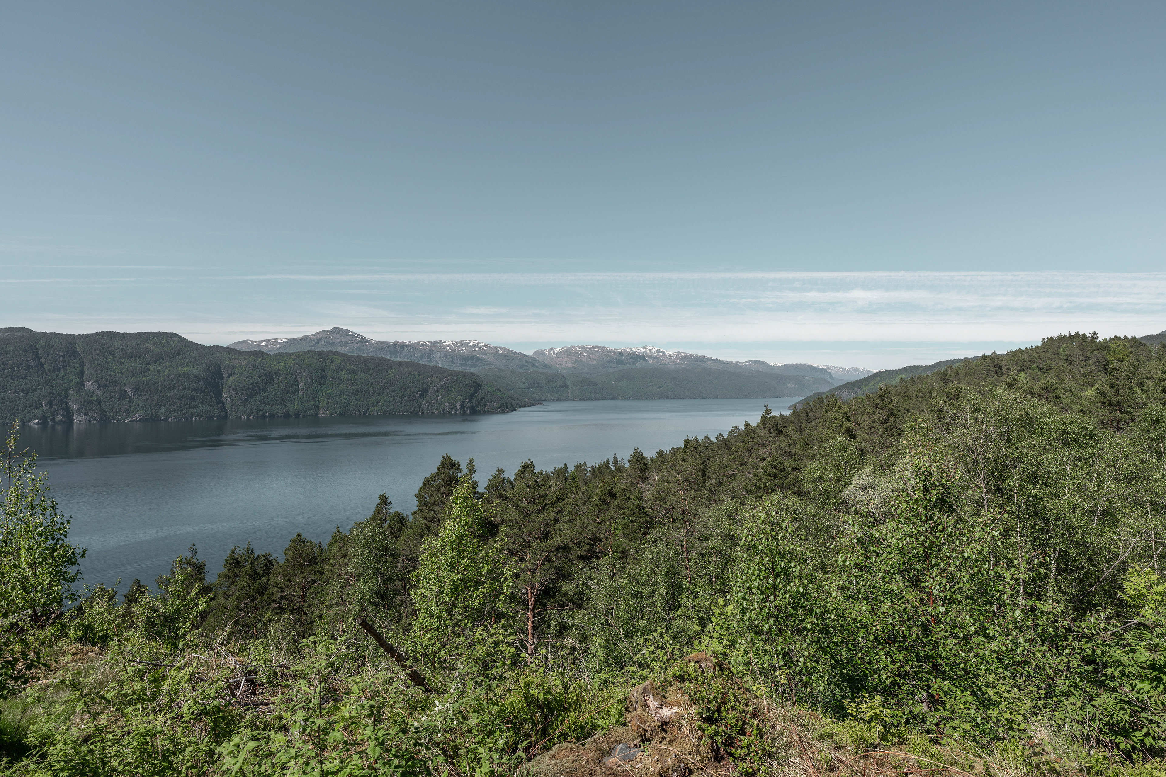
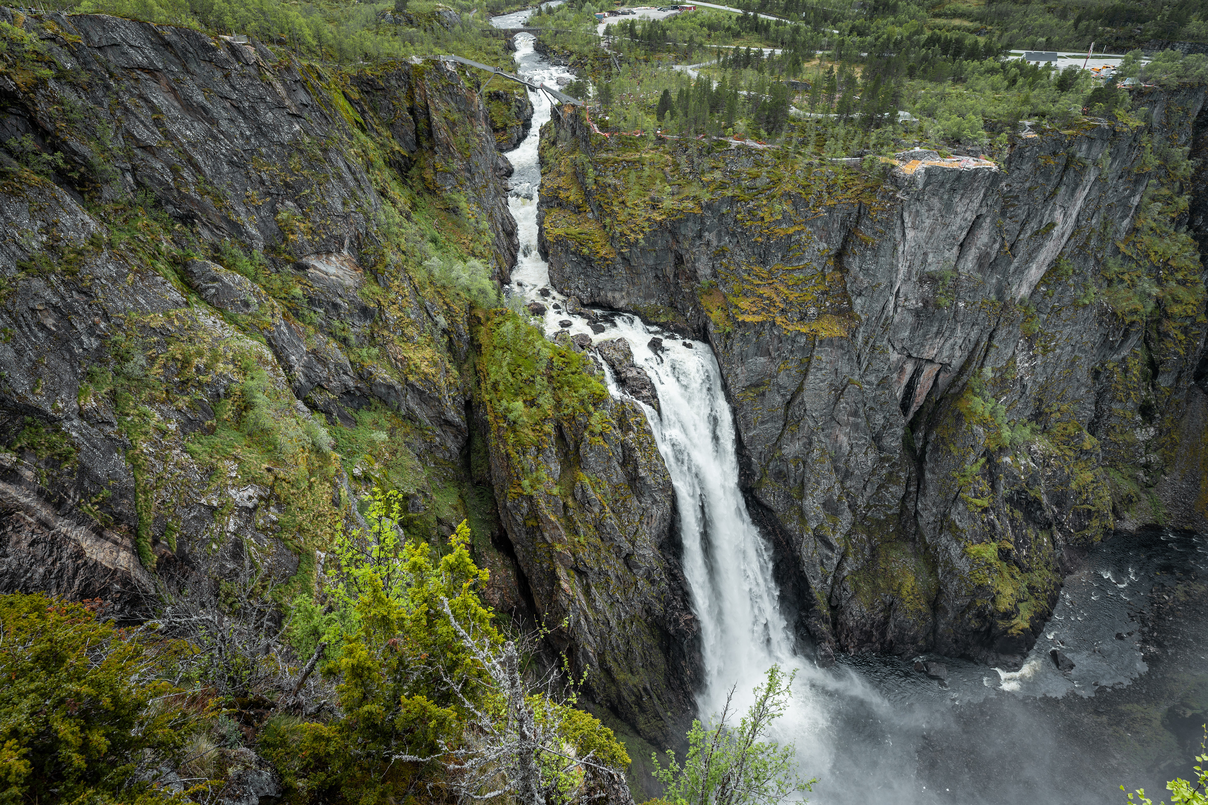
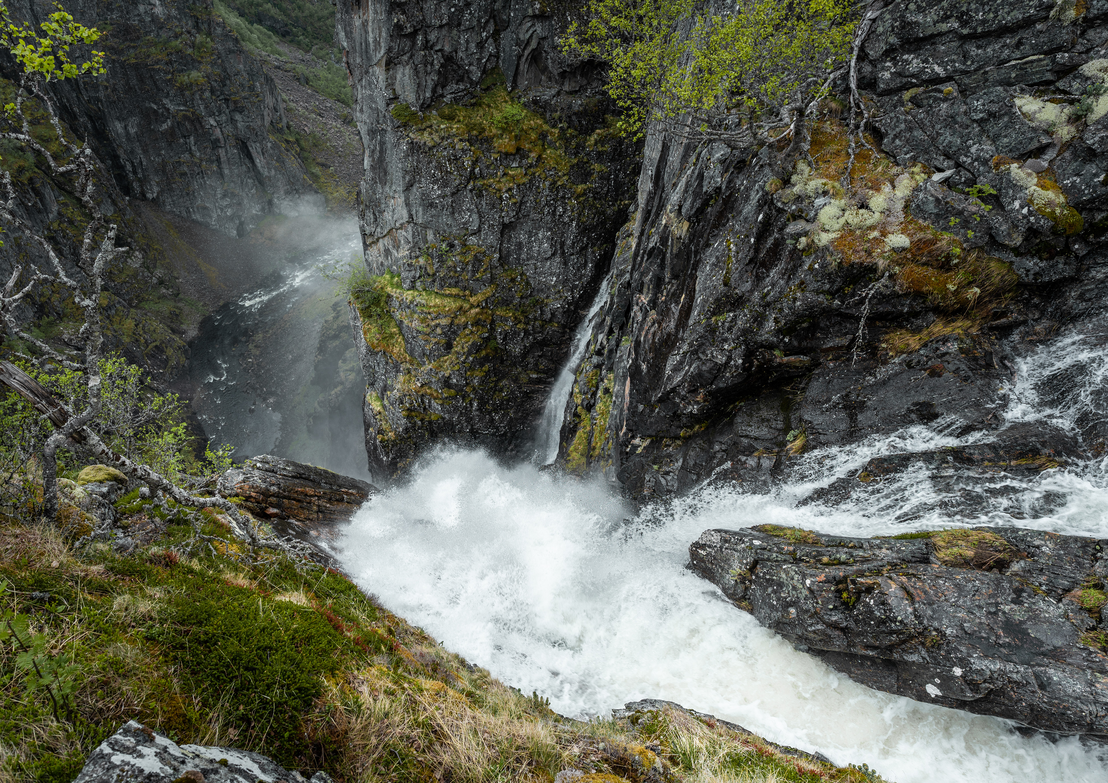
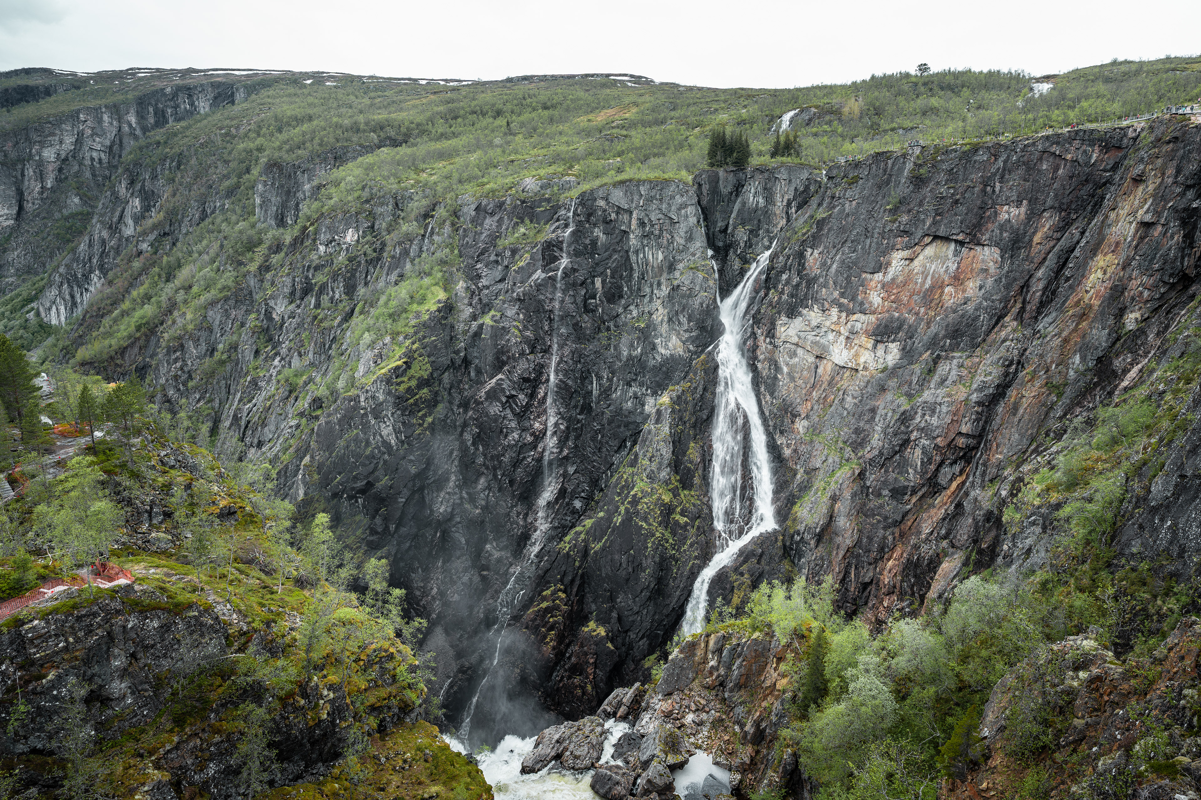
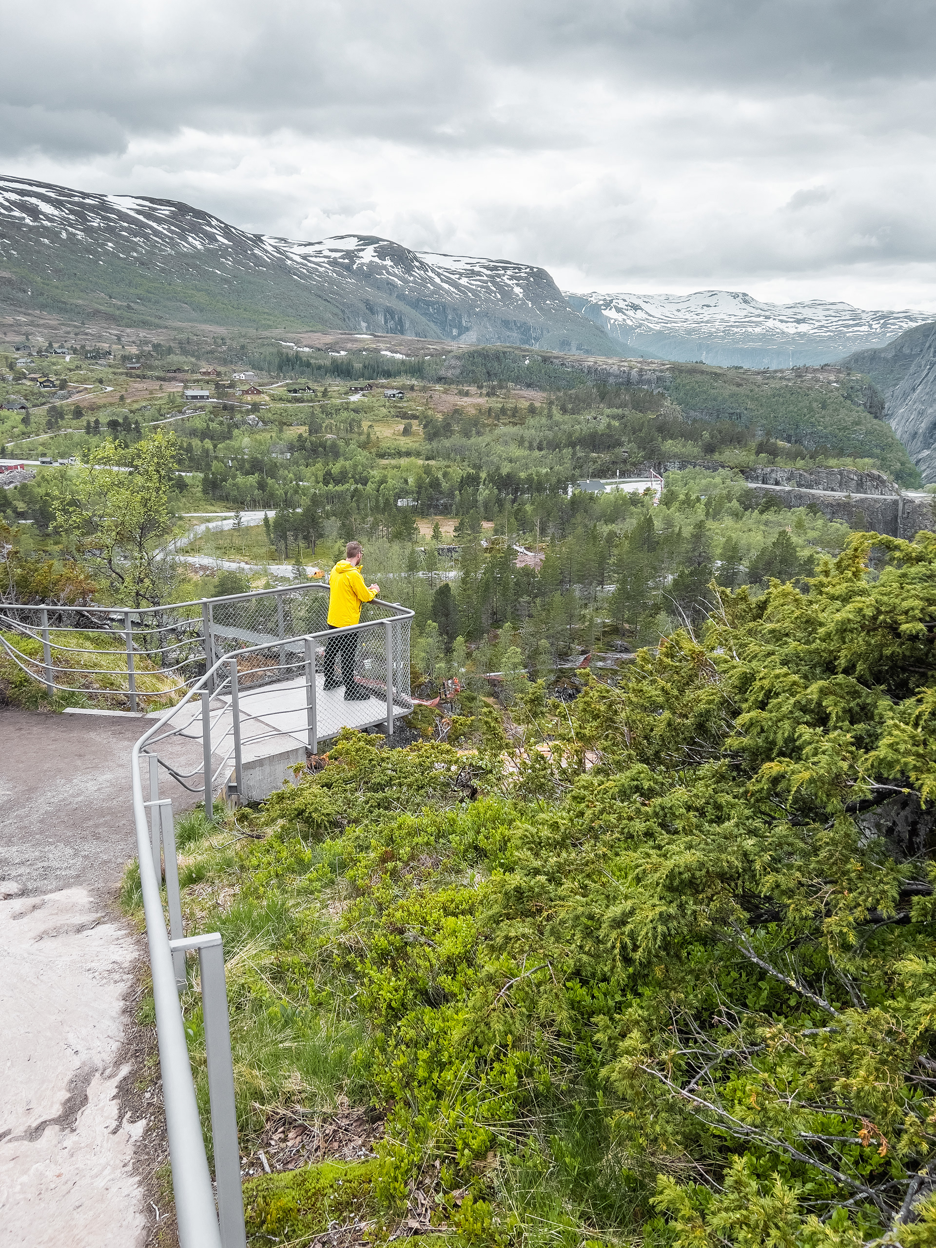
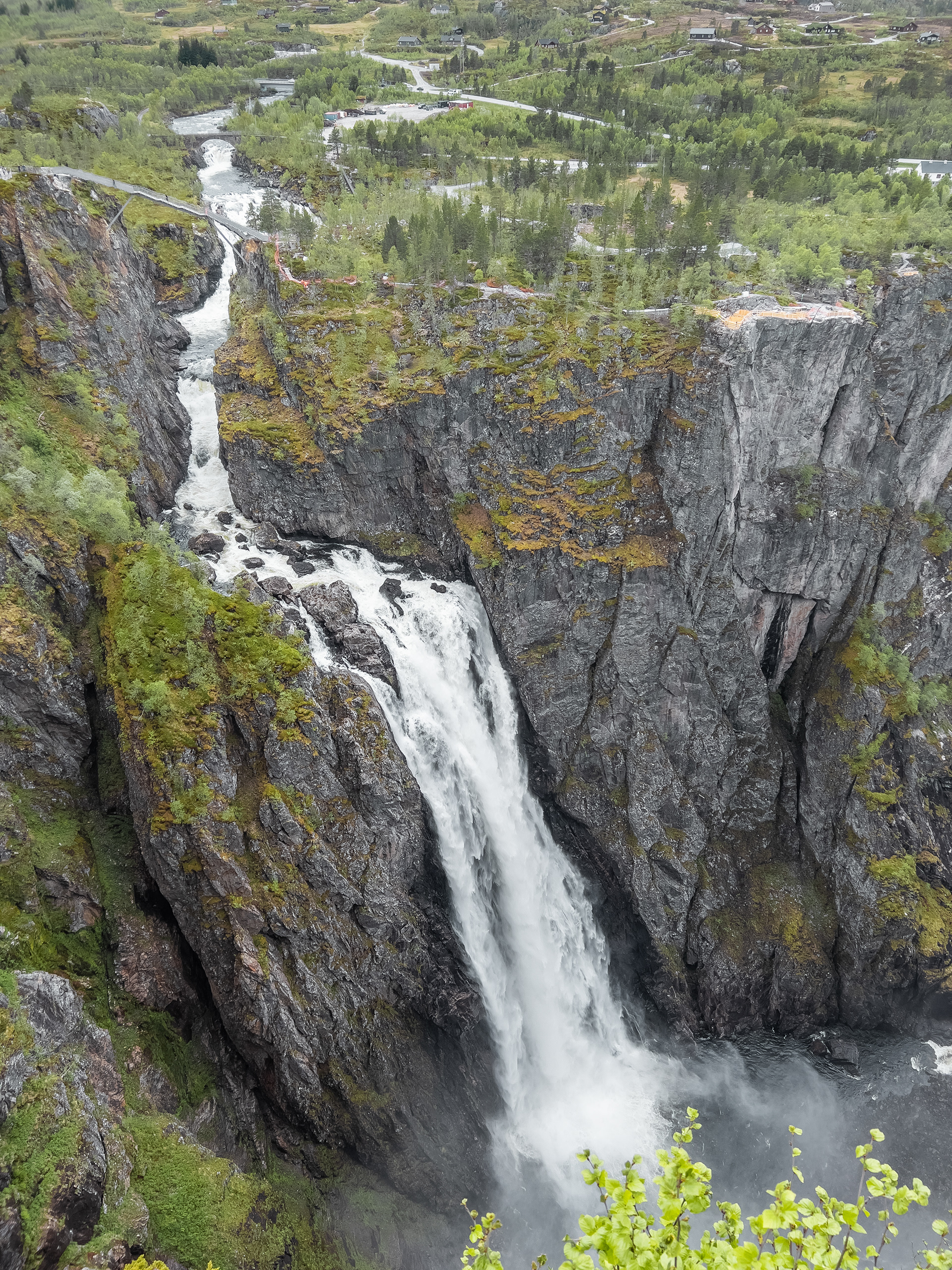
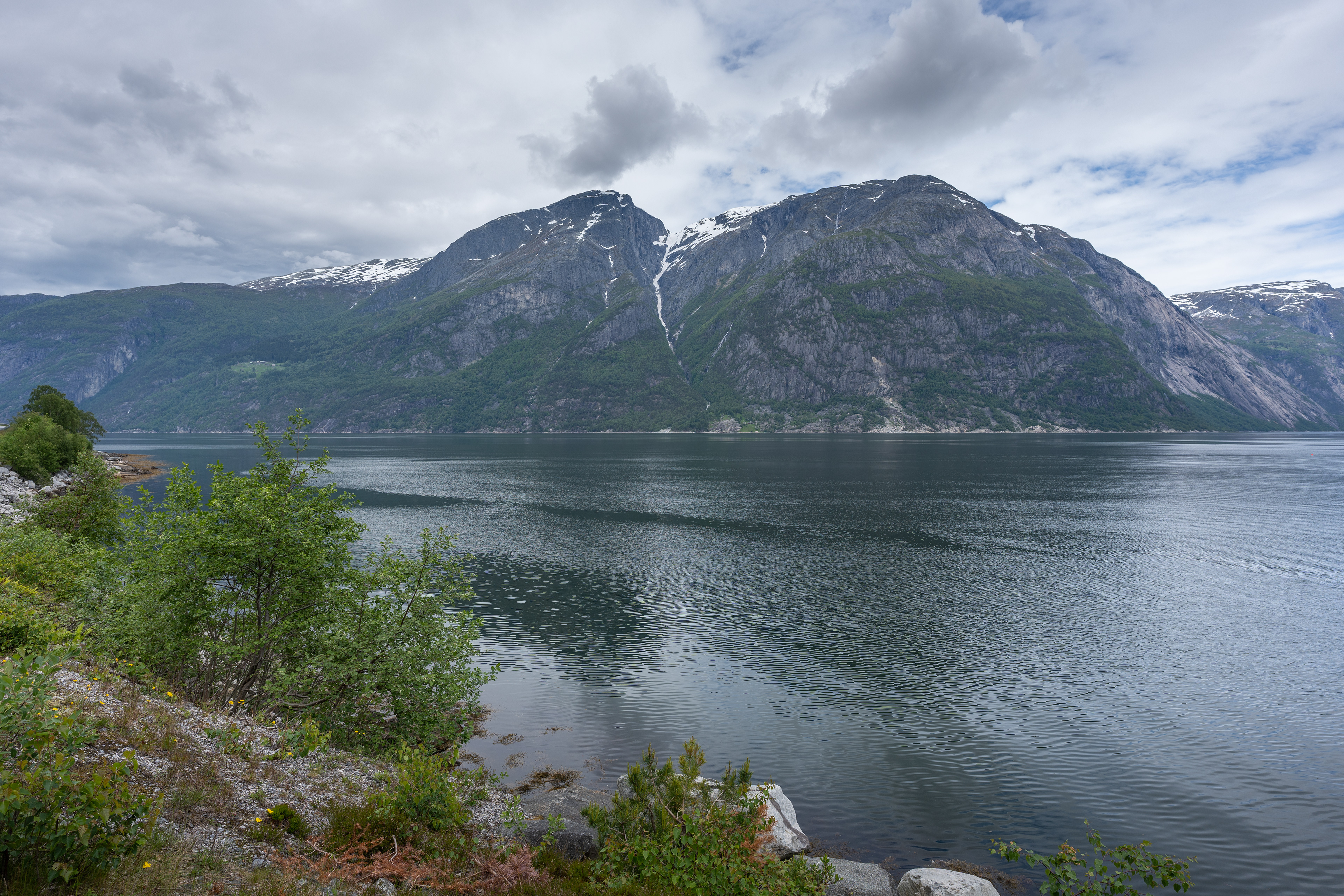
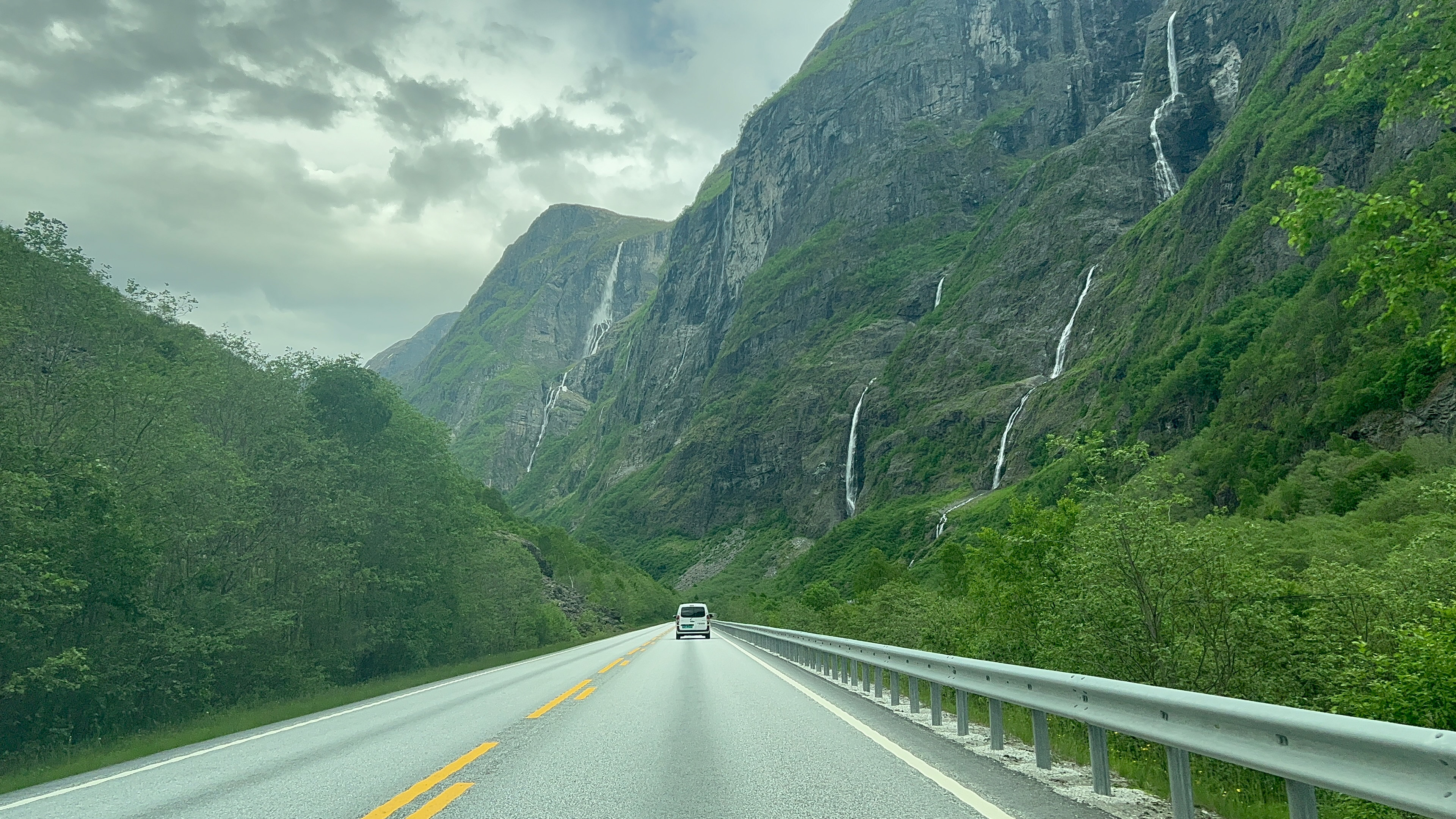
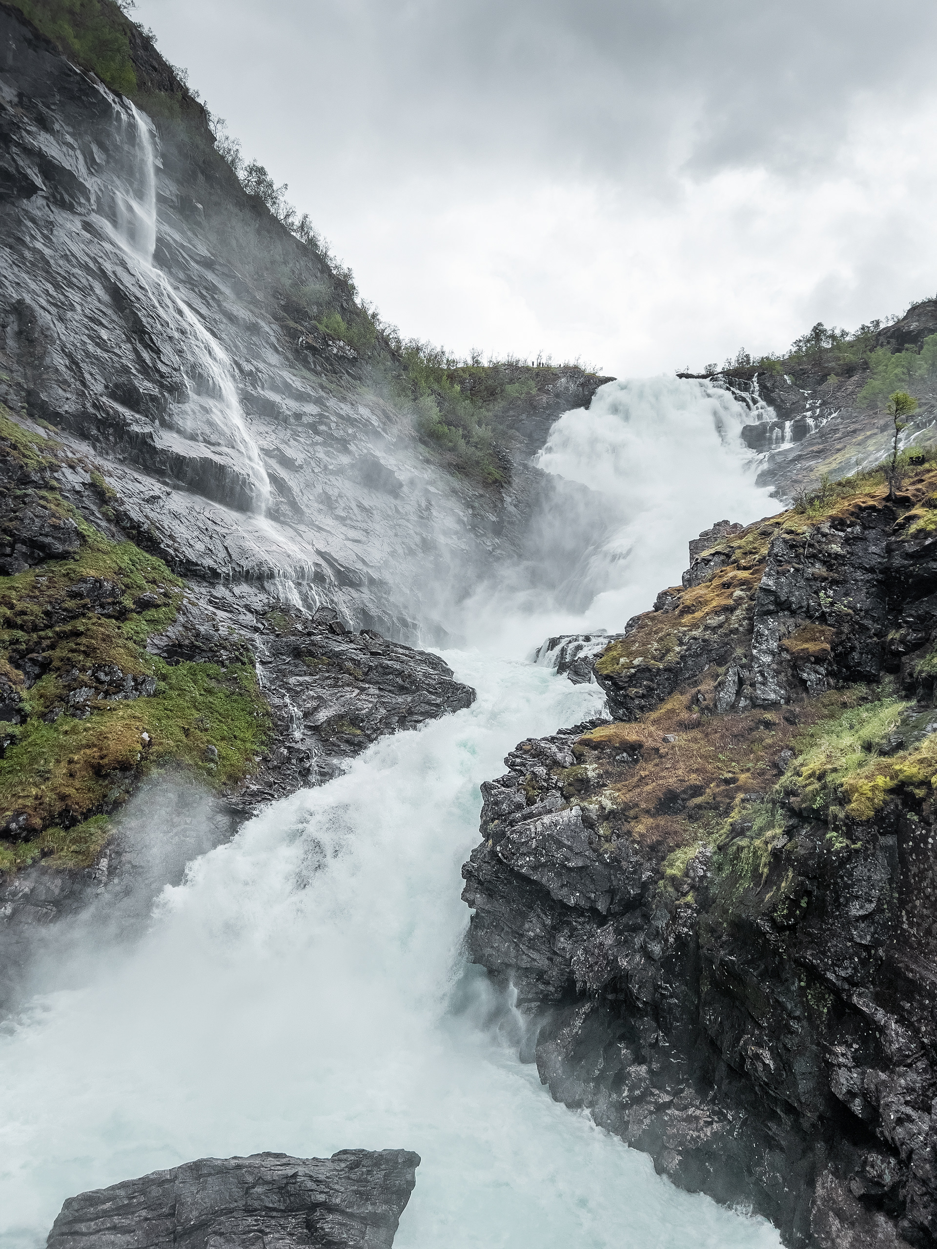
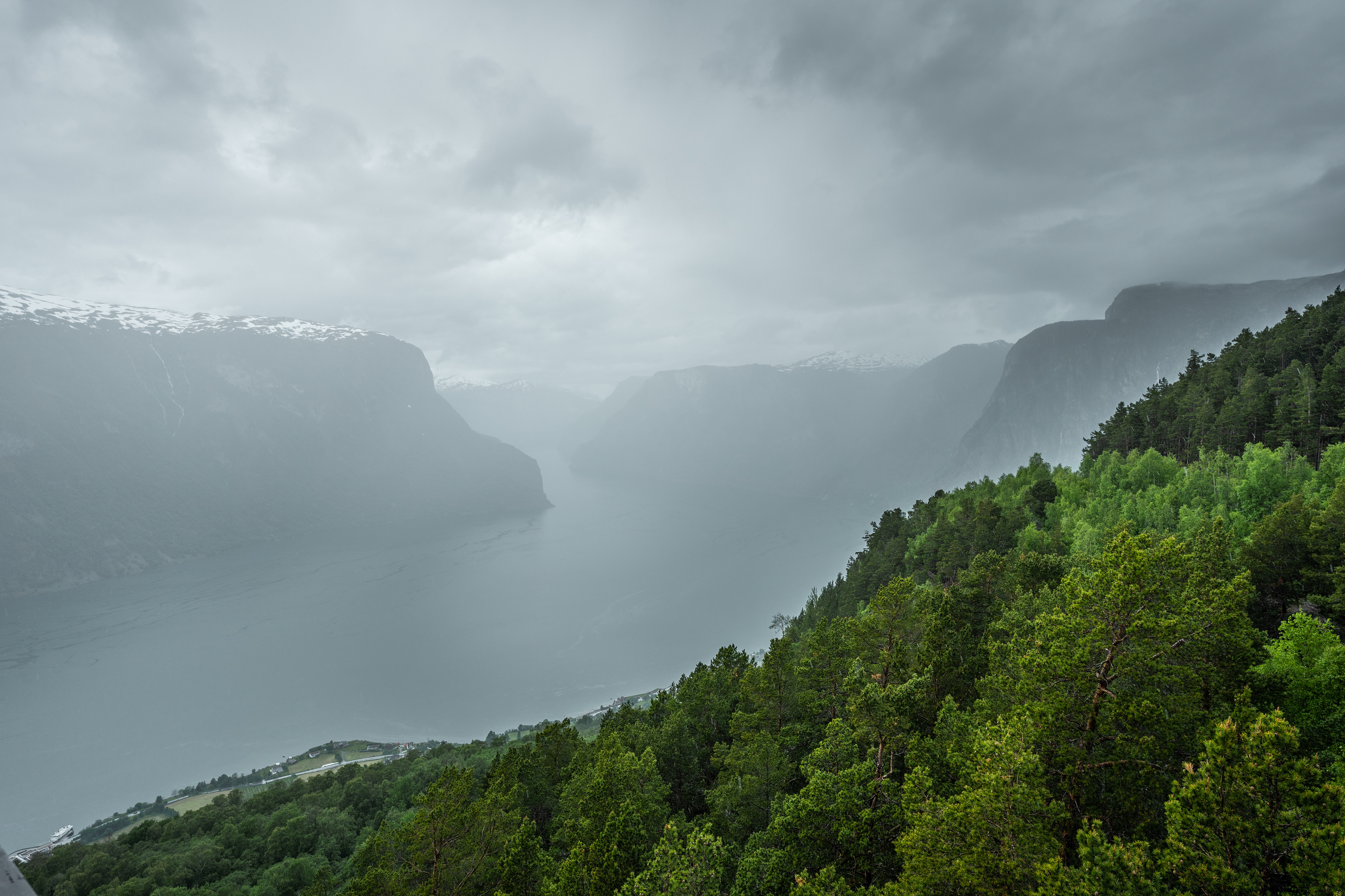
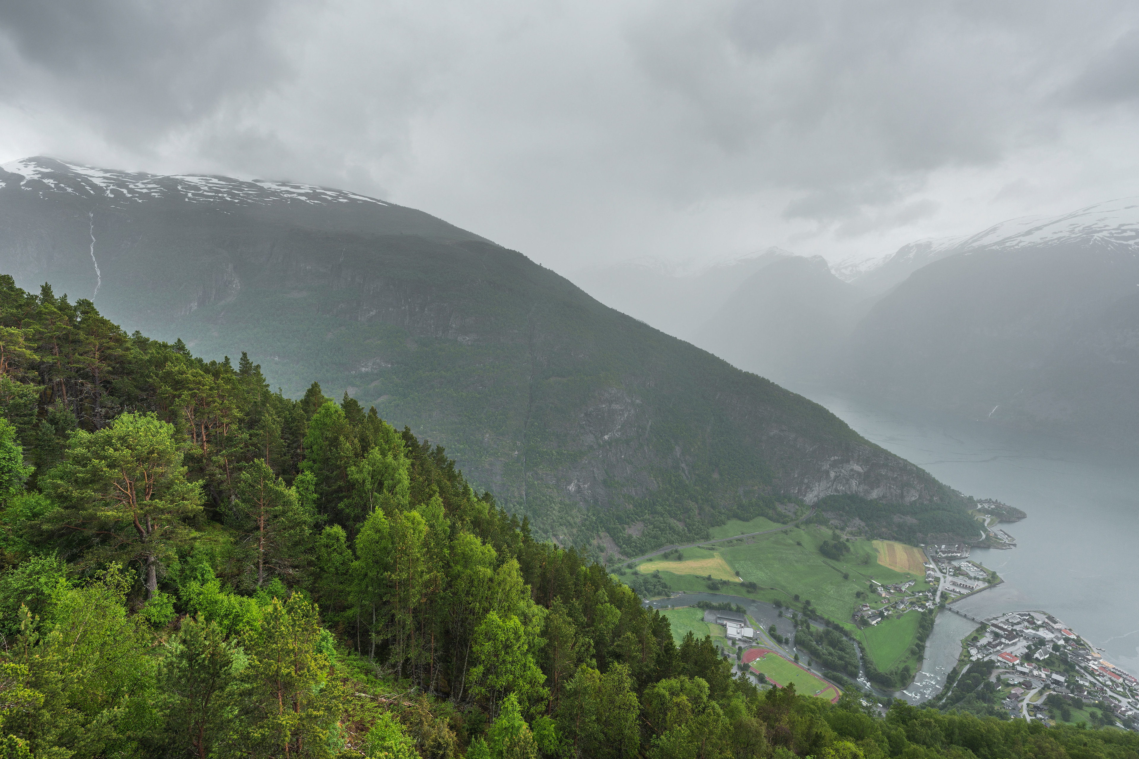
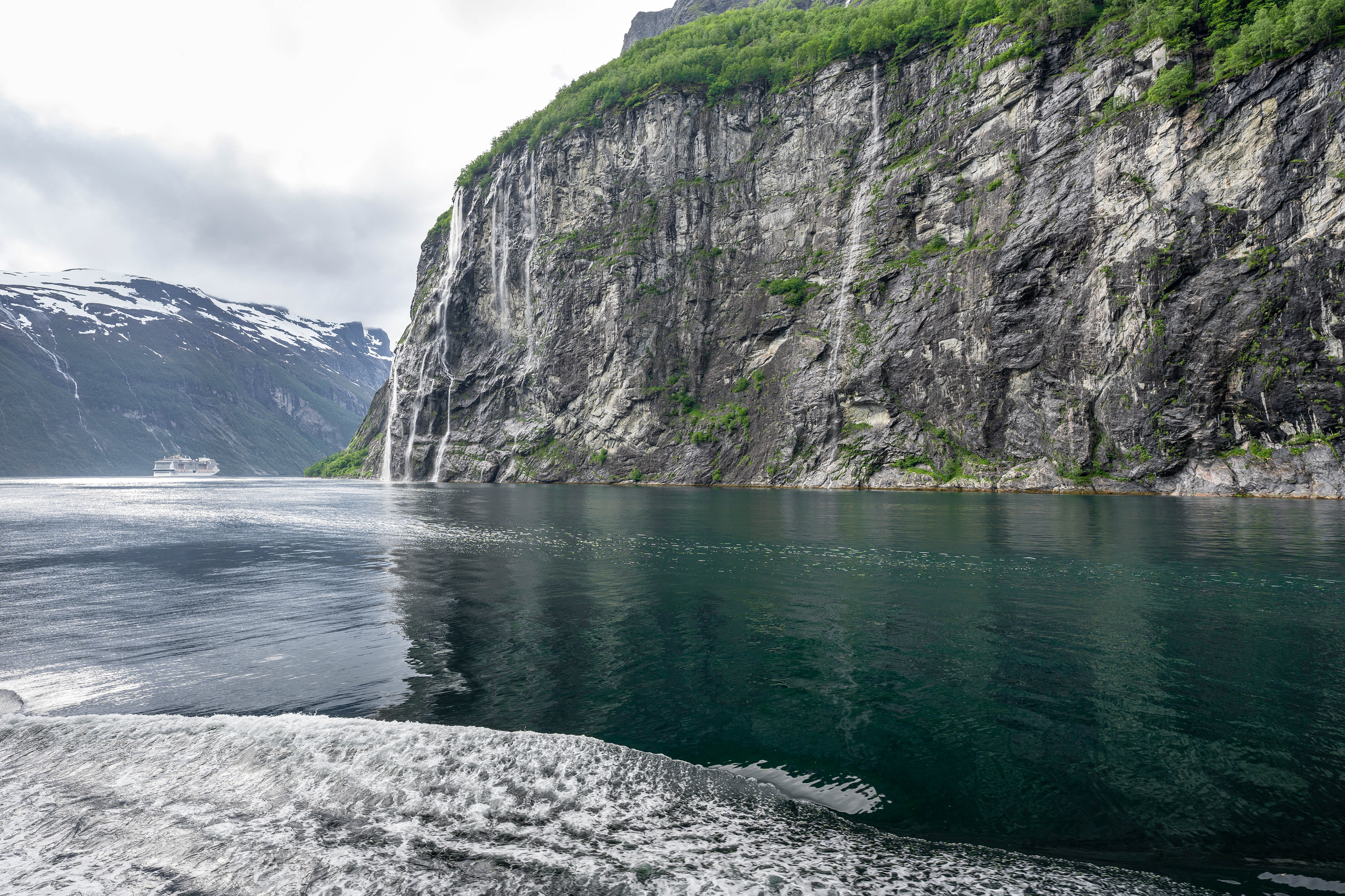
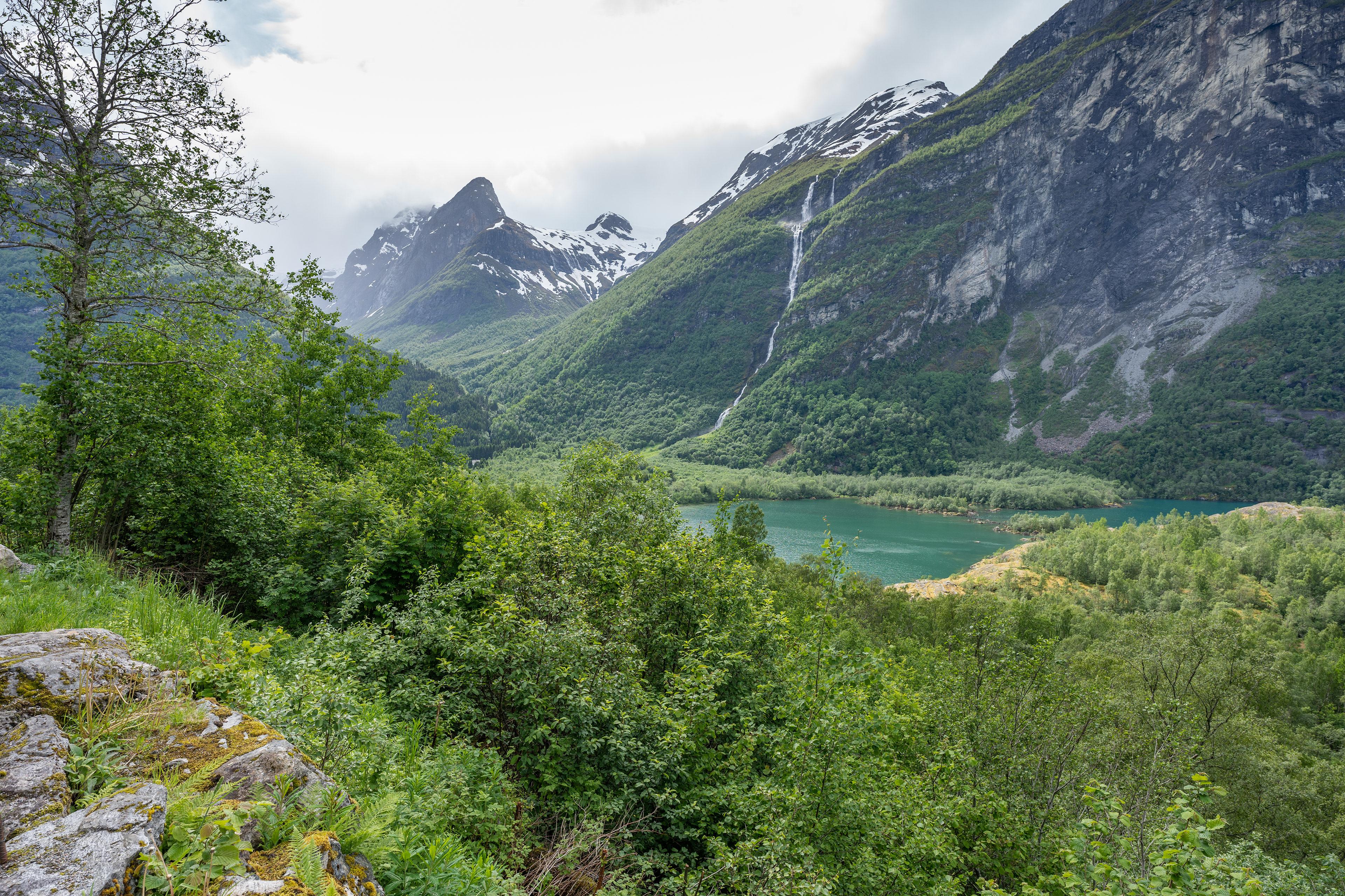
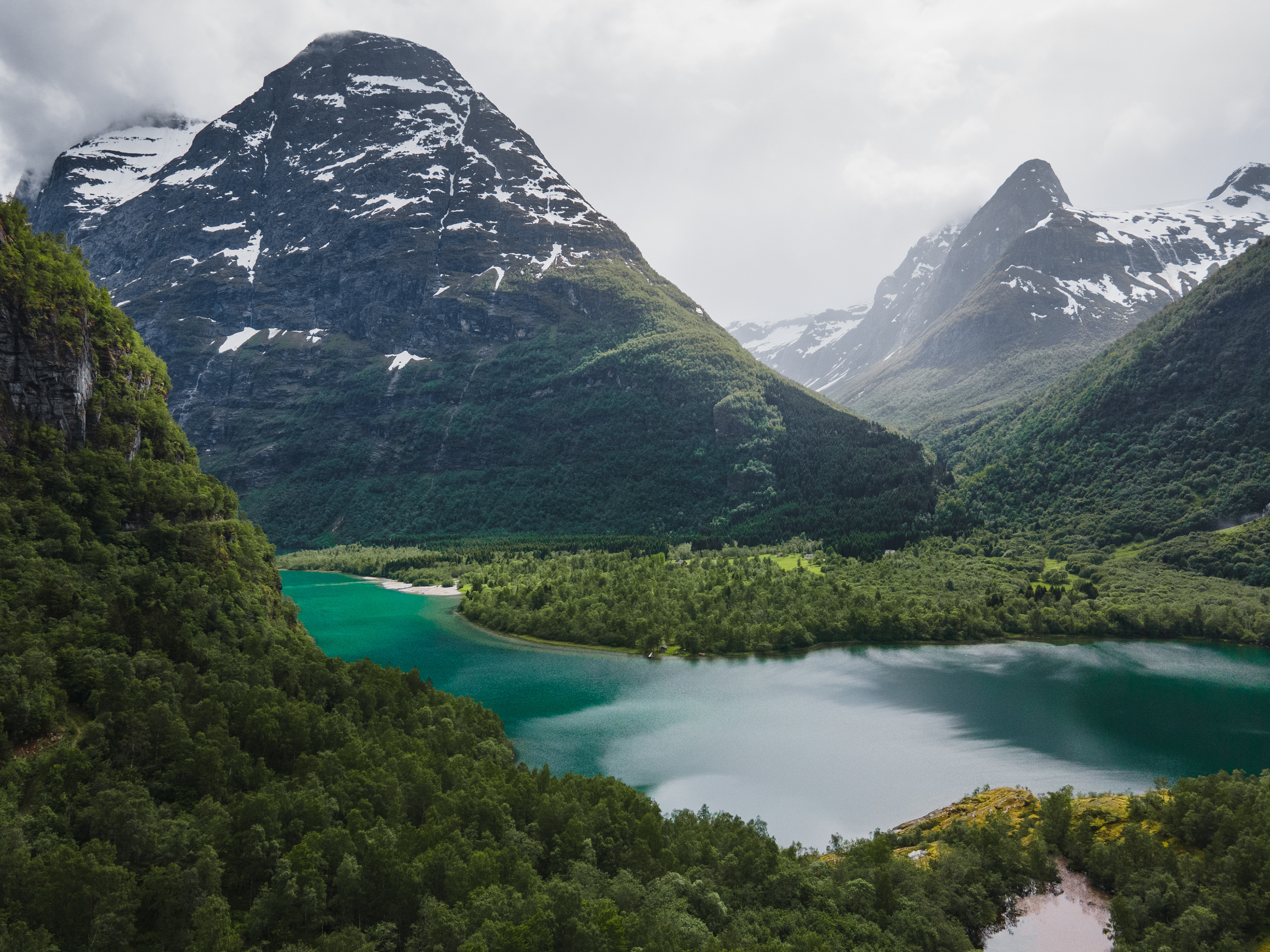
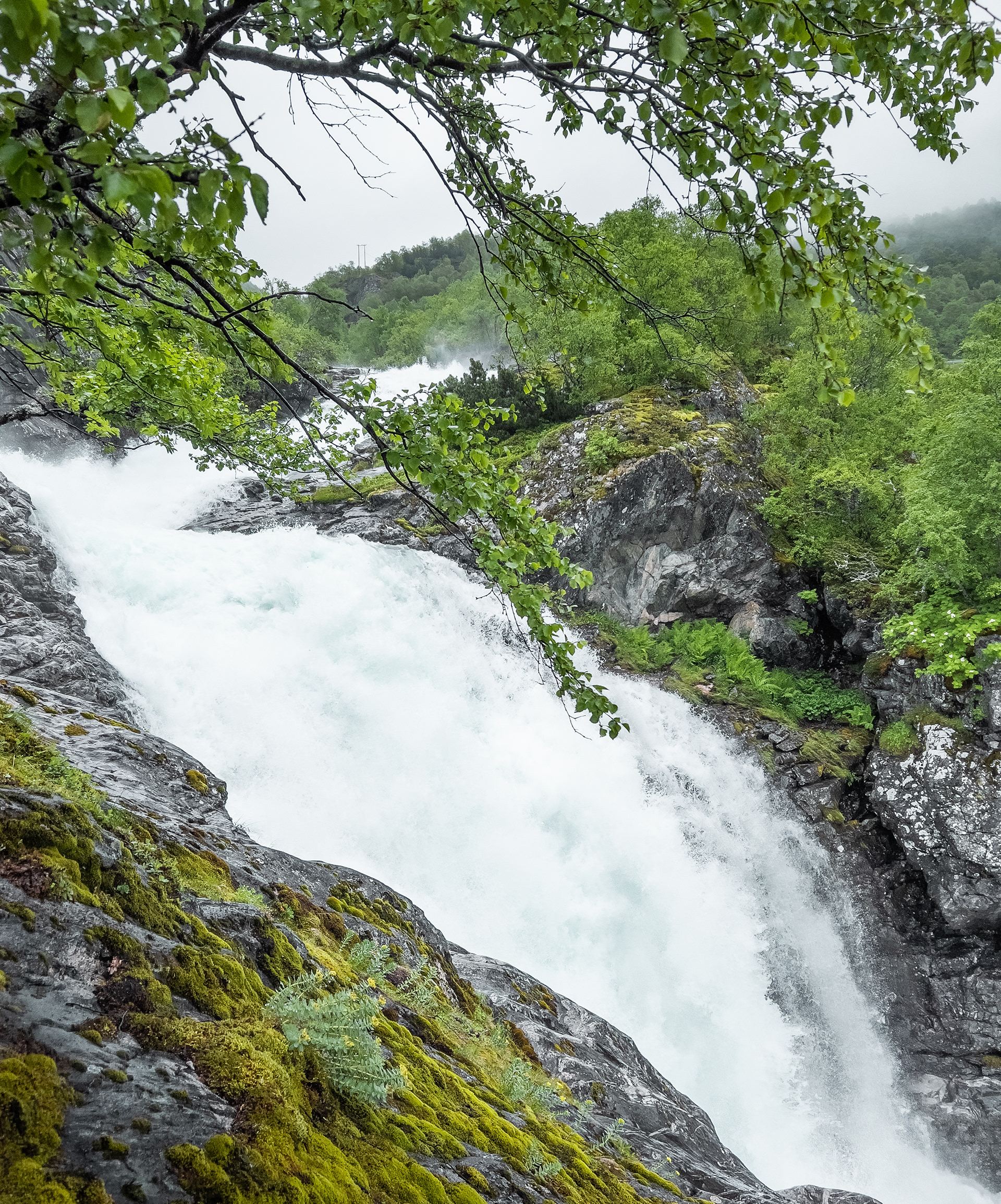
Leaving the Odda Region, we continue our journey further North and see some beautiful natural sights on the way to Norway's 2nd largest city. We follow Riksvei 13 along the Hardangerfjord, which is a very scenic drive by itself. The Hardangerfjord is vast and was long an obstacle for traffic and could only be crossed by ferry. Since about 10 years this is not the case anymore. But before we cross the impressive Hardangerbrua, we bring a visit to Vøringsfossen, a well-known set of waterfalls just off Riksvei 7 that leads onto the Hardangerplateau. When driving up on Riksvei 7 you first drive through Eidfjord, a small town on the northeastern end of the fjord. Upon approaching the town a massive cruiseship the size of a 12-story building appeared on the horizon. Although an impressive sight, not a great sign altogether in my humble opinion. Although I can see the appeal of this type of travel, I find it ill-suited for areas of natural beauty like these. The thousands of passengers are transported with tour buses from the cruiseship on trips to waterfalls like Vøringsfossen. This results in quite crazy peak visitor numbers and crowds where you'd usually not expect them. Unfortunately we also encountered some groups that were really obnoxious and showed no respect for their surroundings. Roadside toilets with packed lunches and sandwiches dumped in them, people throwing their trash out in nature, etc. This took away from the experience a bit but overall we couldn't complain.
Vøringsfossen in general is a must-see. They put a lot of work into the trails and viewing platforms around it. Parking was free of charge this time, which was a bonus. When we were there they were further expanding the infrastructure around the waterfalls as well, so in the future there are likely even more vantage points you can walk up to. The total drop of the waterfall is 183 meters with the highest free drop being 145 meters.
Vøringsfossen
Vøringsfossen
Vøringsfossen
Vøringsfossen
Vøringsfossen
Vøringsfossen
Vøringsfossen
One of the viewing platforms
Vøringsfossen
Hardangerbrua
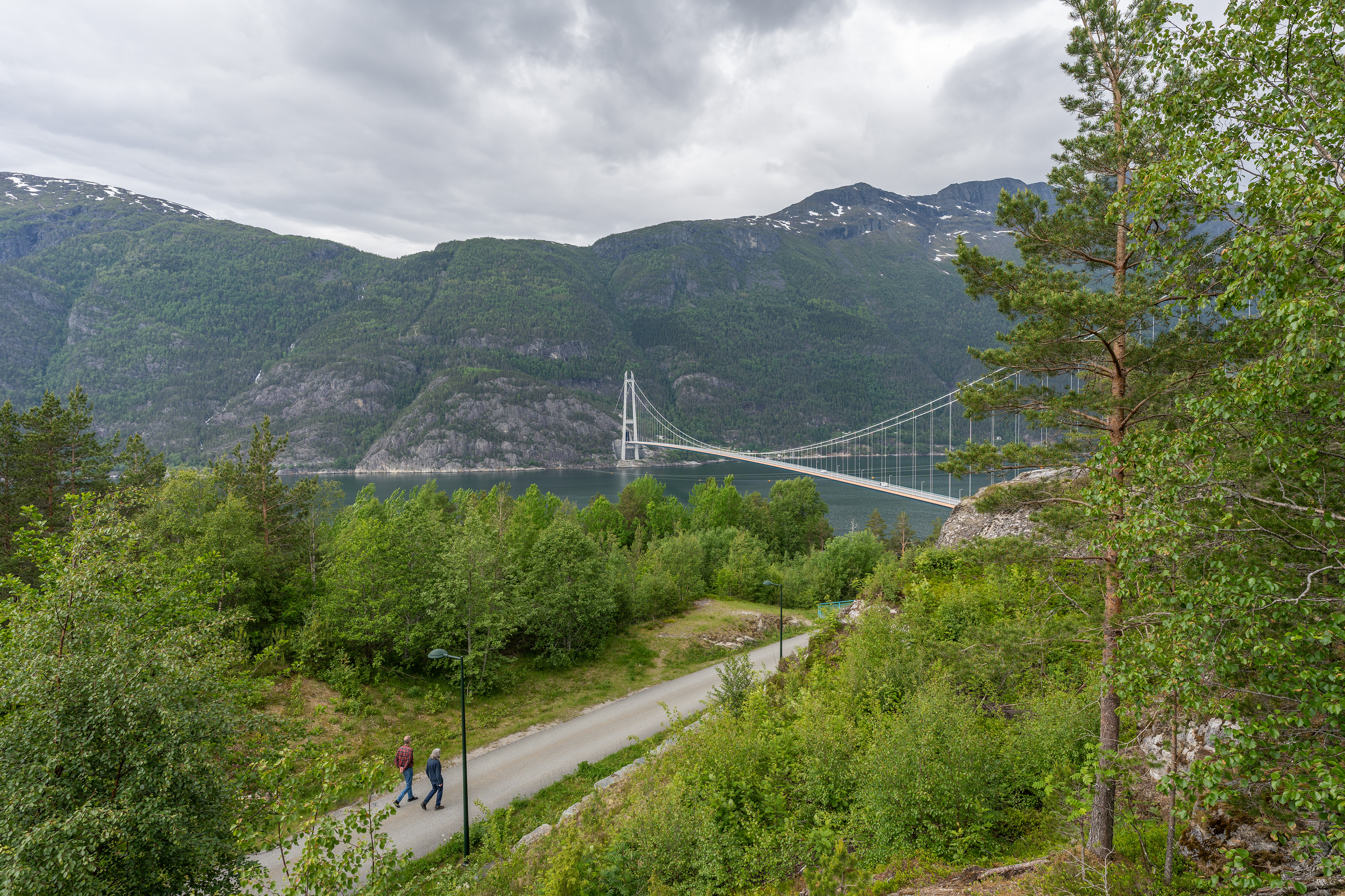
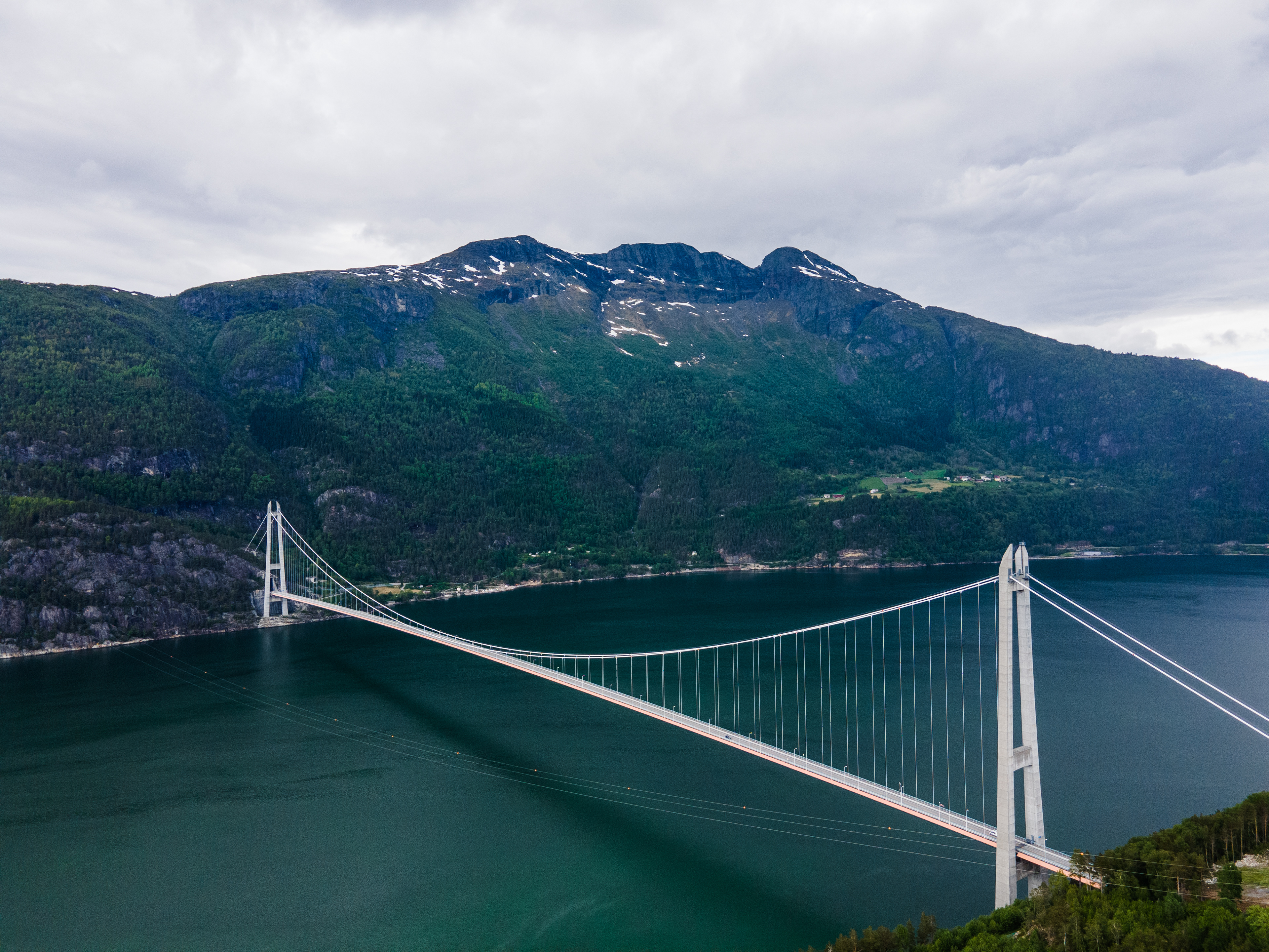
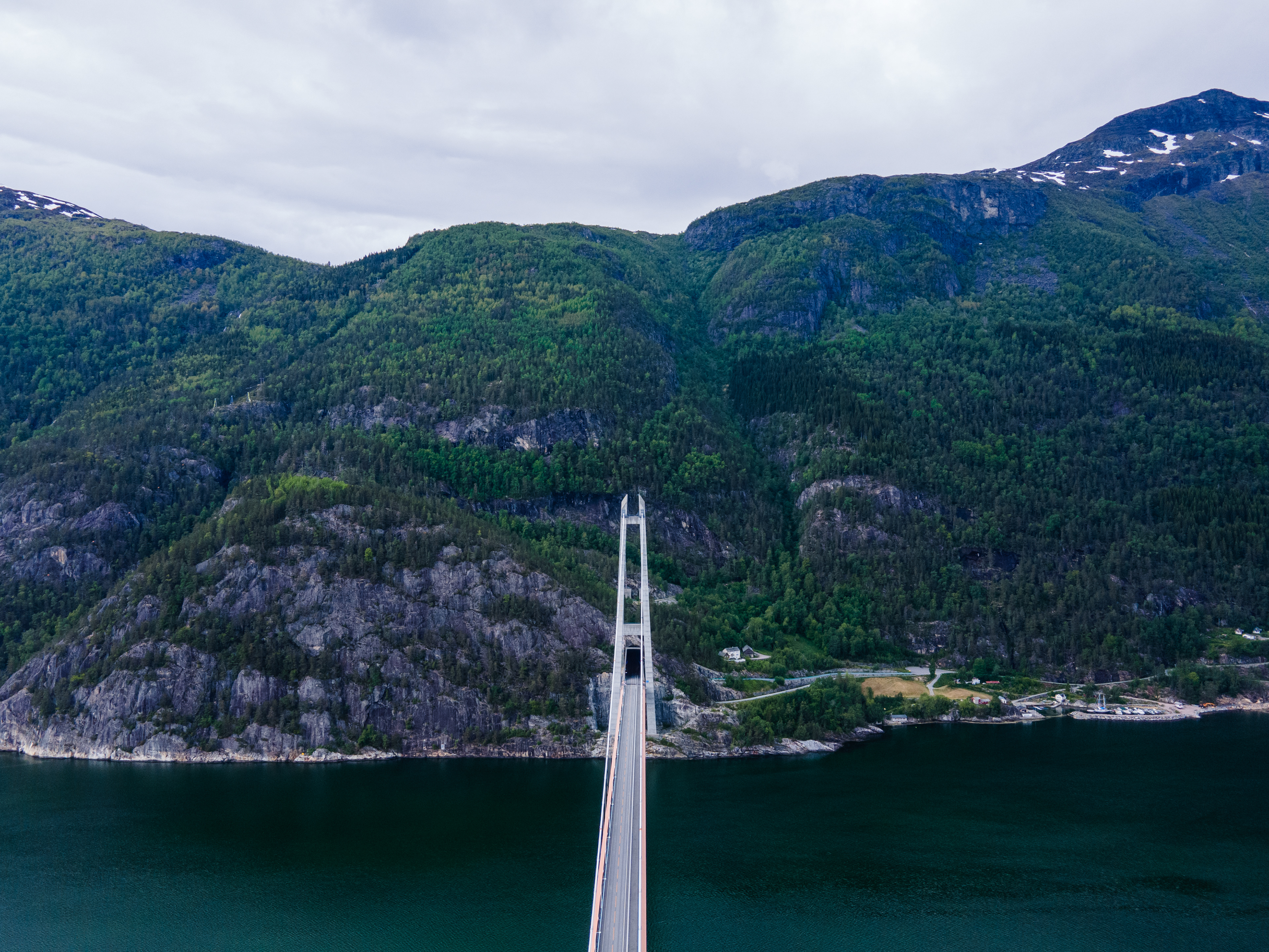
The Hardangerbrua or Hardanger bridge is a large suspension bridge that spans the Hardangerfjord at its narrowest point. It was opened in 2013 and has a total length of 1.380 meters (4.527 ft.). The clearance below is 55 meters, allowing for large cruise ships to pass under as well. It's a really impressive piece of infrastructure that generally improved the reachability of Bergen. The views of the bridge when driving on Riksvei 13 or 7 are quite impressive. There is also a viewing point not too far from the bridge on the south side.
What makes the bridge impressive as well is the combination with the tunnel, which features a roundabout (inside the tunnel). It's a wild experience driving onto the bridge coming from a tunnel and already being at that altitude basically. I took some time to take pictures and take in the scale of this bridge before actually crossing it. Tolls do need to be paid and amount to approximately €11 one-way.
The bridge from the viewing point
Hardangerfjord
Hardangerfjord
Hardangerbrua
Hardangerbrua
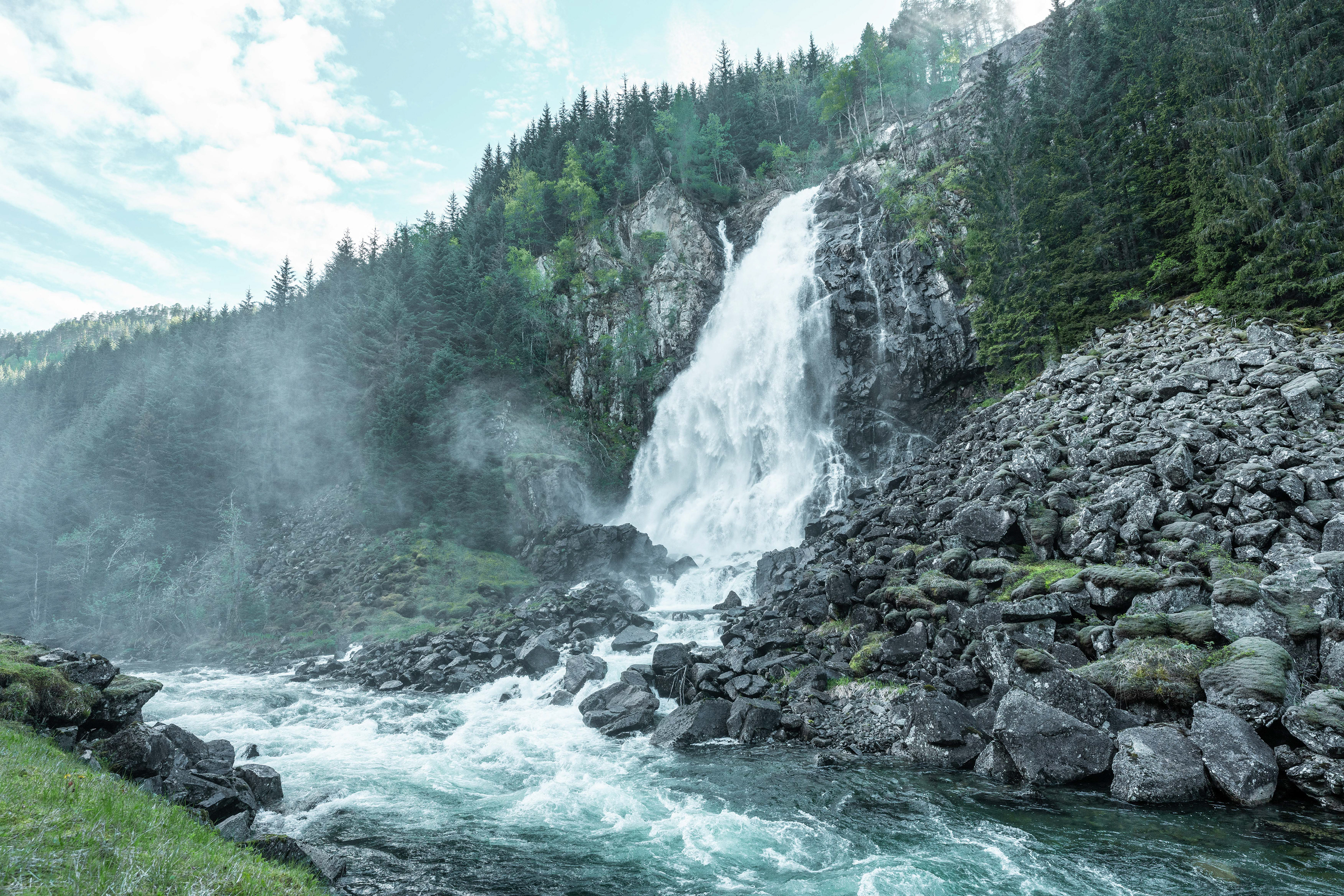
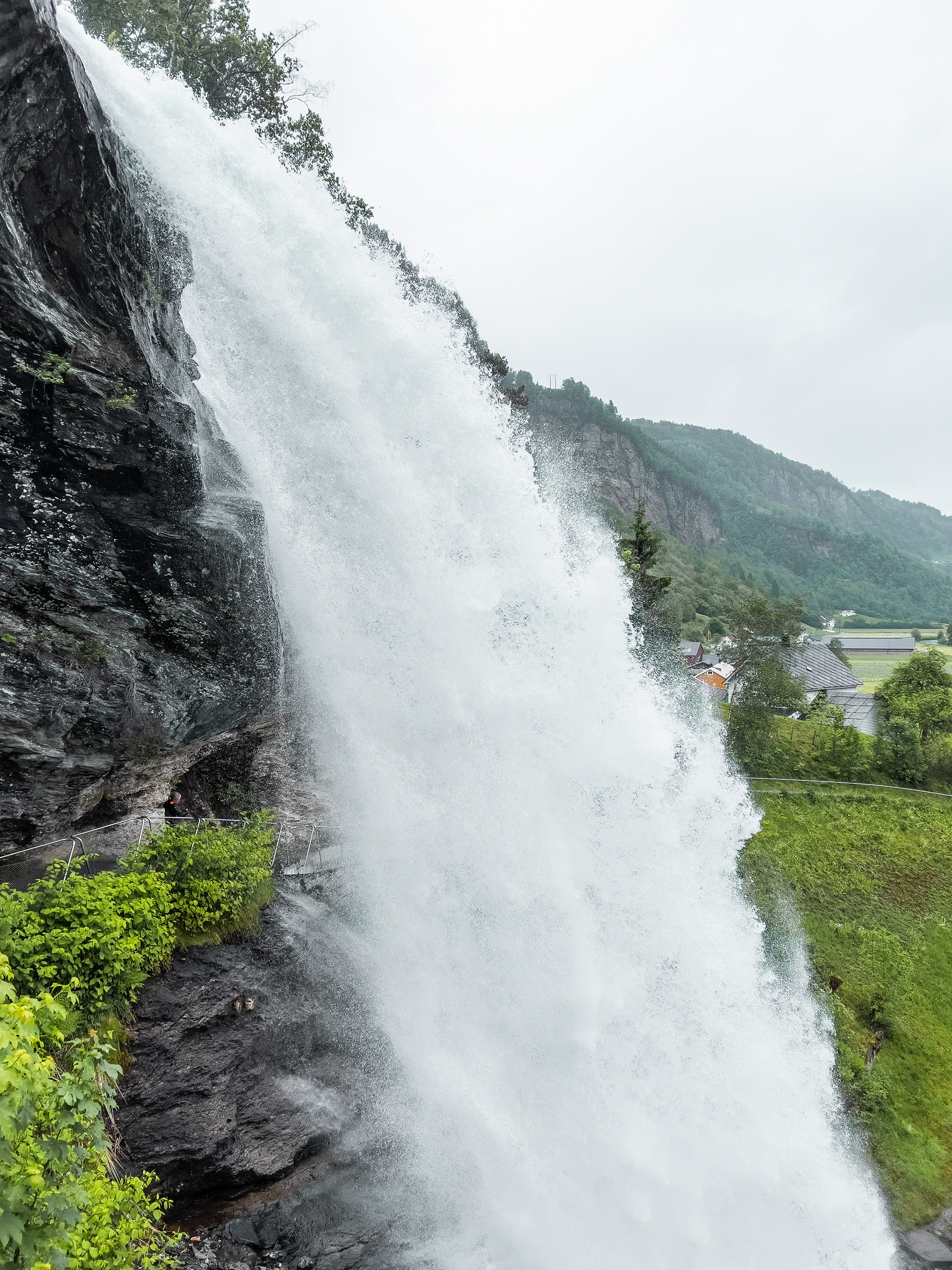
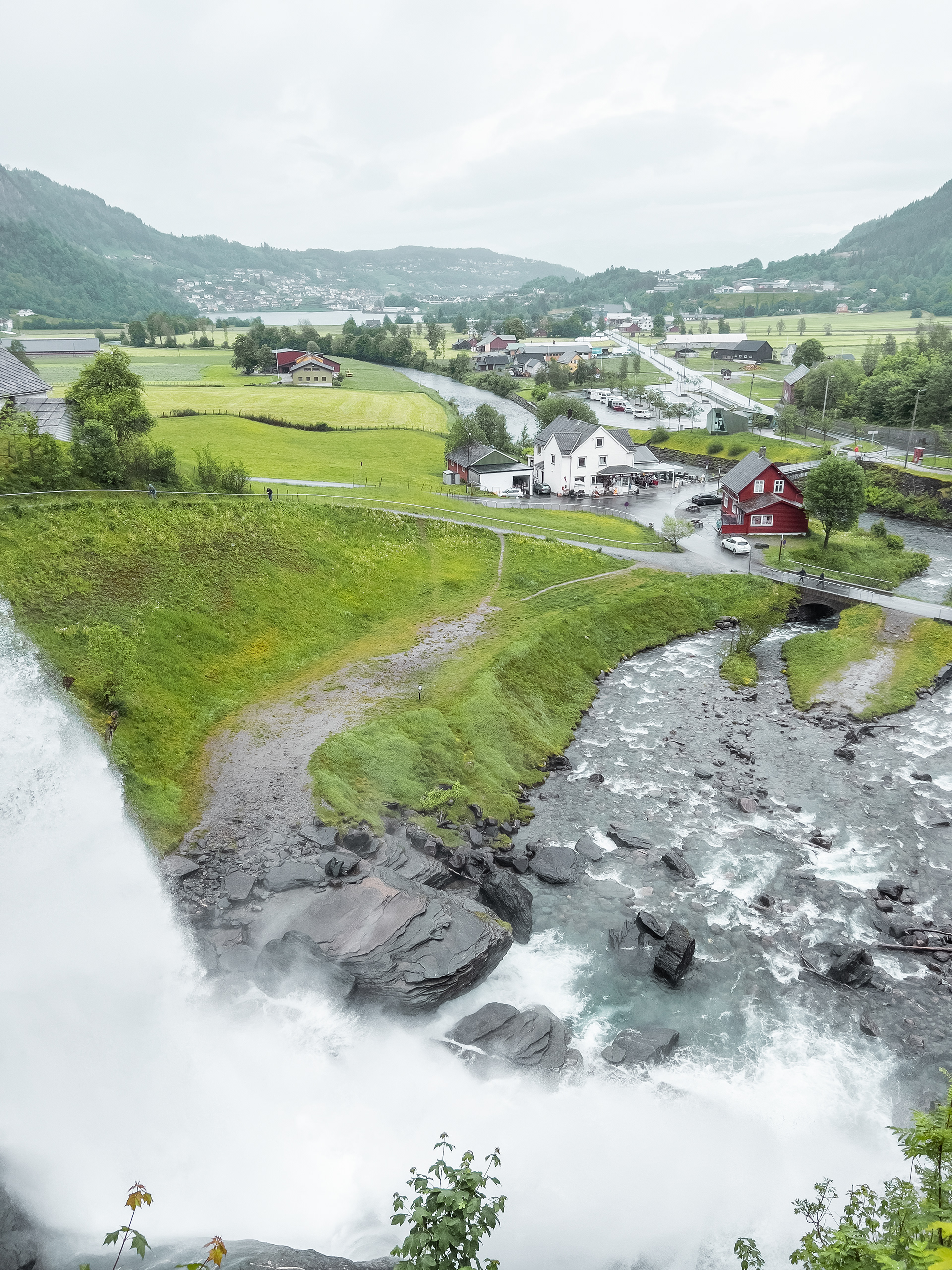
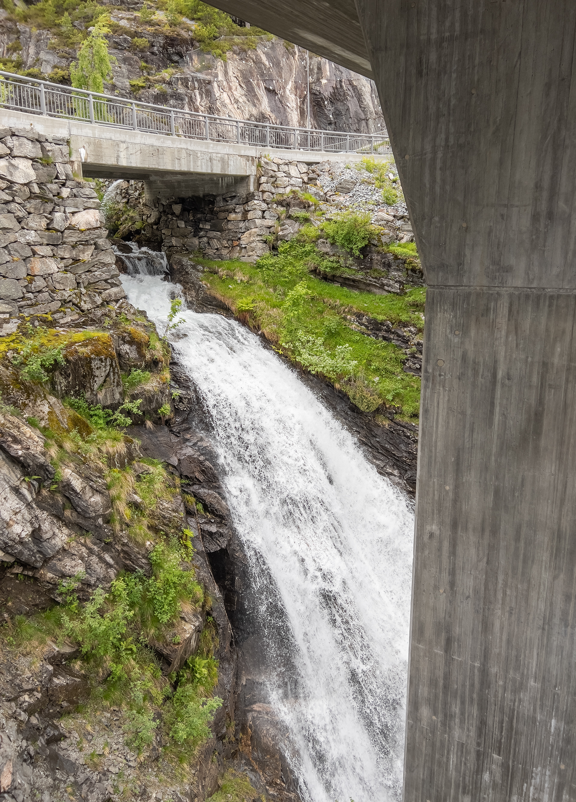
Skjervsfossen & Steinsdalsfossen
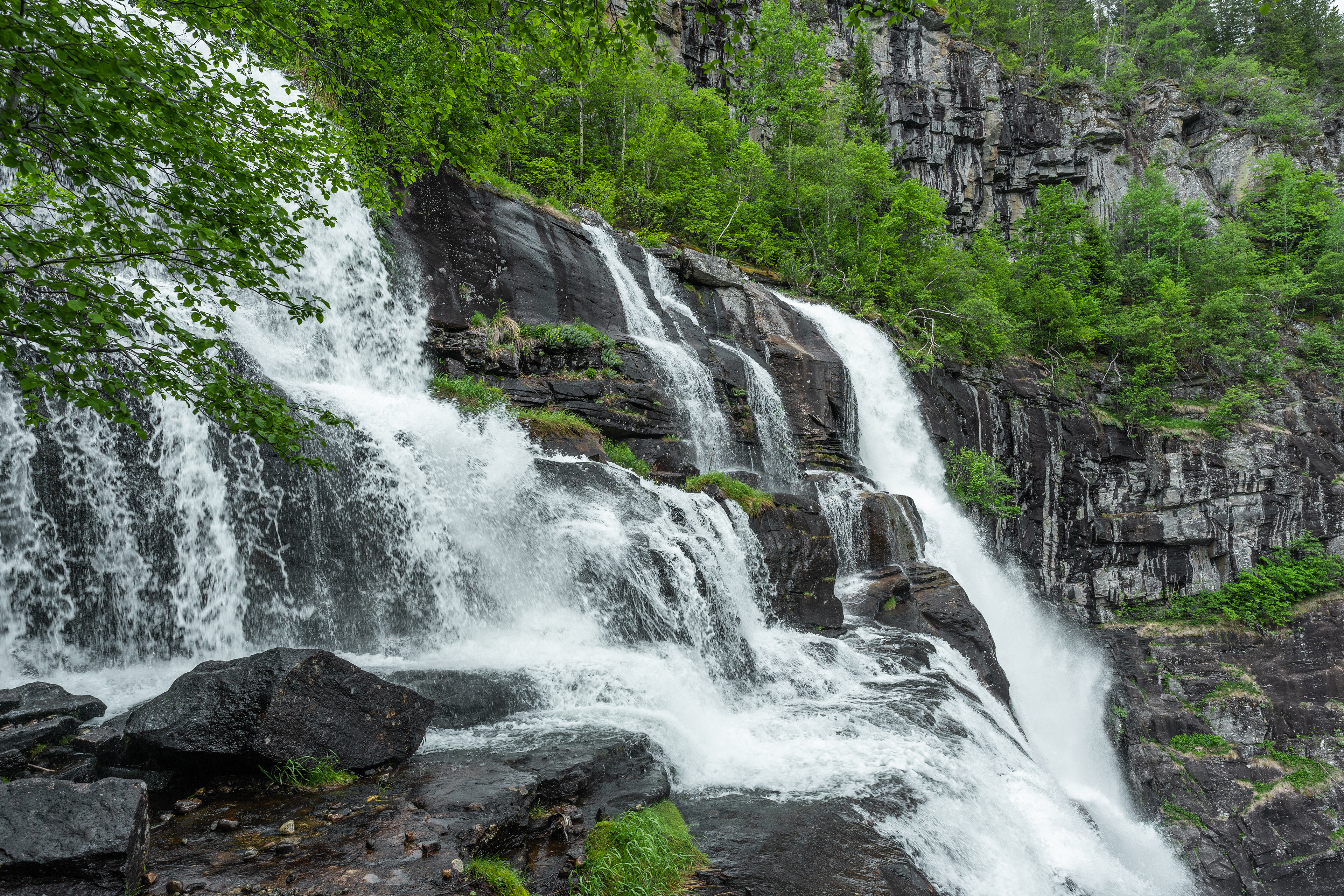
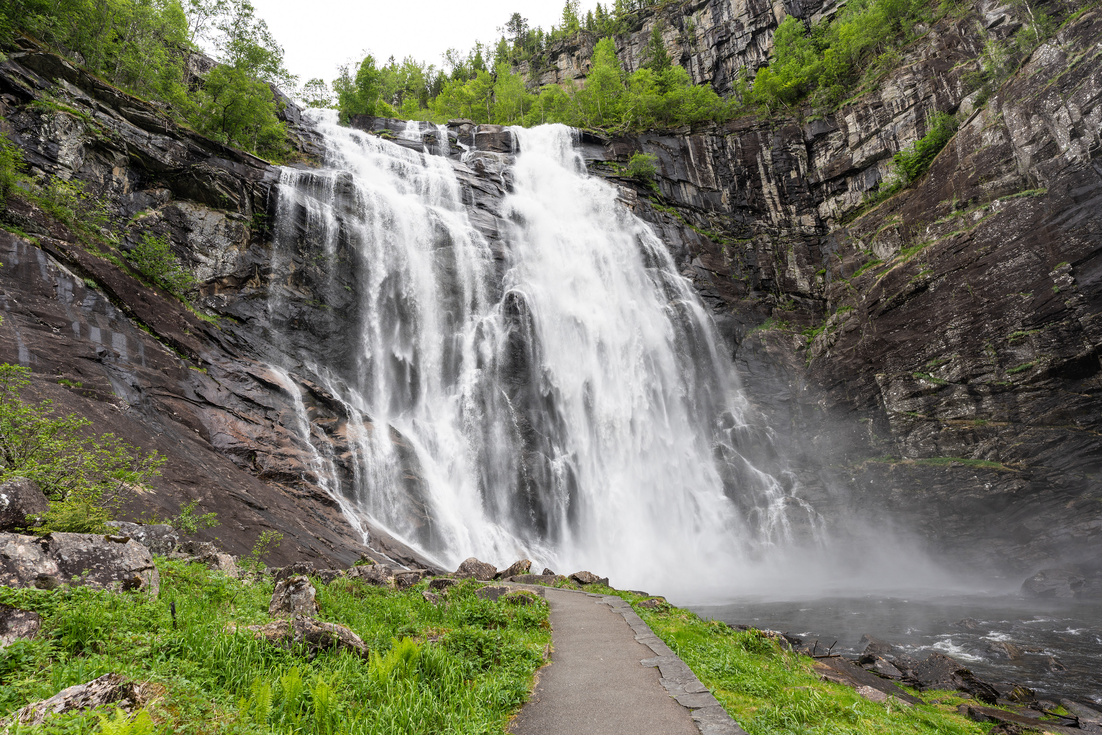
A bit North from Hardanger bridge on Riksvei 13 there is a turn off on the right for Skjervsfossen. This is a big waterfall with a 150-meter drop and some walking paths + viewing points around for visitors. One crazy experience is the toilet near the rest area here. It features glass all around on one side so you can do your business with a view of the water and surrounding nature. As for the waterfall, you can get quite close to the base (and get soaked if you want to).
After visiting Skjervsfossen, we decided to drive back to the base of the bridge on the northern side and choose the alternative Steinsdalsvegen scenic road to Bergen. Knowing that we were gonna drive the E16 when leaving Bergen a few days later, I didn't want to drive the same road twice (I say that a lot! :D). The Steinsdalsvegen is a beautiful route that follows the Hardangerfjord until Norheimsund where it turns inland in the direction of Bergen. Just past Norheimsund you will find Steinsdalsfossen on the right. What makes this waterfall special is that it extends over some cut out rock basically. This means that you can walk underneath it which is pretty cool. It's maybe a little out of the way for most visitors but if you are close I recommend that you have a look!
Skjervsfossen
Skjervsfossen
Skjervsfossen
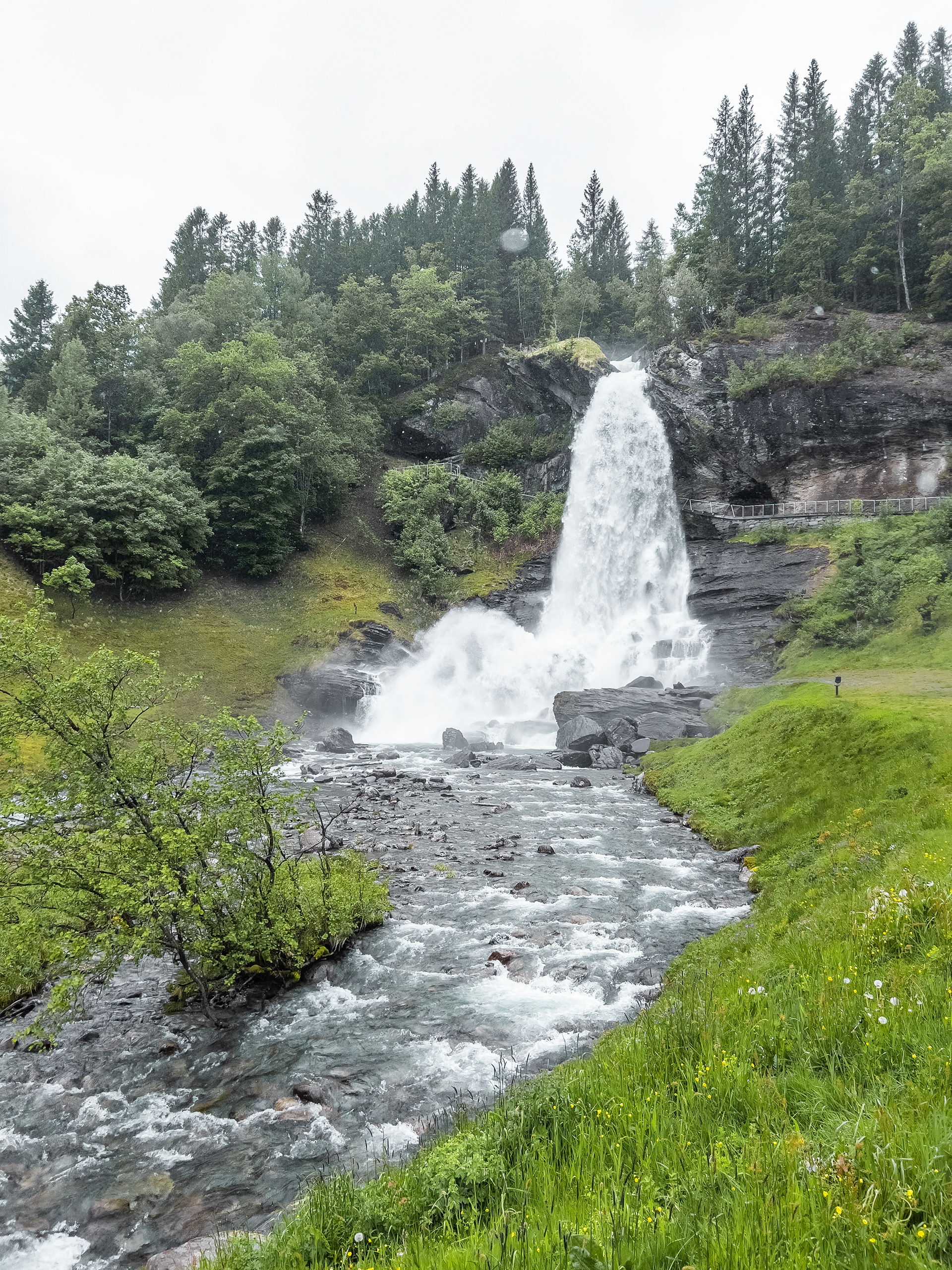
Steinsdalsfossen
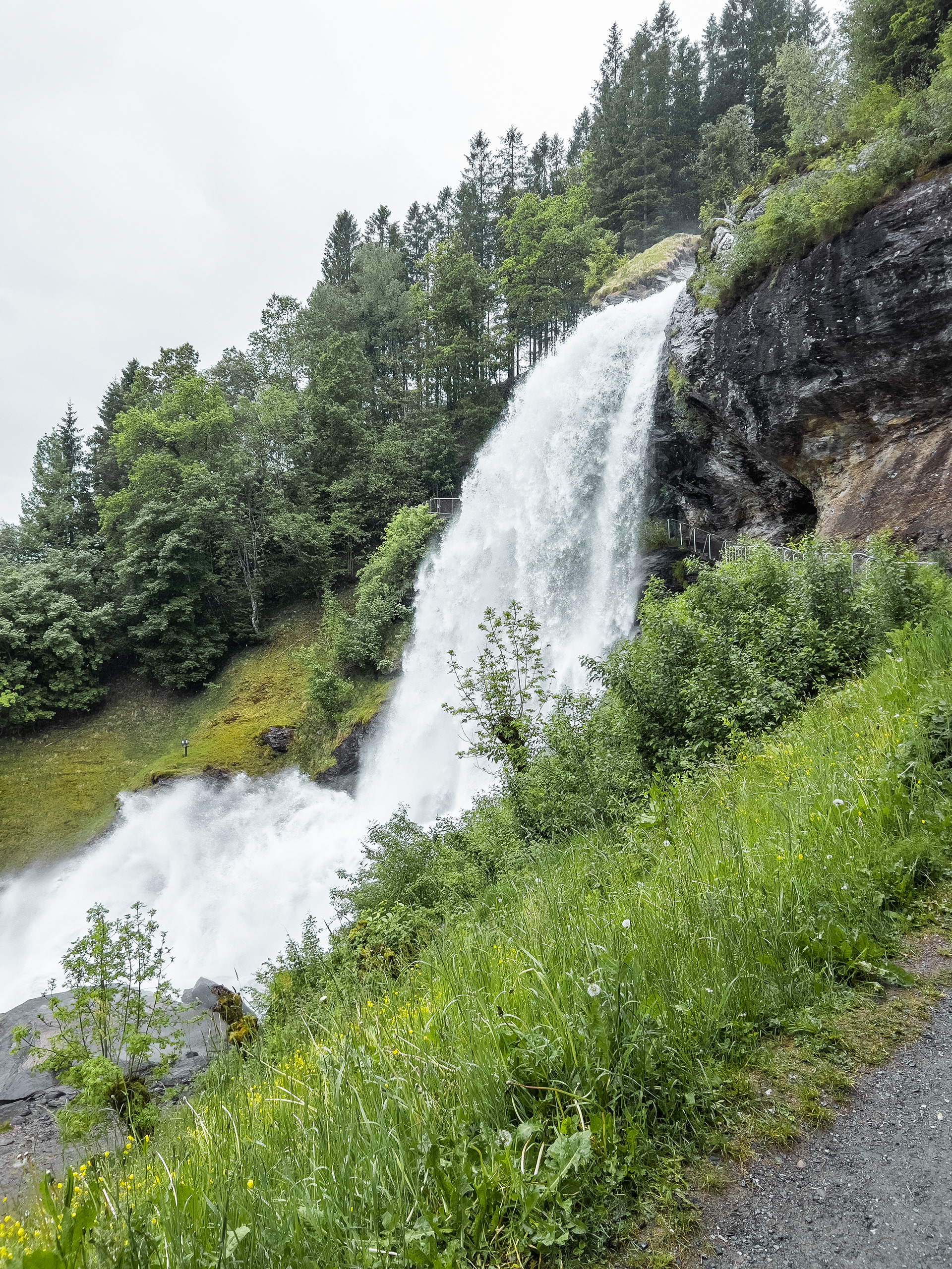
Steinsdalsfossen
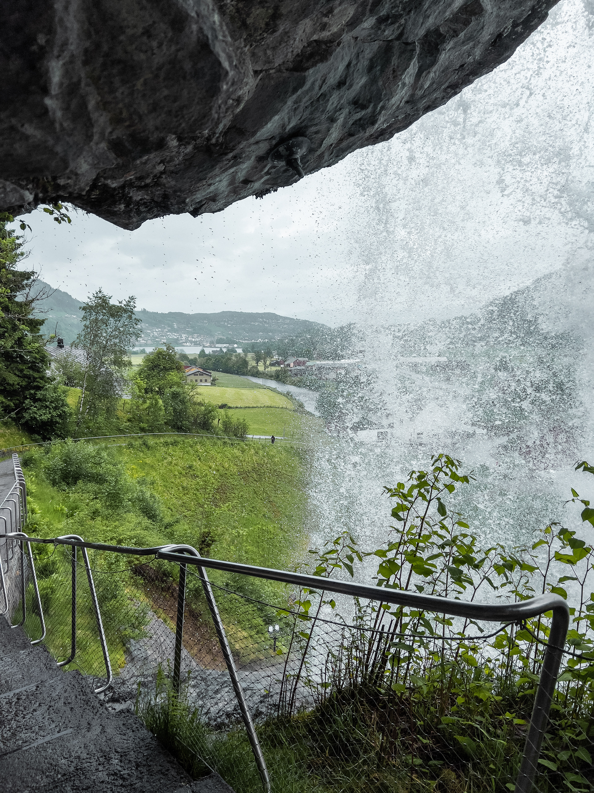
Steinsdalsfossen
Steinsdalsfossen
Steinsdalsfossen
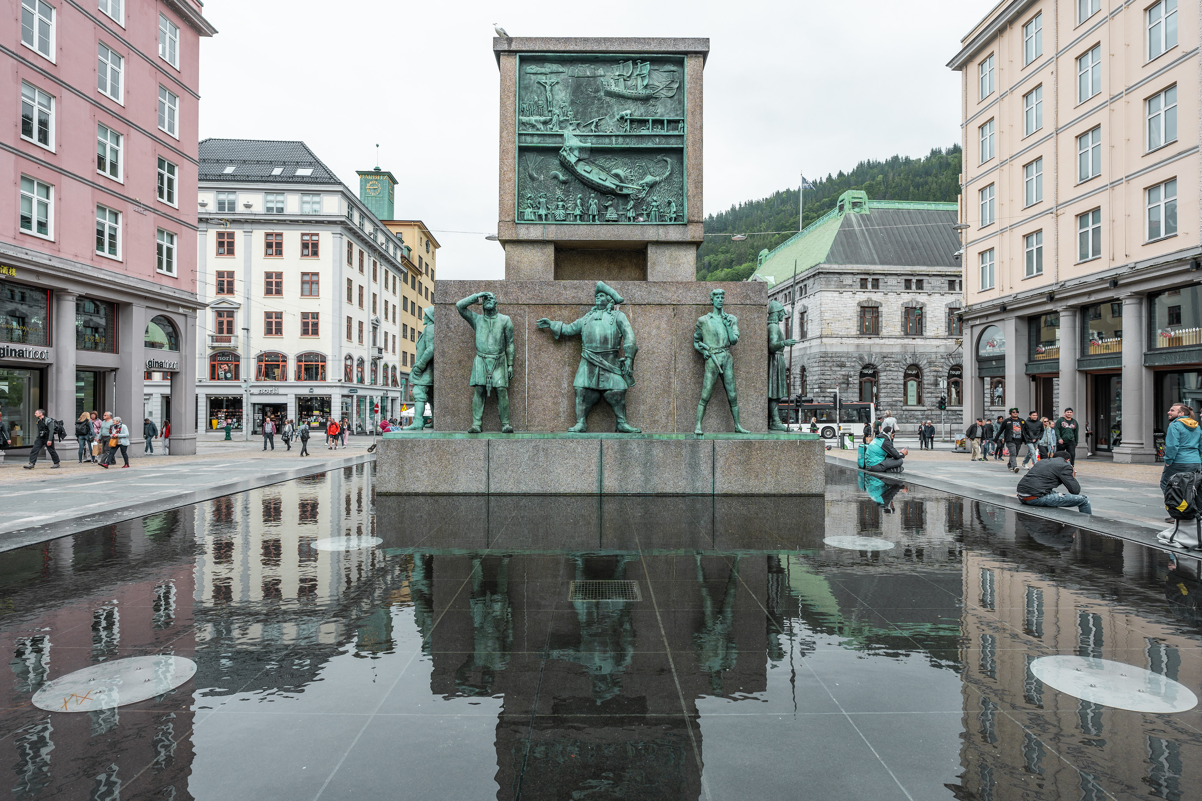
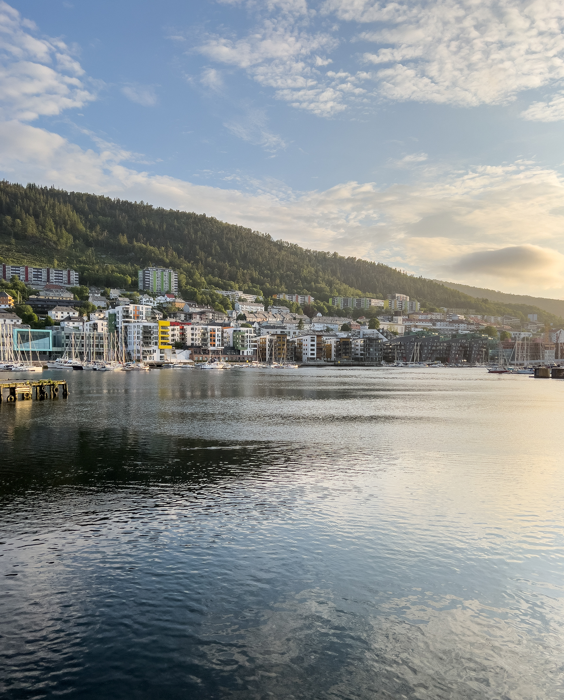
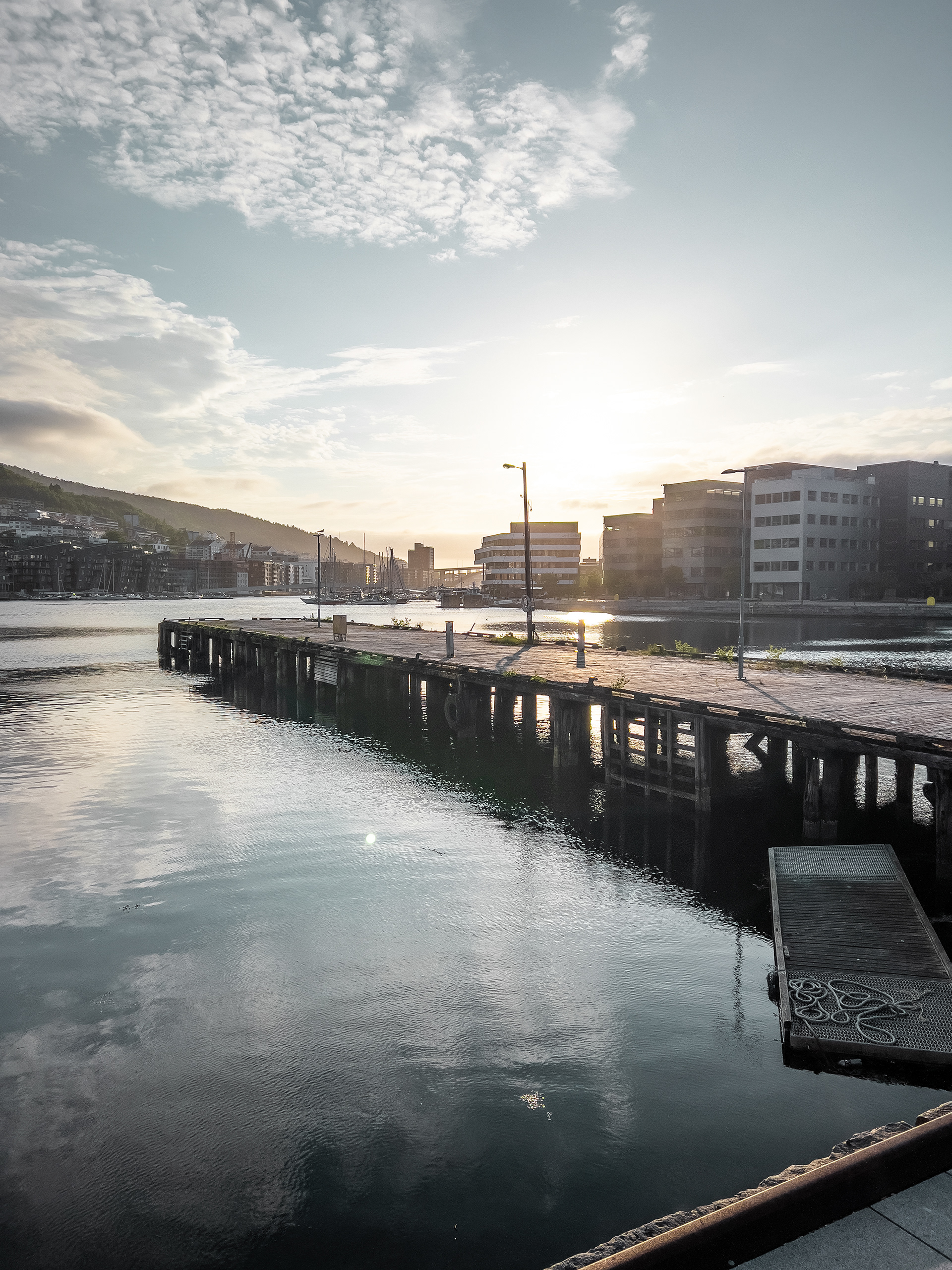
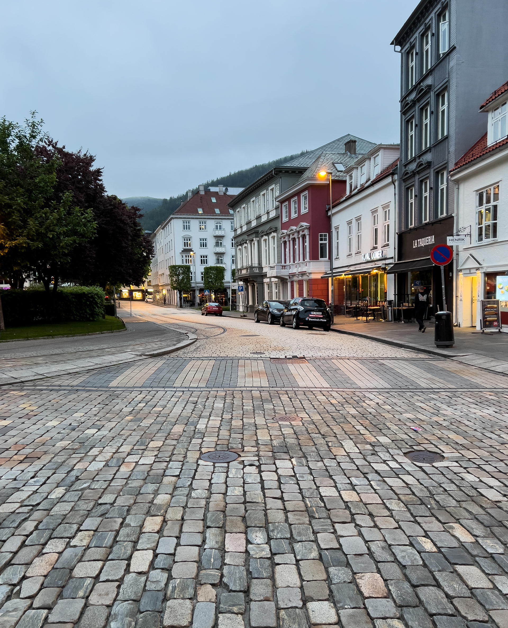
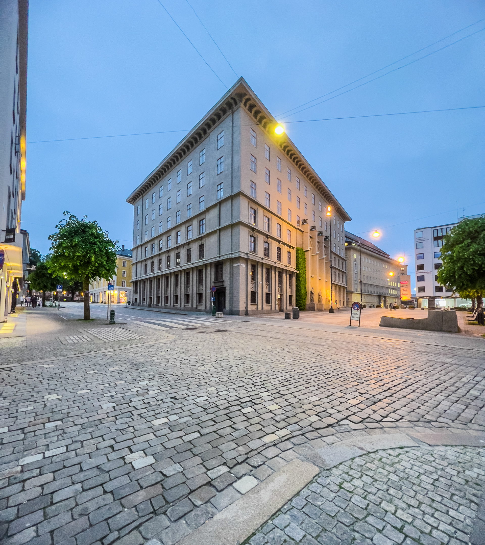
The rainiest city in Europe?
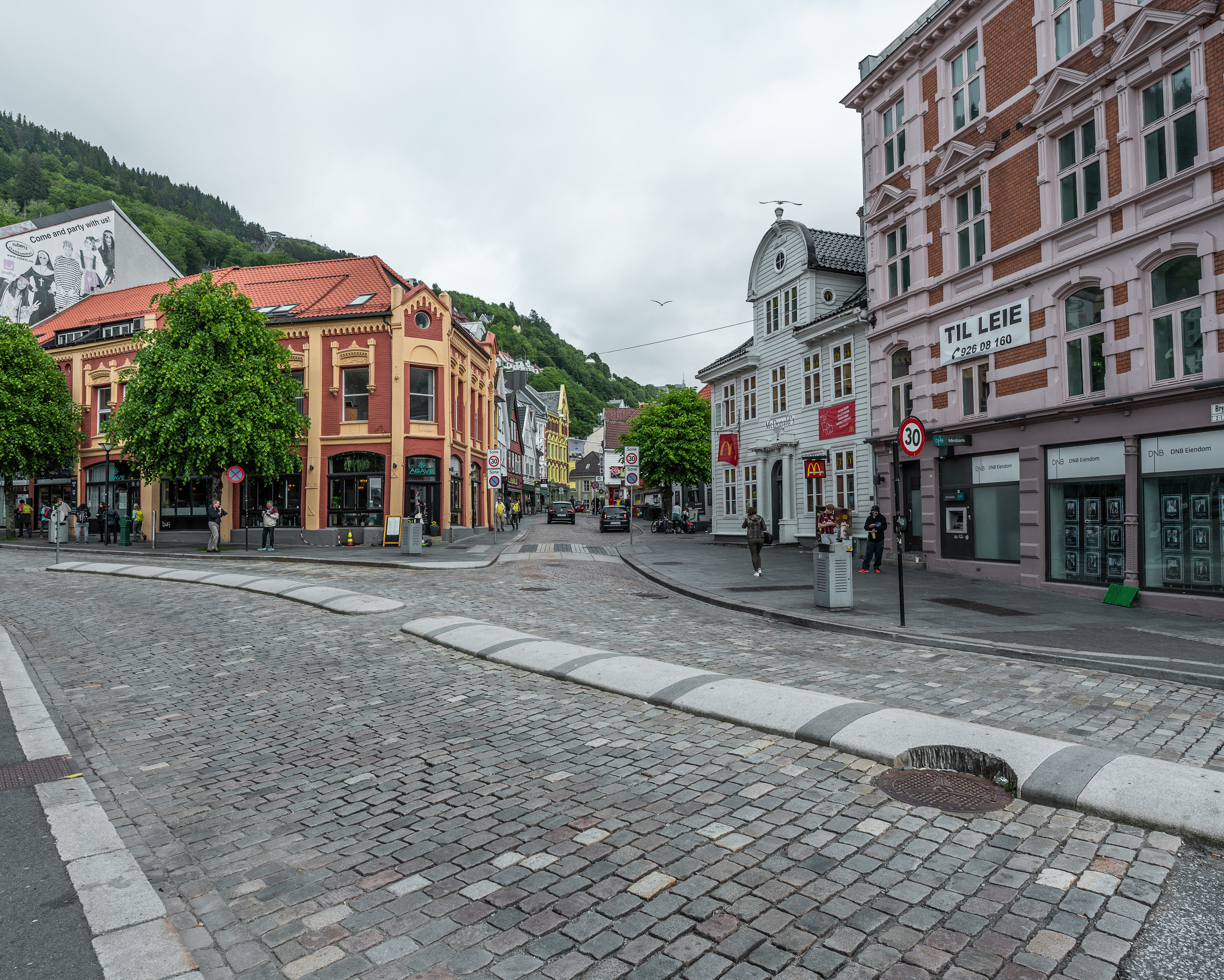
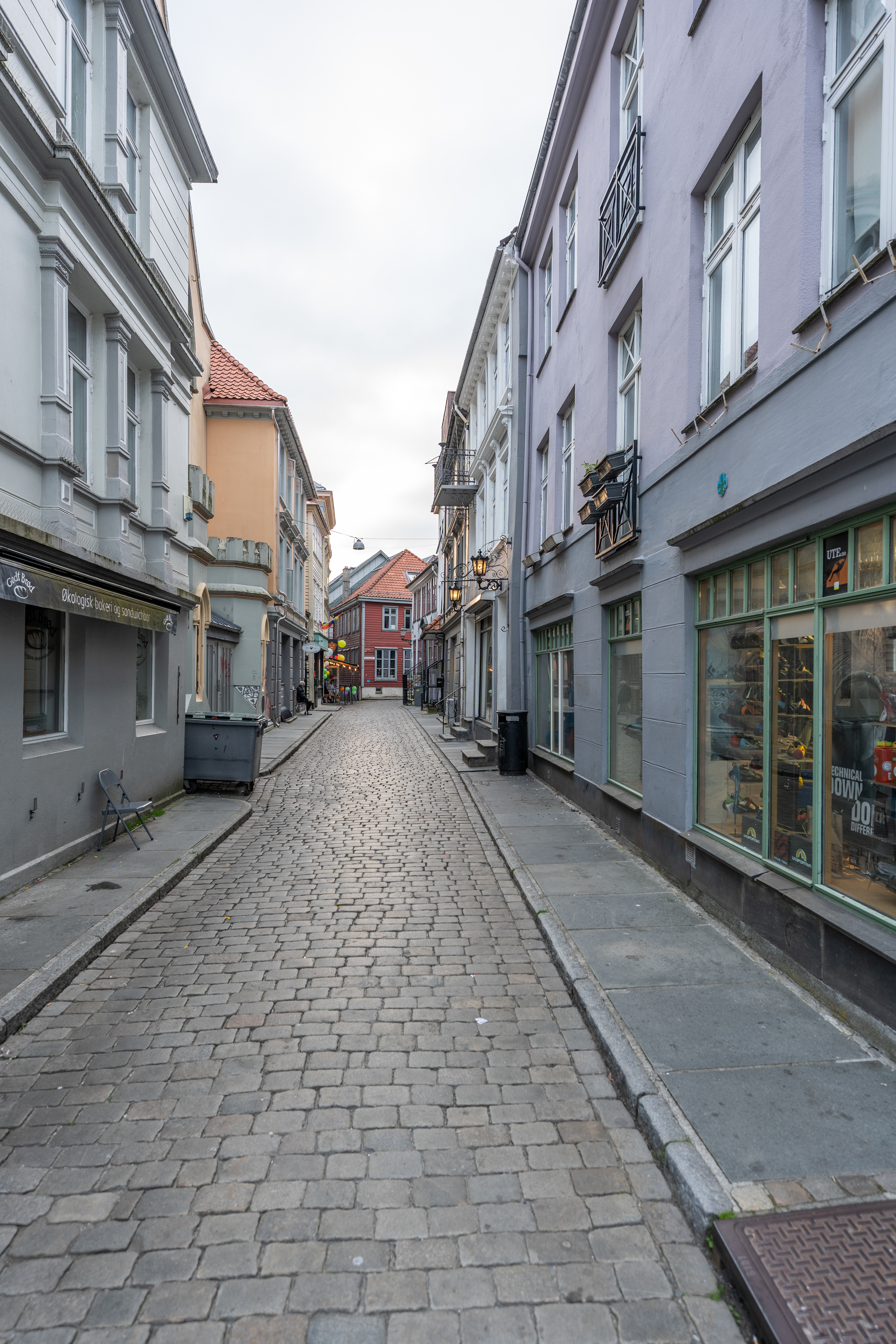
We arrived in Bergen and stayed here for 2 nights in a no-frills hotel in the suburbs. Expect to pay around €200 a night here or more if you want something nice closer to the city center. From our hotel the center was quite walkable and we didn't mind the walk. Bergen is the 2nd largest city in Norway after capital Oslo and has well over 200.000 inhabitants. We actually had great weather, although the city is quite notorious for its rain. The first evening we took a stroll around the center and it was quite full of life and definitely made a more lively impression than Stavanger and Kristiansand. Our first dinner was not a great success, since we were staying at a hotel on this trip for the first time we were eating out and opted for a more affordable pizzeria that was rated really well. How it got the 4.9 stars out of 300+ reviews had me wondering as my frozen pizza came straight from the supermarket, hence the pricing at this restaurant :).
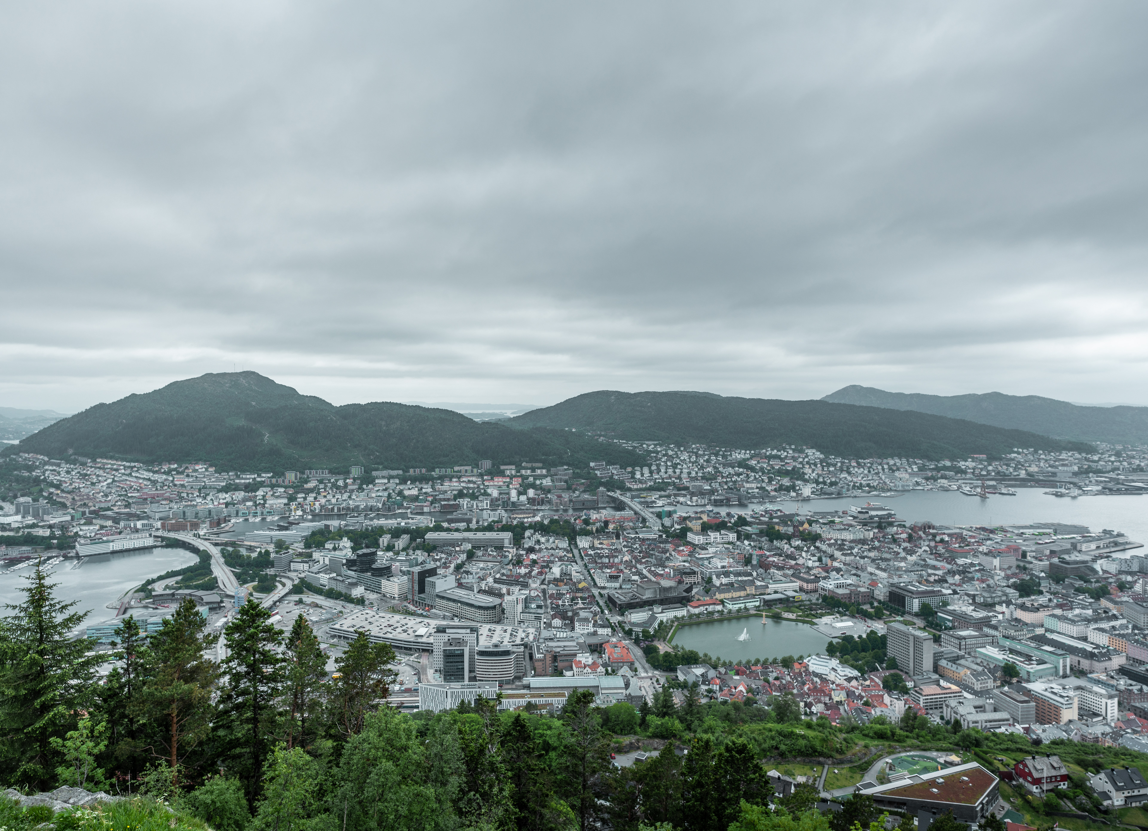
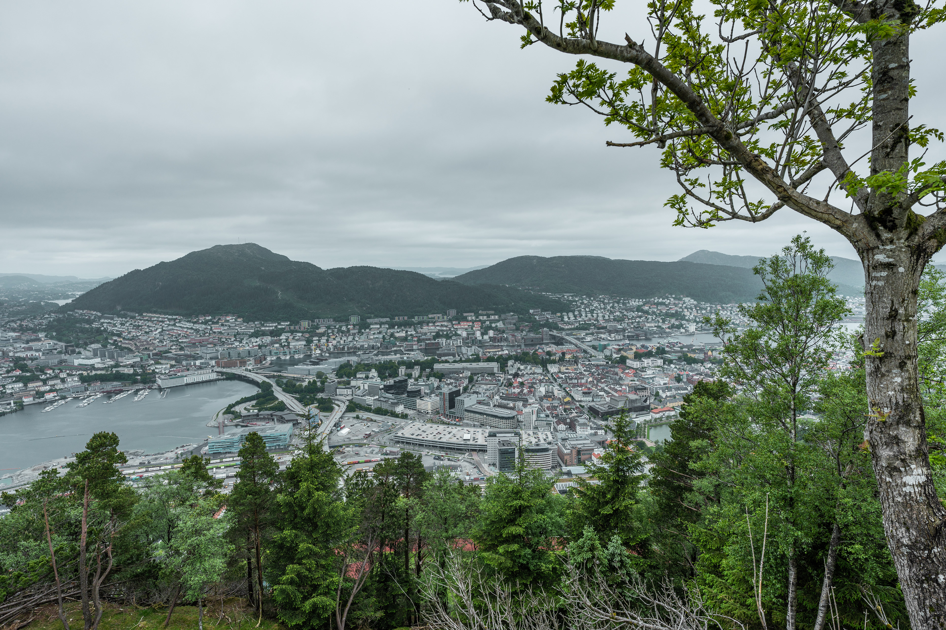
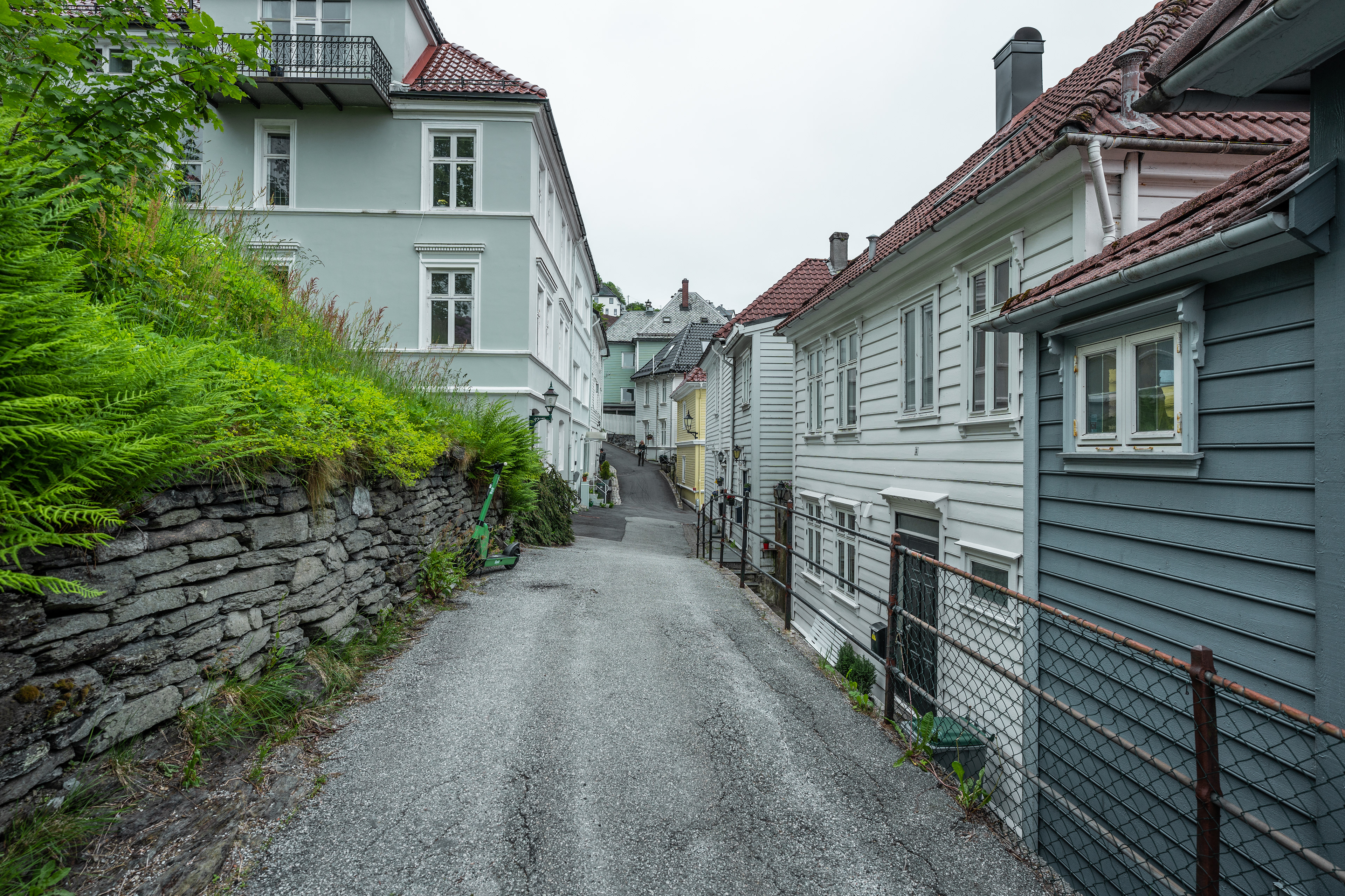
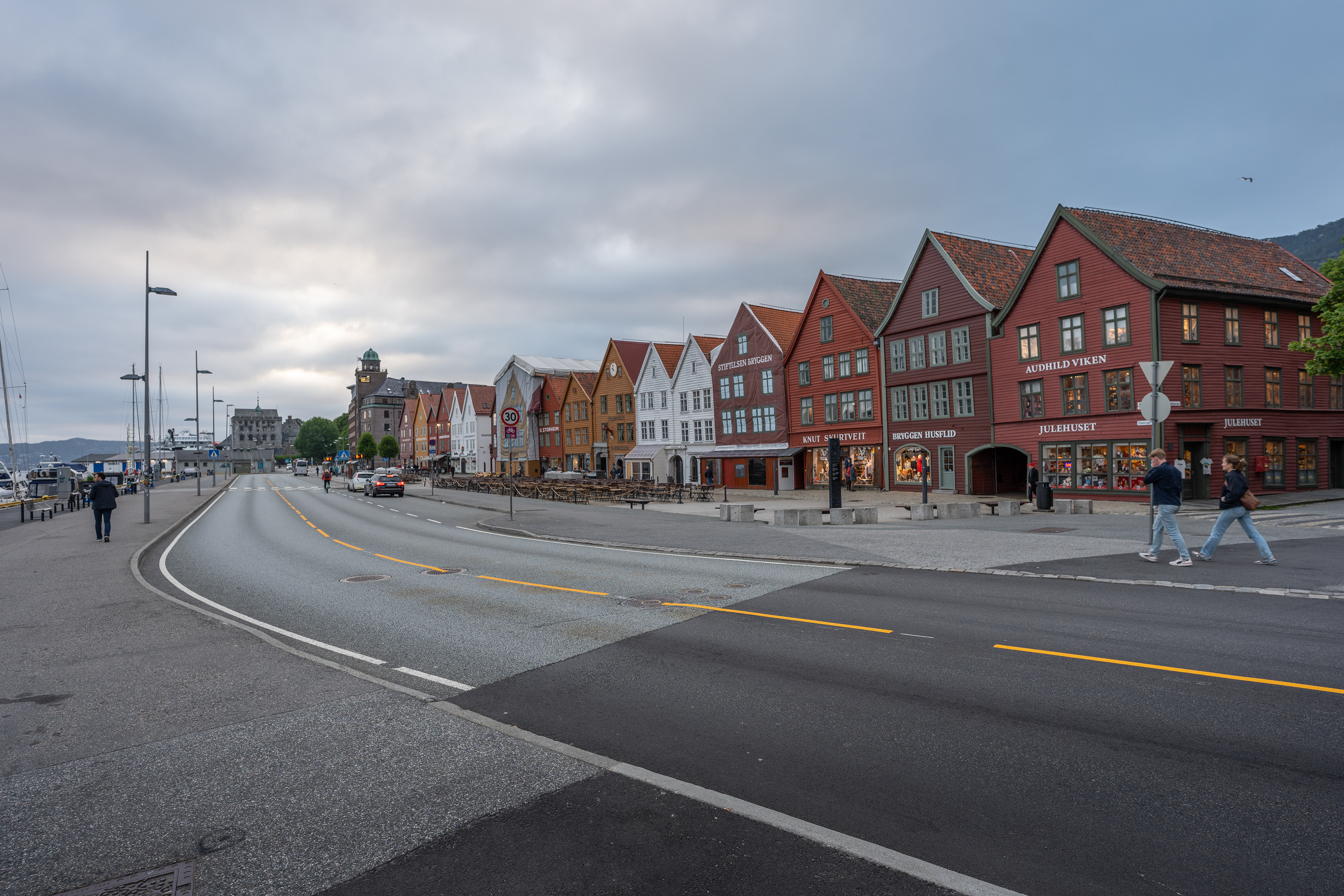
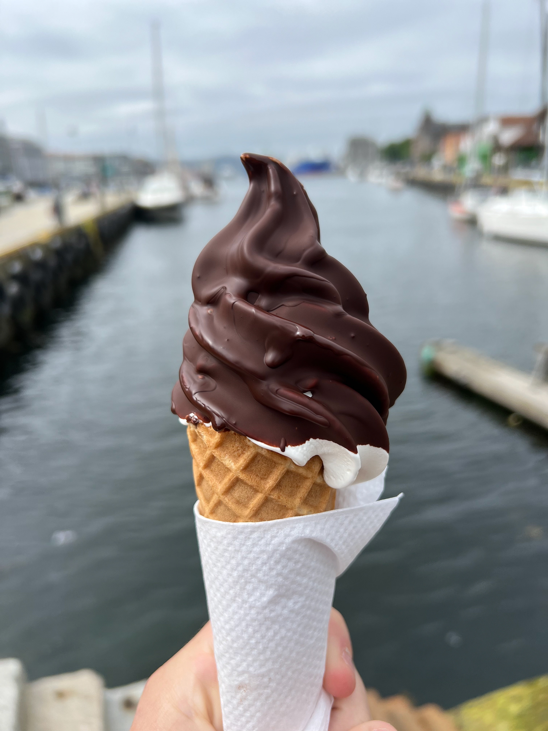
In a city it's easy to go over budget on the simplest things. An example is a soft ice cream from a market stand, which cost about €6. You can see that the city and its citizens are faring well but of course this is also reflected in the prices. The 2nd day we also explored Bergen the entire day and took the cable car up onto the mountain to enjoy some views of the city and its surrounding area. You can choose to hike up there as well but we just enjoyed the views and the free running goats before descending by foot. Worth a mention is also the UNESCO-listed Bryggen district. It features nice old wooden buildings that are protected heritage. Bergen was the last city on the Hanseatic trading route, which originates in the Netherlands.
Bergen
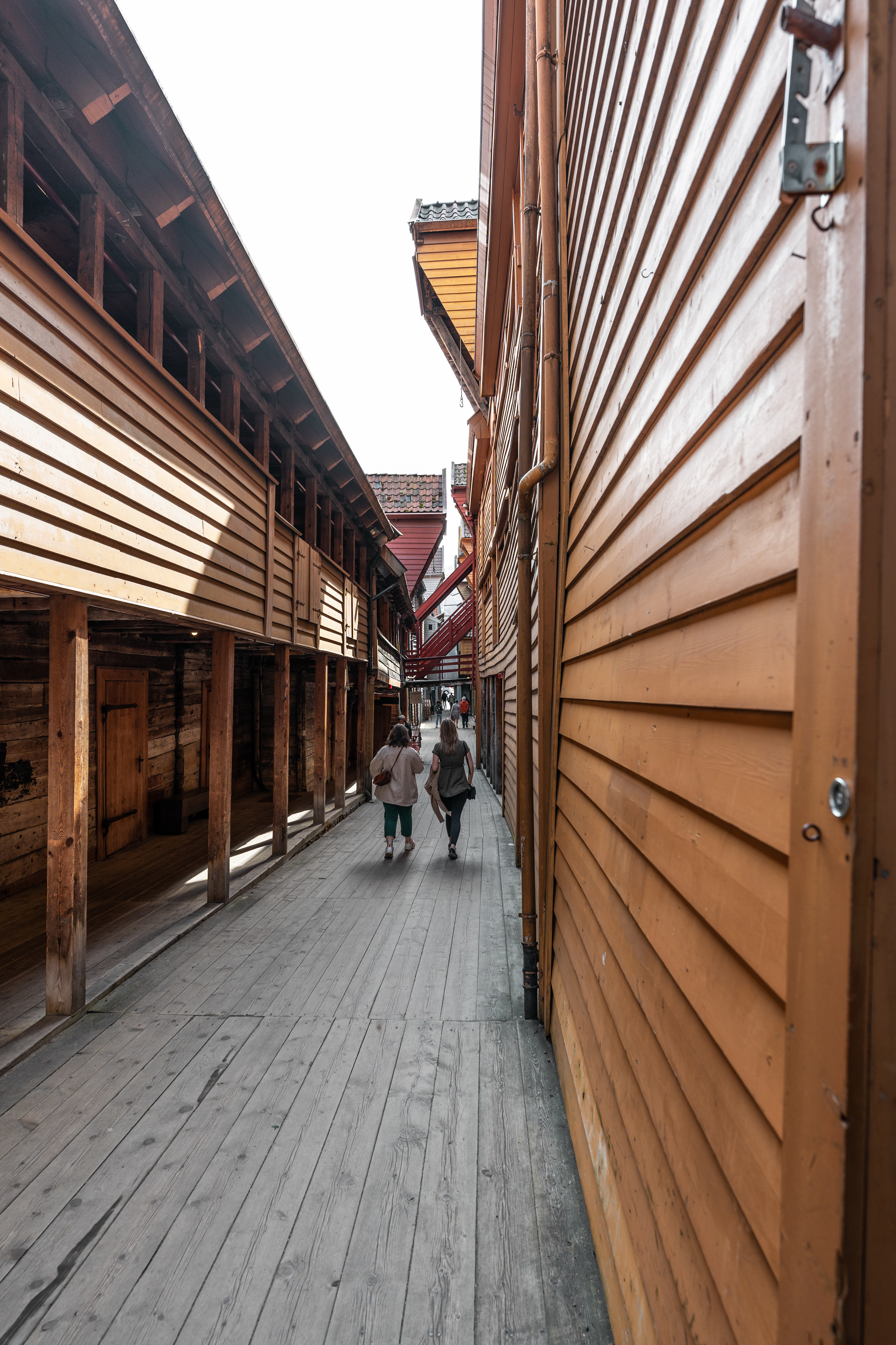
Bryggen
Bergen
View of Bergen
View of Bergen
Bergen
Bergen
Bryggen
Fish market
€6 ice cream

Lunch bowl
Bergen
Bergen
Bergen
Bergen
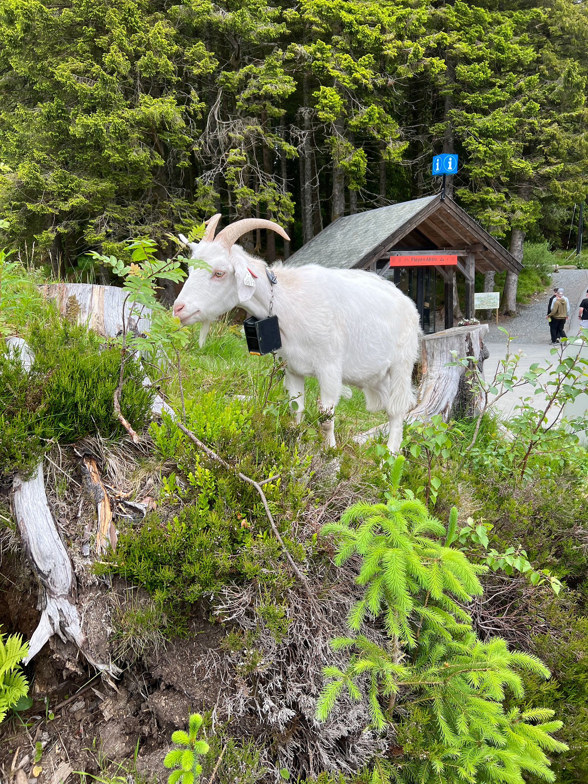
A Bergen goat
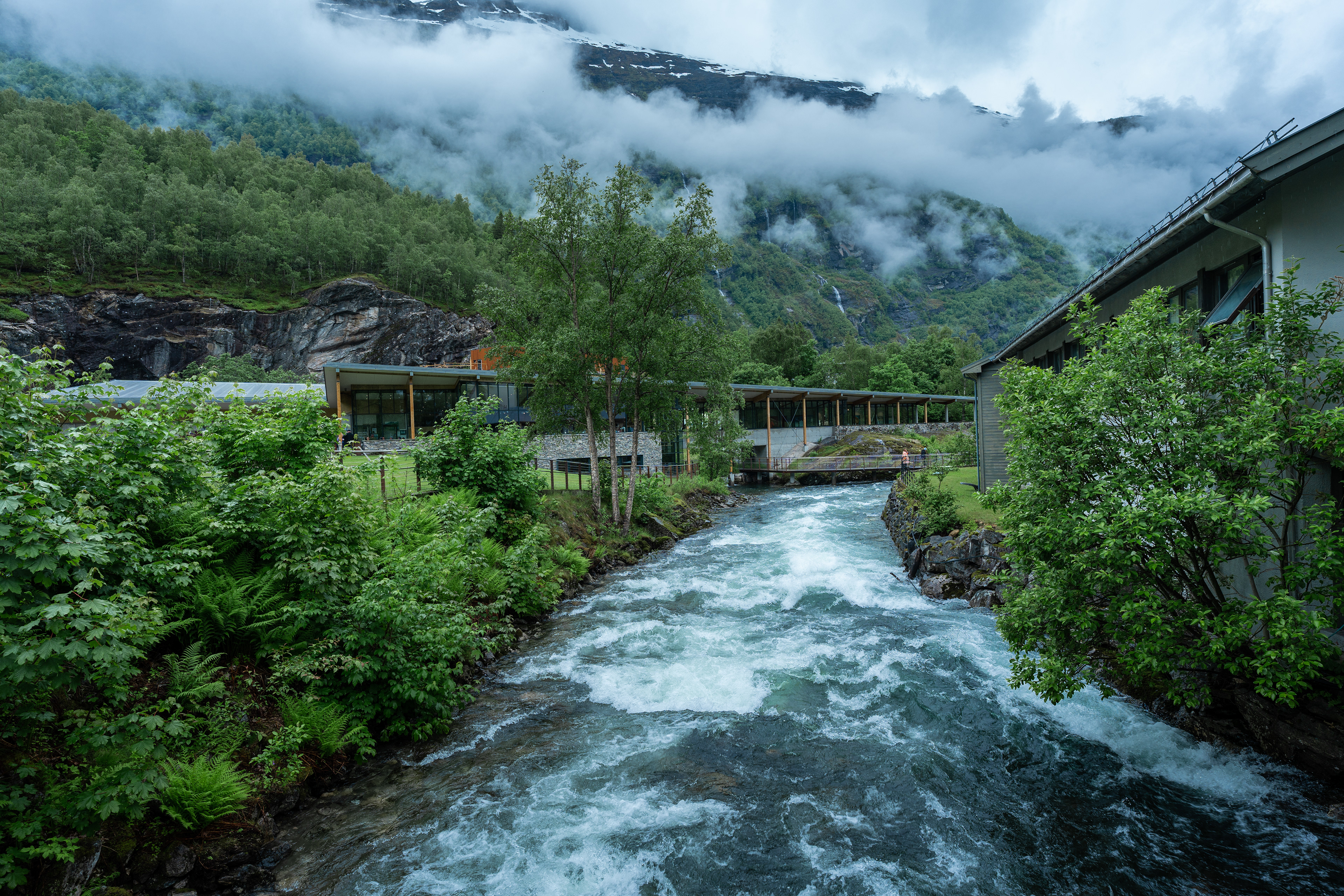
Flåm Region
A view from the Flåmsbana
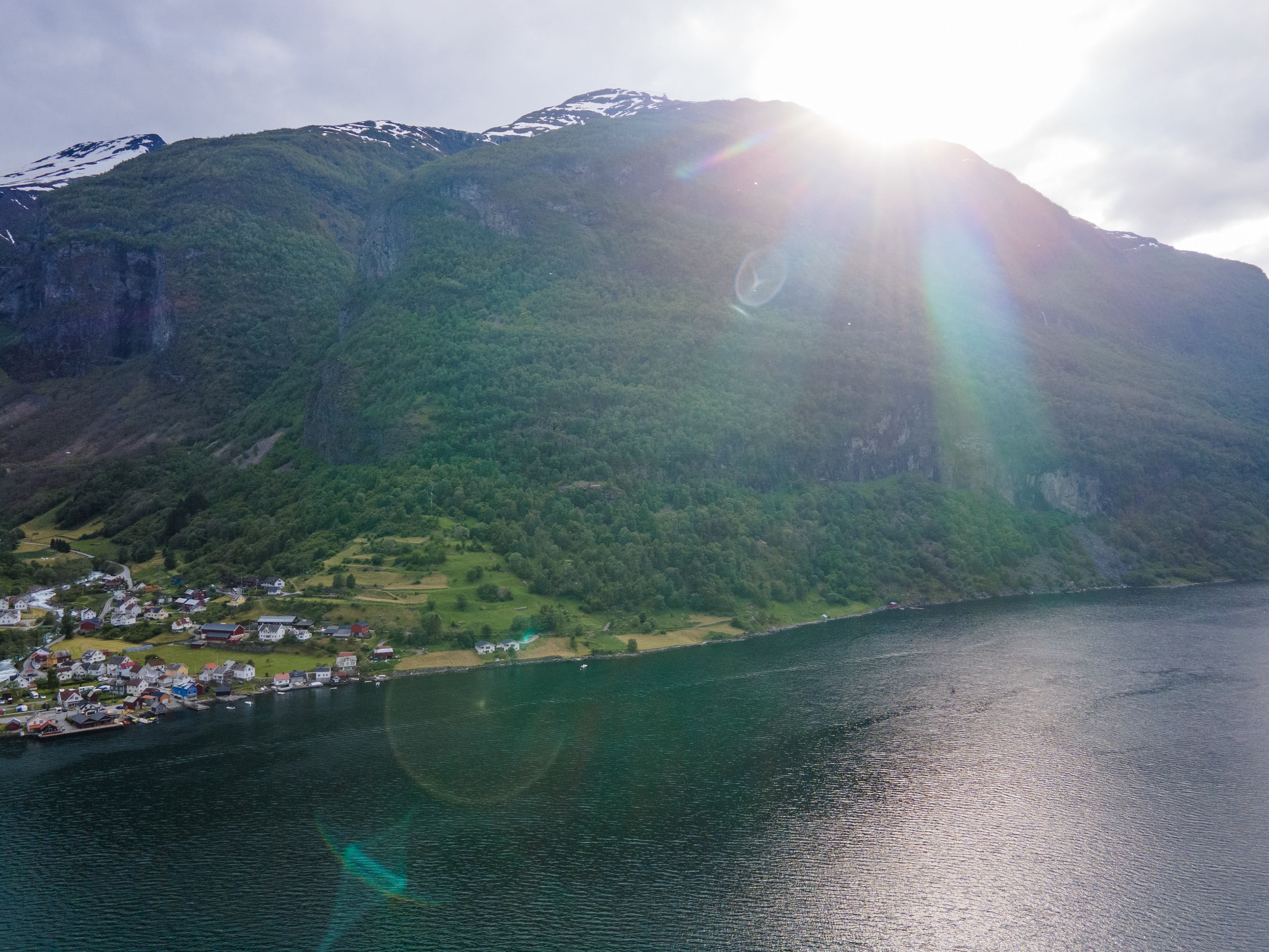
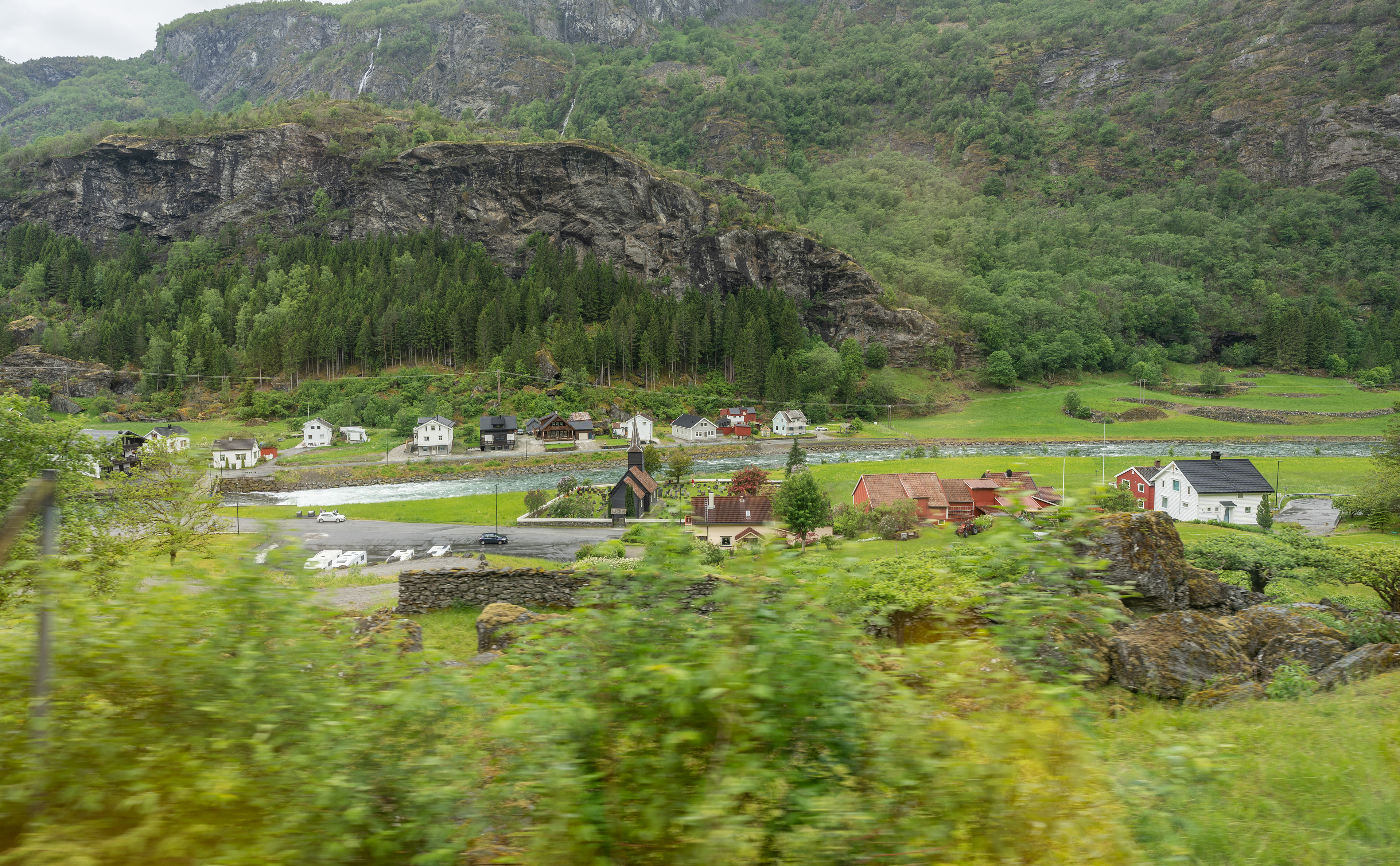
Undredal
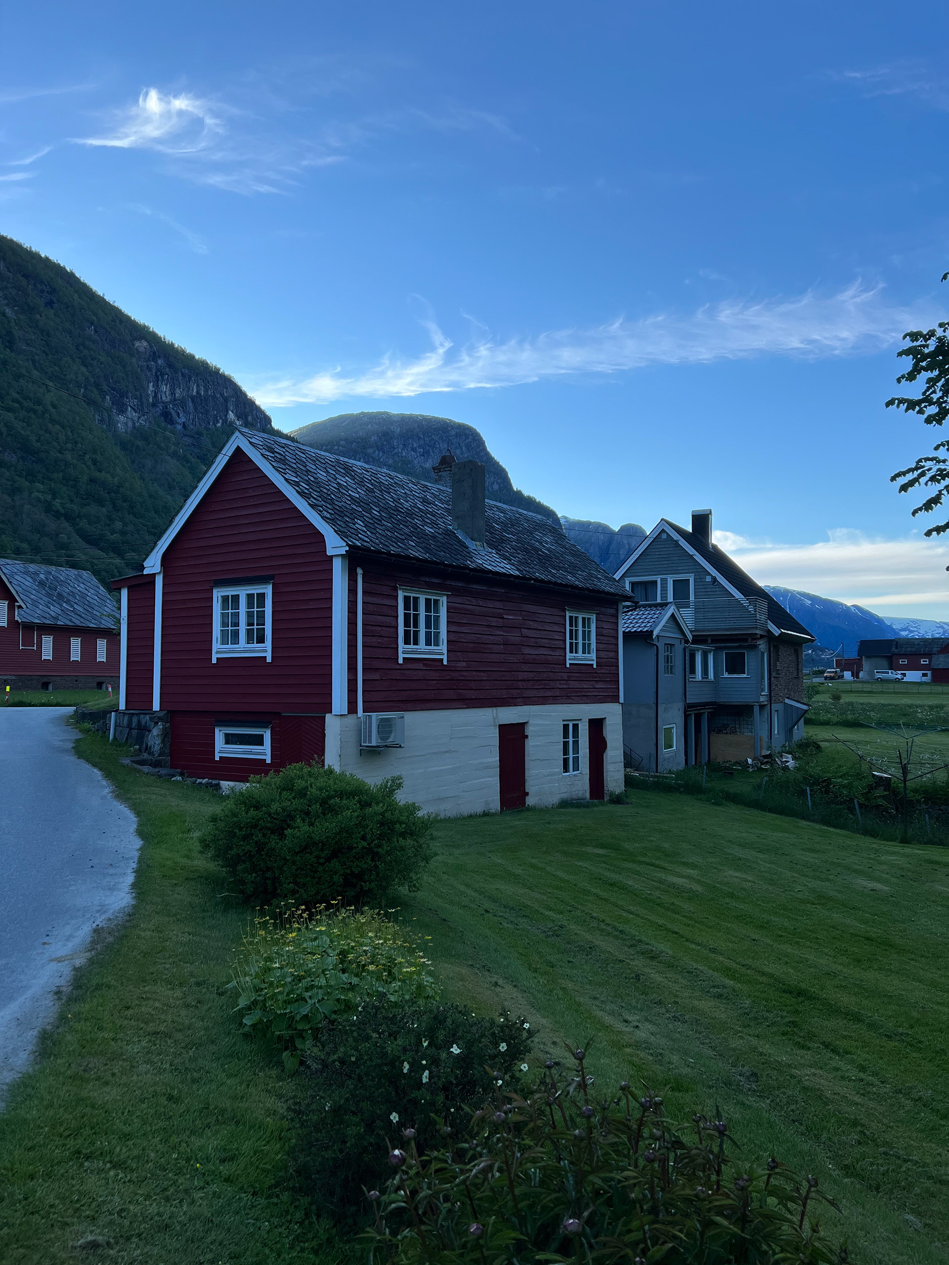
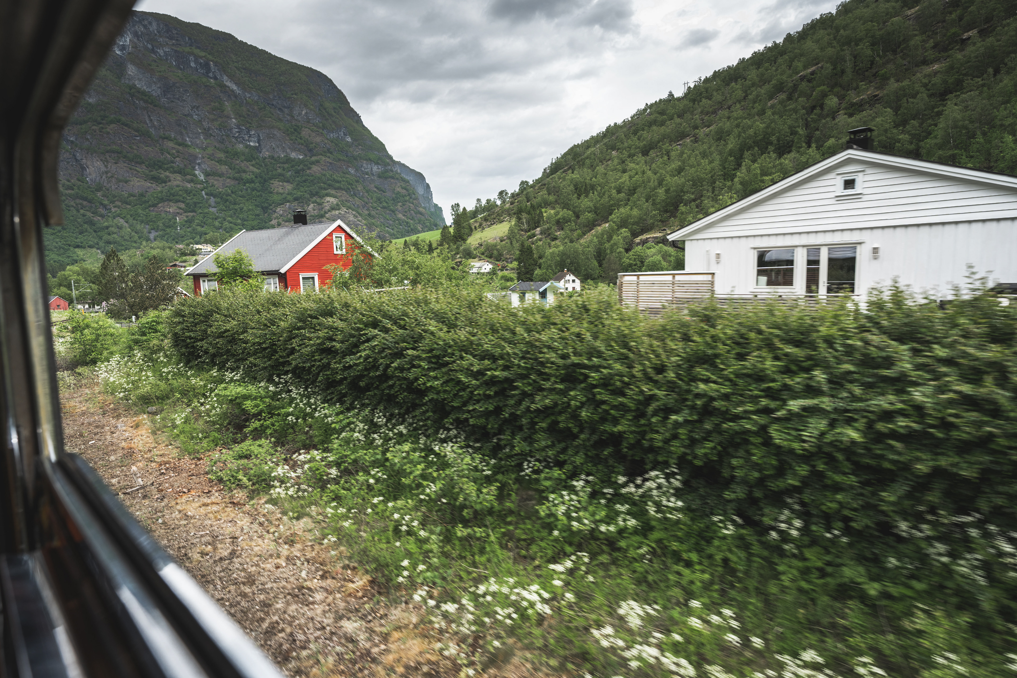
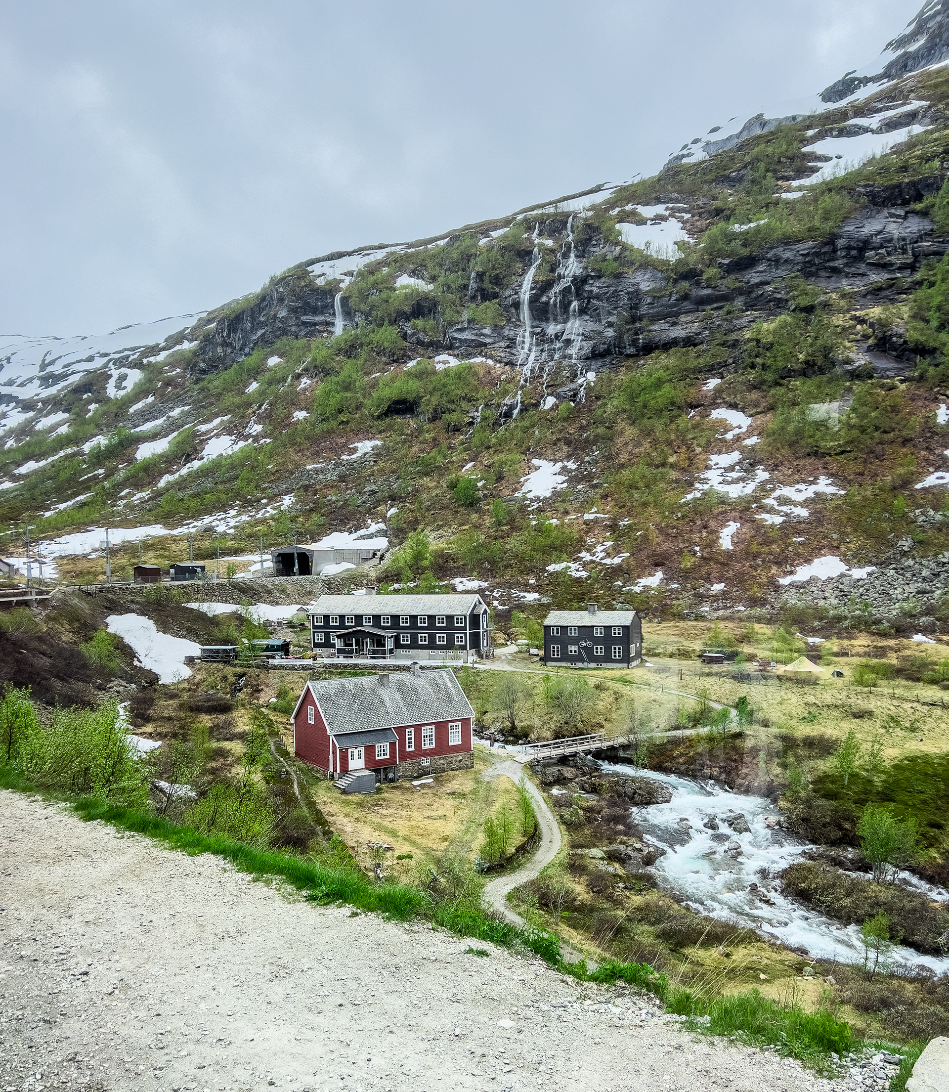
Undredal is perhaps not known to most visiting this part of Norway. The only reason I include it is because or Airbnb was located in a remote valley leading to the town of Undredal. It's worth mentioning because although a dead-end, it leads to a view of the fjords that's really pretty. I have to mention our Airbnb again here as well. Just like the one in Sandvin, this was a characteristic red wooden house in a valley surrounded by mountains. It had a very traditional tasteful interior, which elevated our stay even further. After arriving I decided to drive out to Undredal and check out the views. However, the drive took me much longer than anticipated thanks to a herd of goats that was on the road. They were going super slow and didn't want to move over, at some point I got afraid they would damage the car so I kept my distance. Eventually the farmer came around and helped me out after his goats created a bit of a traffic jam :D.
Our Airbnb
Our Airbnb
View of the Aurlandsfjord from Undredal
Undredal
Undredal
Undredal
E16 between Voss and Gudvangen
E16 between Voss and Gudvangen
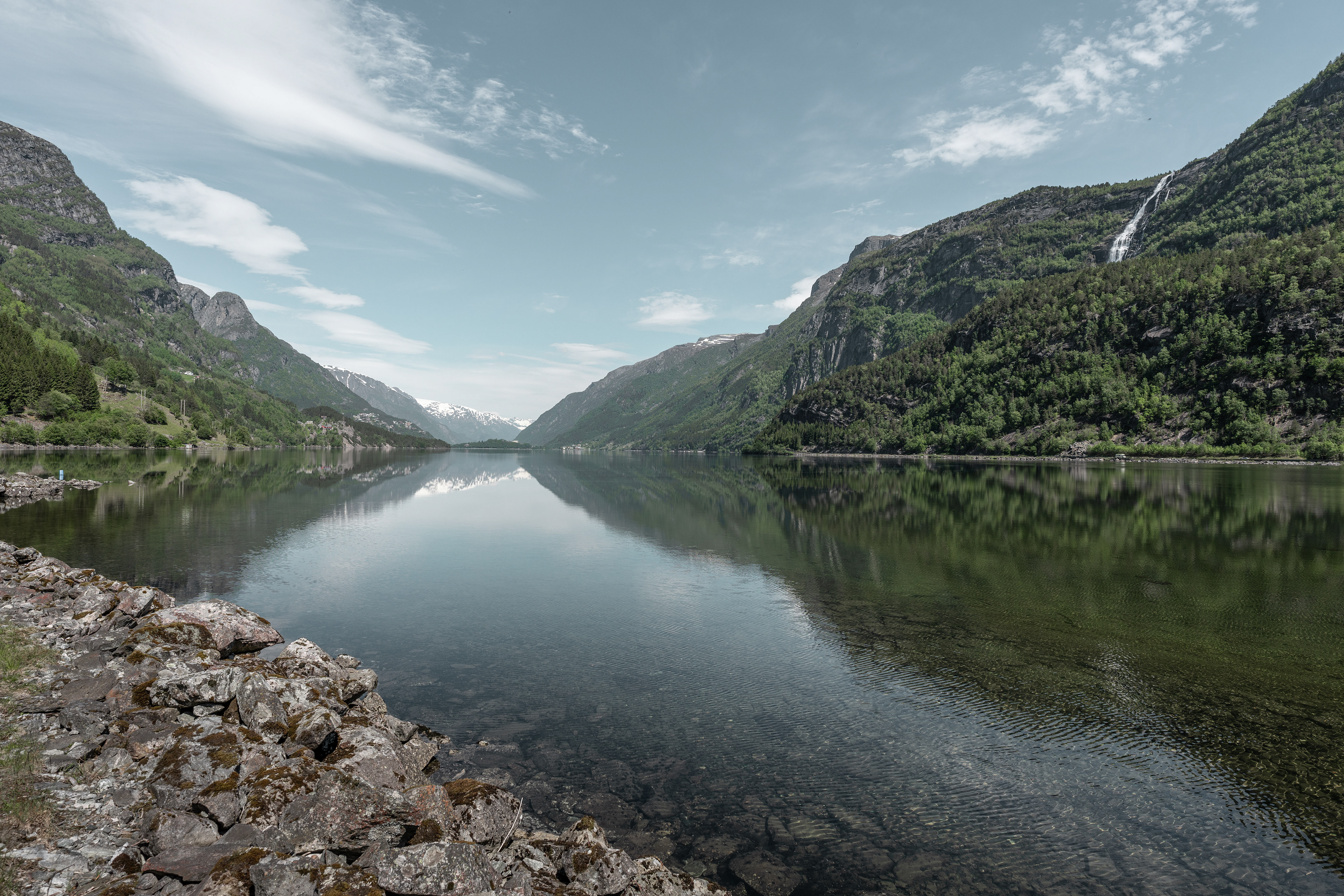
Nærøyfjorden
In the evening we decided to take a look at the Nærøyfjord, which is a UNESCO-listed fjord together with the Geirangerfjord. It wasn't so far from our Airbnb, basically just one valley over to Gudvangen. In order to get there, you have to drive through the Gudvangentunnelen, an 11-kilometer long tunnel on the E16. It was once the longest tunnel in Norway before the Lærdalstunnelen, currently world's longest road tunnel, opened in 2000. Nærøyfjorden is a bit hard to visit by car and best seen from a boat. We chose to do other things so didn't do the boat trip. If you go by car you can drive just beyond the village of Bakka until you reach a campsite. This is the end of the road although it's barely 1/3 into the fjord.
Nærøyfjorden
Nærøyfjorden
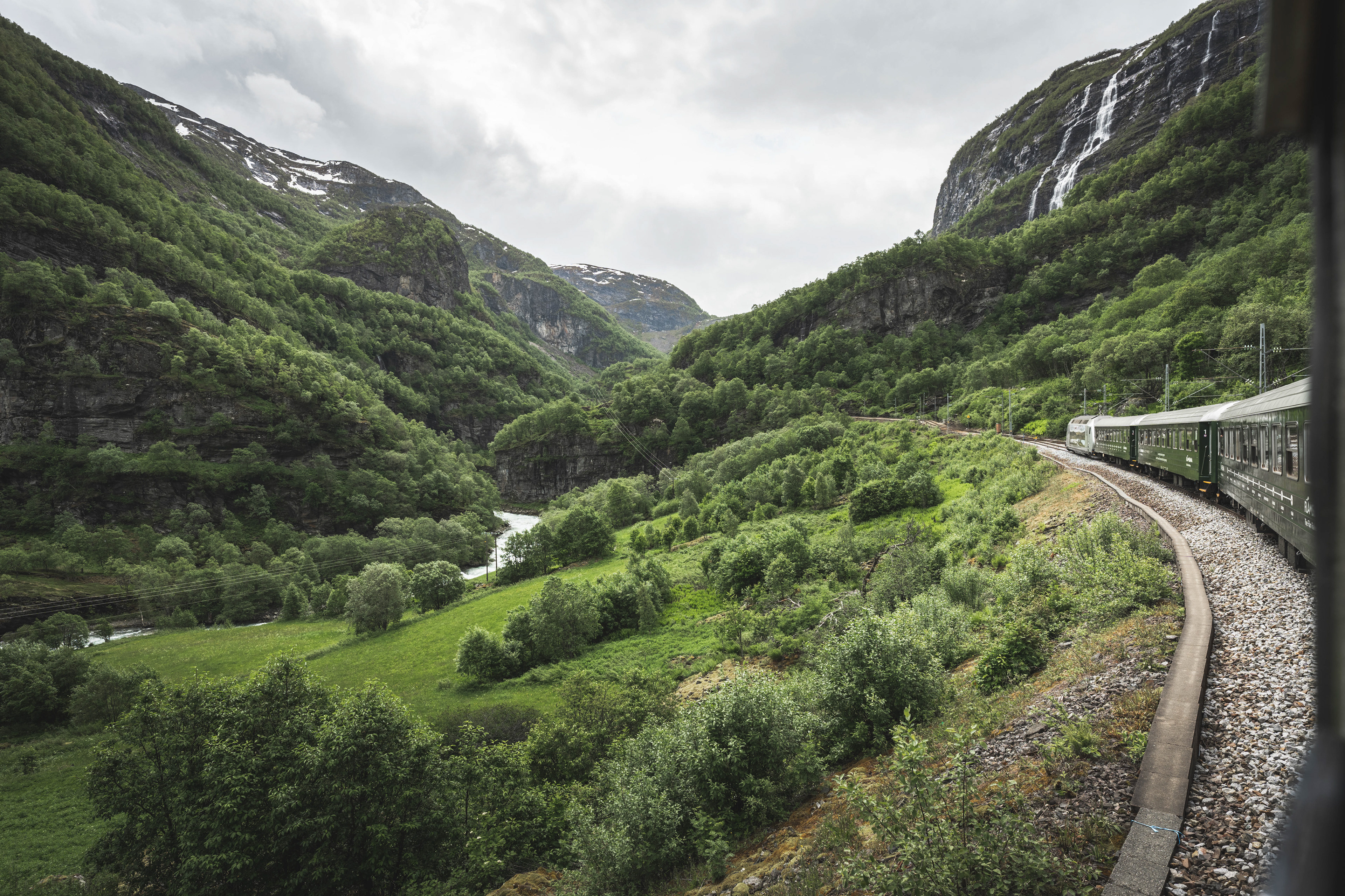
Flåmsbana / Flåm Railway
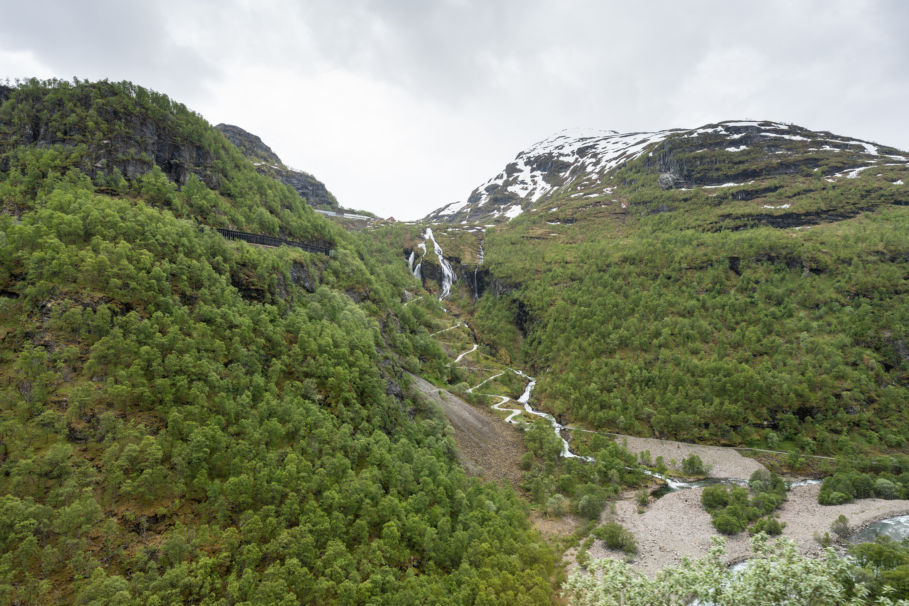
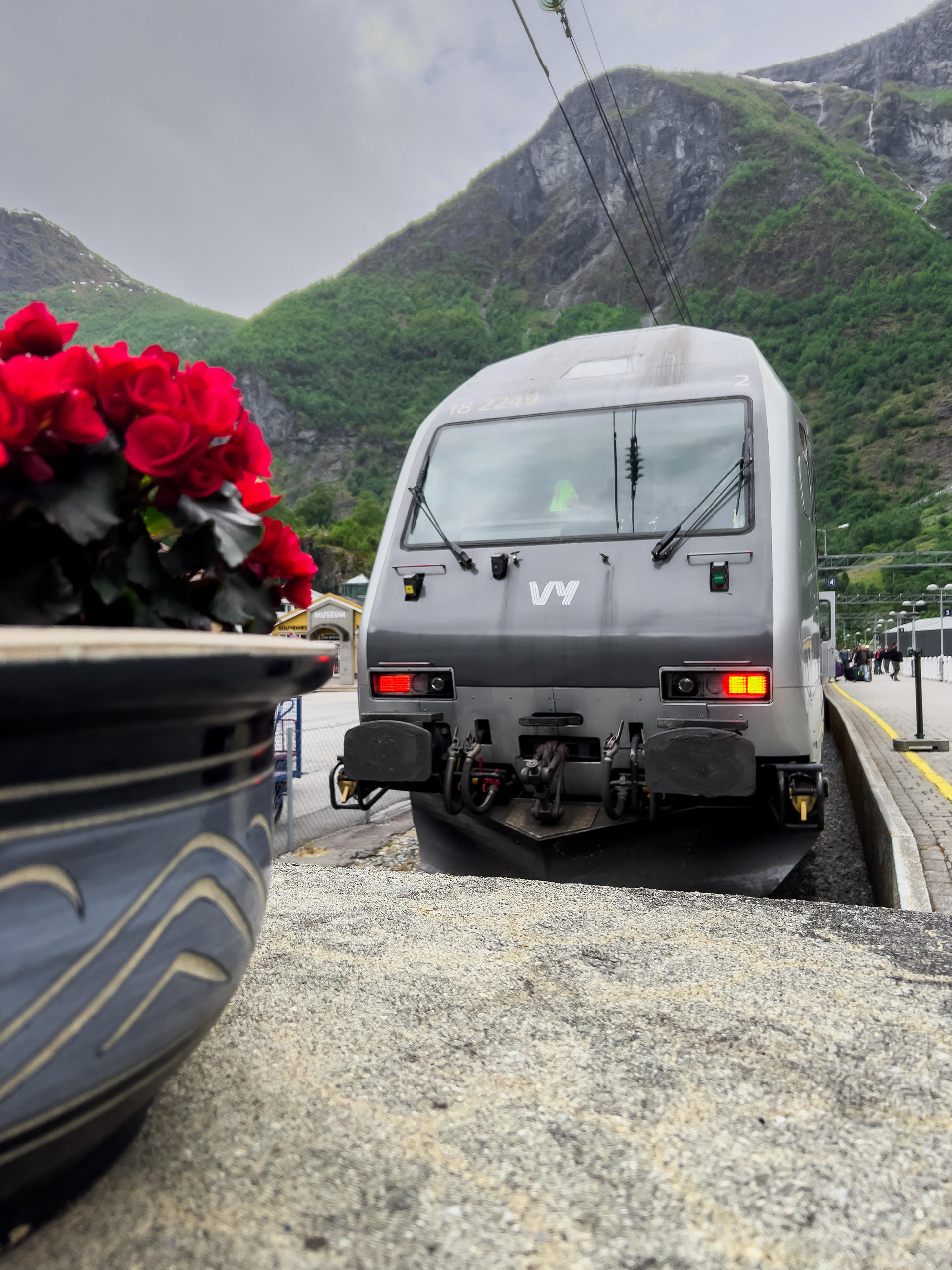
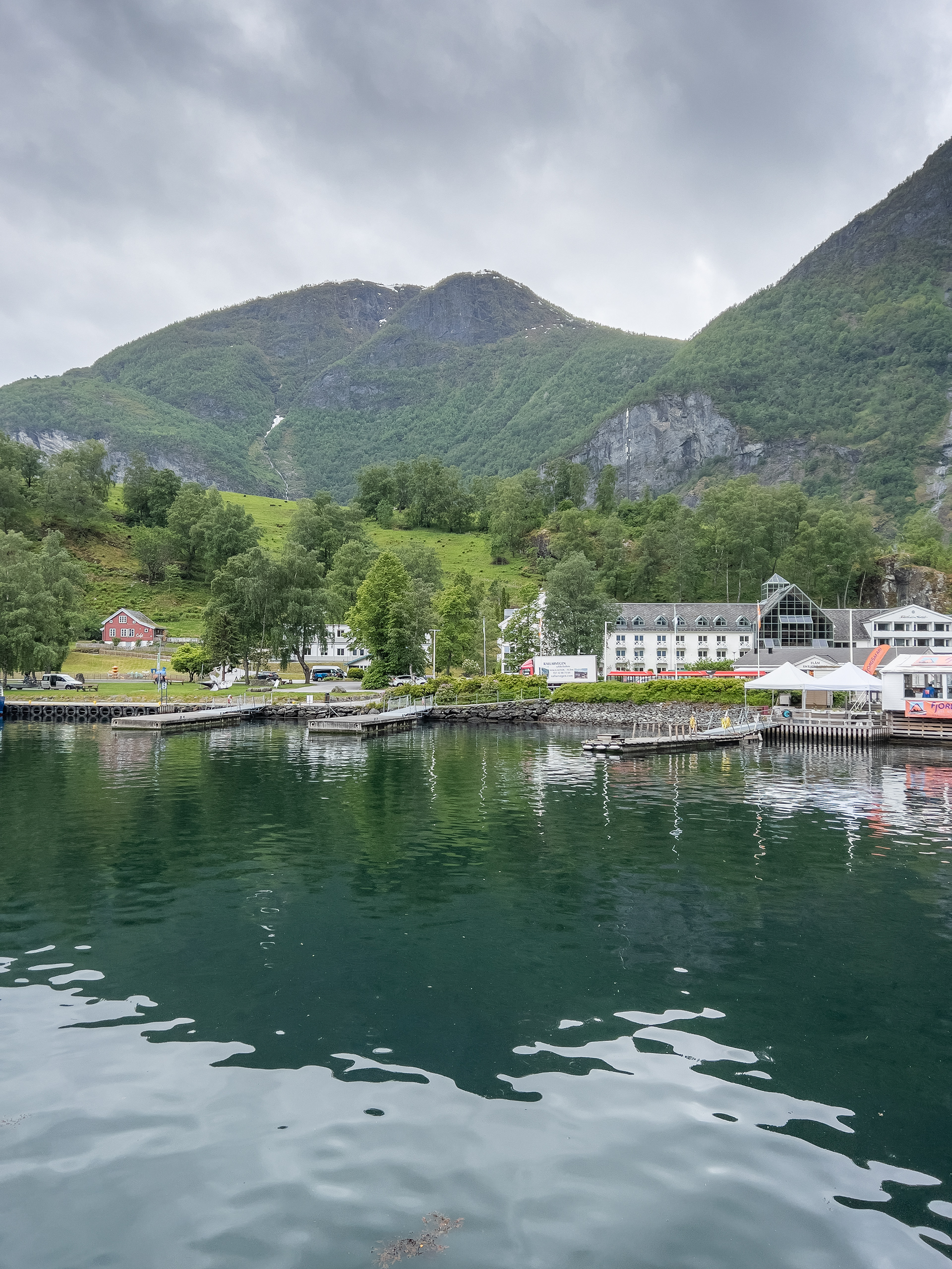
The Flåmsbana or Flåm Railway is a must-do when you are in the area. It's a touristic train ride up to Myrdal with great views on the way. There is also a connection to the regular train network, the track continues to Voss and beyond. If you just go up to Myrdal and do the touristic ride, it includes a stopover at Kjosfossen waterfall. There is a platform just to view the waterfall and get back into the train, the train typically stops for a few minutes. There is a lady that sings at the waterfall. The views from the railway are really amazing and I can generally recommend it. However, here you also need to consider it's not cheap. I believe we paid over €150 for 2 persons and altogether it took about 1.5 hours.
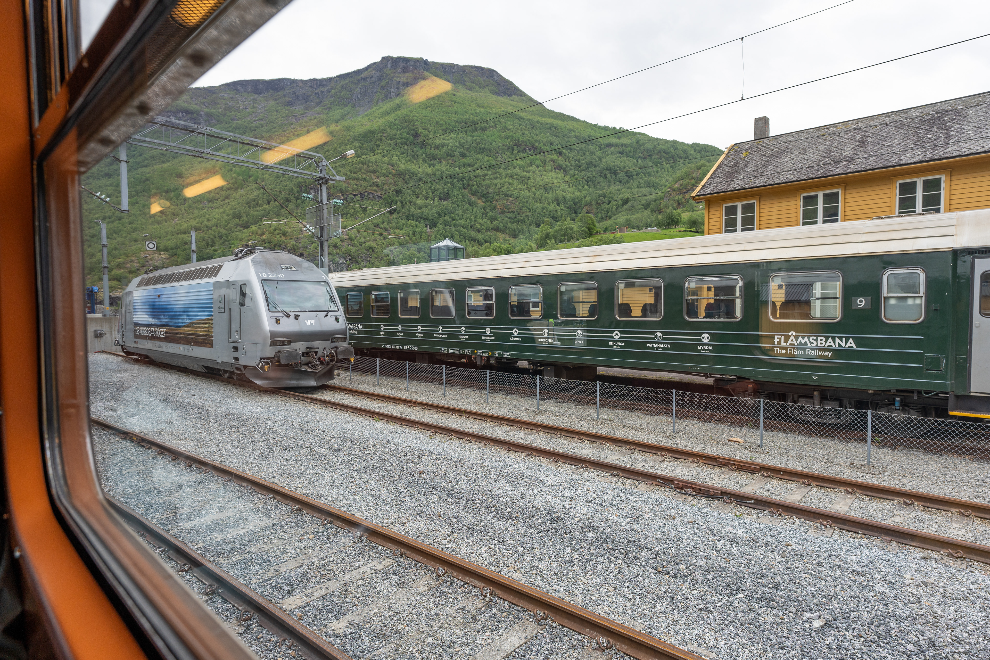
The station in Flåm
Views from the Flåmsbana
Views from the Flåmsbana
Views from the Flåmsbana
Views from the Flåmsbana
Views from the Flåmsbana
Flåm Station
Flåm
Kjosfossen
Views from the Flåmsbana
Views from the Flåmsbana
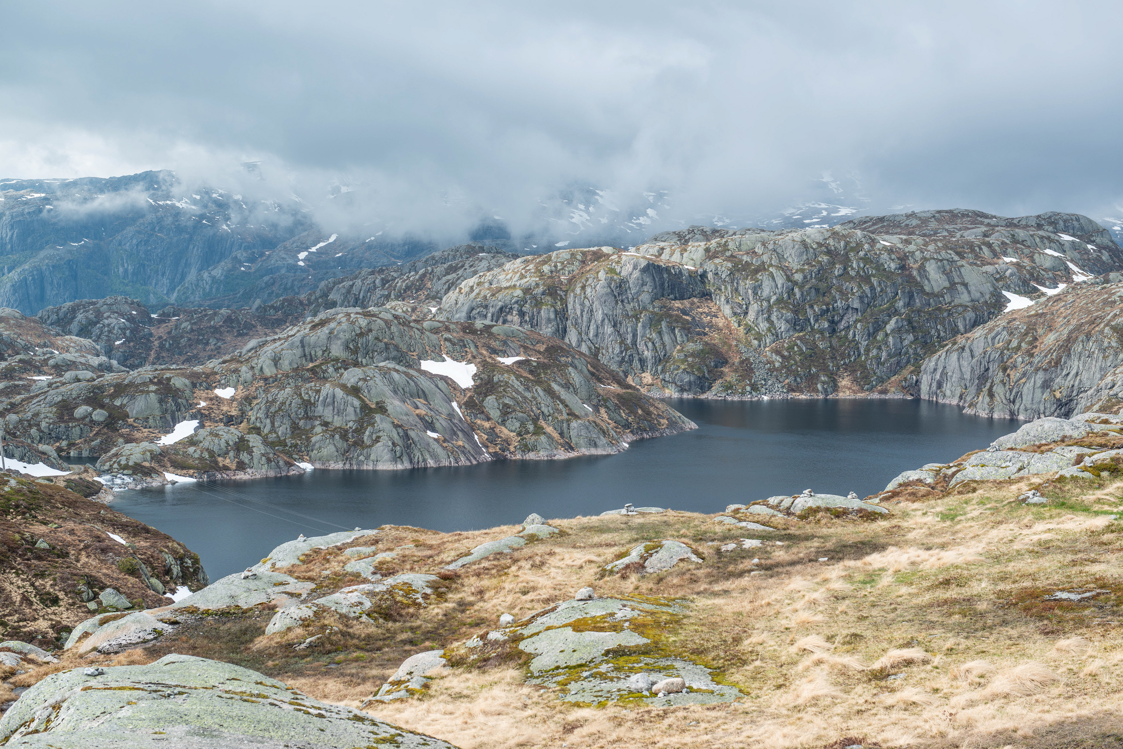
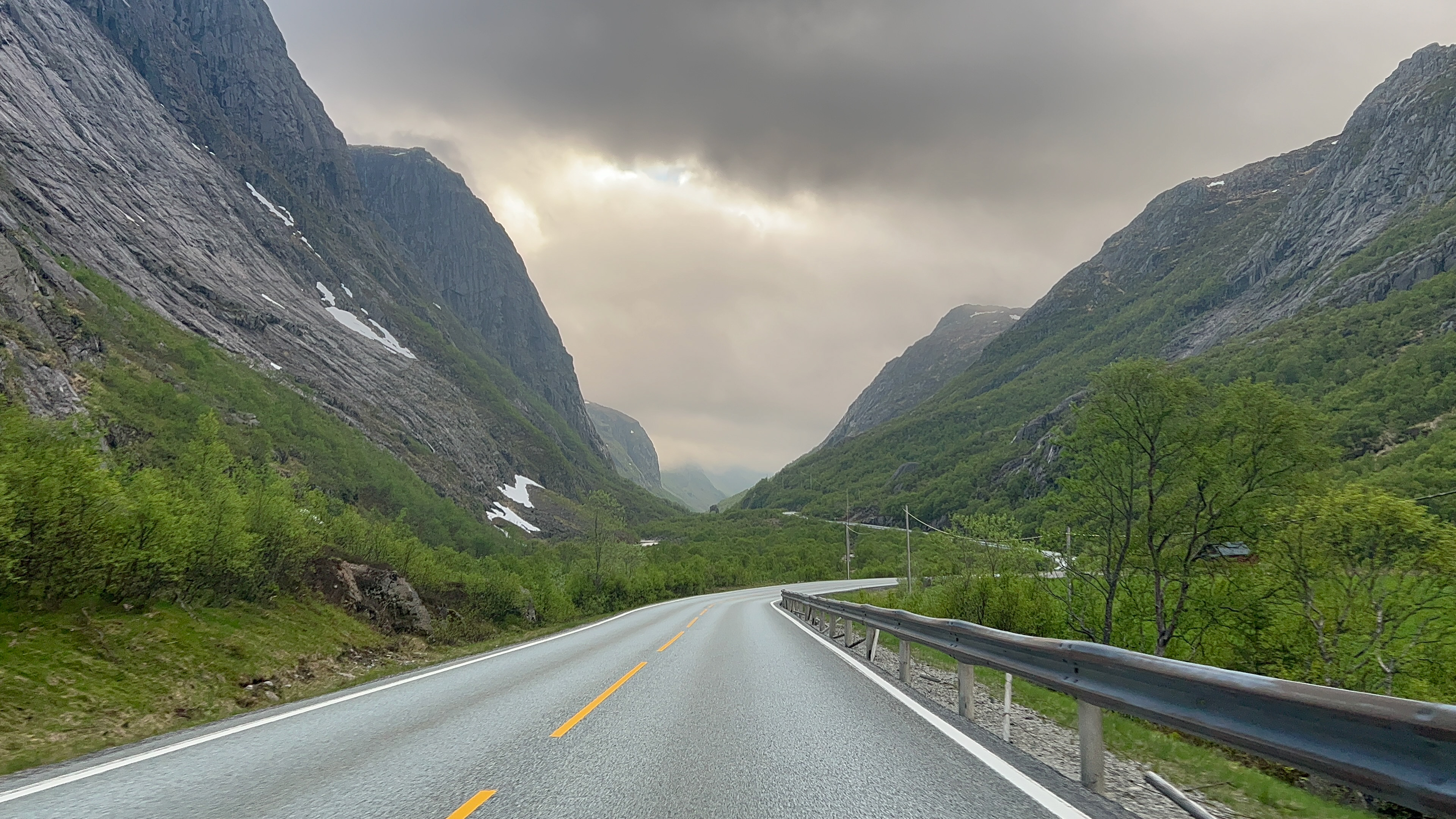
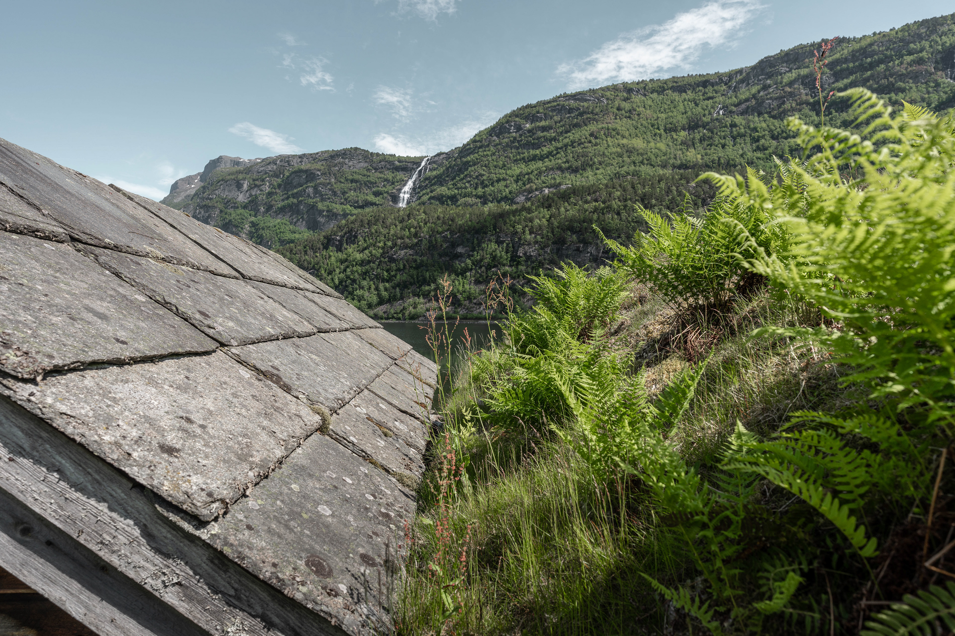
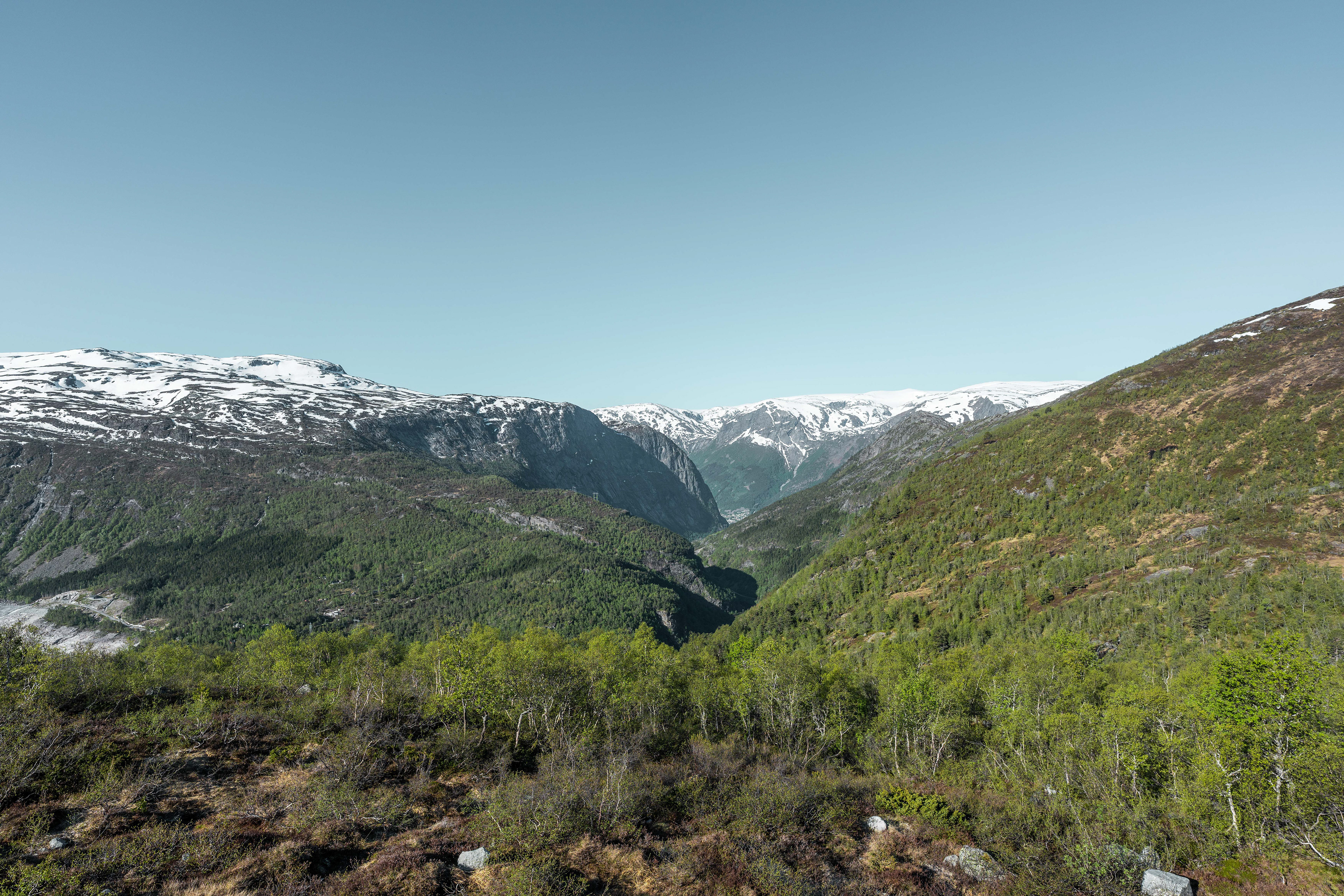
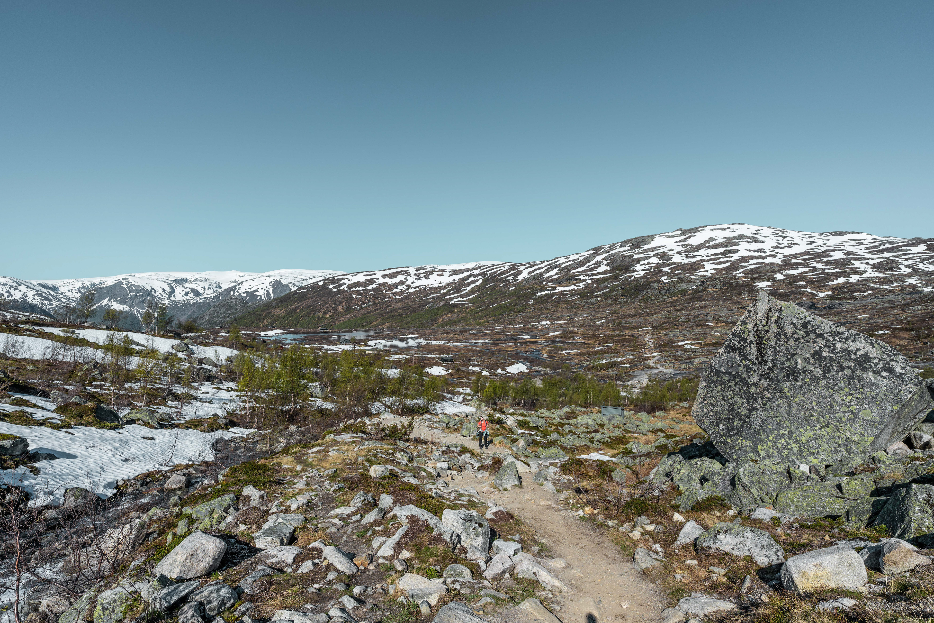
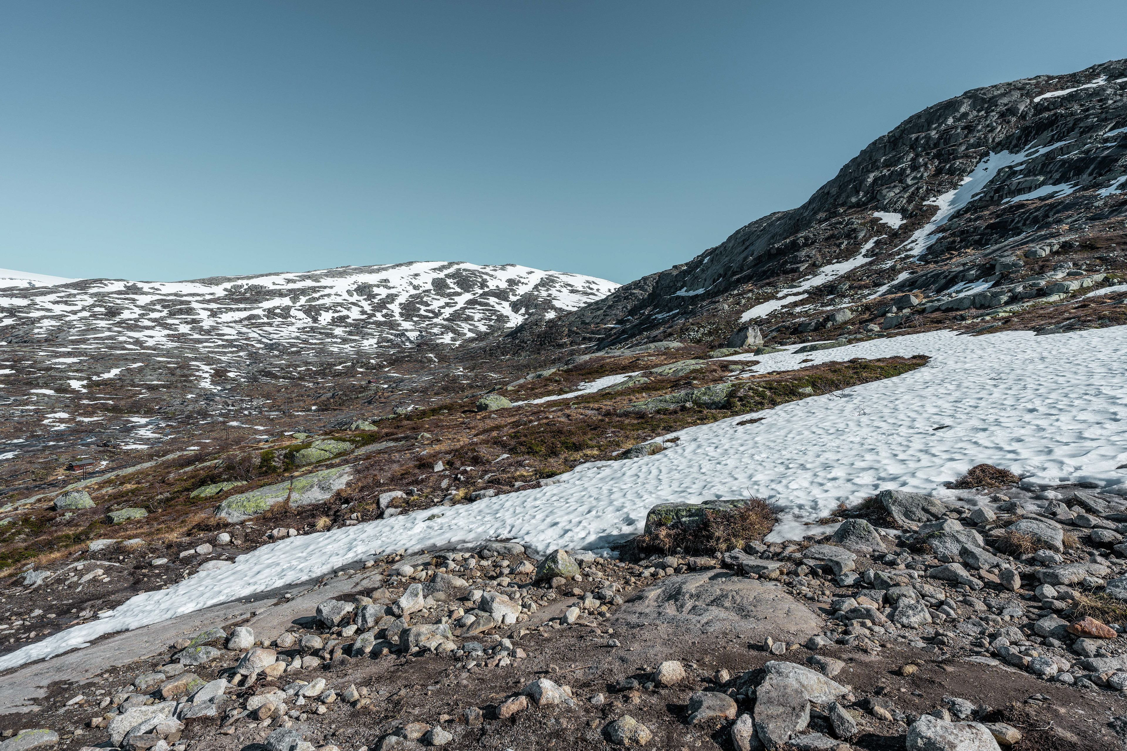
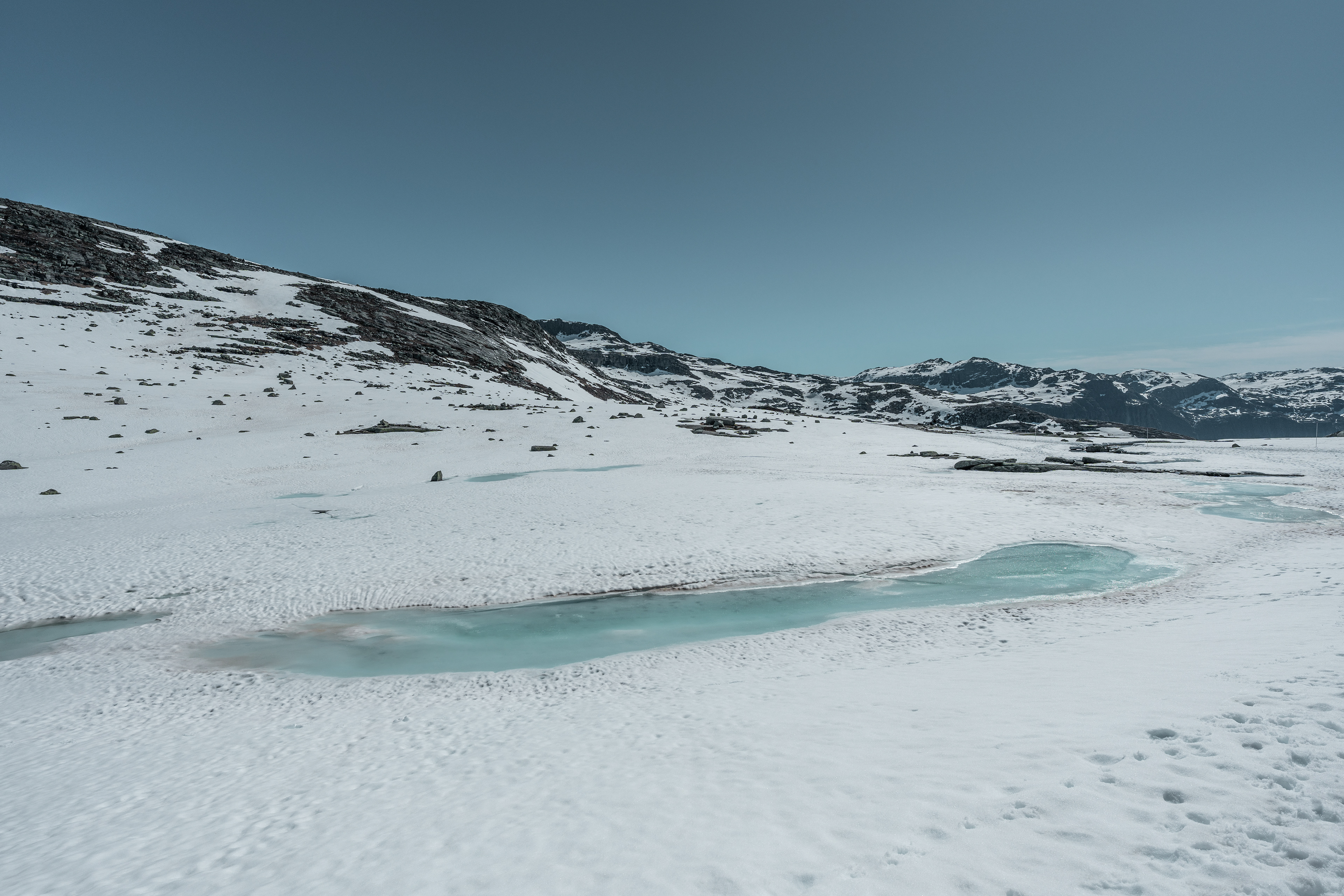
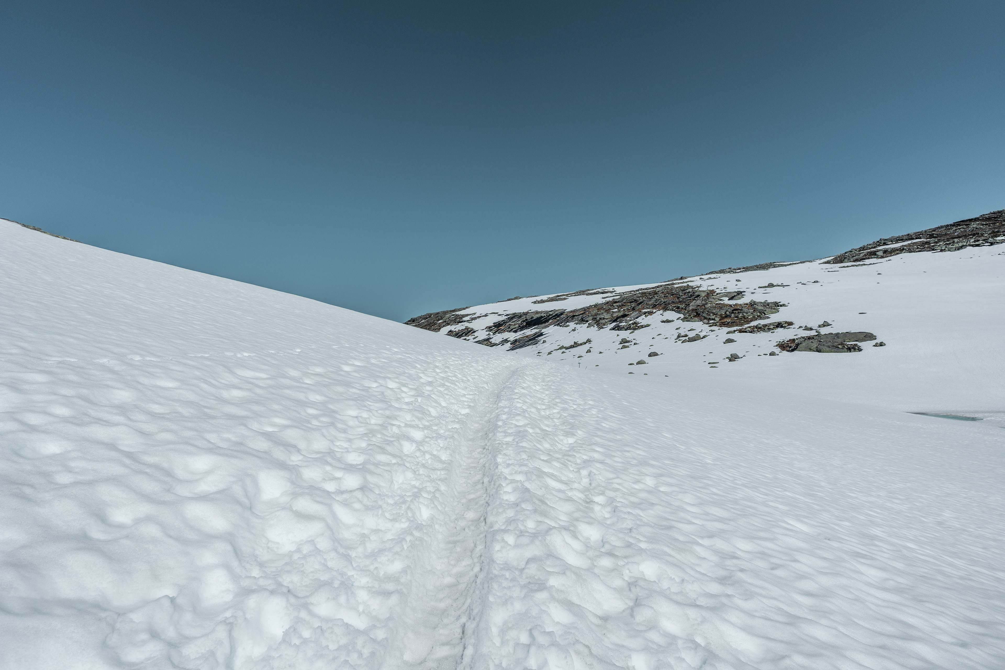
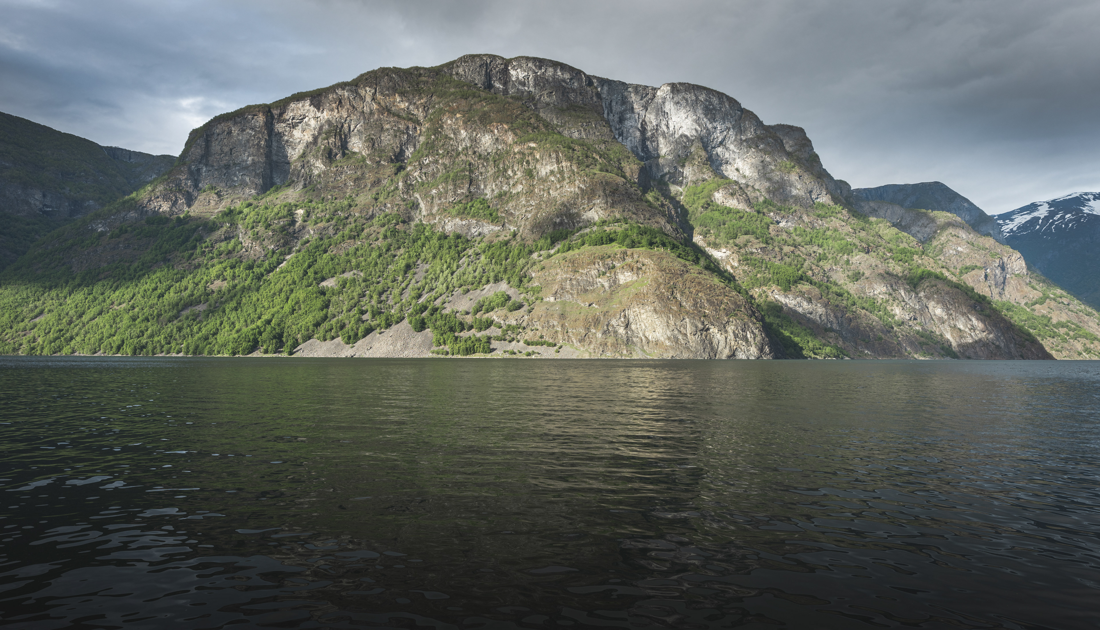
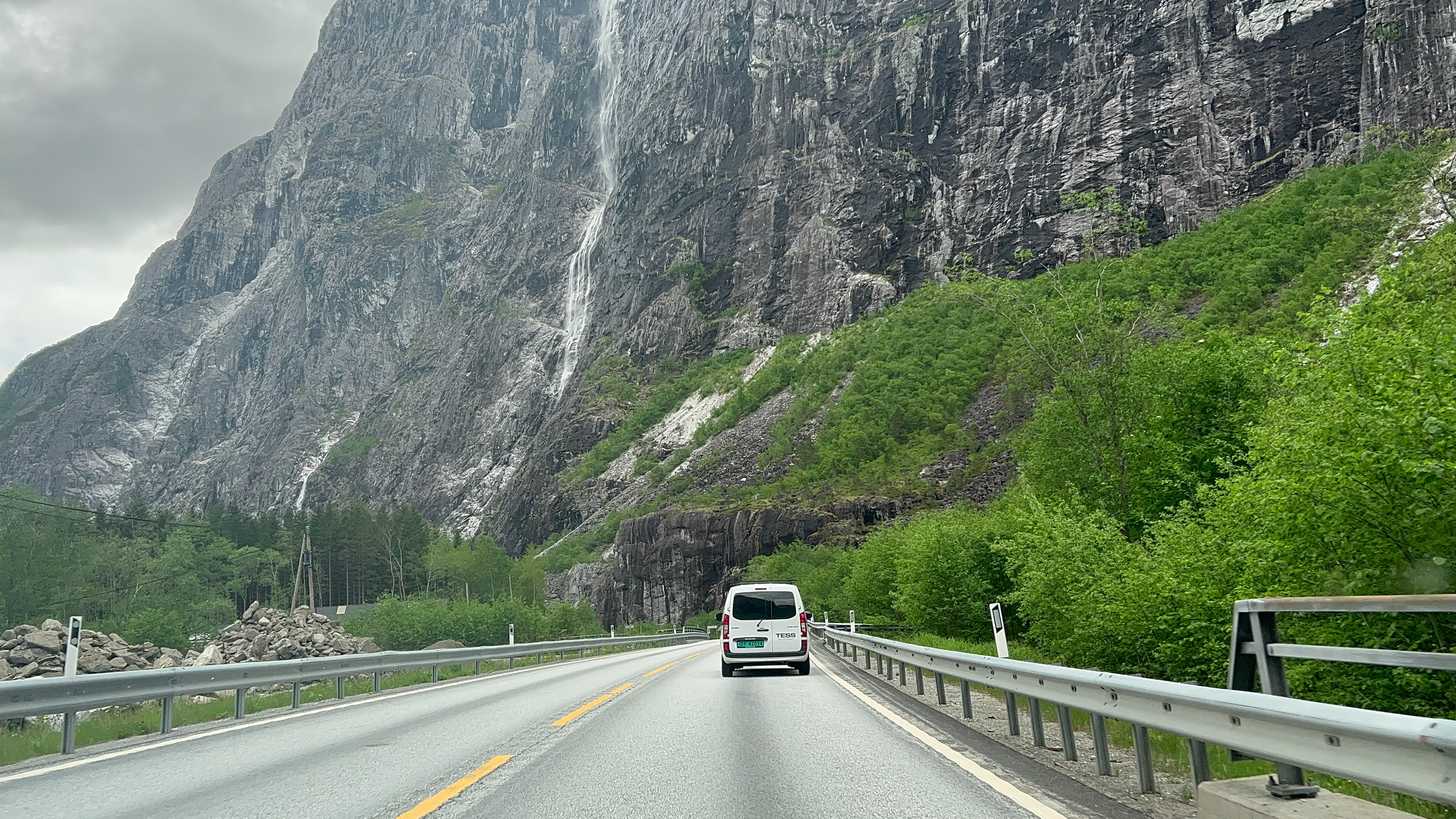
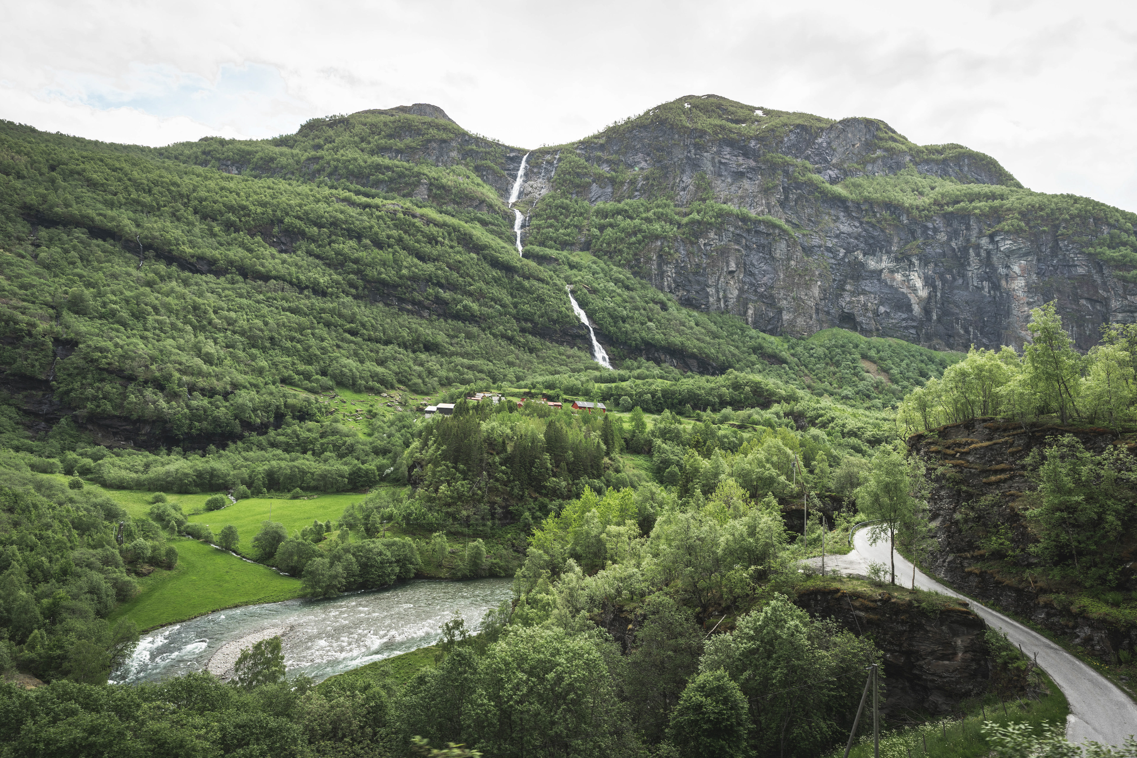
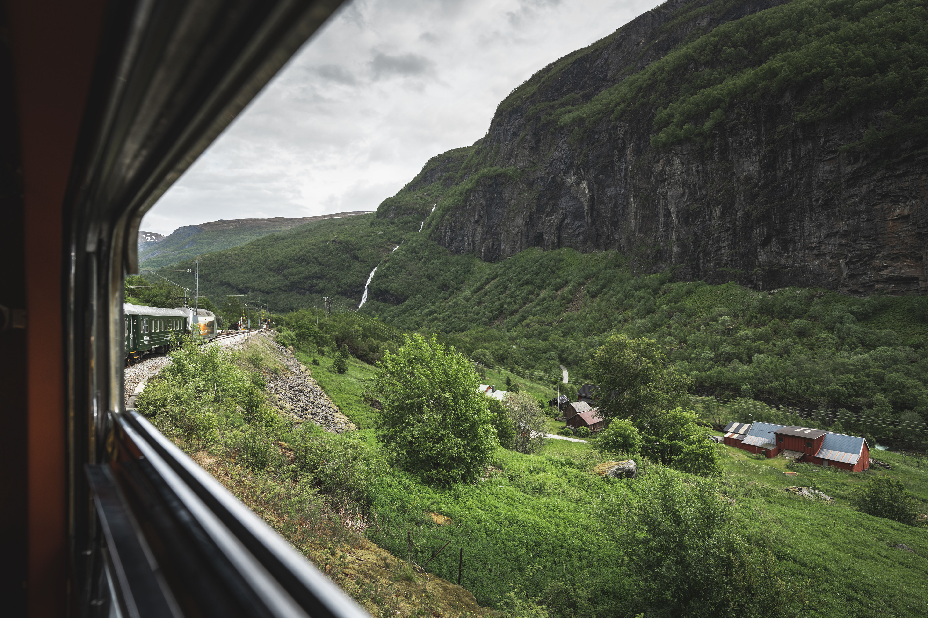
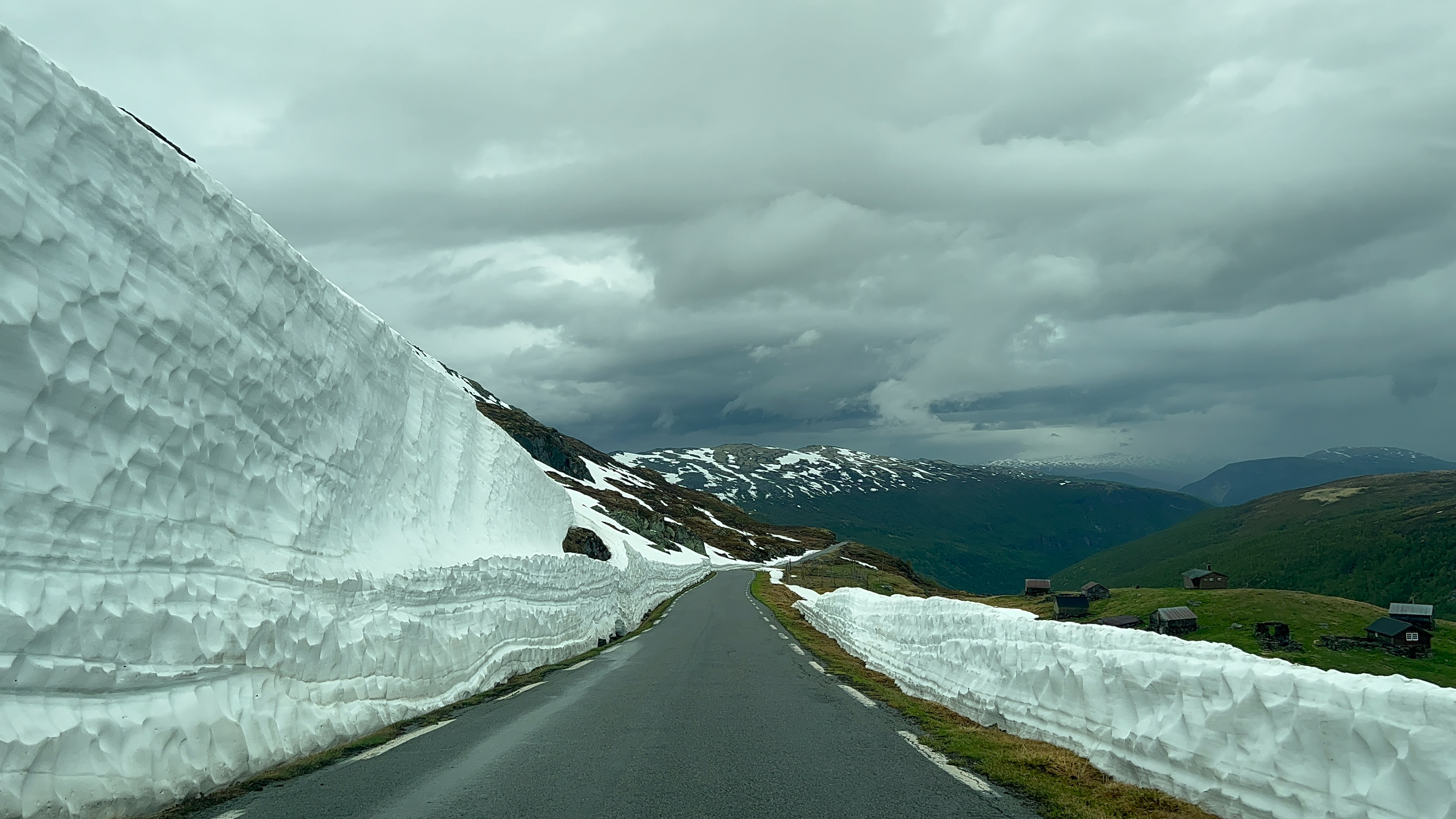
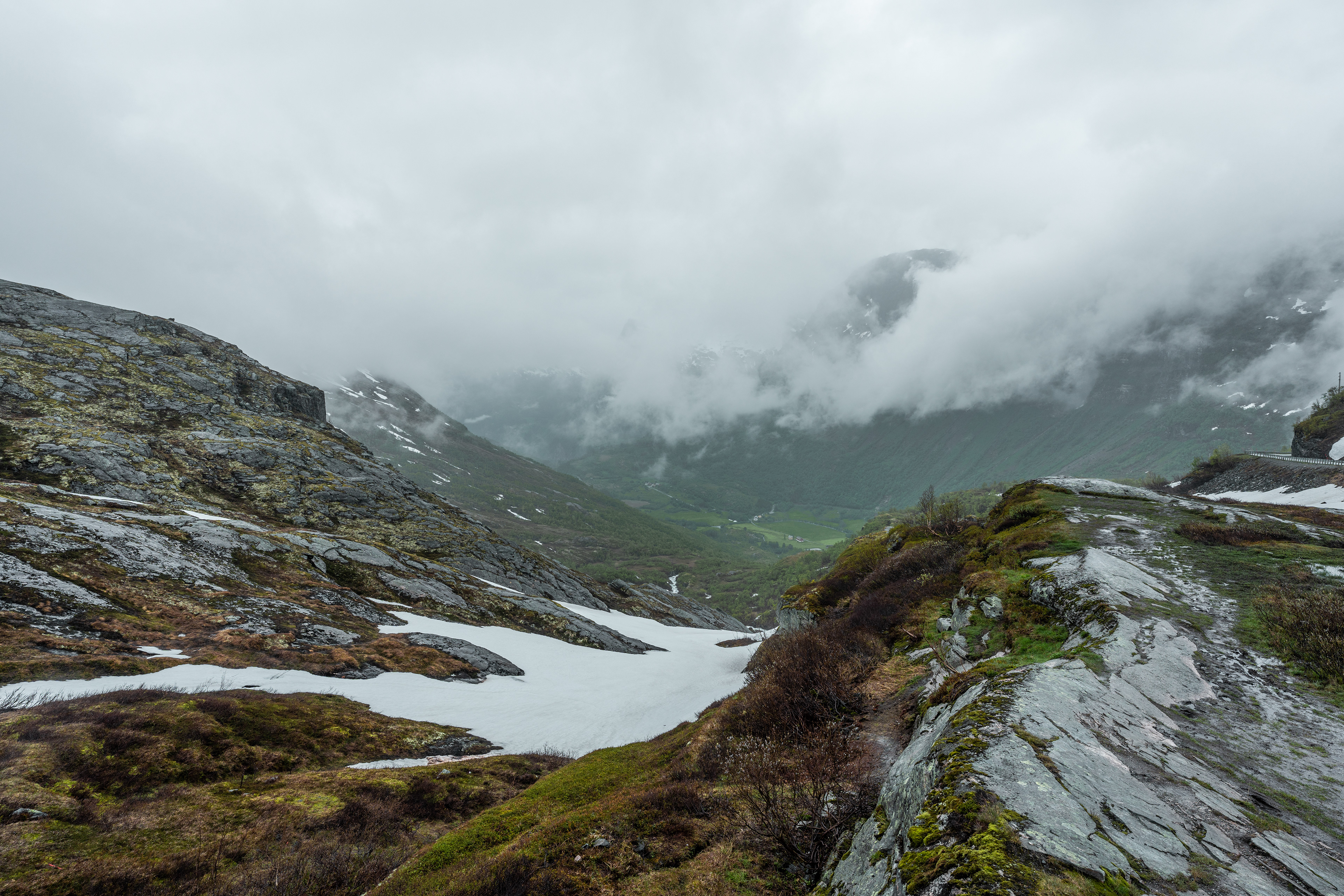
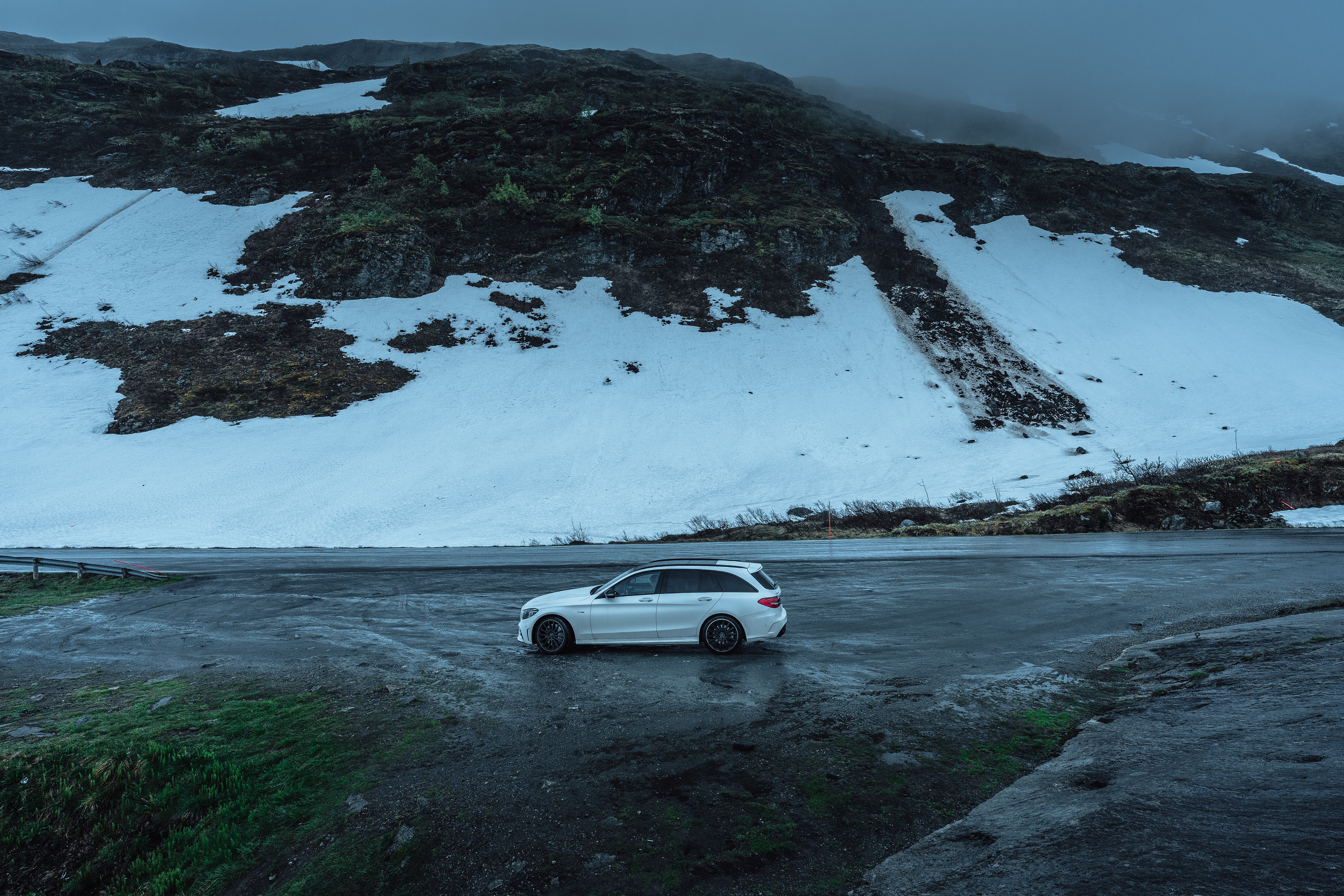
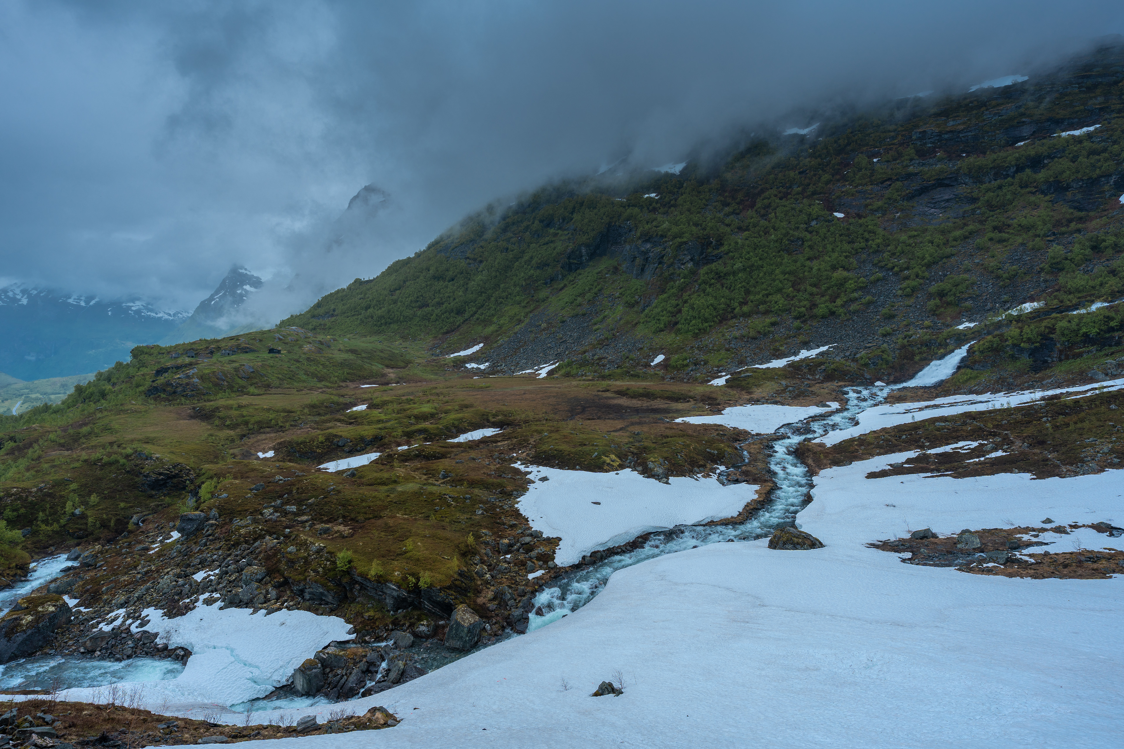
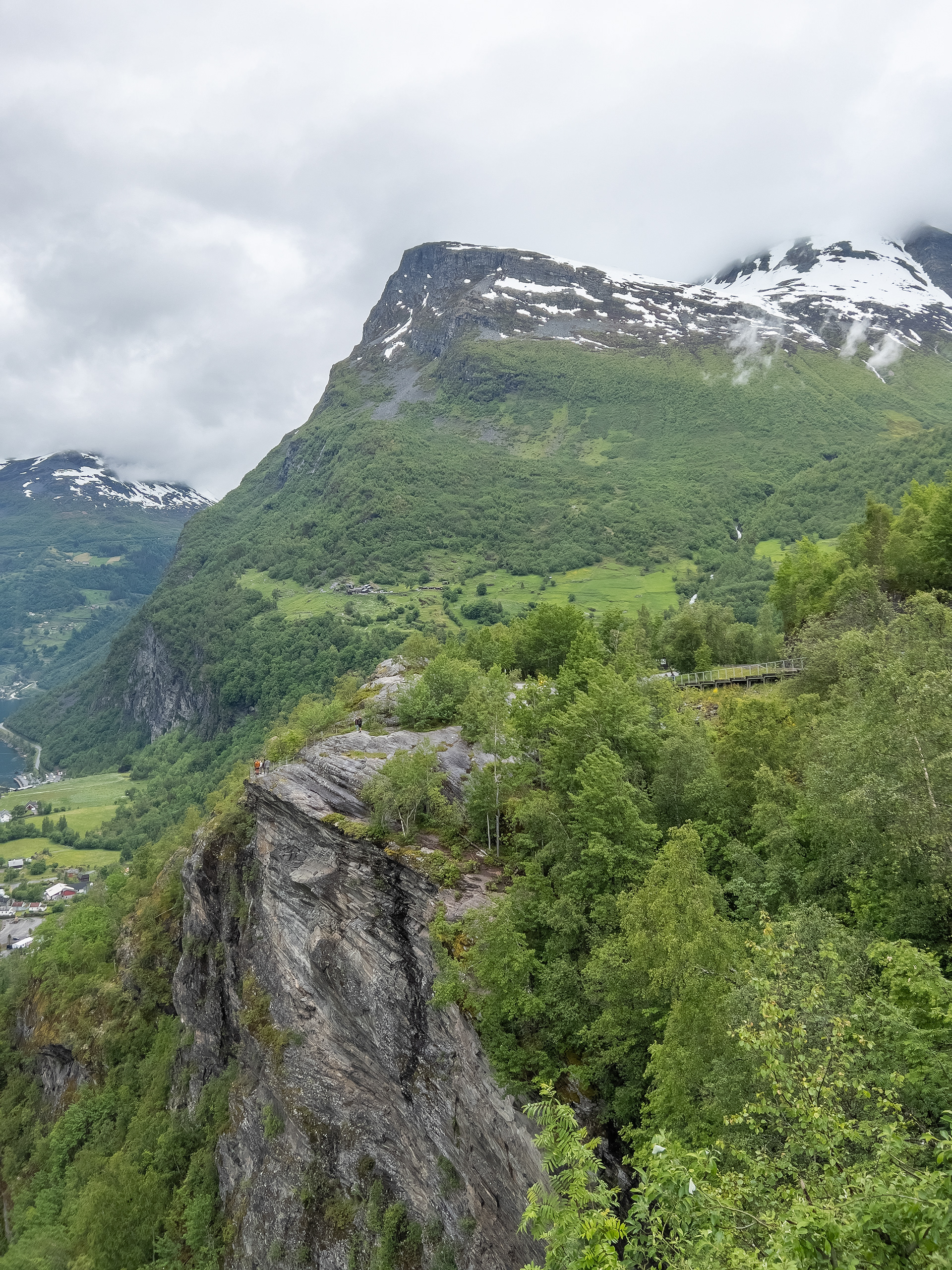
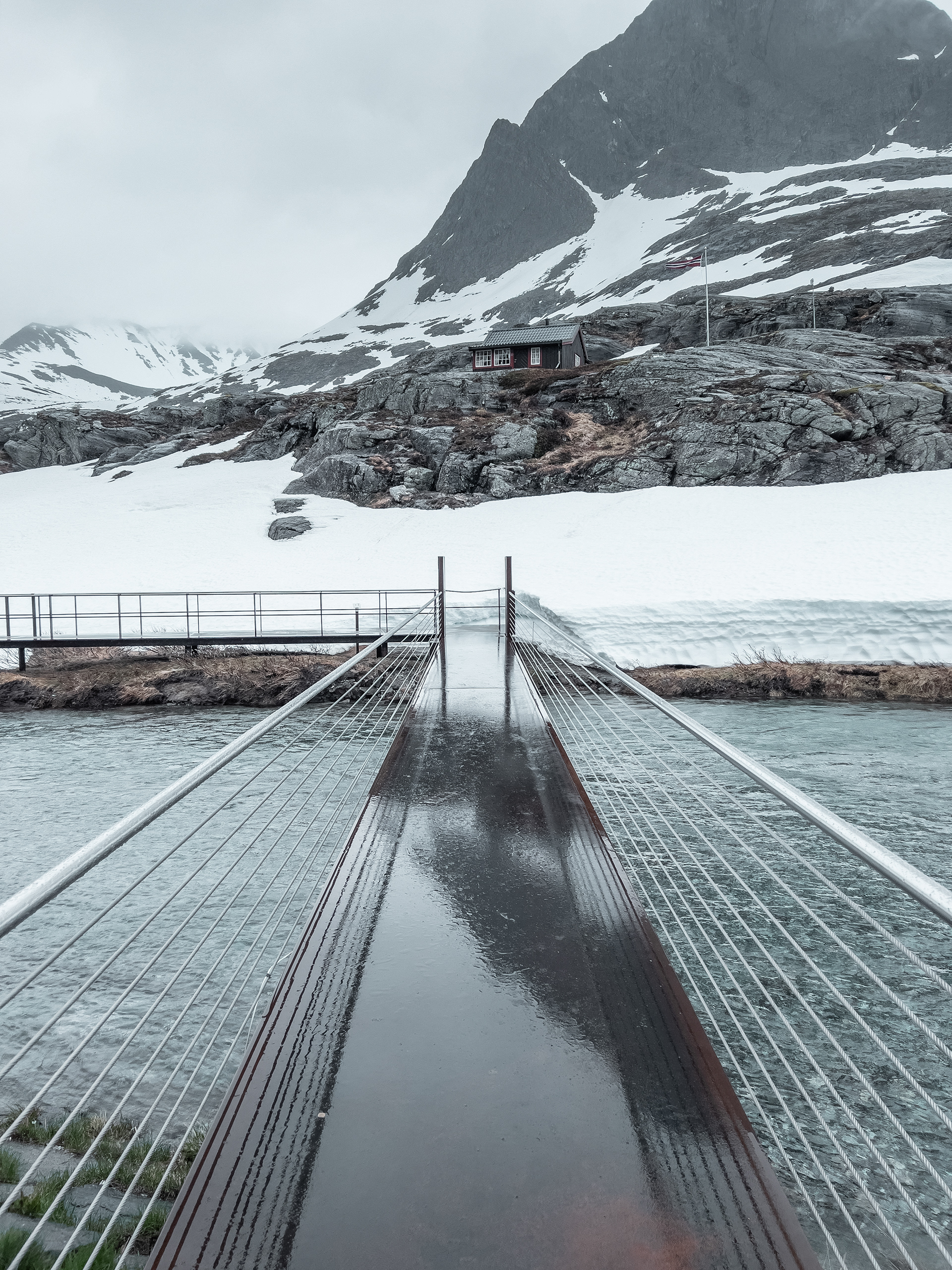
Aurlandsfjellet
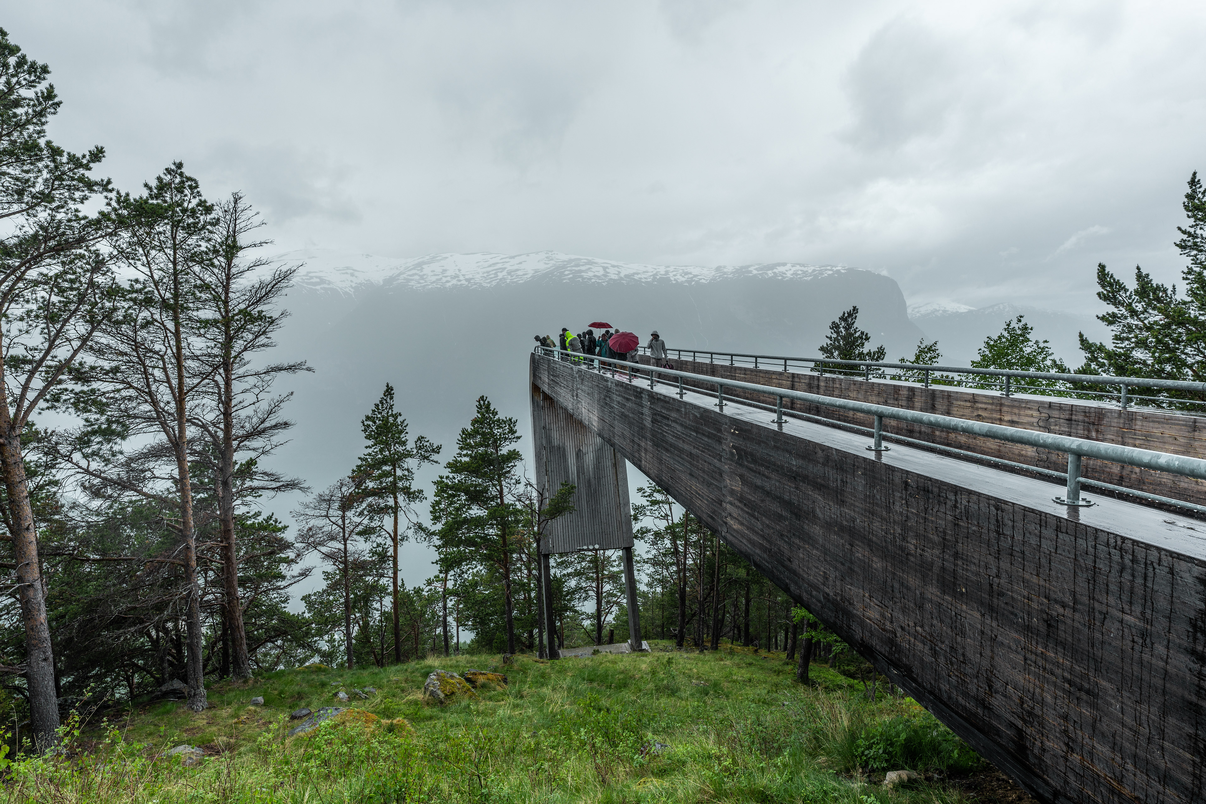
Aurlandsfjellet is a scenic mountain pass between Aurlandsvangen and Lærdal. Until the opening of the 24.5-kilometer long Lærdalstunnelen in 2000, this was one of the only routes between these areas and generally on the route between Bergen and Oslo. The entire route from Aurland to Lærdal is about 48 kilometers (30 miles) and its highest point is at 1.306 meters. The pass is not open the entire year, only the 7 kilometers from Aurland to the Stegastein Viewpoint are open all year. The rest of the route only opens in the summer months because of the snow. As you can see in June there is still plenty of snow around. There are some interesting stops on the drive including some exhibitions and viewing points. We also visited the Stegastein Viewpoint, although we didn't see much because of the rainy weather. It's a viewpoint that extends outward from the mountain and provides views of the Aurlandsfjord. Funny coincidence: a tourbus stopped right around the time we were there and it happened to be a travel group accompanied by Rick Steves, a well-known American travel show host. I actually watched some of his videos on Youtube on this particular area to get inspired of what I wanted to see.
Stegastein Viewpoint
View from Stegastein
Aurlandsfjellet

Aurlandsfjellet
View from Stegastein
Lærdal & Borgund
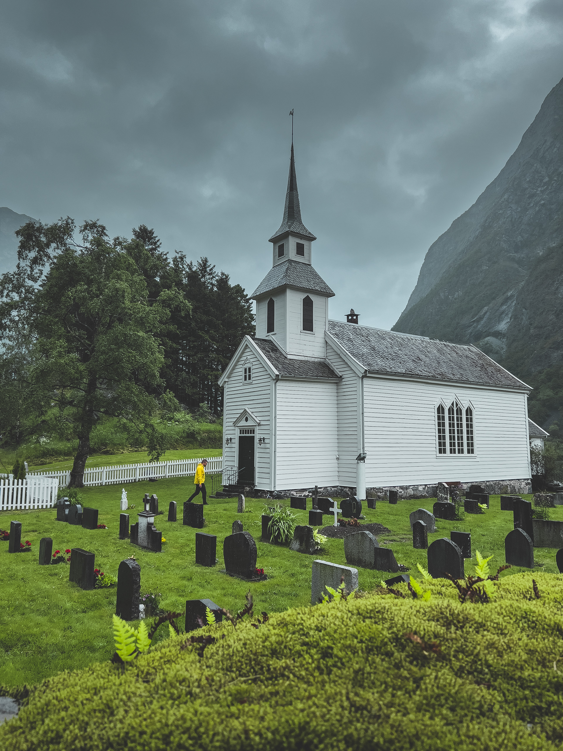
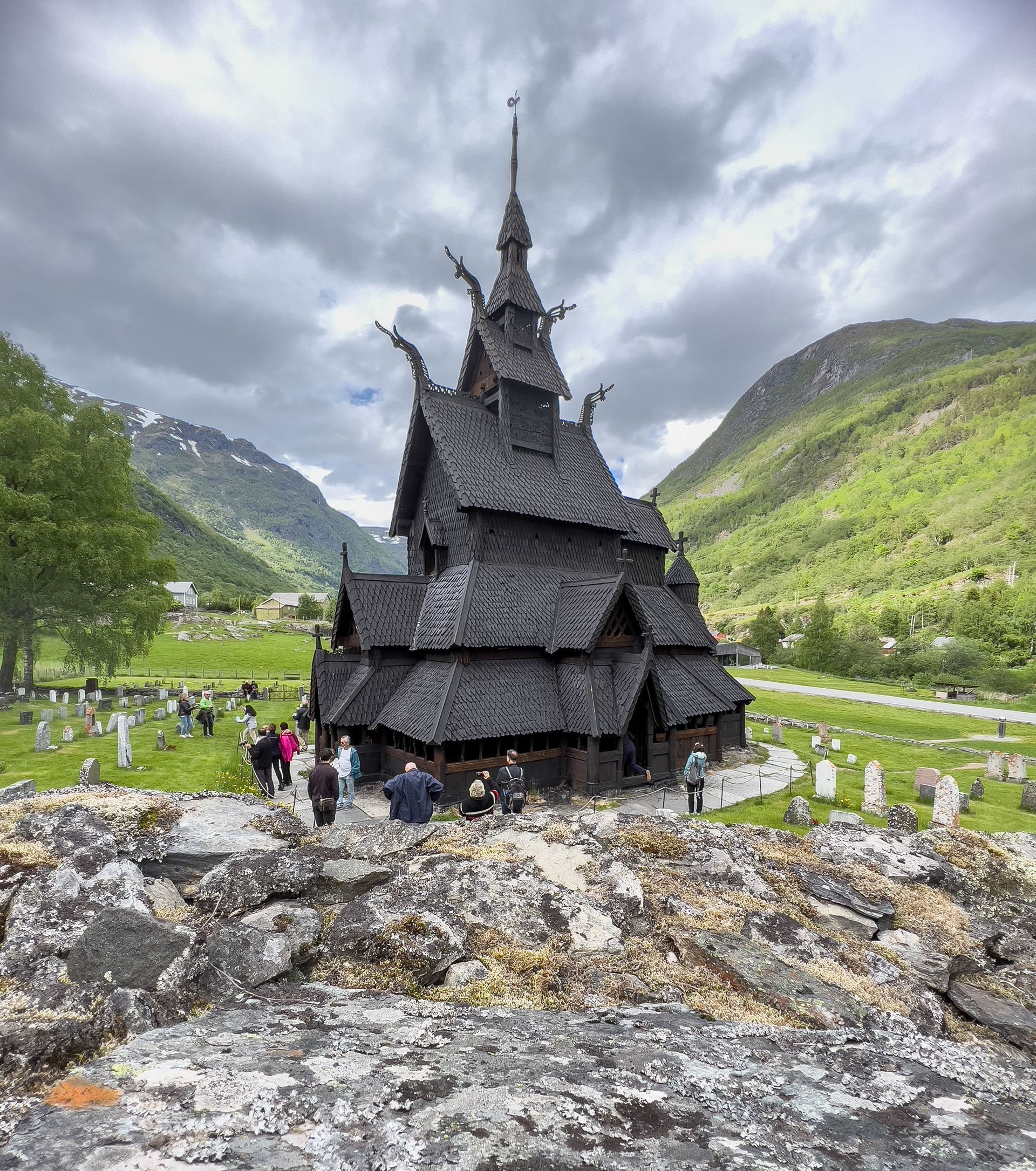
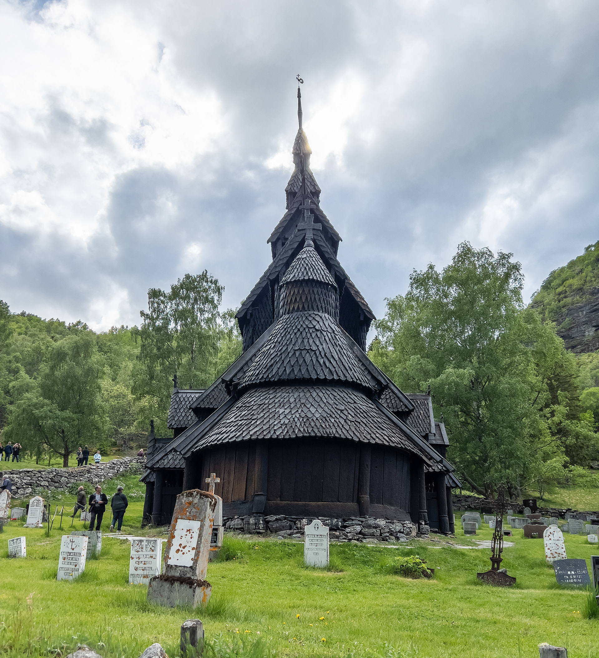
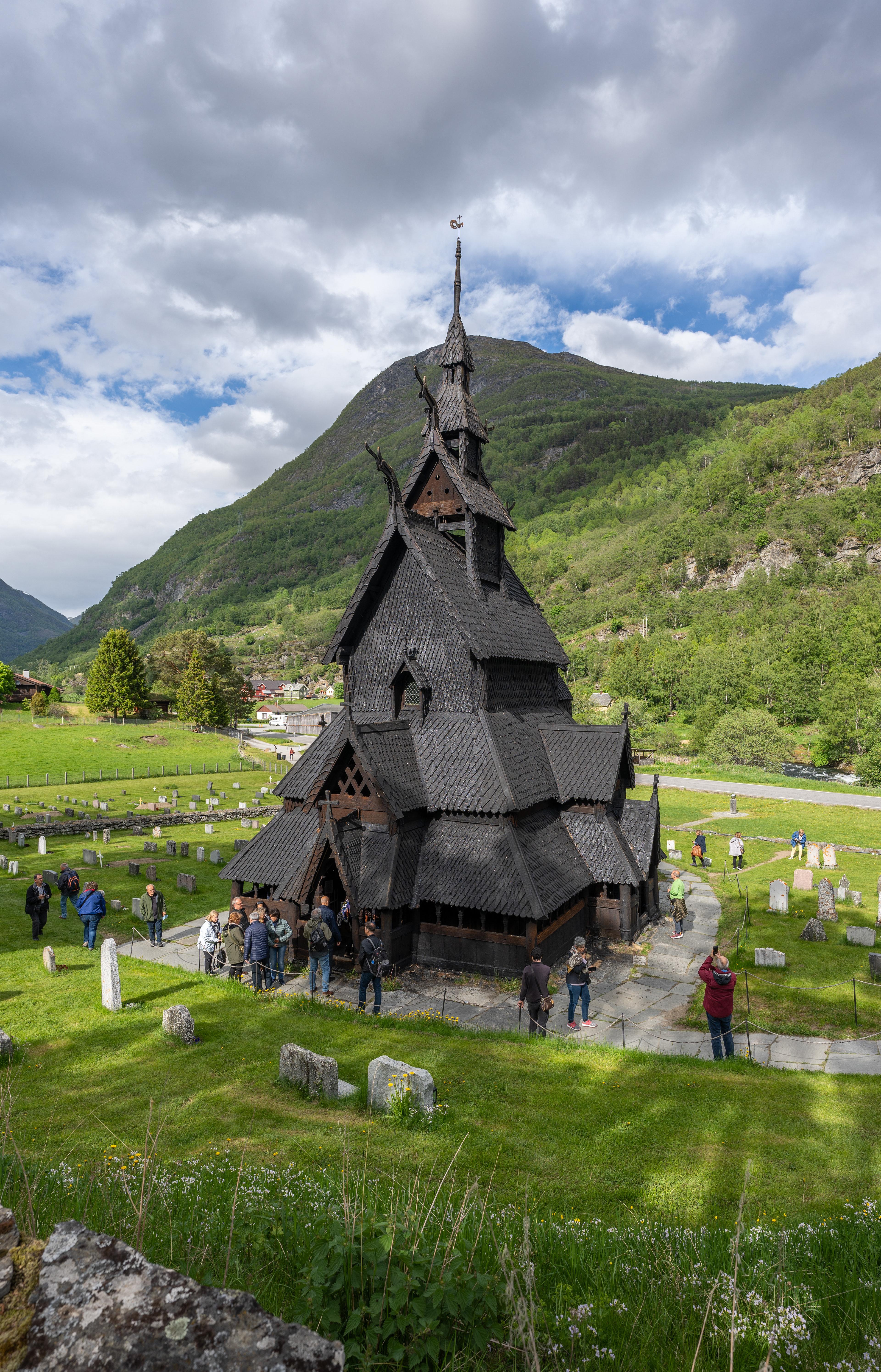
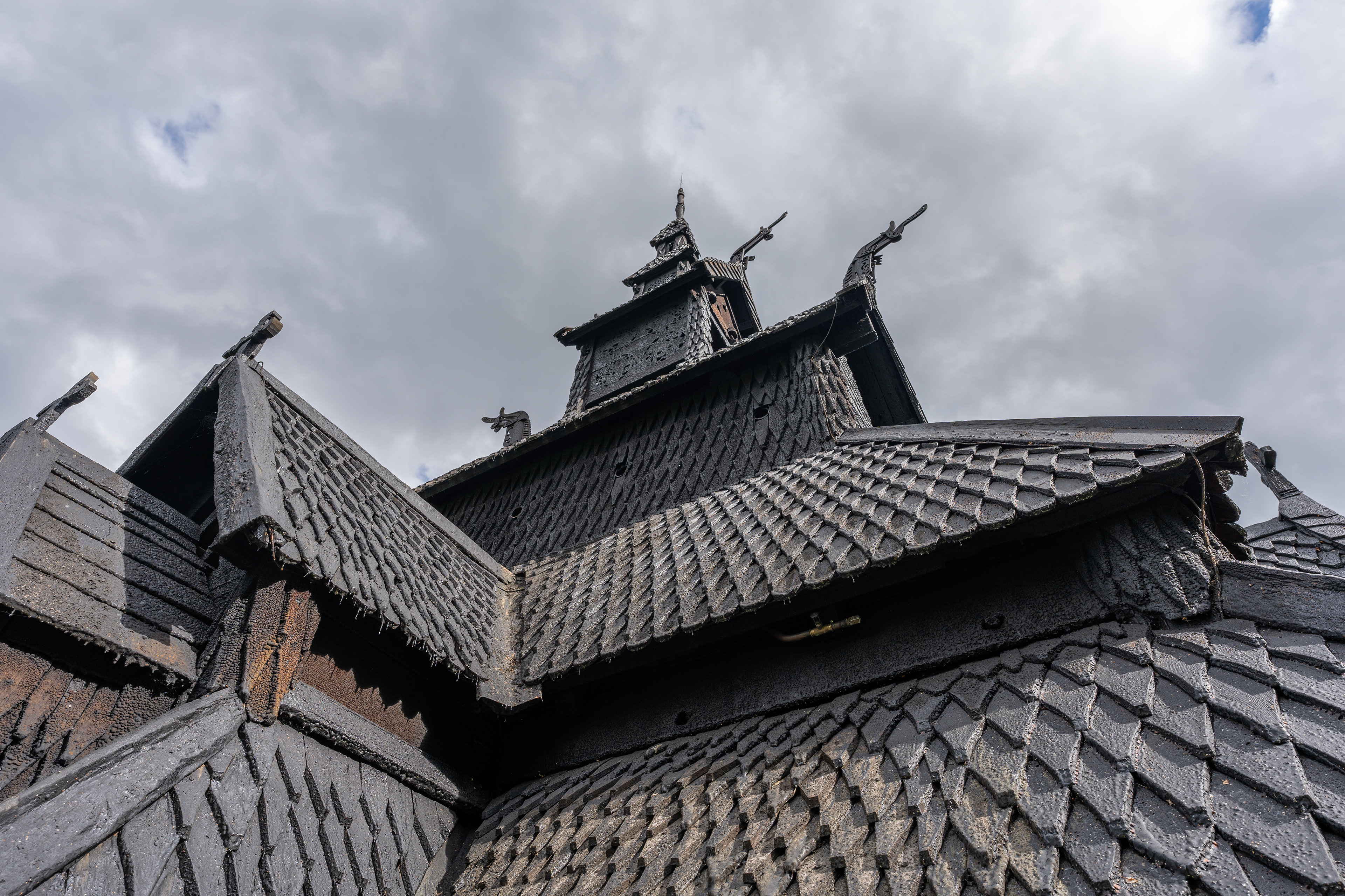
After crossing Aurlandsfjellet we arrived in Lærdal, a small historic town. There is not a whole lot to do except for walking through the town and seeing some of the older and picturesque houses. We took a look at the Norwegian Wild Salmon Center but it seemed to be closed for visitors on that day. We then decided to continue to Borgund to see the Borgund Stave Church, one of the few famous old stave churches from the 14th century. It's listed as UNESCO World Heritage and definitely worth a visit. Unfortunately we were a bit late and no entry tickets were sold anymore. However, we were free to have a look around ourselves without a ticket, although we weren't allowed to go inside.
Borgund Stave Church
Borgund Stave Church
Borgund Stave Church
Borgund Stave Church
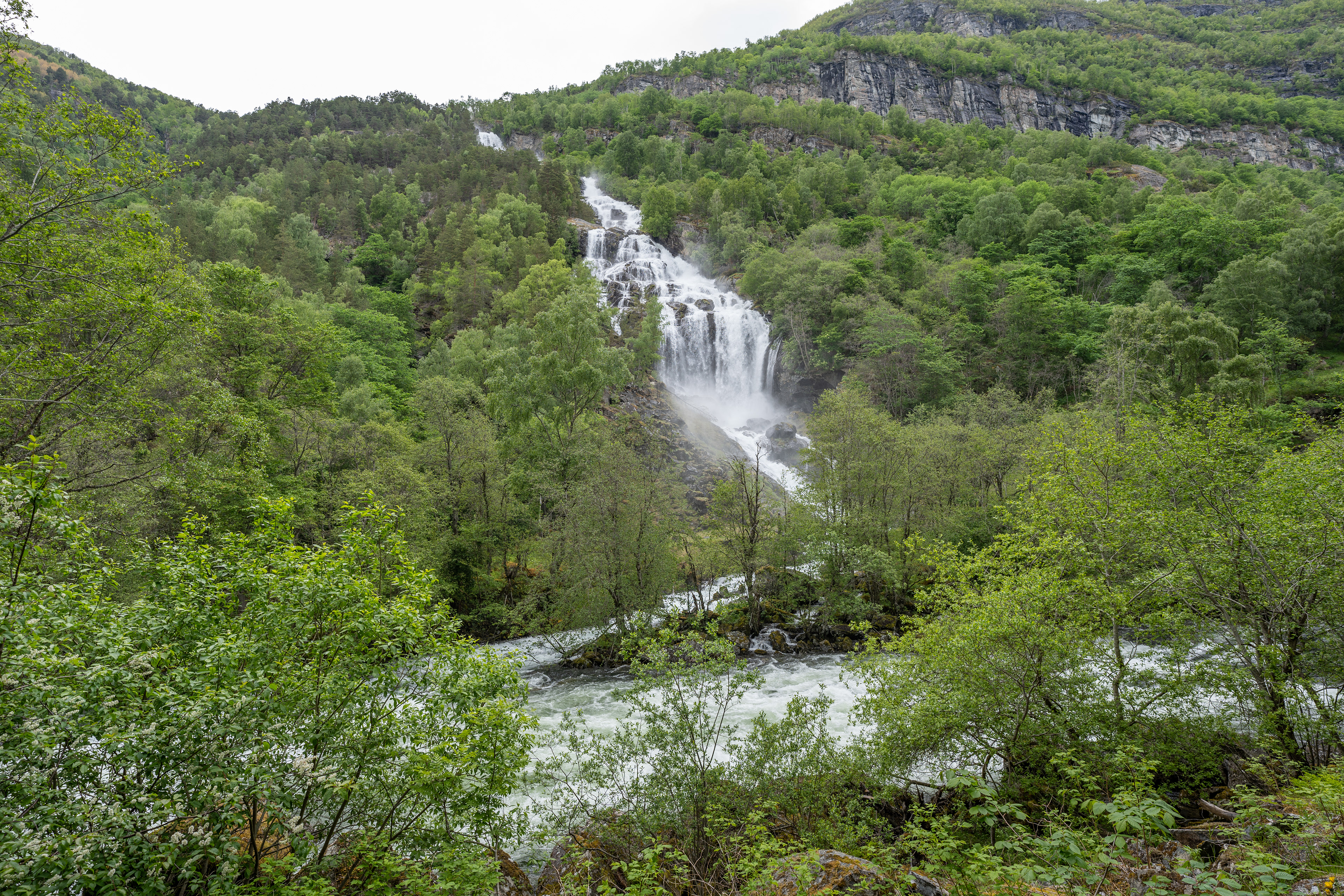
A waterfall near Borgund
Møre og Romsdal Region
View from a ferry on the Geirangerfjord
Road to Stranda
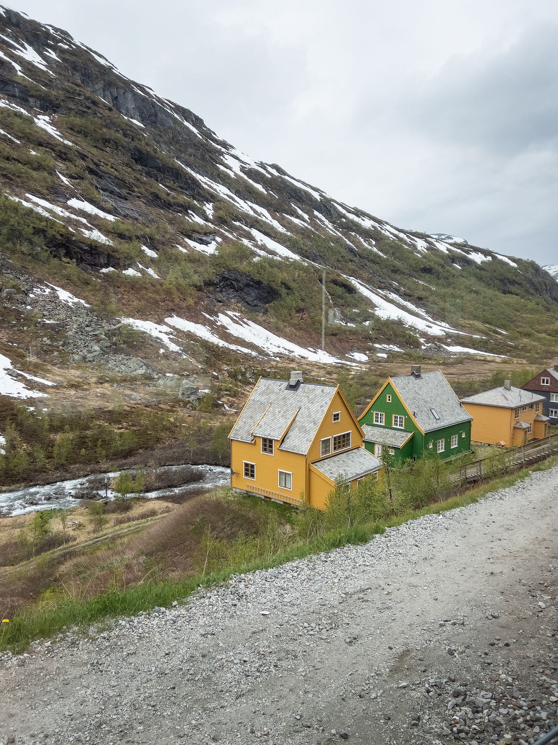
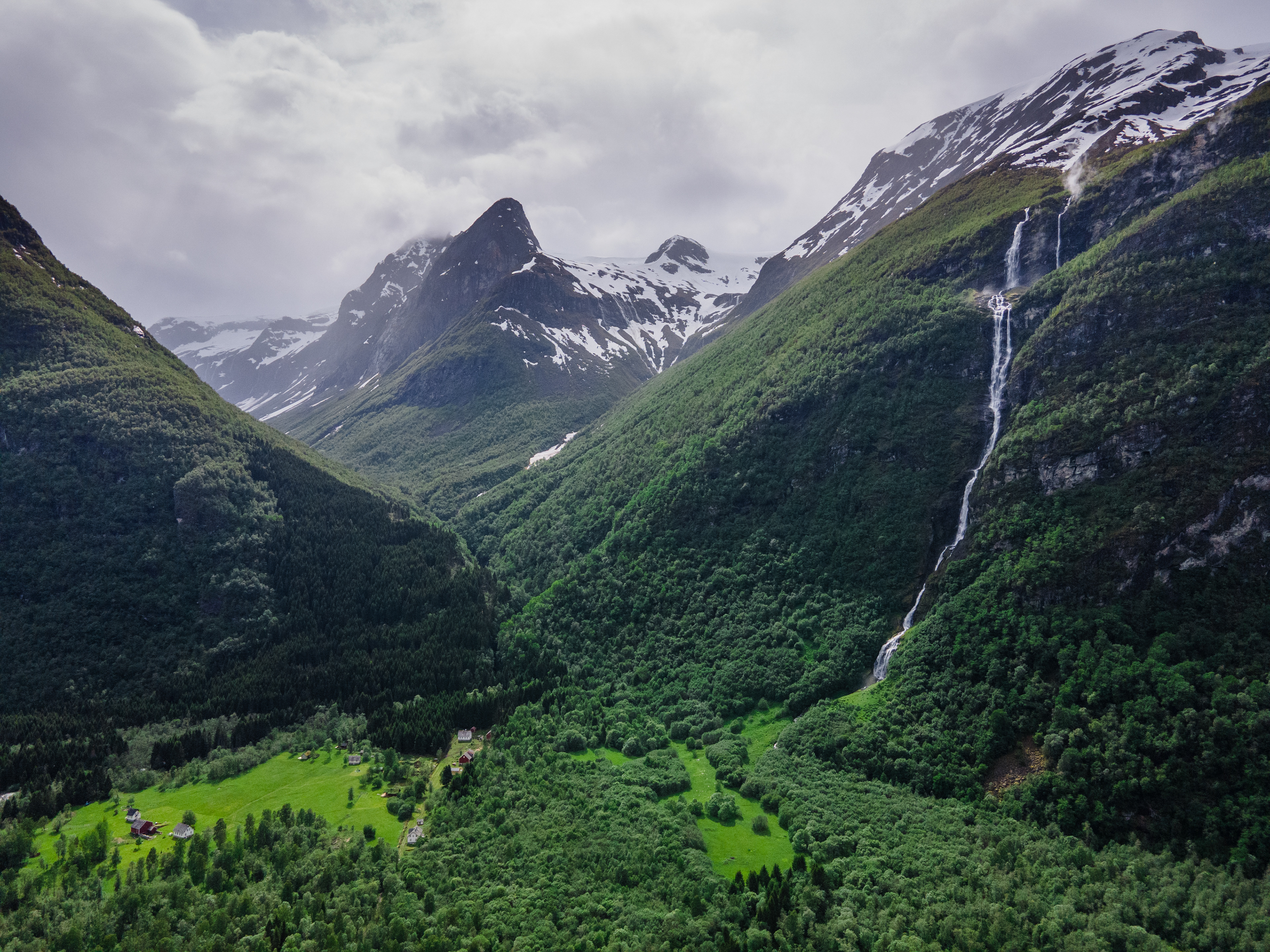
We chose Stranda as our base for exploring Møre og Romsdal and its many attractions. Staying in this area is not very affordable and there is a lot to see so you have to get creative. Stranda is arguably not the best place to stay since everything is a bit of a drive away but we were okay with that.
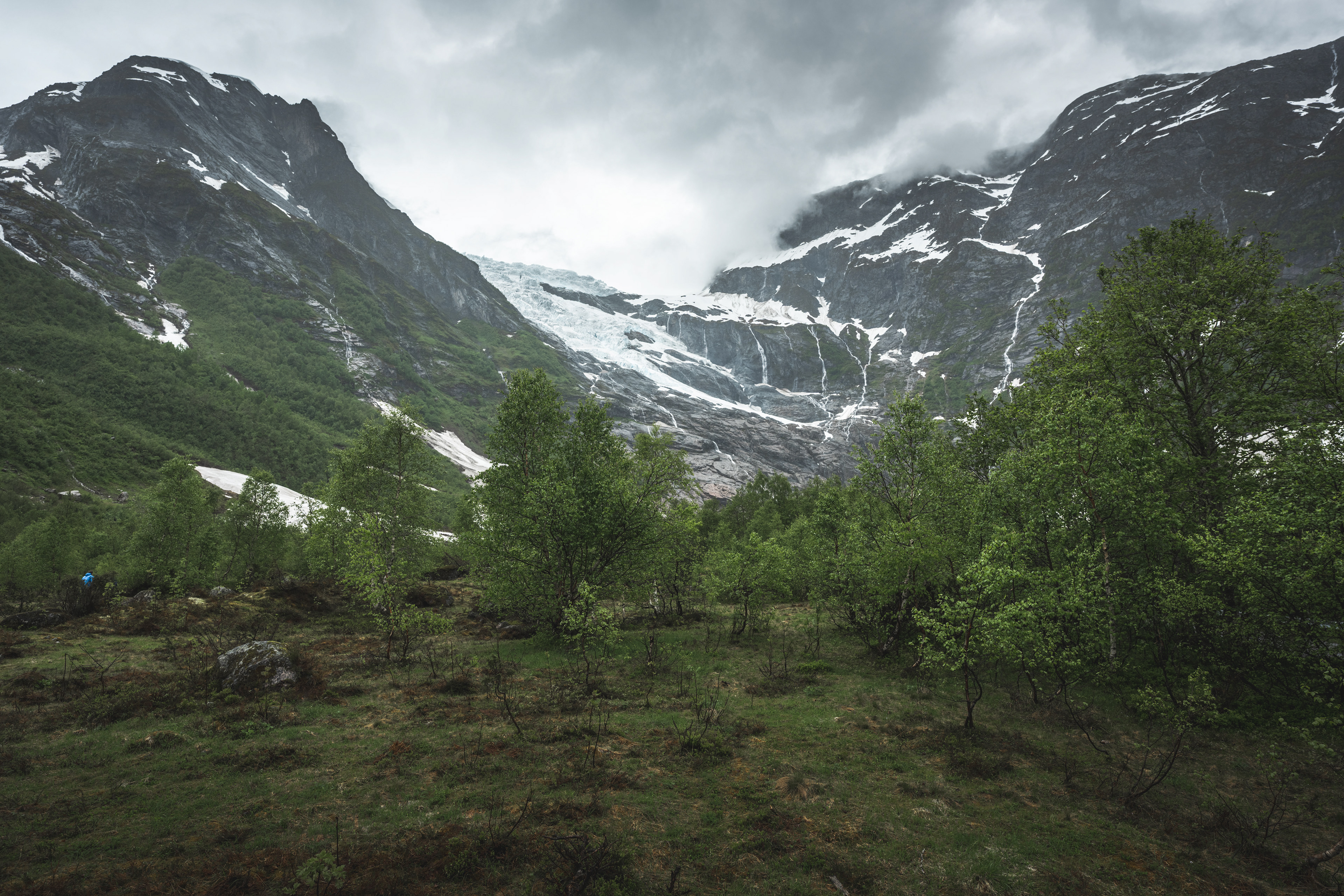
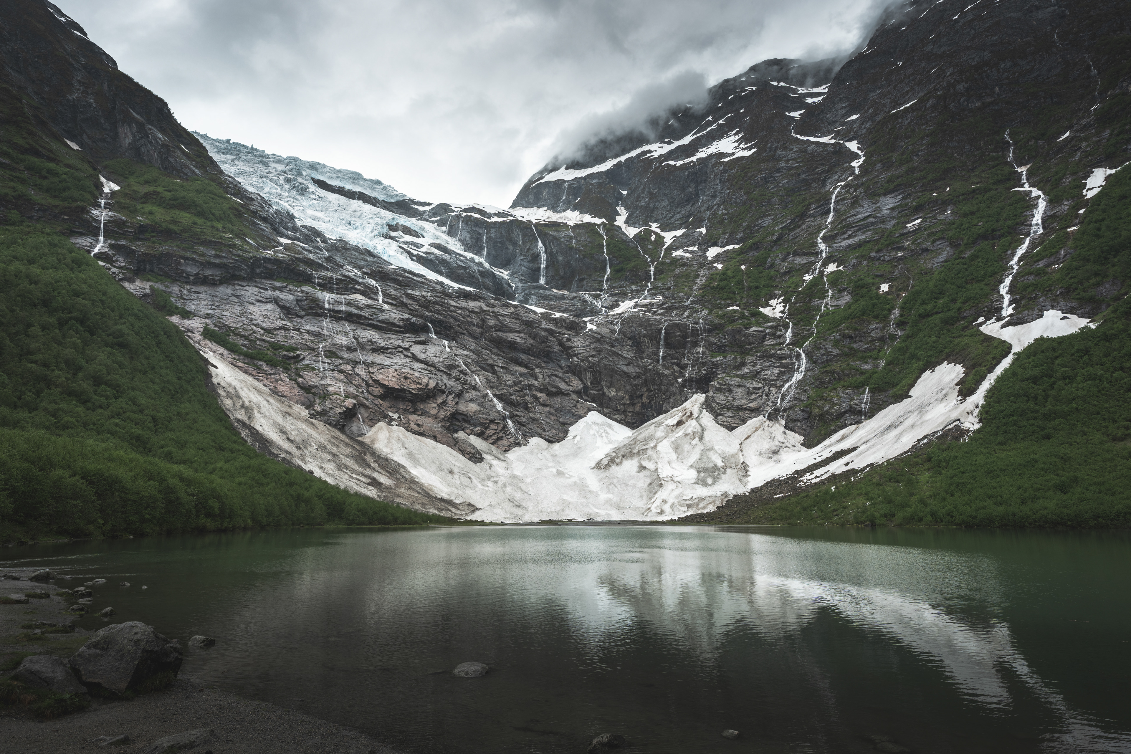
In order to get to Stranda, you follow Riksvei 5 to Stryn from Lærdal. It involves a ferry and it passes the Jostedalsbreen National Park before joining the E39. I can highly recommend this route as it's very scenic. You can stop over at the Bøyabreen Glacier Viewpoint just North of Fjærland. This is basically a roadside glacier you can walk up to, quite amazing. I don't think I have seen this anywhere else in the world so far. Sure, in Switzerland, but you are quite high up in the Alps there.
As we got to Stryn, we decided to venture out to Lovatnet, a nearby lake. It was one of the more beautiful drives we did in Norway with so much to see. I included some pictures from the lake and surrounding mountains here as well.
Bøyabreen Glacier Rest Area
Bøyabreen Glacier Rest Area
Bøyabreen Glacier
Bøyabreen Glacier Rest Area
Bøyabreen Glacier
Lovatnet
Lovatnet
Lovatnet
Lovatnet
Lovatnet
Lovatnet
Lovatnet
Lovatnet
Lovatnet
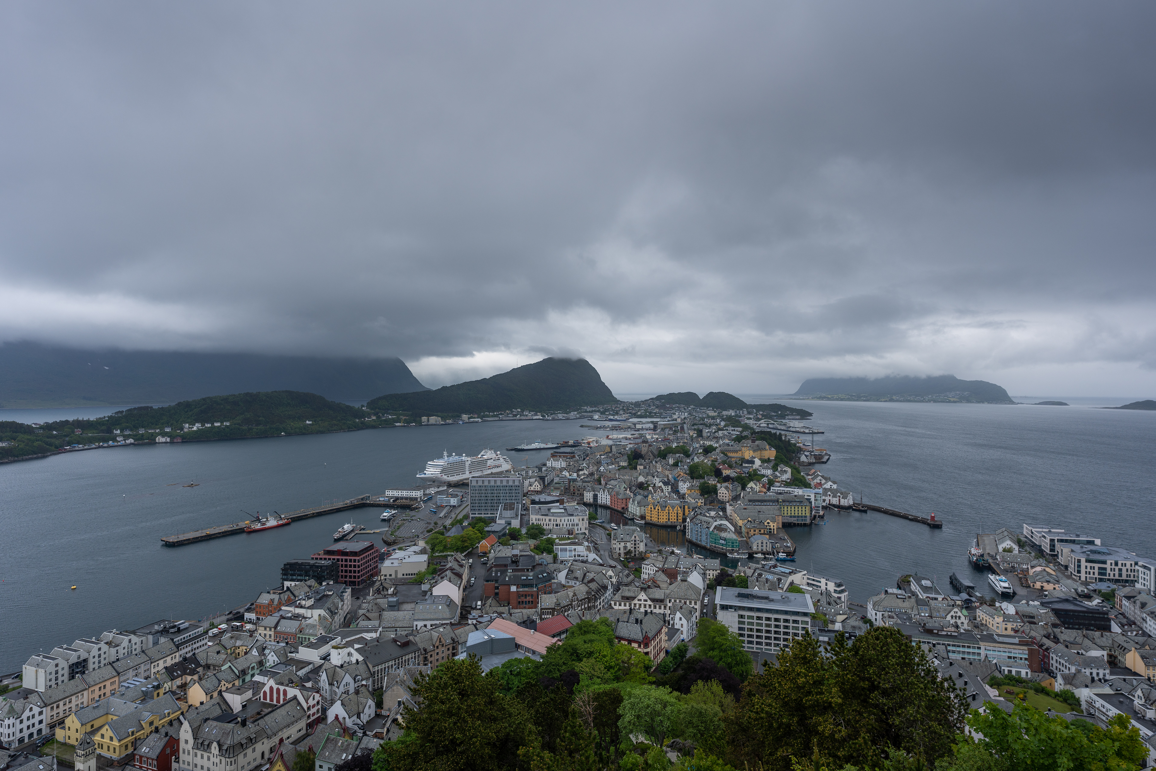
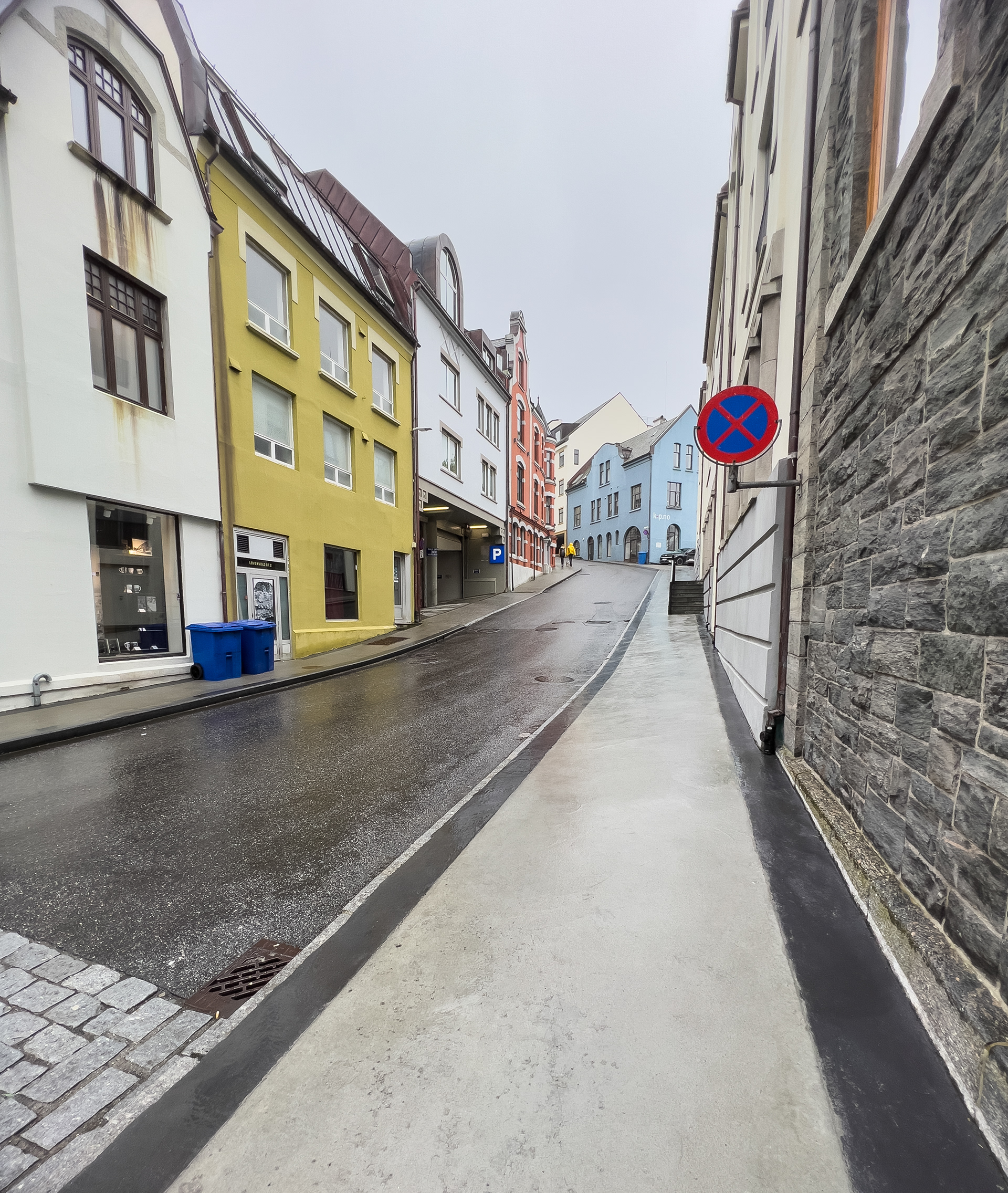
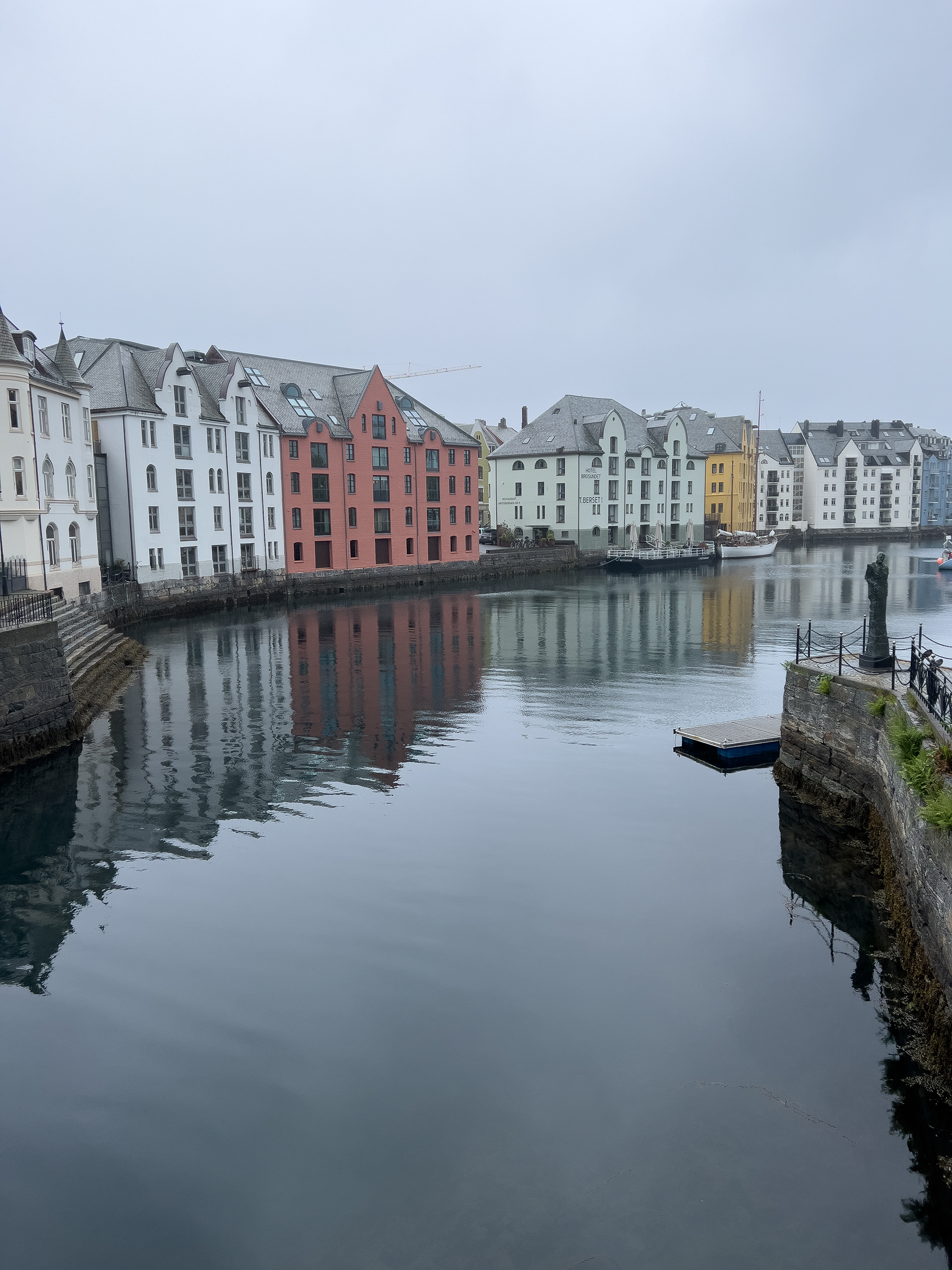
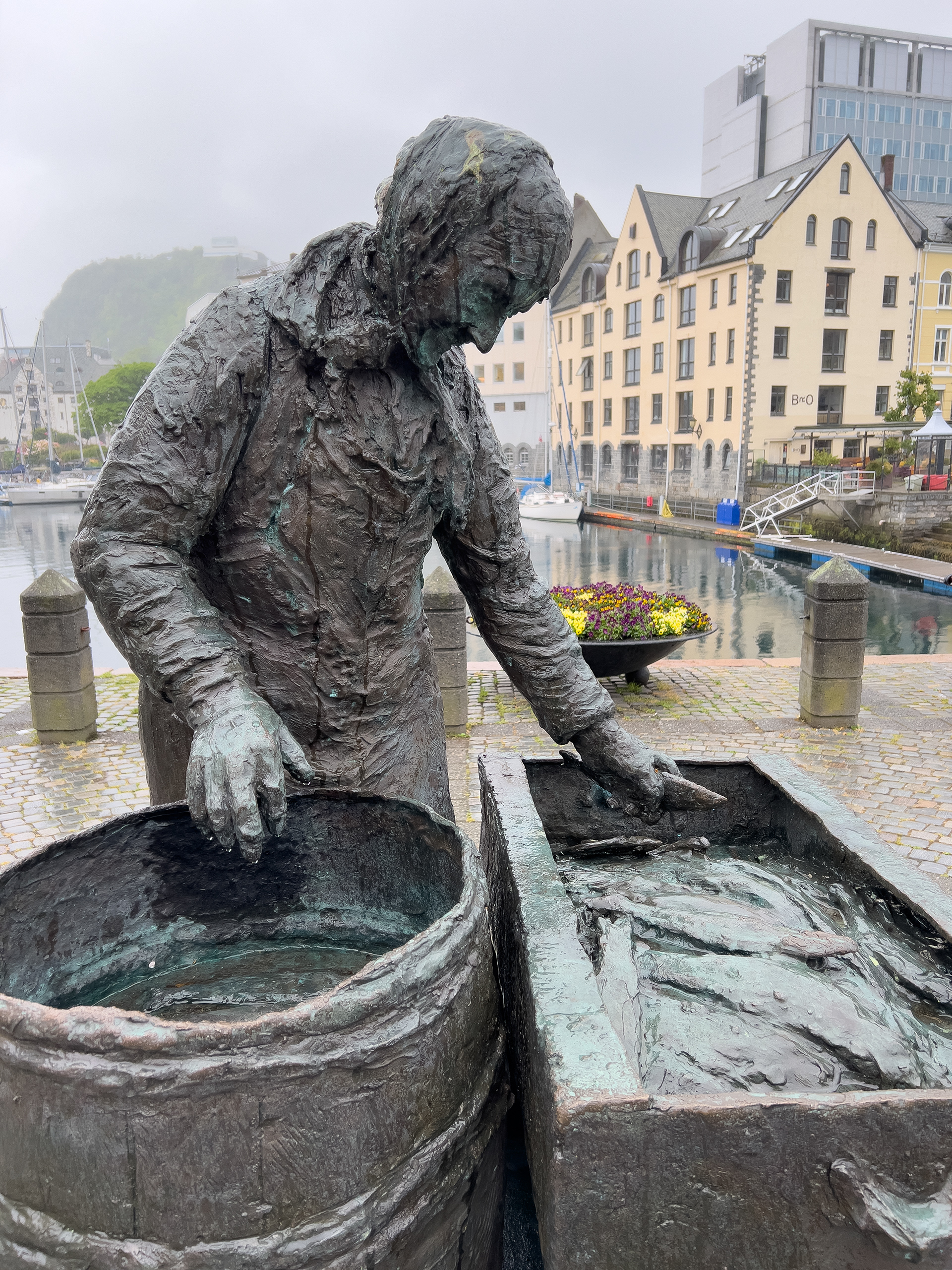
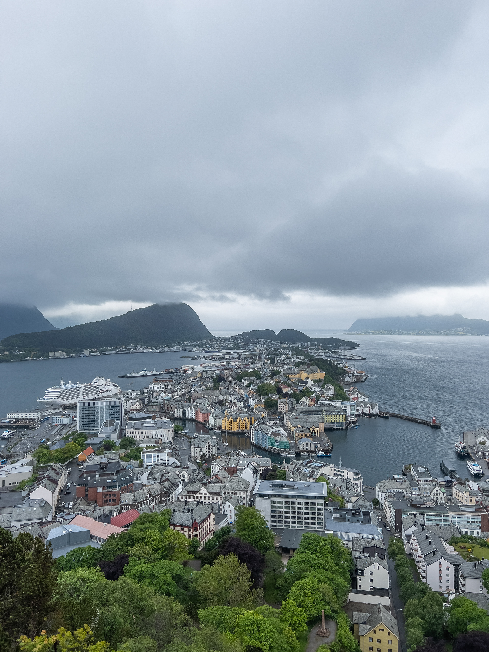
Ålesund
We stayed in Stranda for about 3 nights. You could easily spend 5+ days here if you want to do and see everything. We considered driving beyond Alesund to the famous Atlantic coastal road but decided it was a little too much. We stuck to Ålesund for the day and it's a nice city to visit. You definitely don't need more than 4-5 hours to see most of it. We did climb up to the viewing point over the city, which is a recommendation. The city has about 45.000 inhabitants. We had dinner at Anno Restaurant & Lounge Bar, which had somewhat affordable seafood and was really decent in terms of quality.
Ålesund
Ålesund
Ålesund
Ålesund
Ålesund
Seafood in Ålesund
Seafood in Ålesund
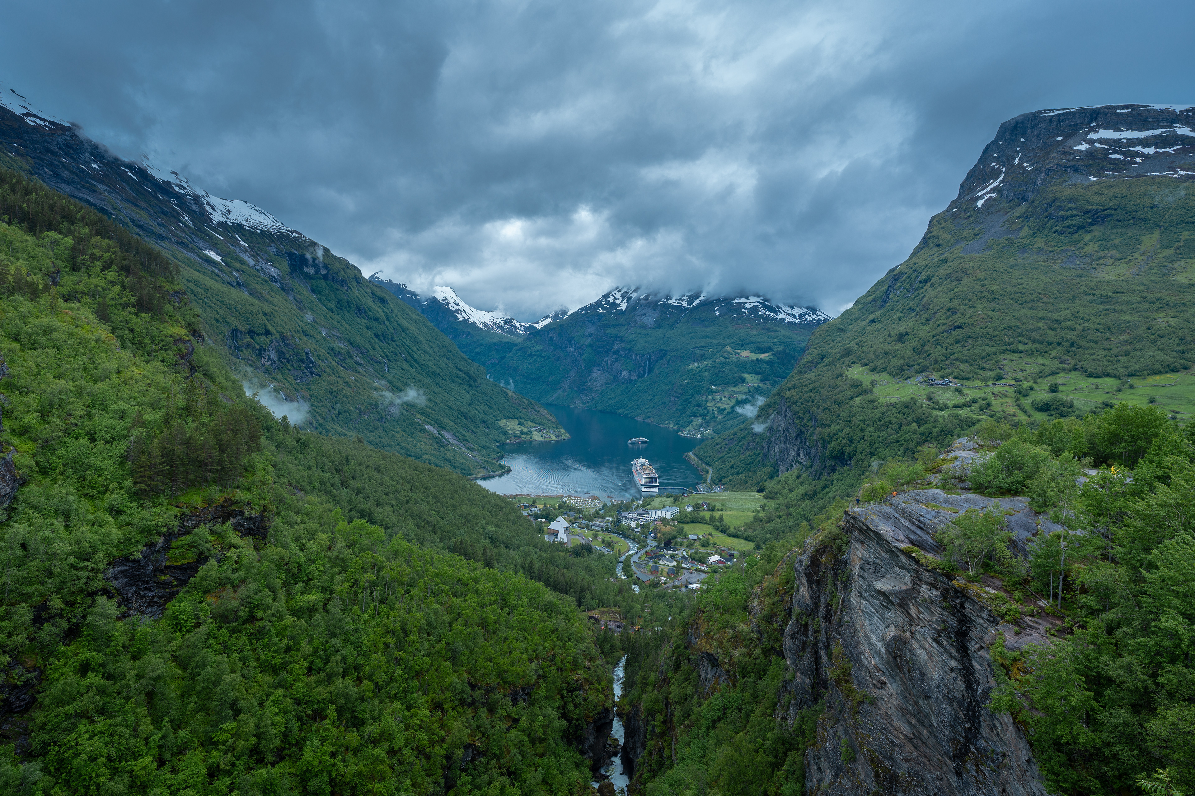
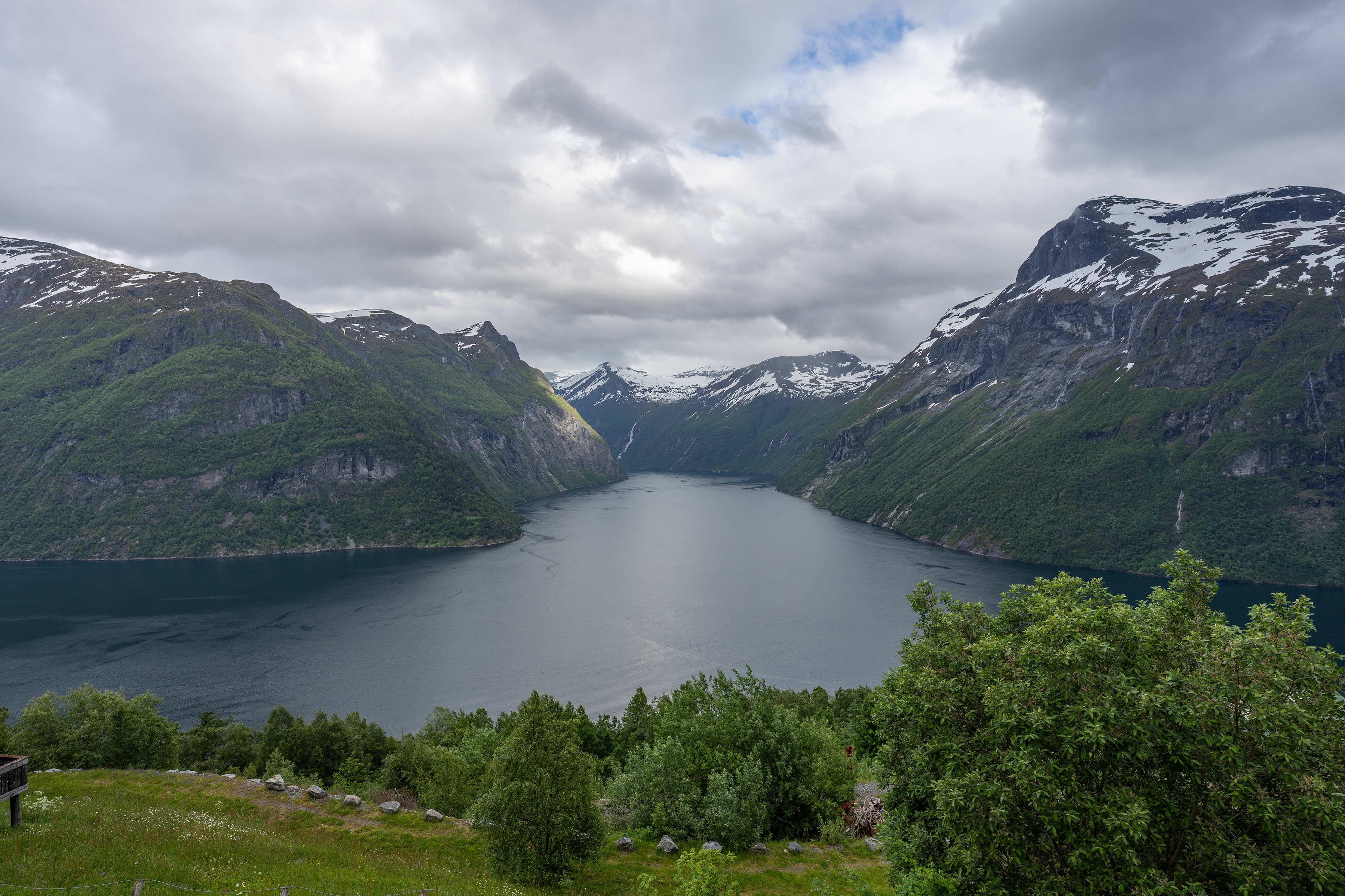
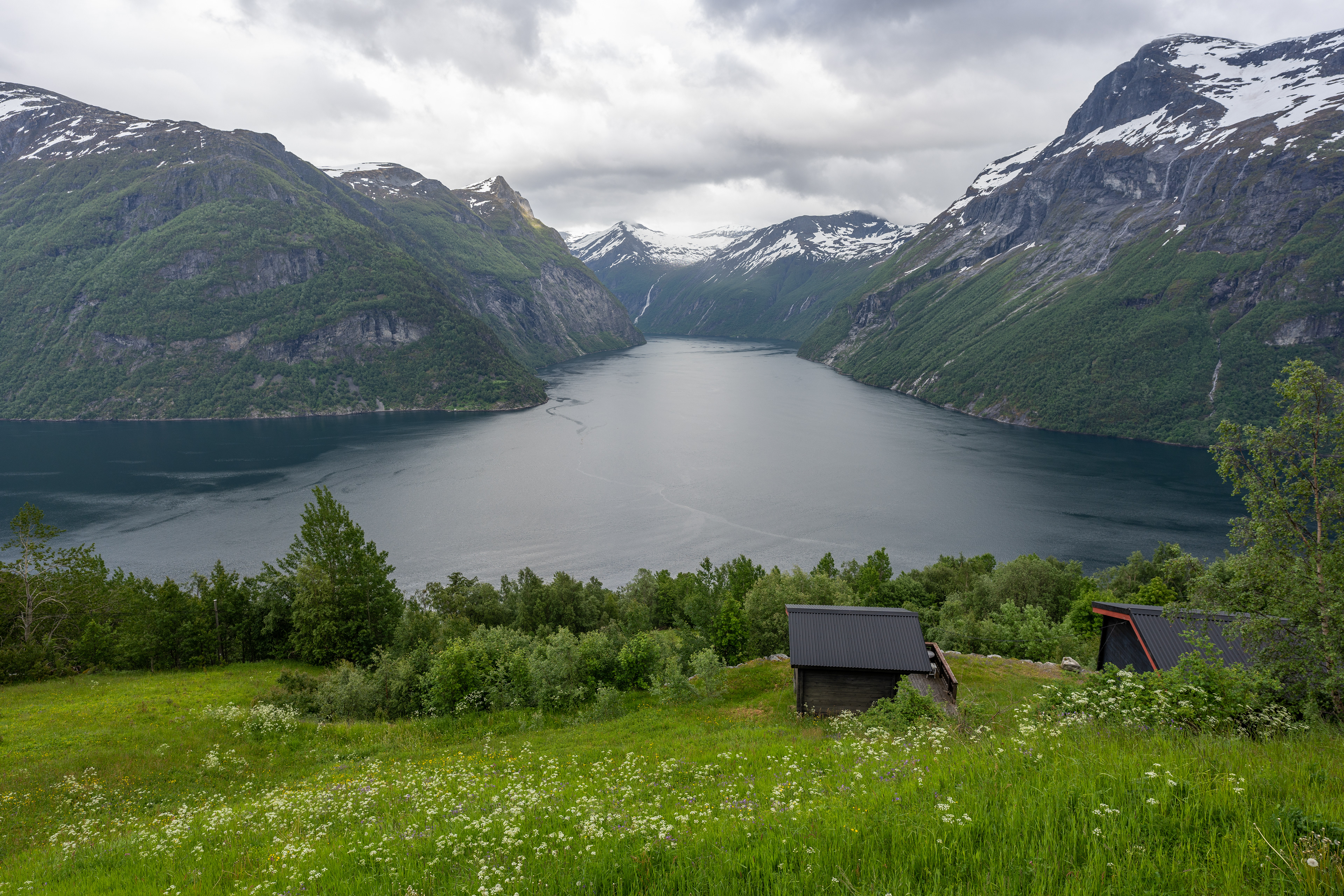
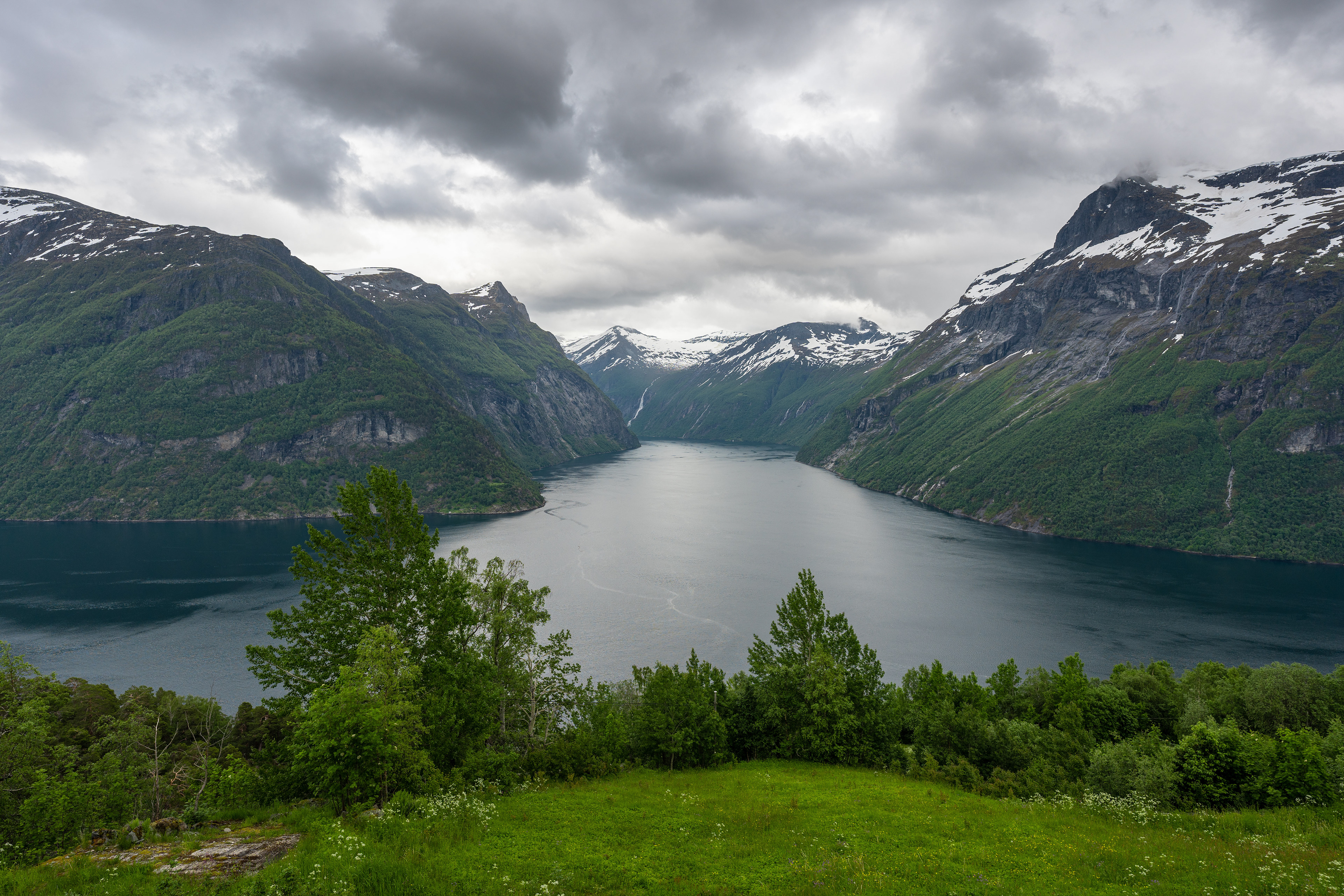
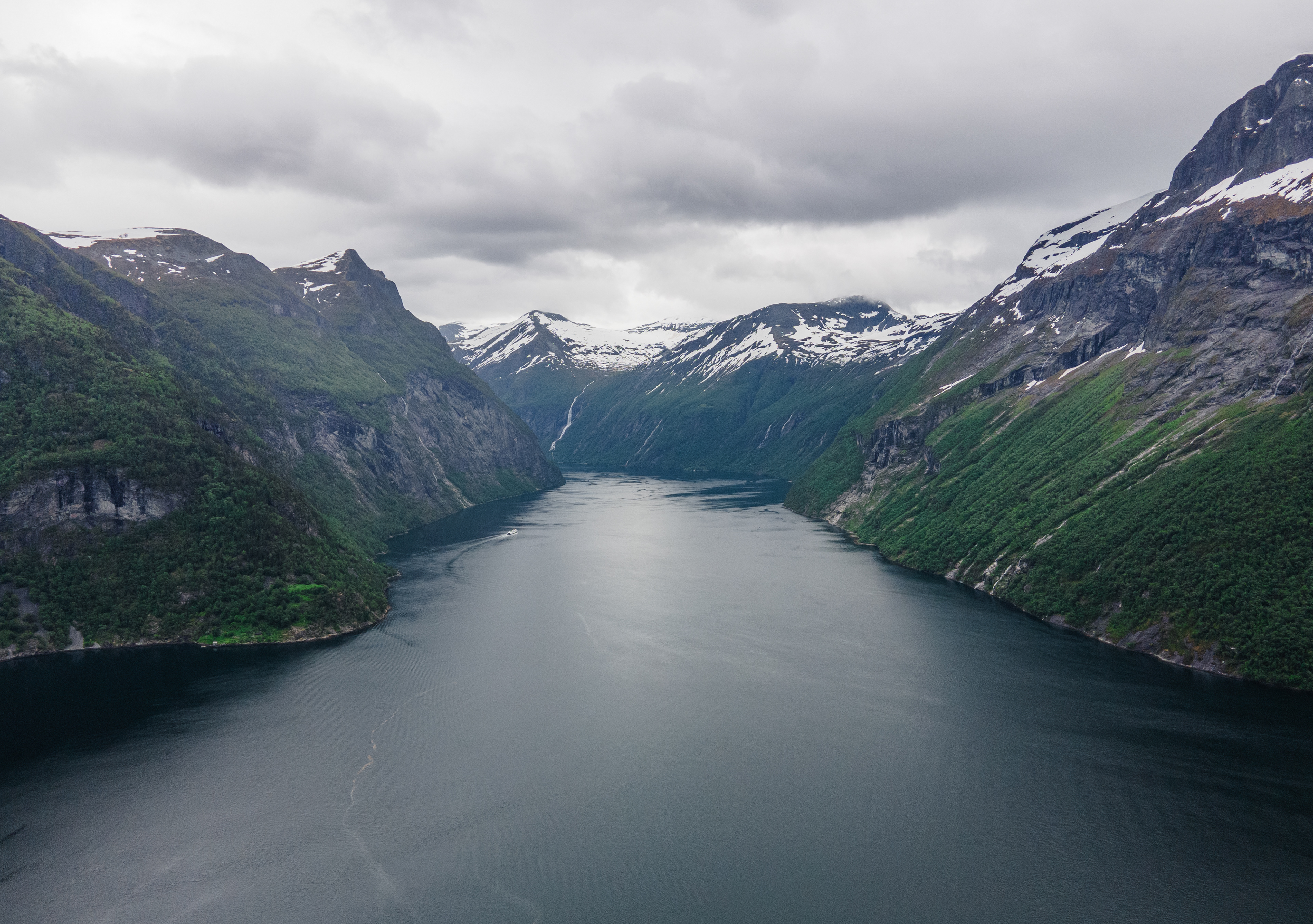
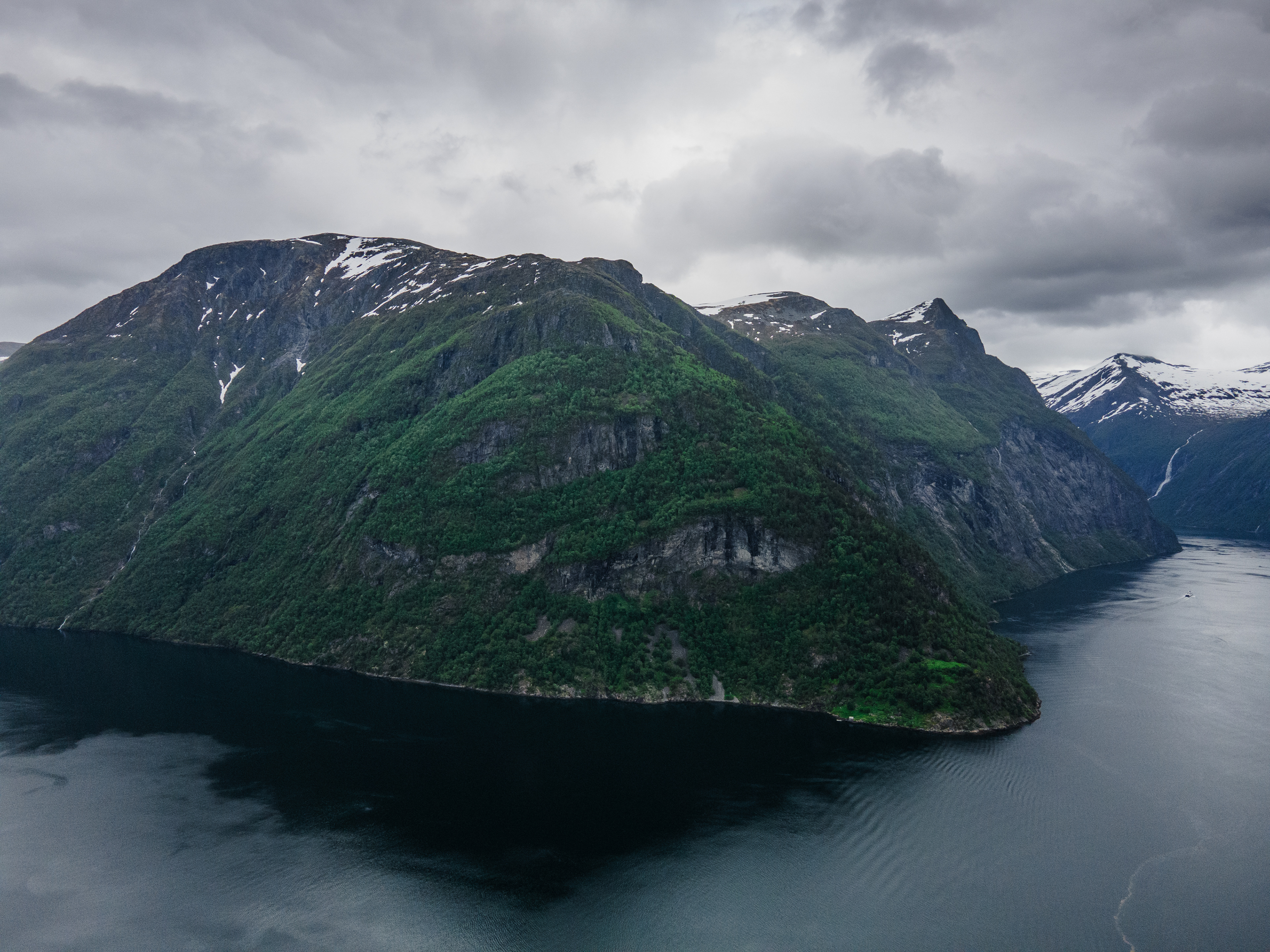
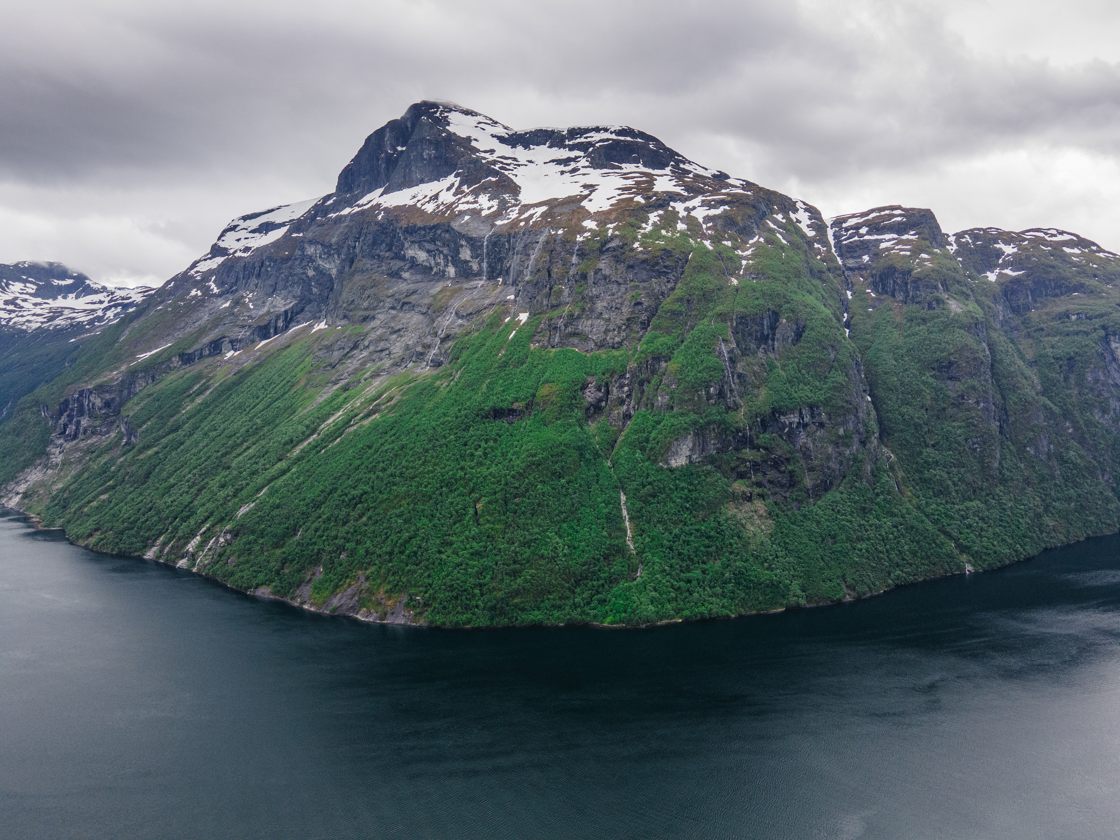
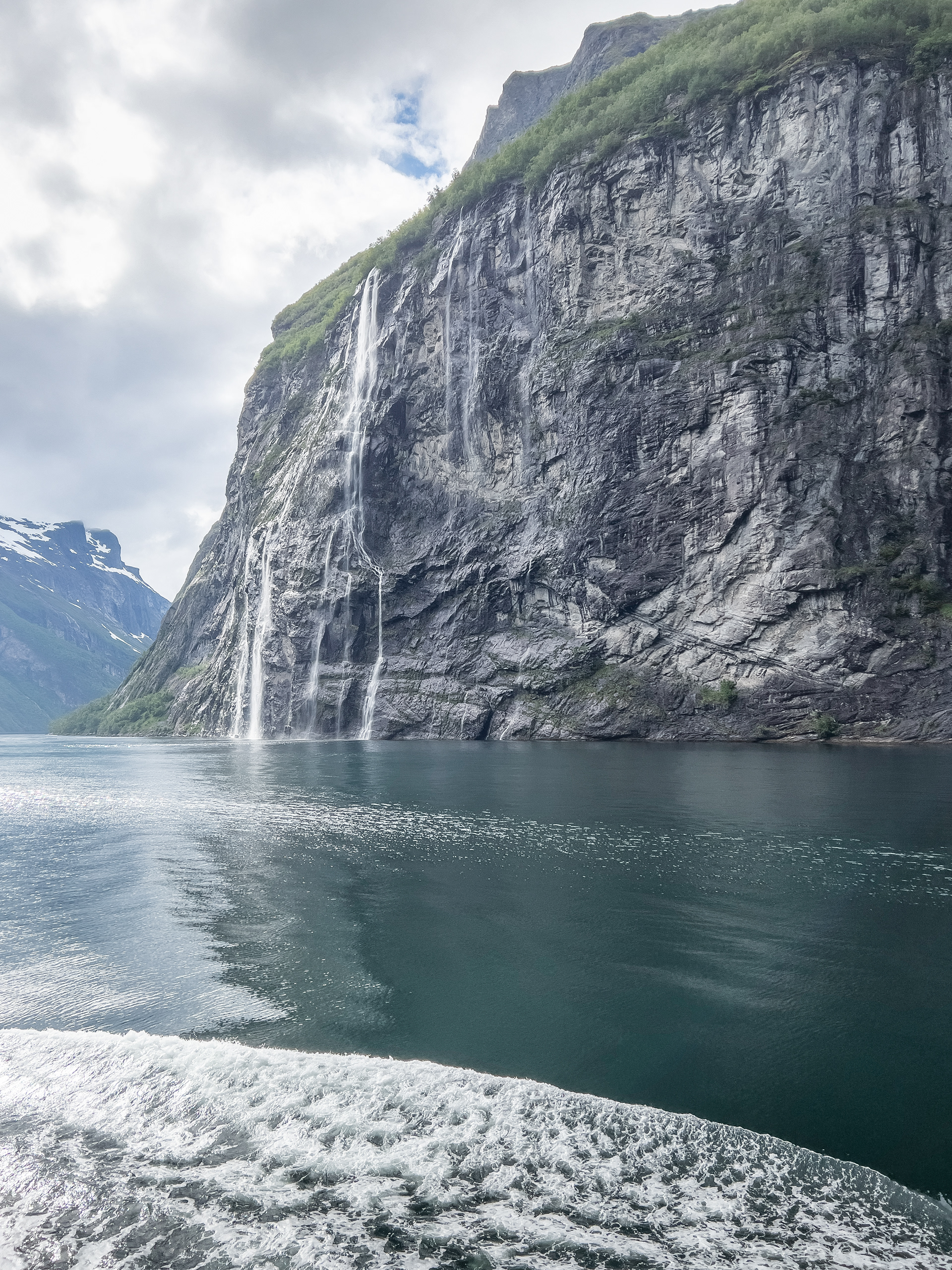
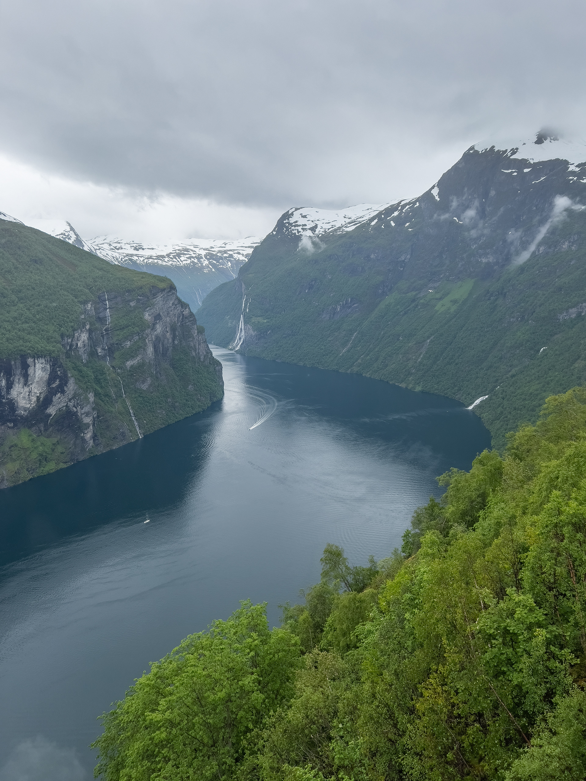
Geirangerfjord
The Geirangerfjord is the other fjord that is listed as UNESCO World Heritage and very popular with tourists. It's quite heavily frequented by cruise ships as well and all-around an area where you can easily spend an entire day. The route to get there is a destination in itself. Fylkesvei 63 is a national tourist road and has some of the best views I have ever seen. You can watch the entire road on my Youtube channel.
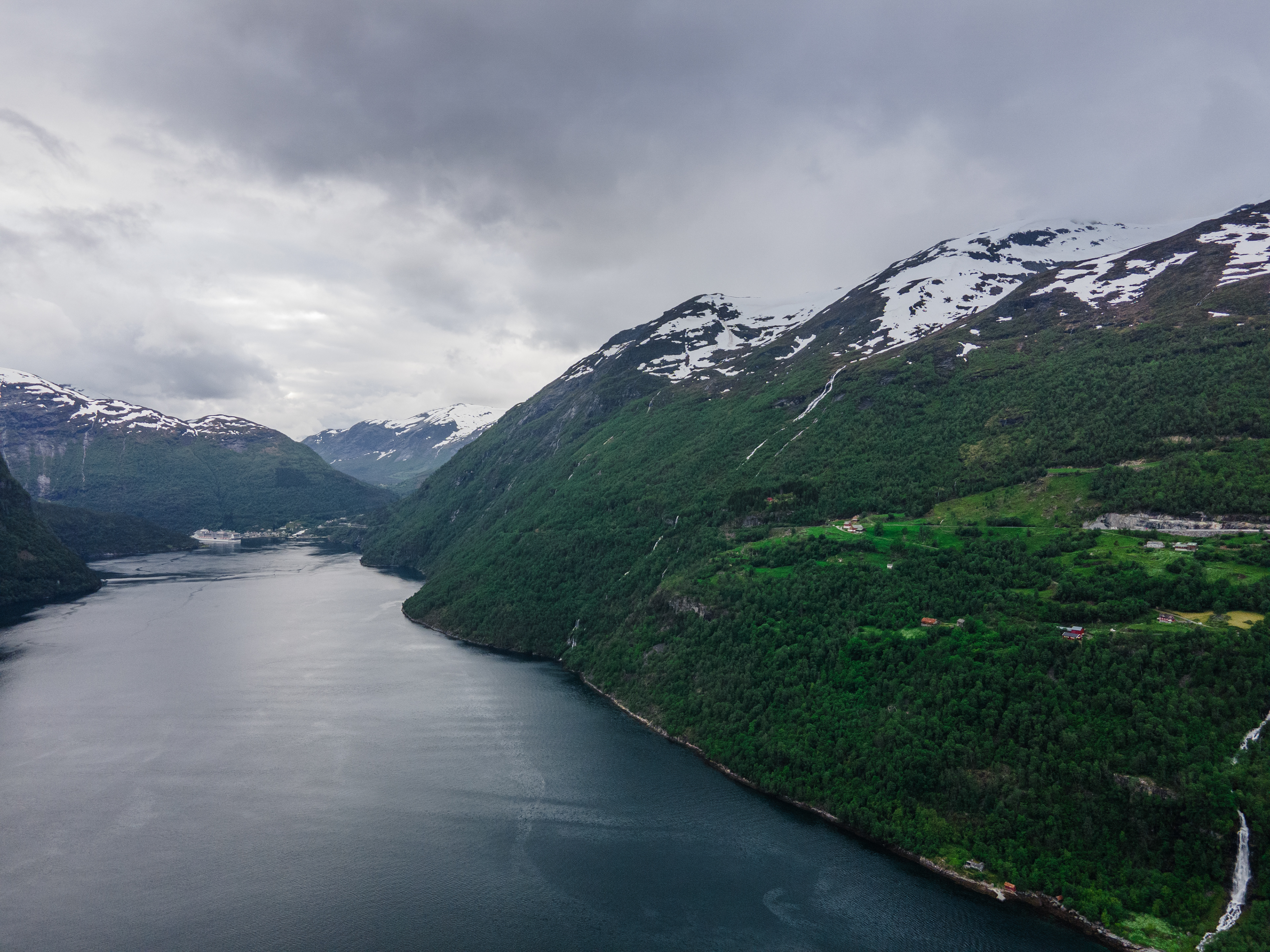
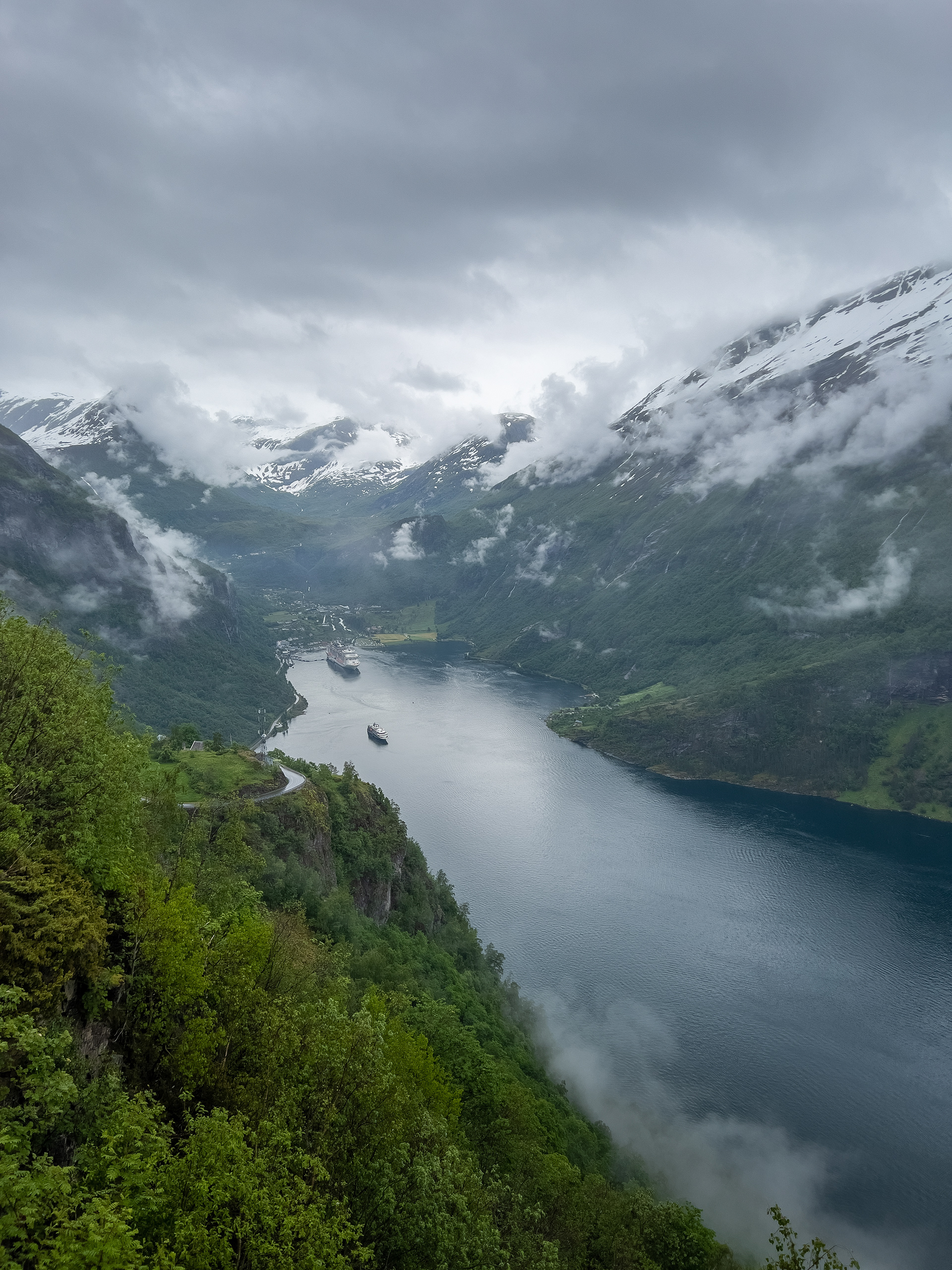
In order to get there from Stranda, you have to take 2 ferries. First the ferry to Liabygda and then the ferry to Eidsdal. From Eidsdal you take the Fv63 down to Geiranger. Before arriving at Geiranger, there is a viewpoint (Ørnesvingen) that gives you a great view over the fjord and Geiranger. Be prepared for a lot of traffic and not enough parking spots though...
Afterwards the road descends to Geiranger, which has a few things to offer. One of them is the Norwegian Fjord Center. It includes a museum where you can learn a great deal about the geography and origination of fjords in general. There is also a scenic walkway back into town.
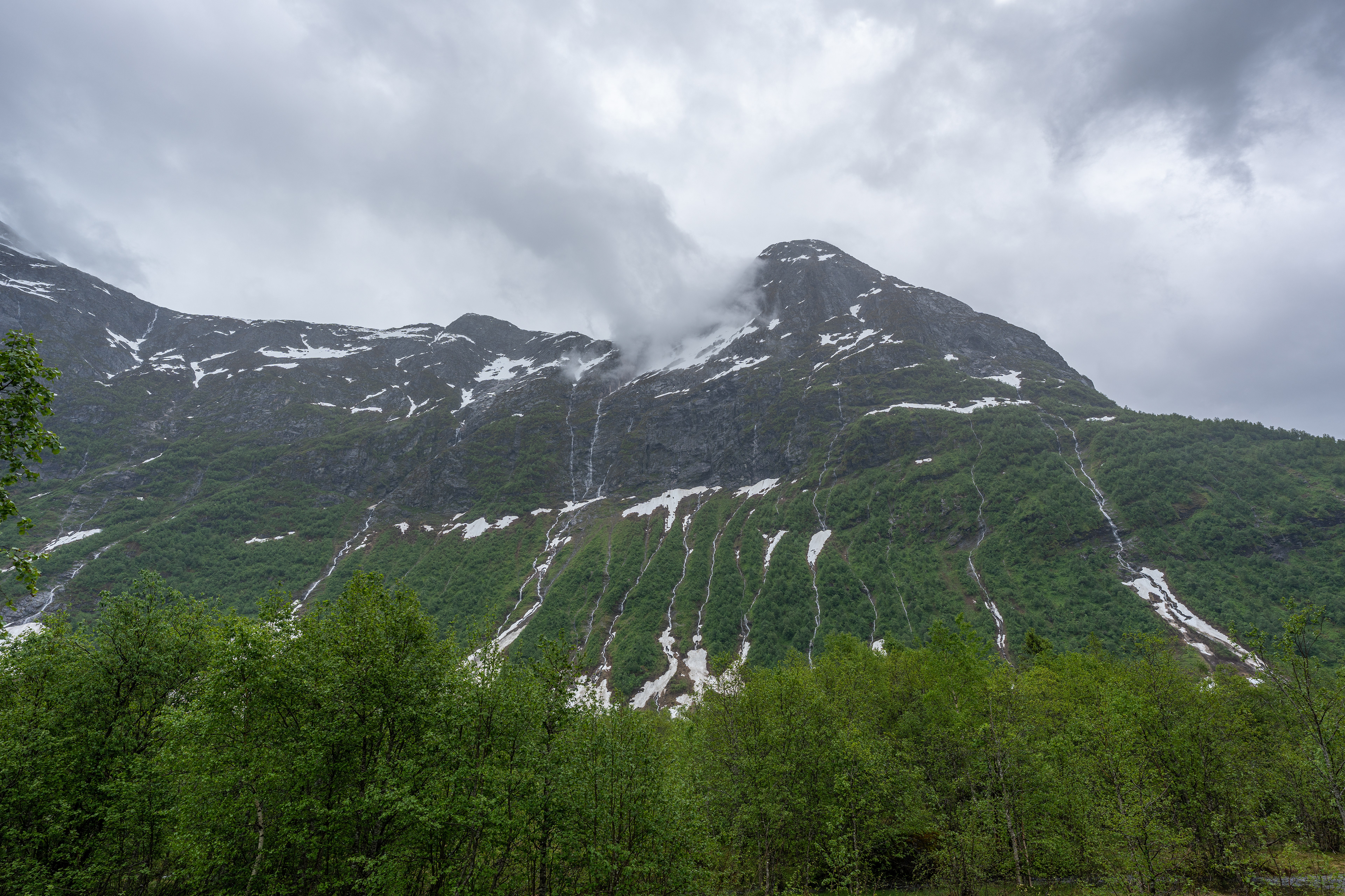
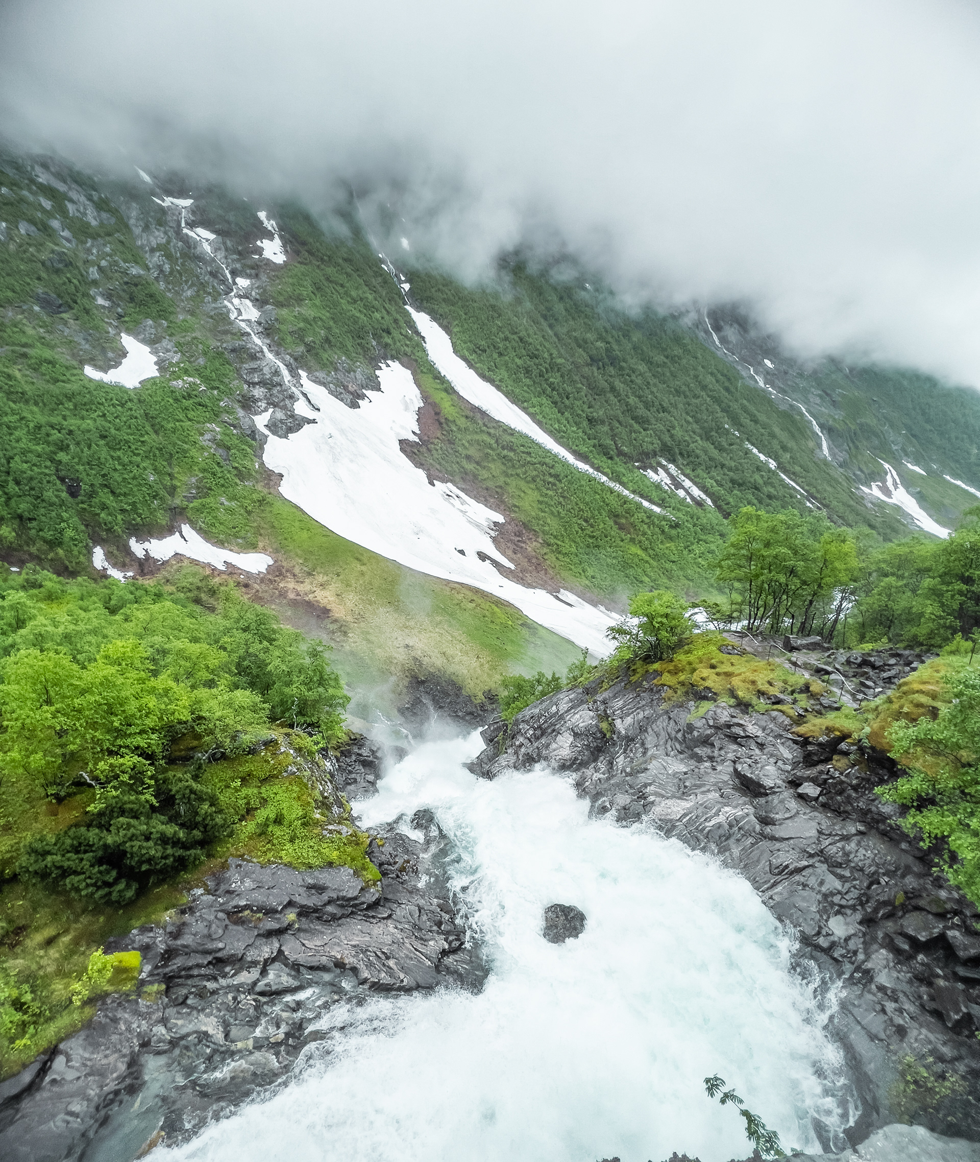
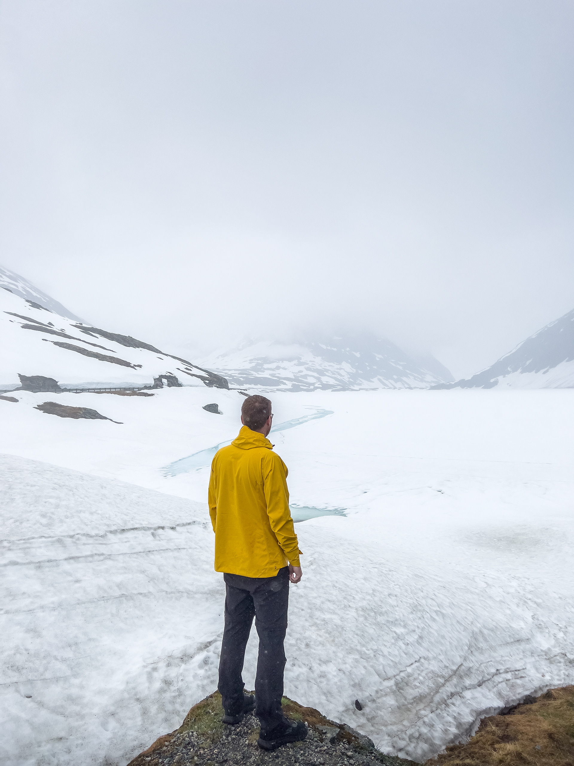
From there we continued on Fylkesvei 63 back up into the mountains. The road reaches an altitude of well over 1.000 meters here so we were counting on snow. There was quite a lot of it, we even had to dodge some larger ice blocks on the road here and there. We considered going to the Dalsnibba Viewpoint, which can be reached via a toll road. I believe it costs around €25 to go up. Normally you would get a great view of the surrounding area including the Geirangerfjord. However, the weather when we were there wasn't particularly good so we decided not to do it. We drove on towards Riksvei 15 and then to Øvstefossen, also a waterfall you can visit. On the way we stopped over at Djupvatnet, a lake that was still completely frozen over and covered with snow. Quite surreal in the middle of June to be honest.
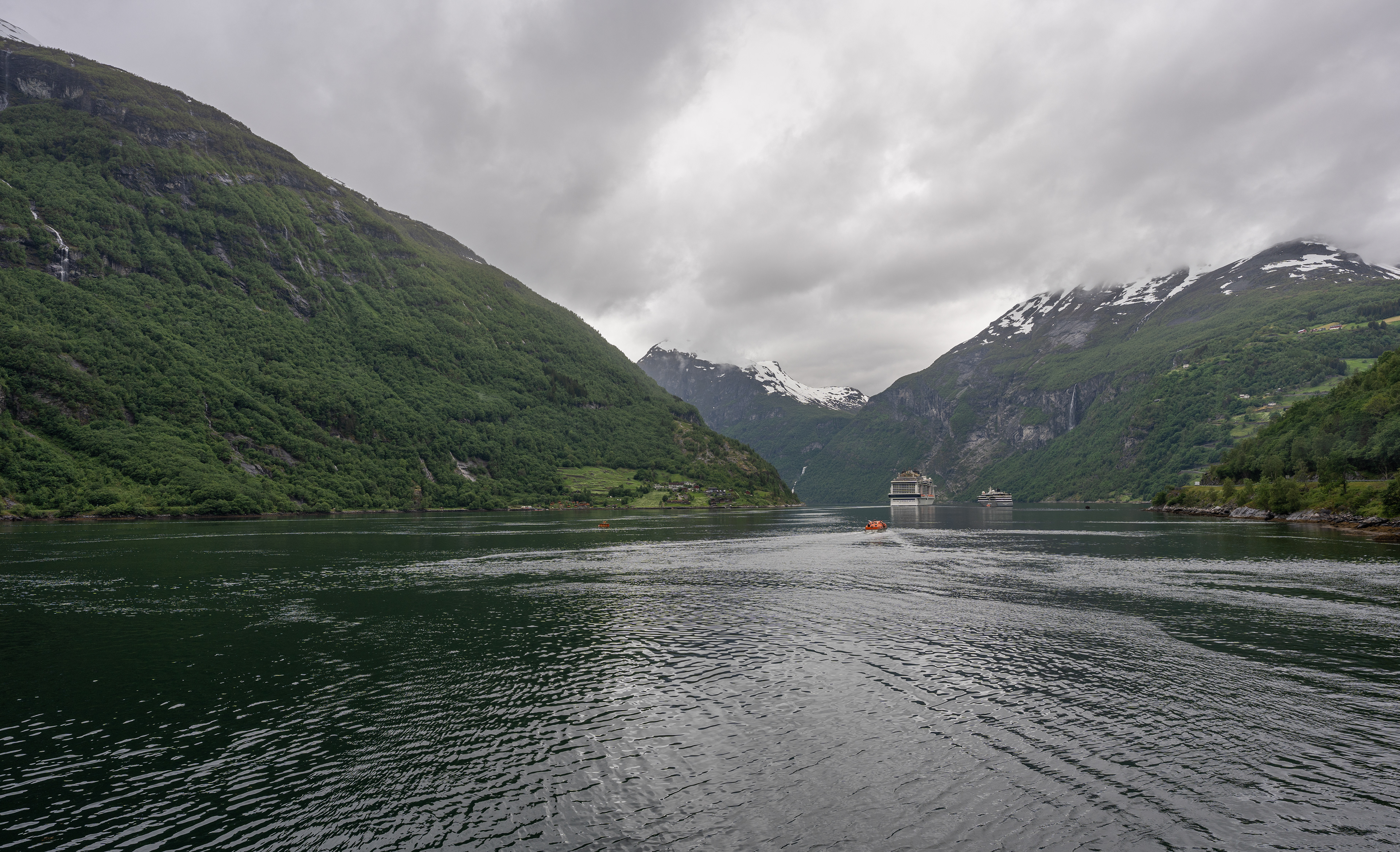
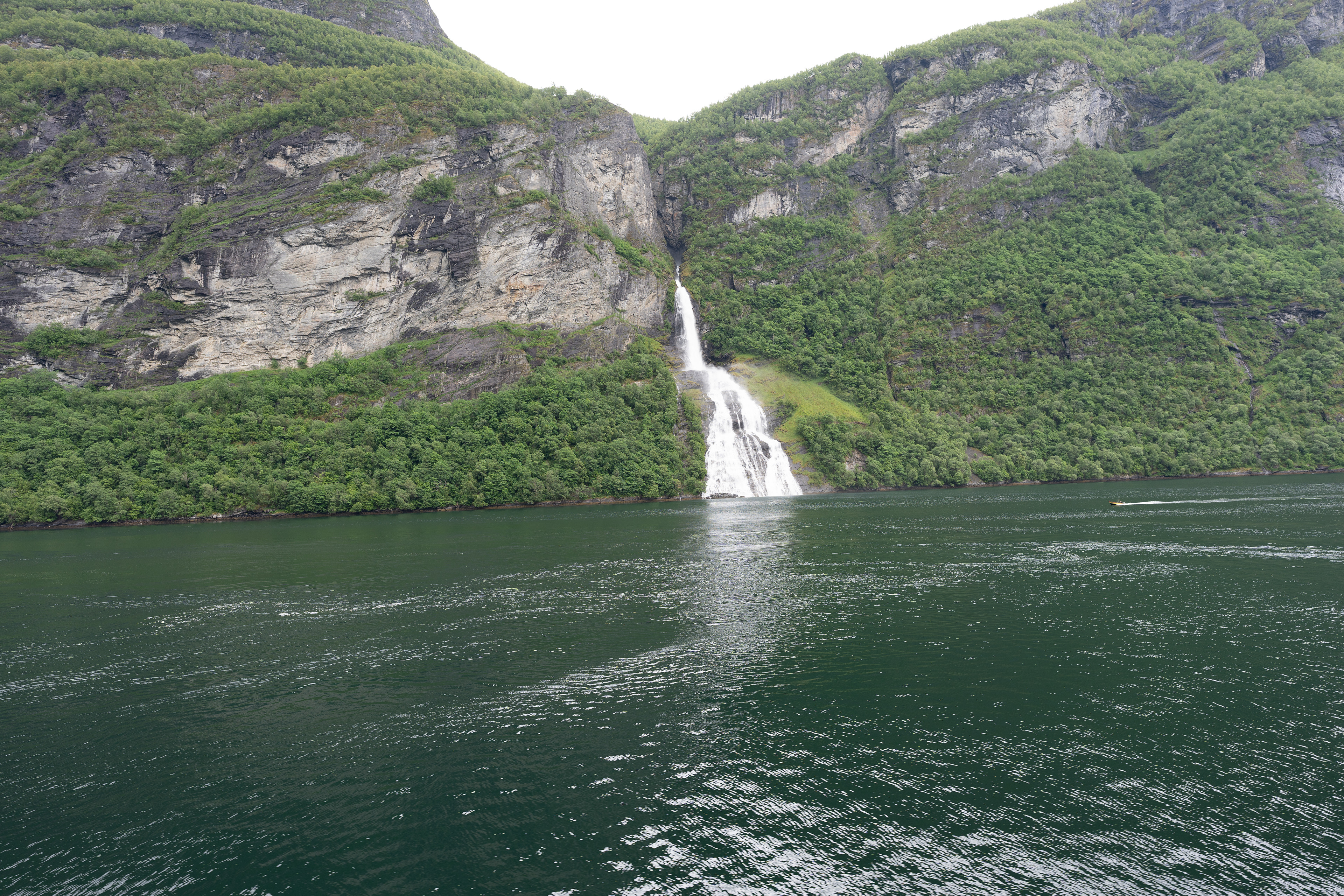
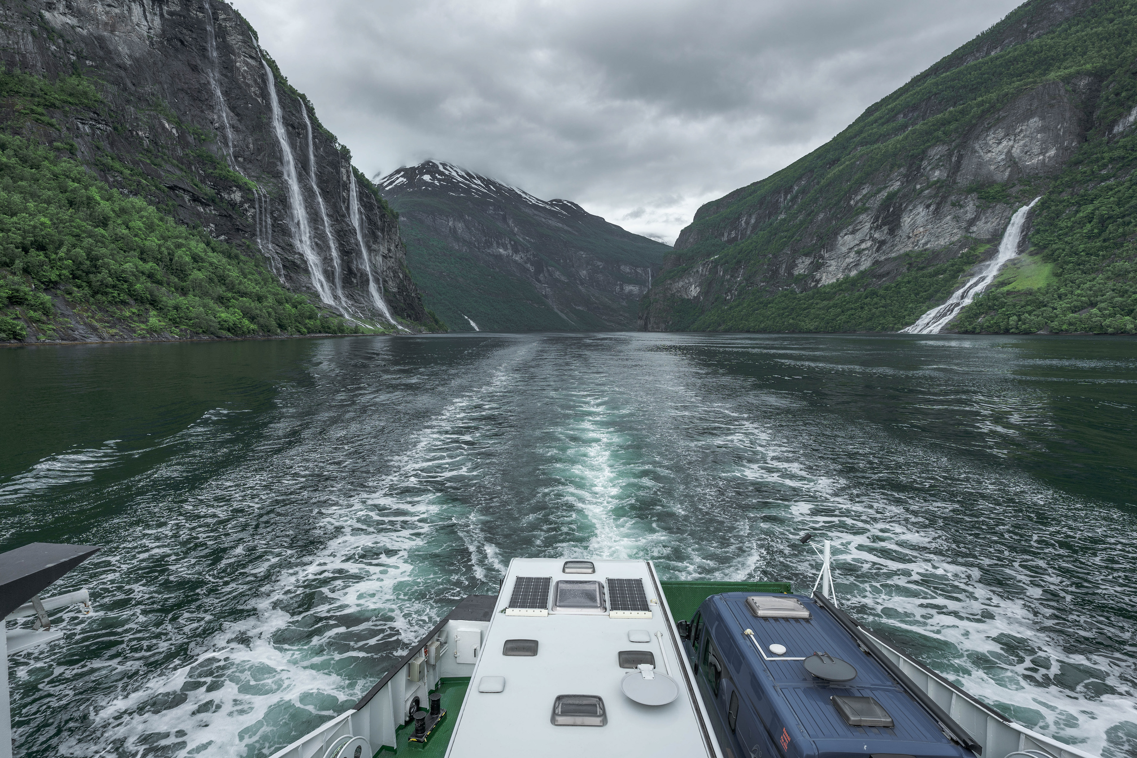
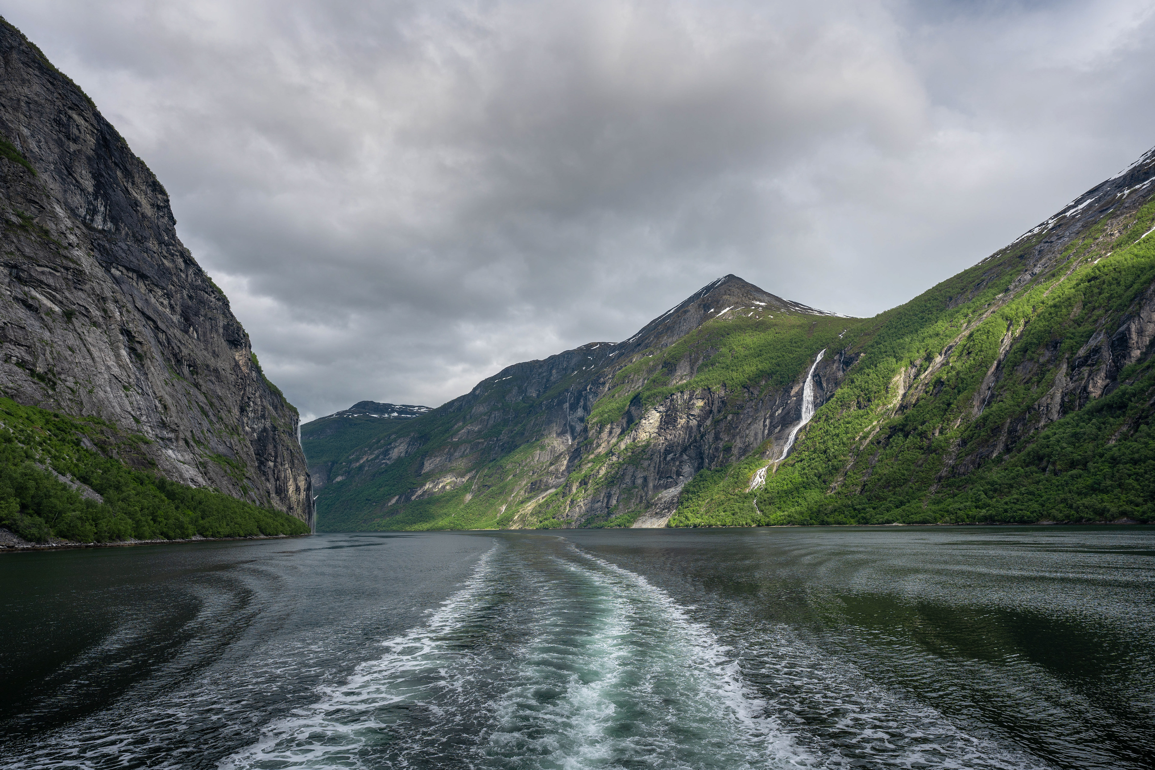
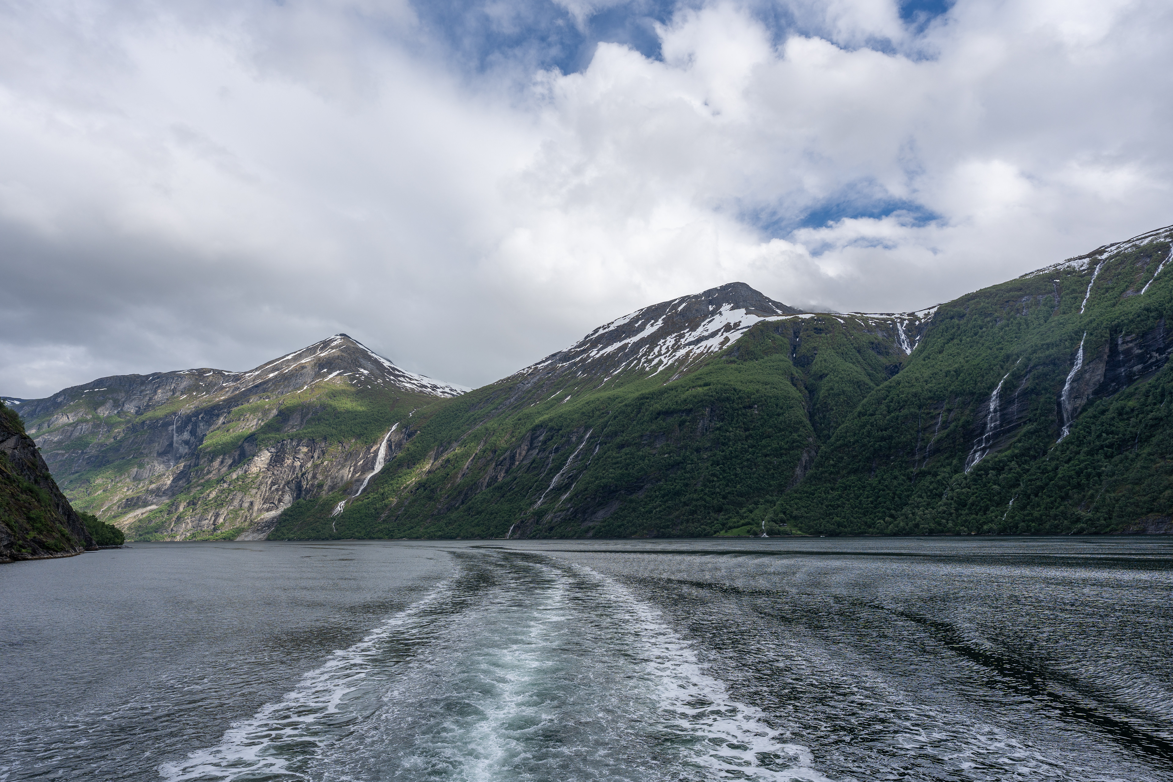
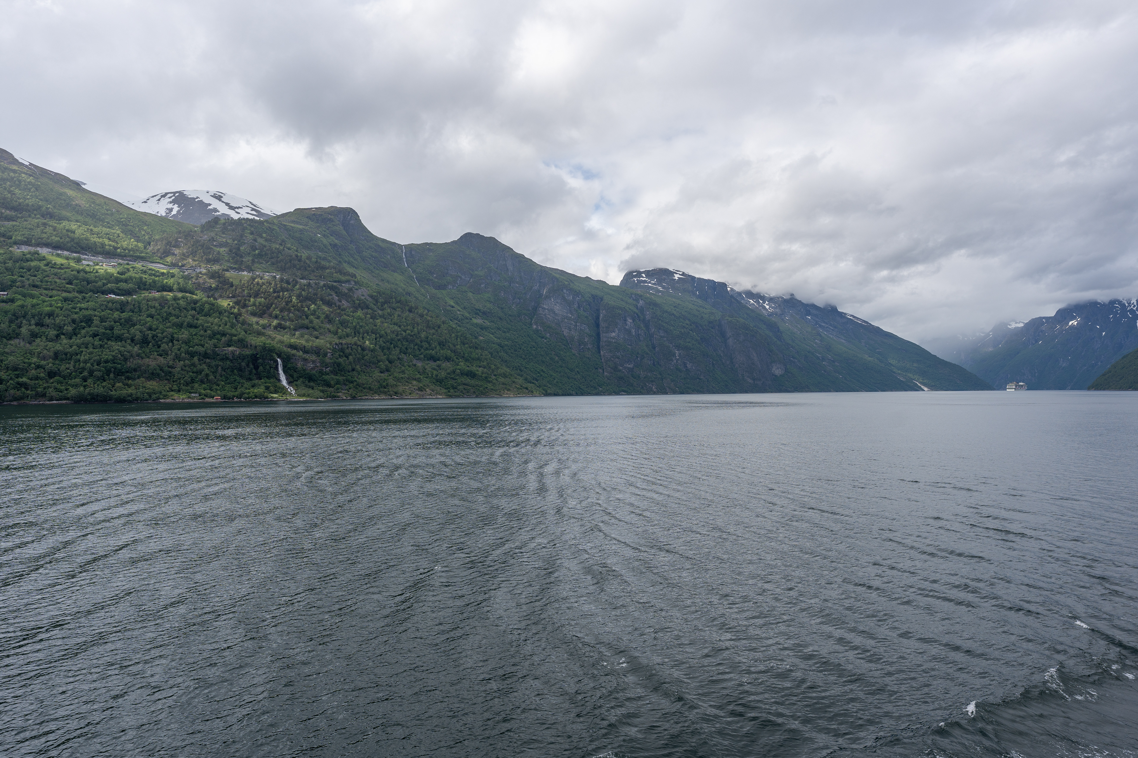
Afterwards we drove back to Geiranger and then took the car ferry to Hellesylt so we could enjoy the Geirangerfjord from the water. We learned our lessen from the first day so we booked this ferry in advance. The ferry takes about an hour and cost us about €120 for 2 persons and a car. I'd say it's worth it for the views, it comes with english commentary about what you are seeing. The Seven Sisters Waterfall for instance or some very interesting insights about farming in this rugged area back in the day.
The Norwegian Fjord Center
Views from Fv63
Views from Fv63
Views from Fv63
Geiranger from Flydalsjuvet Viewpoint
Geirangerfjord
Geirangerfjord
Geirangerfjord

Geirangerfjord
Geirangerfjord
Geirangerfjord
Geirangerfjord
Geirangerfjord Viewpoint on Fv60 near Hellesylt
Geirangerfjord Viewpoint on Fv60 near Hellesylt
Geirangerfjord Viewpoint on Fv60 near Hellesylt
Geirangerfjord
Geirangerfjord
Geirangerfjord
Geirangerfjord
Norwegian Fjord Center
Norwegian Fjord Center
Norwegian Fjord Center
Øvstefossen
Øvstefossen
Øvstefossen
Djupvatnet
Geirangerfjord
Waterfall near Geirangerfjord Viewpoint
Views from Fv63
Geirangerfjord from Ørnesvingen Viewpoint
Geirangerfjord from Ørnesvingen Viewpoint
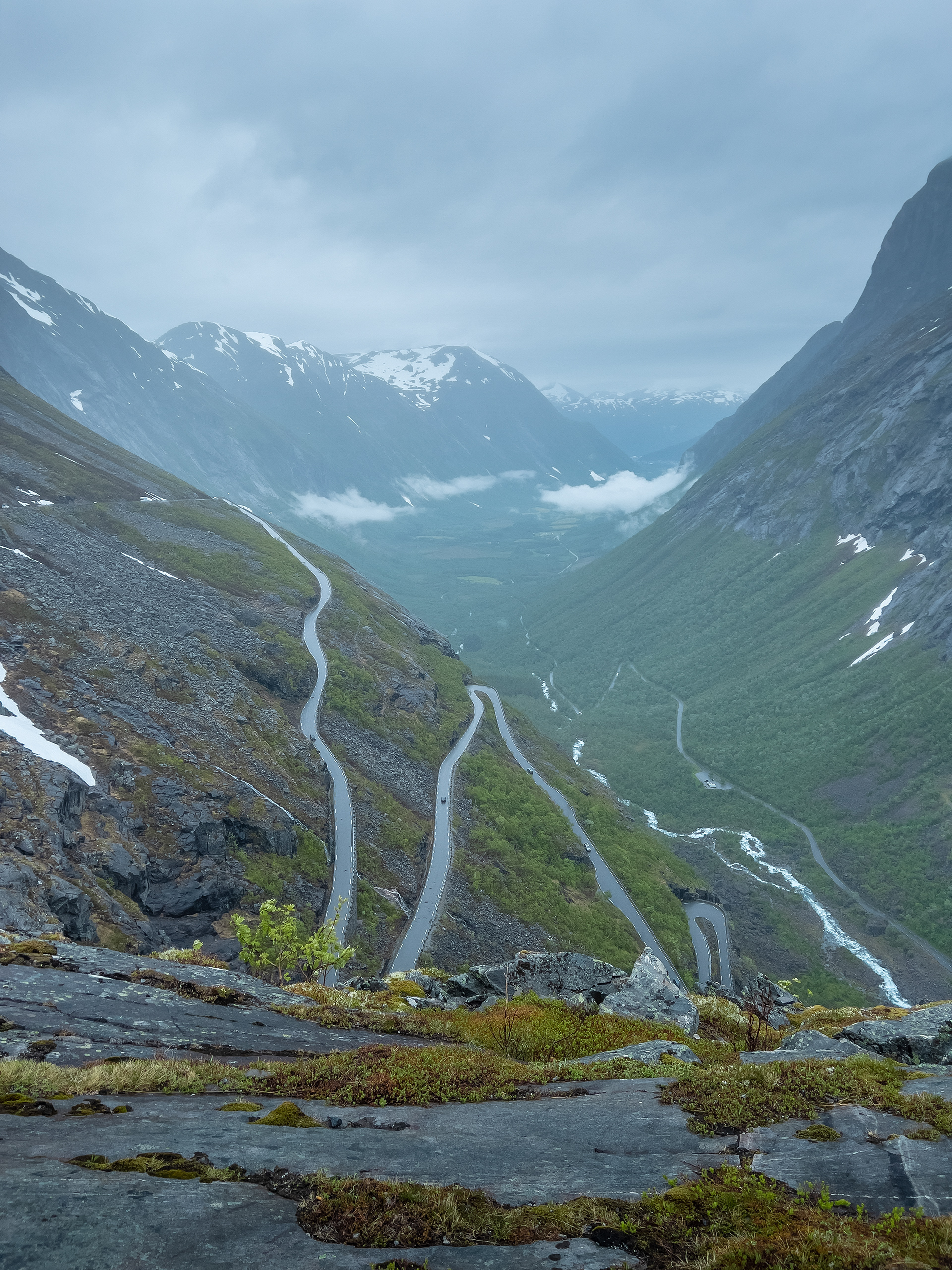
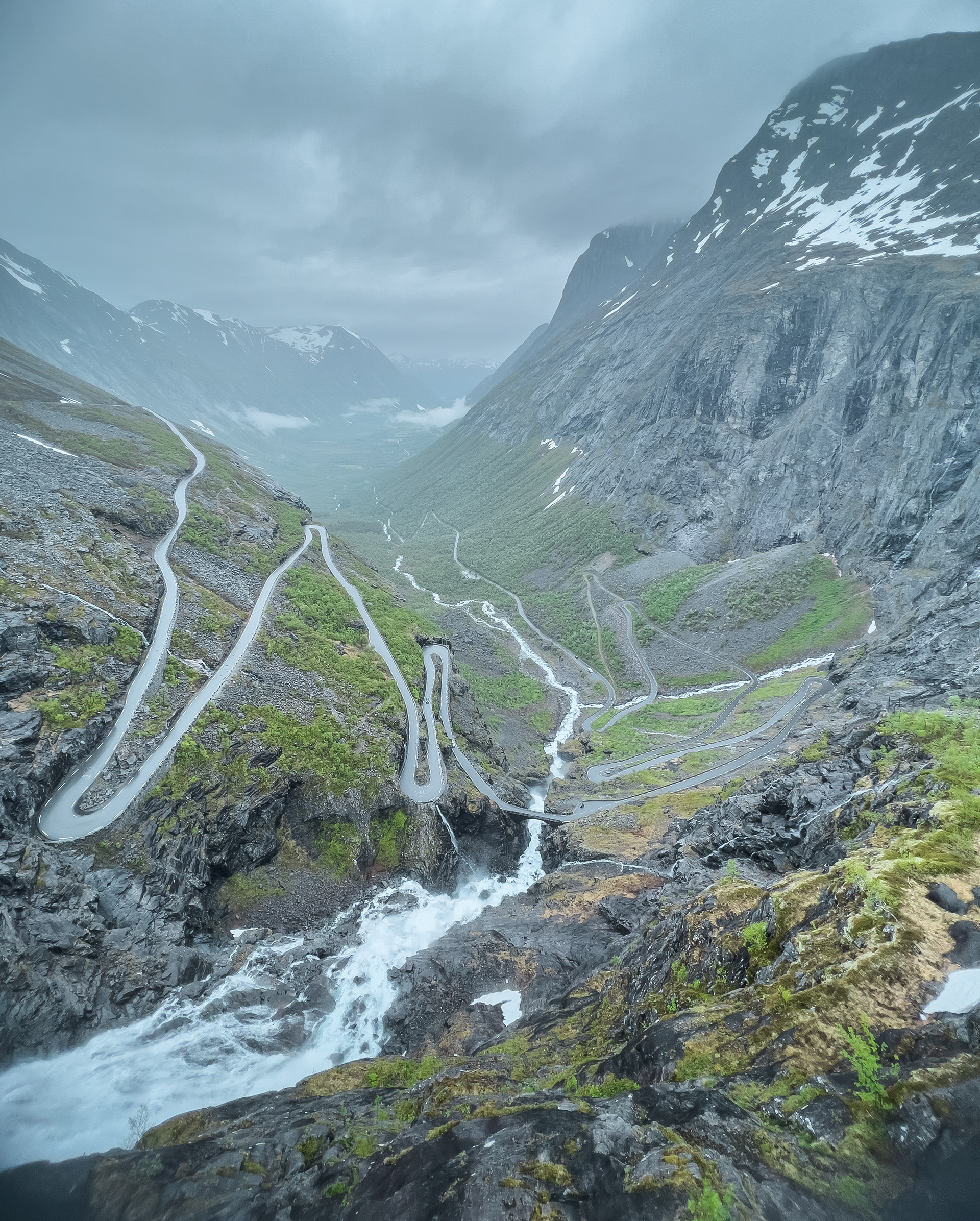
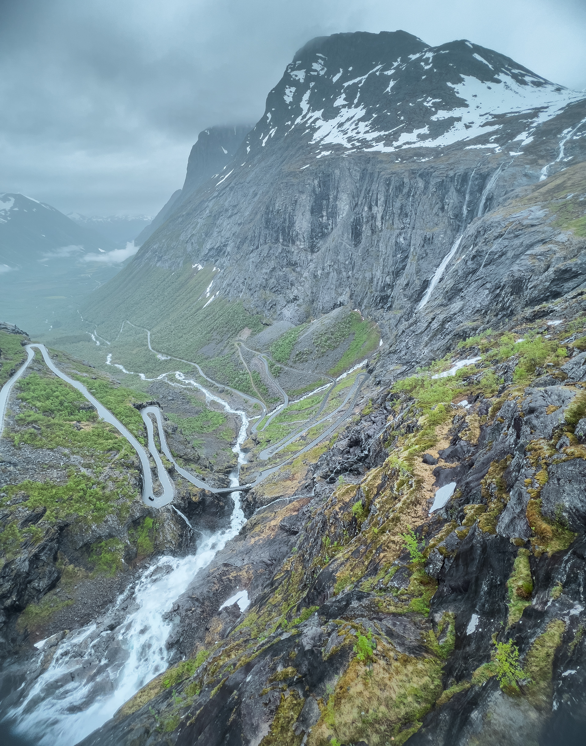
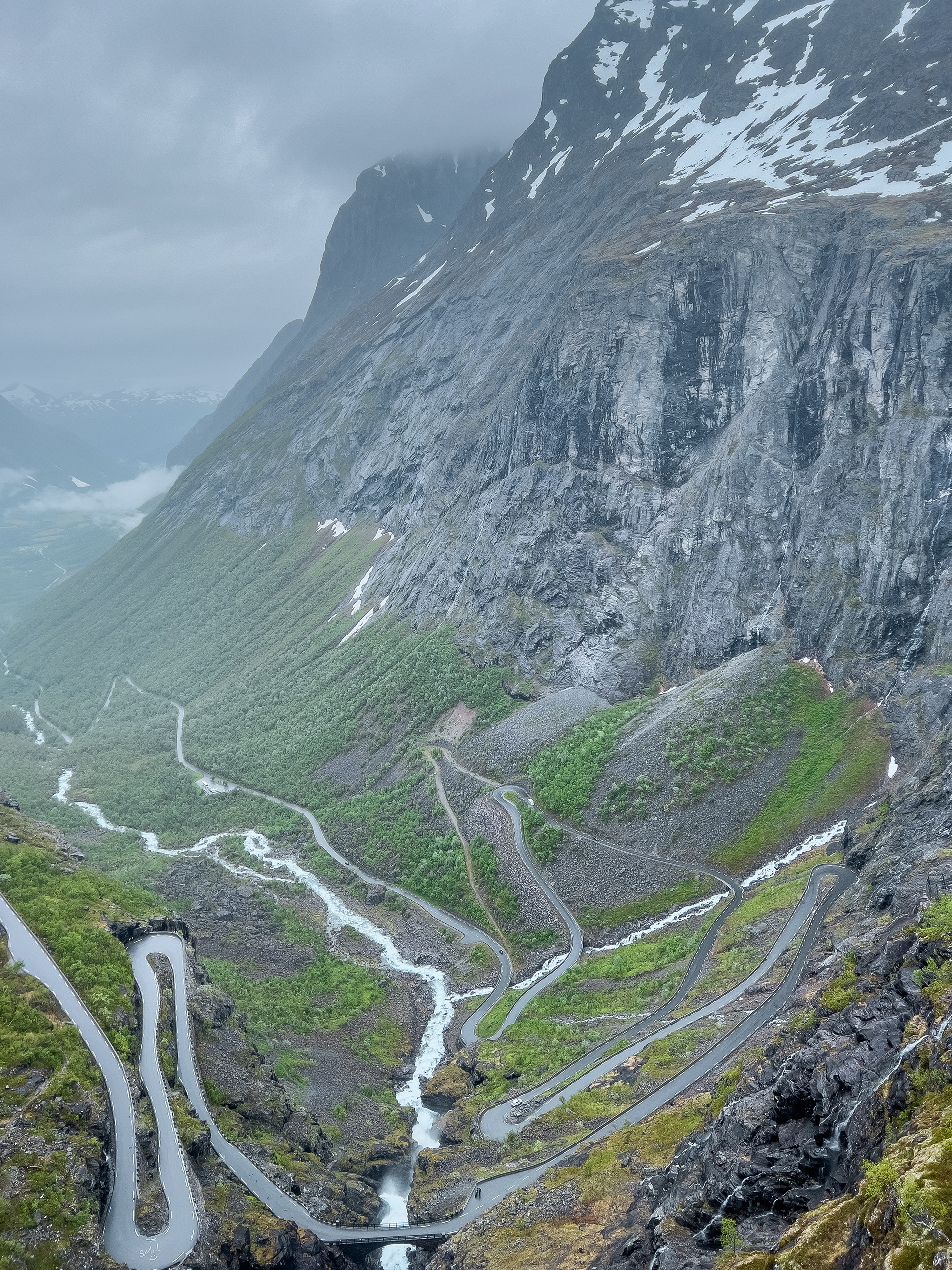
Trollstigen
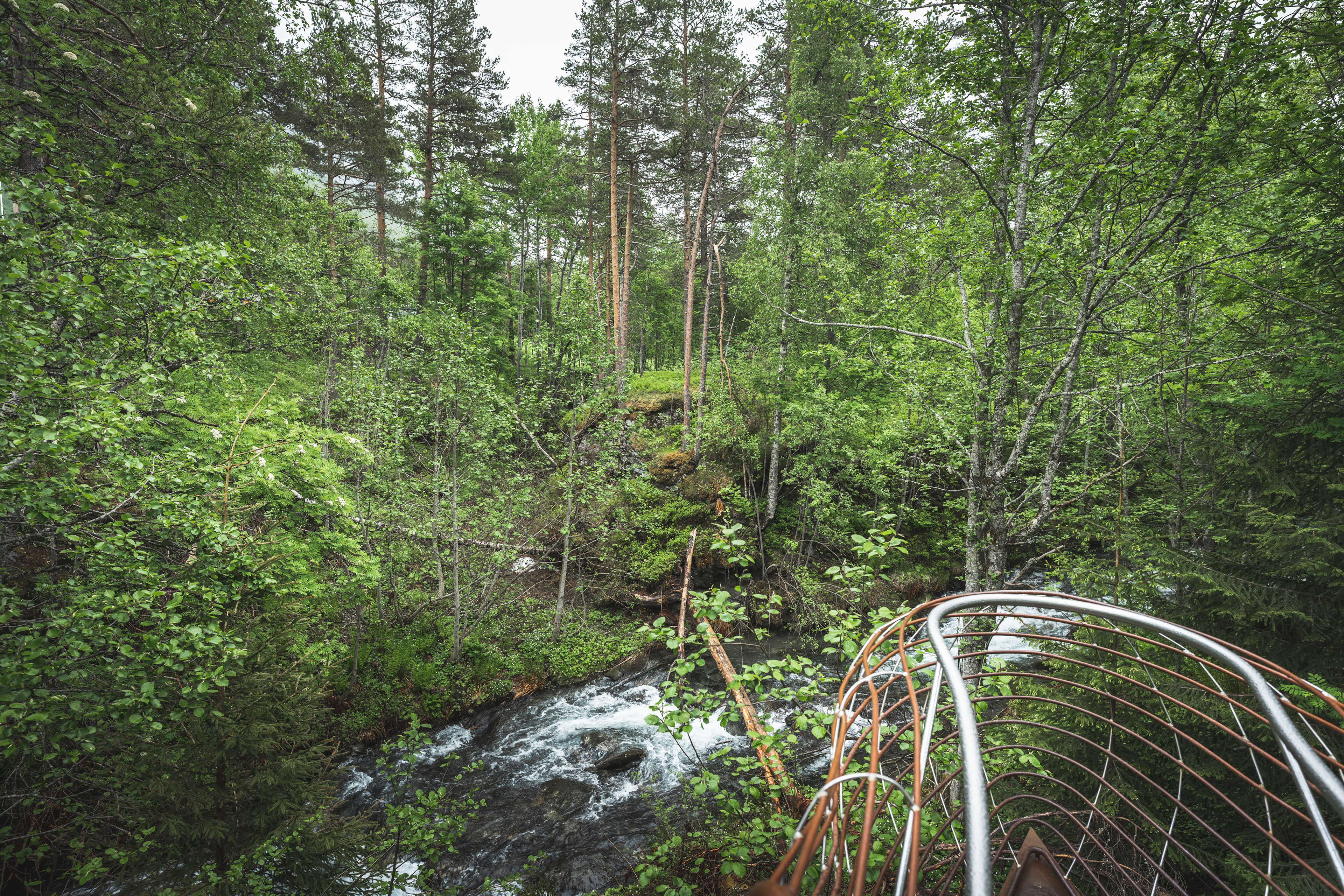
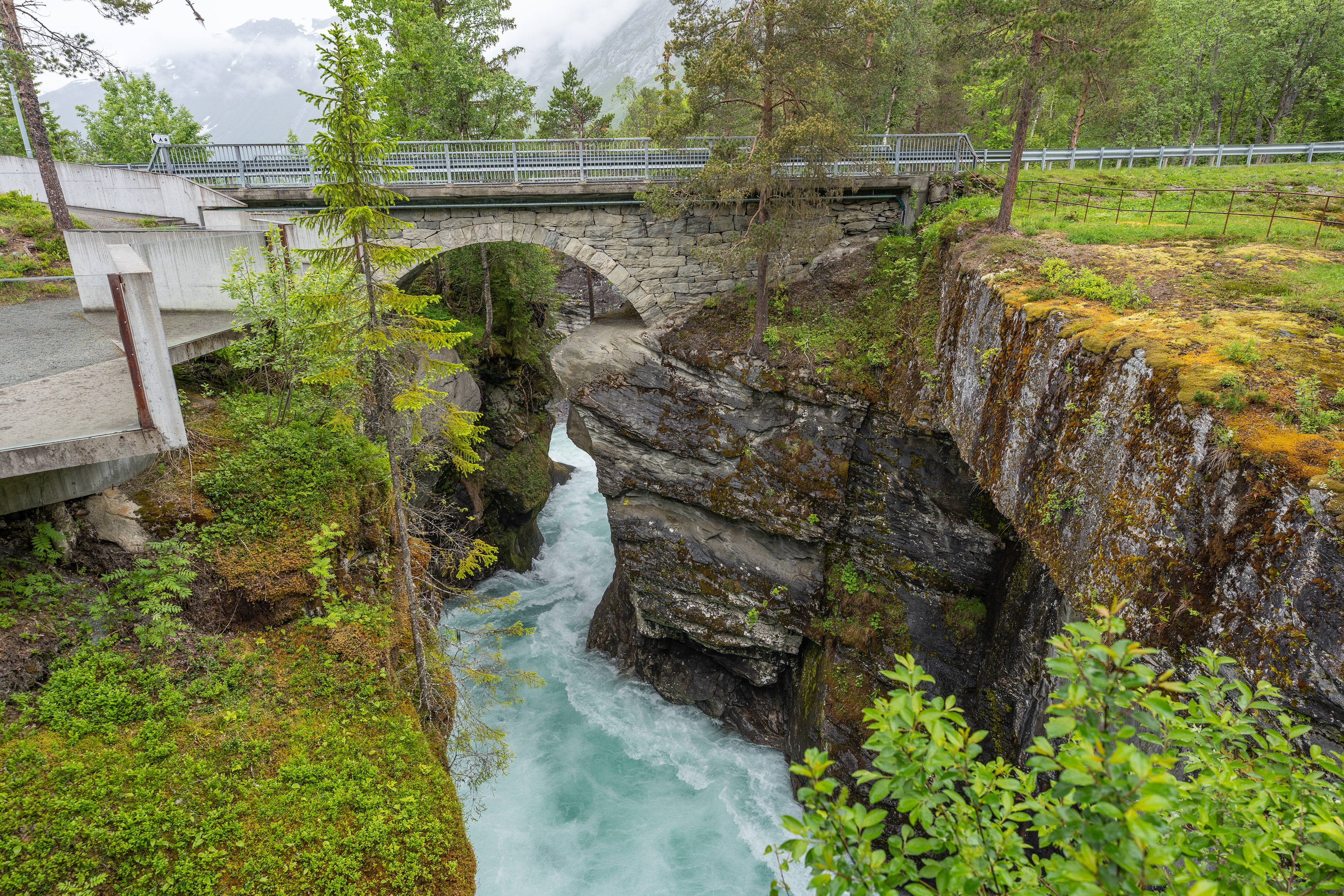
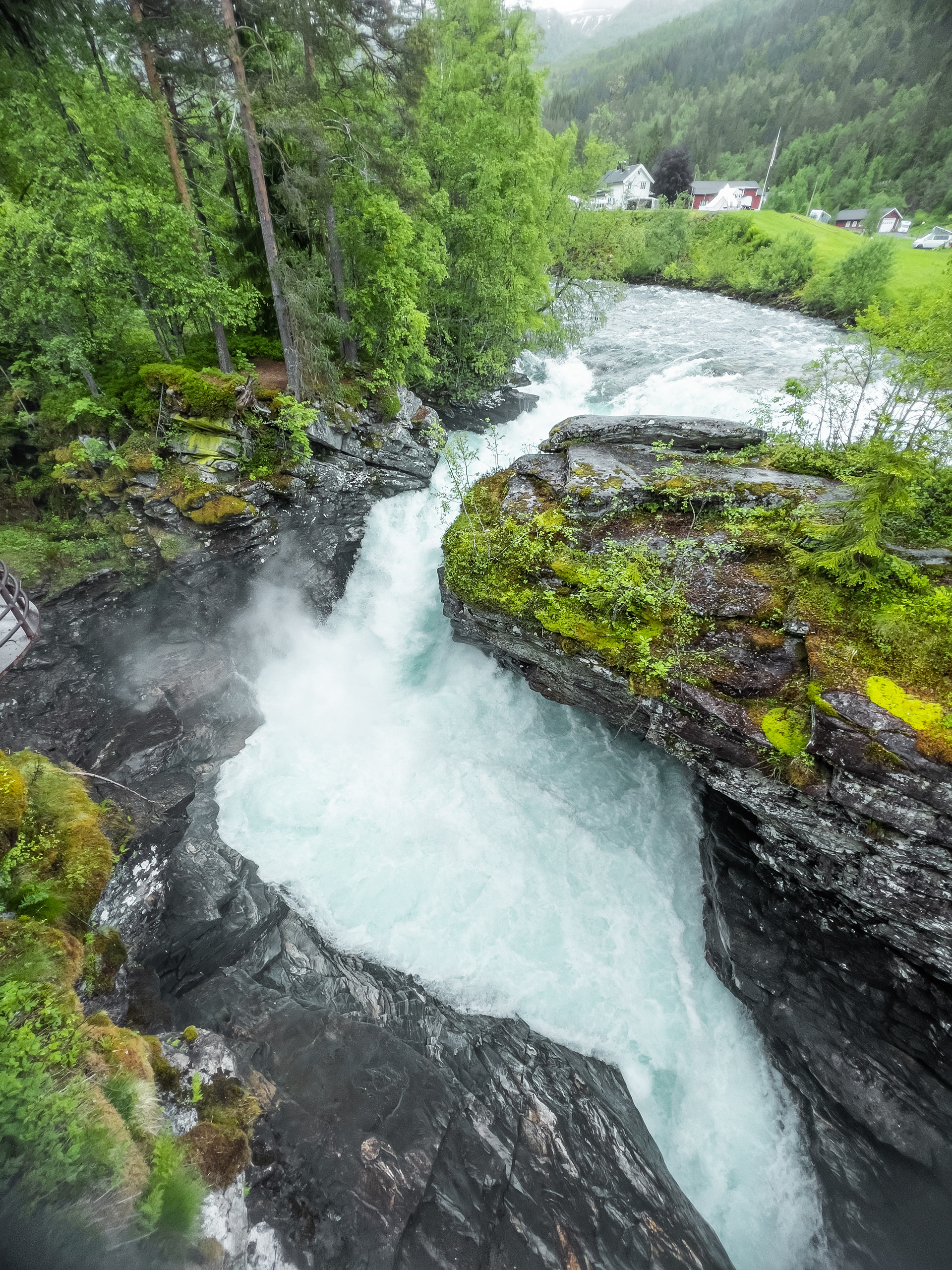
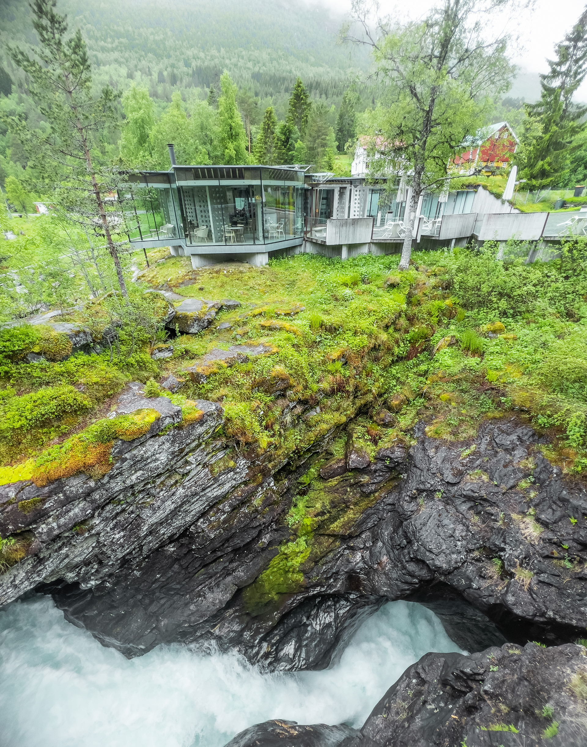
Trollstigen is a famous mountain pass on Fylkesvei 63 in the More øg Romsdal Region. Before we get there we follow Fv63 North and there is an interesting stop on the way that I can recommend visiting. It's called Gudbrandsjuvet and here there are some smaller waterfalls you can observe as they cut through the rock. There are some well designed walkways around as well as a nicely designed road side rest area.
Trollstigen is open only a few months a year and well-known for its many hairpins. There is a visitor center at the top (South side) and some walkways leading up to viewing platforms over the pass. There are multiple waterfalls that can be observed from up there as well as from the pass itself. When we were there an avalanche had just hit the area a few weeks prior so the visitor center was closed because of all the damage. You can see the drive of Trollstigen on my channel.
Gudbrandsjuvet
Gudbrandsjuvet
Gudbrandsjuvet
Gudbrandsjuvet
Trollstigen
Trollstigen
Trollstigen
Trollstigen
Trollstigen
Trollstigen
Trollstigen
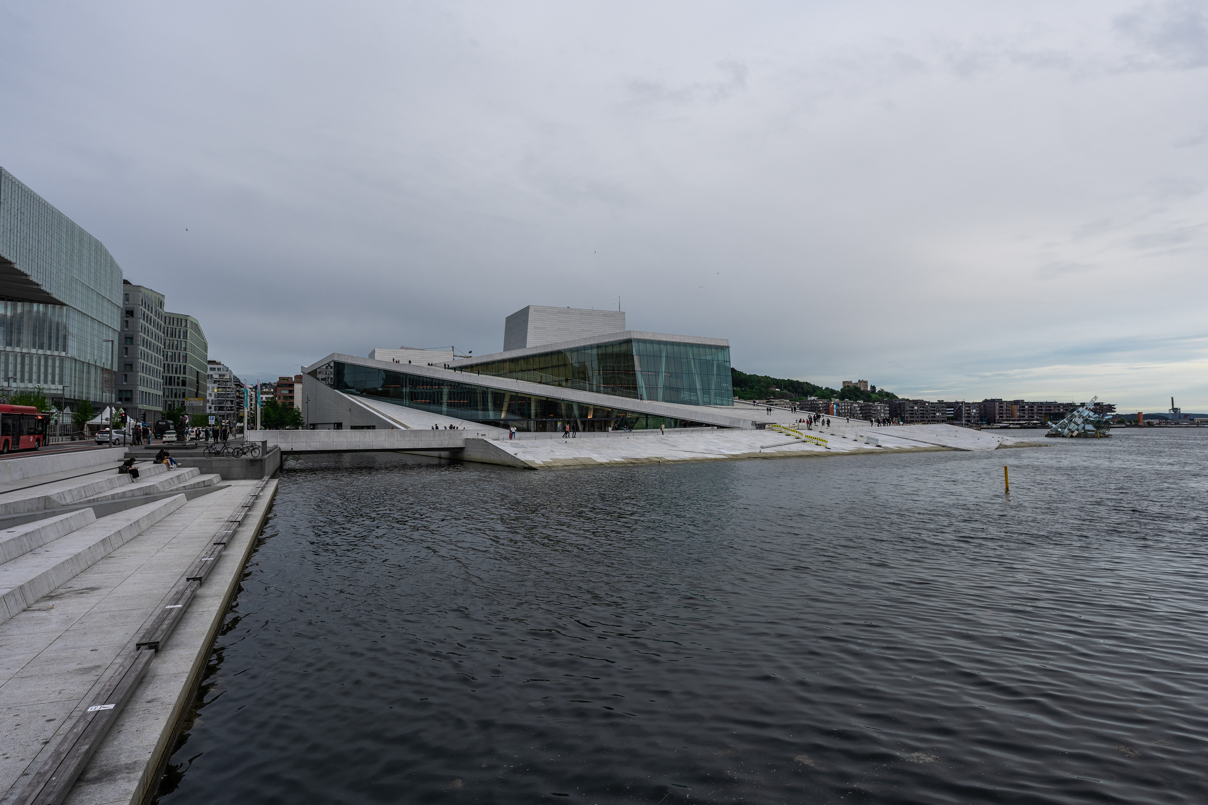
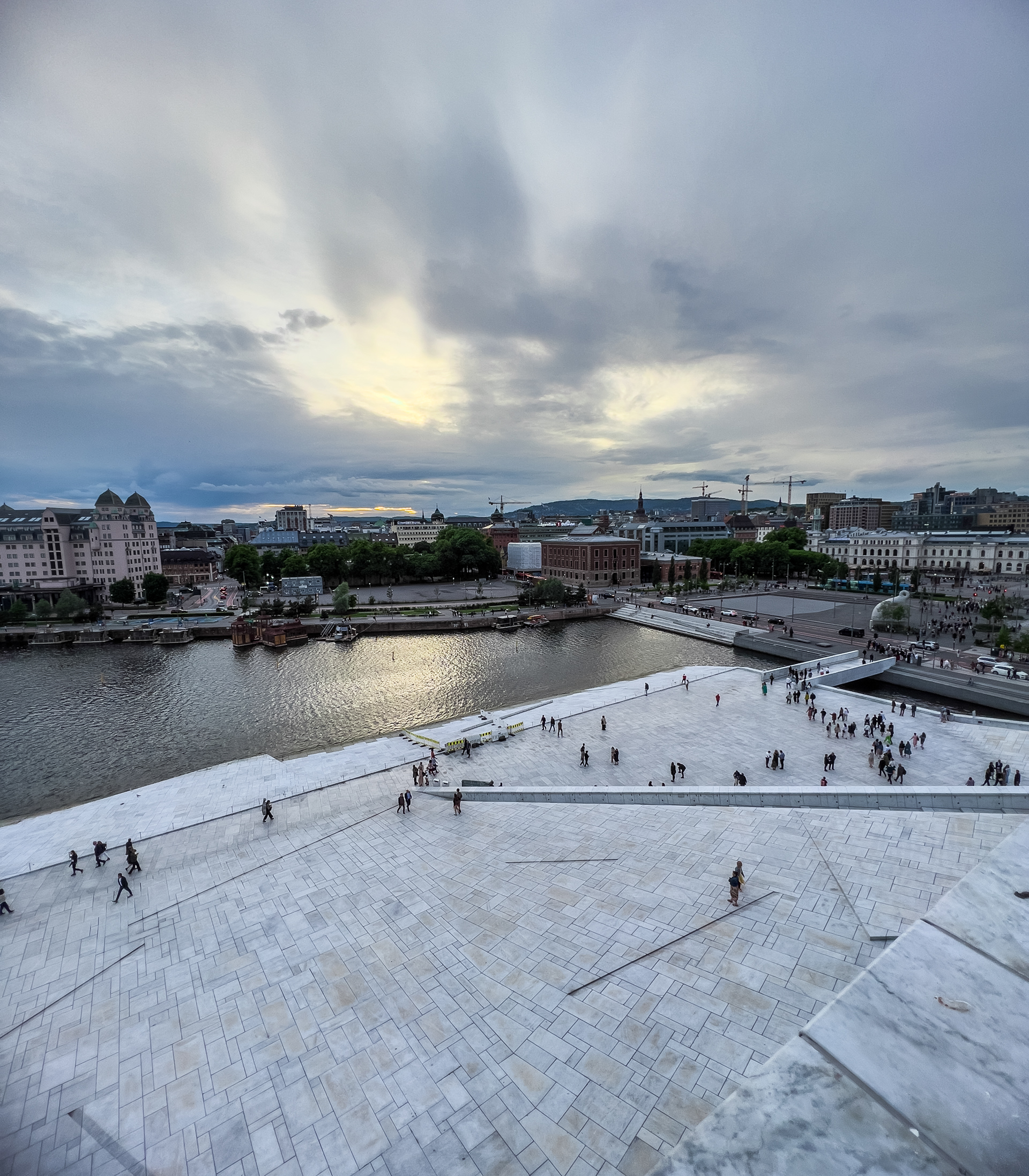
Oslo
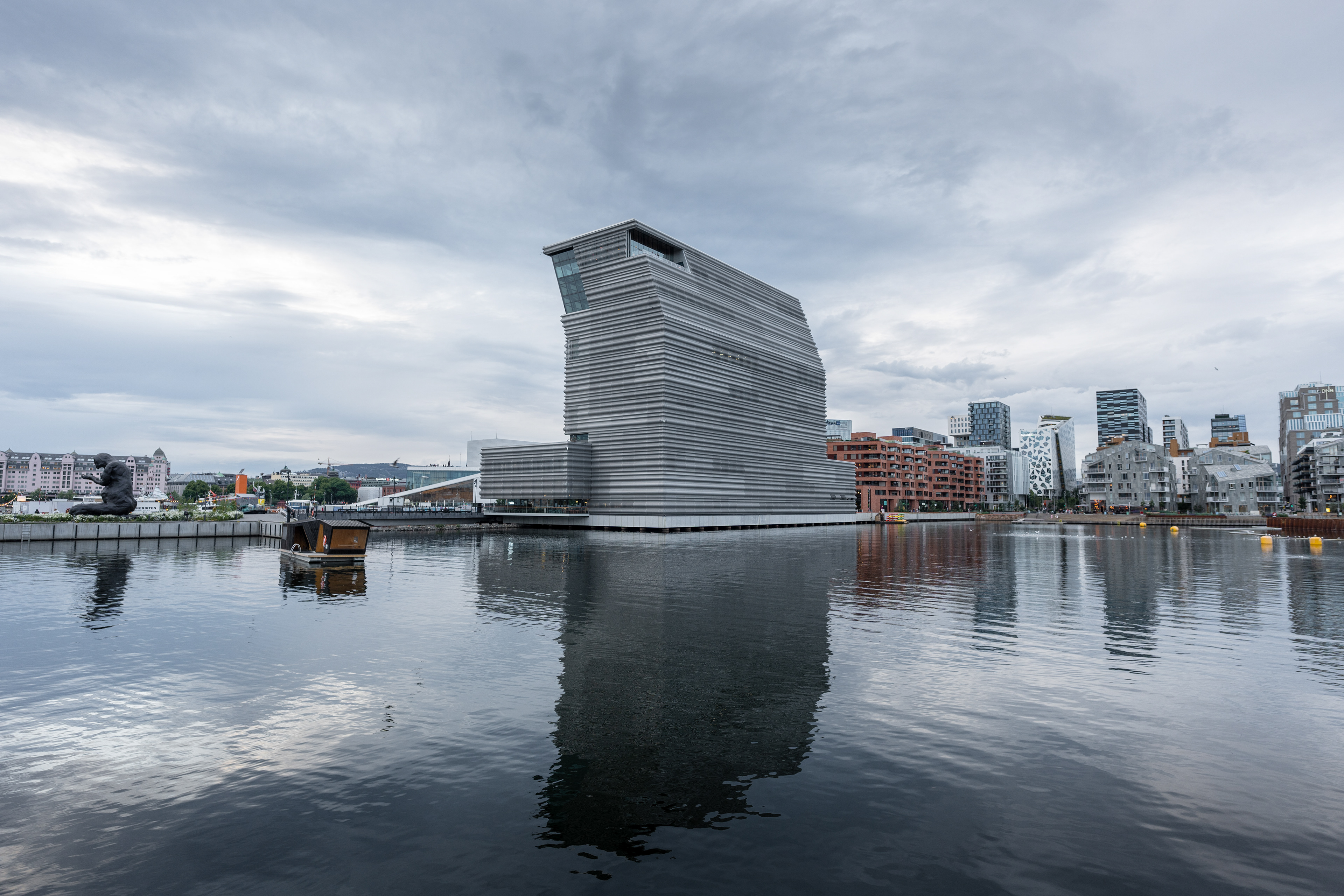
Oslo's MUNCH Museum and Operakvarteret in the background
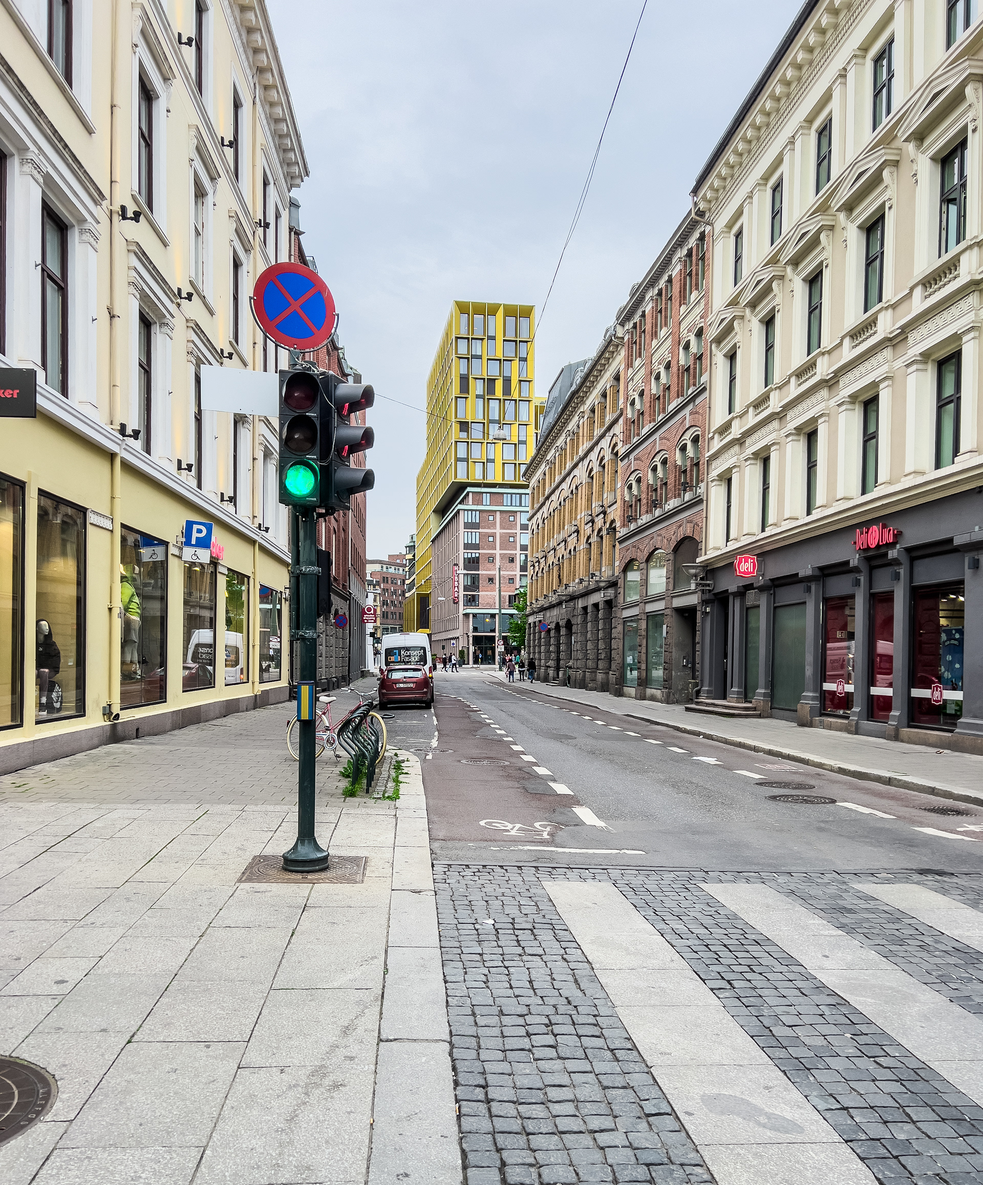
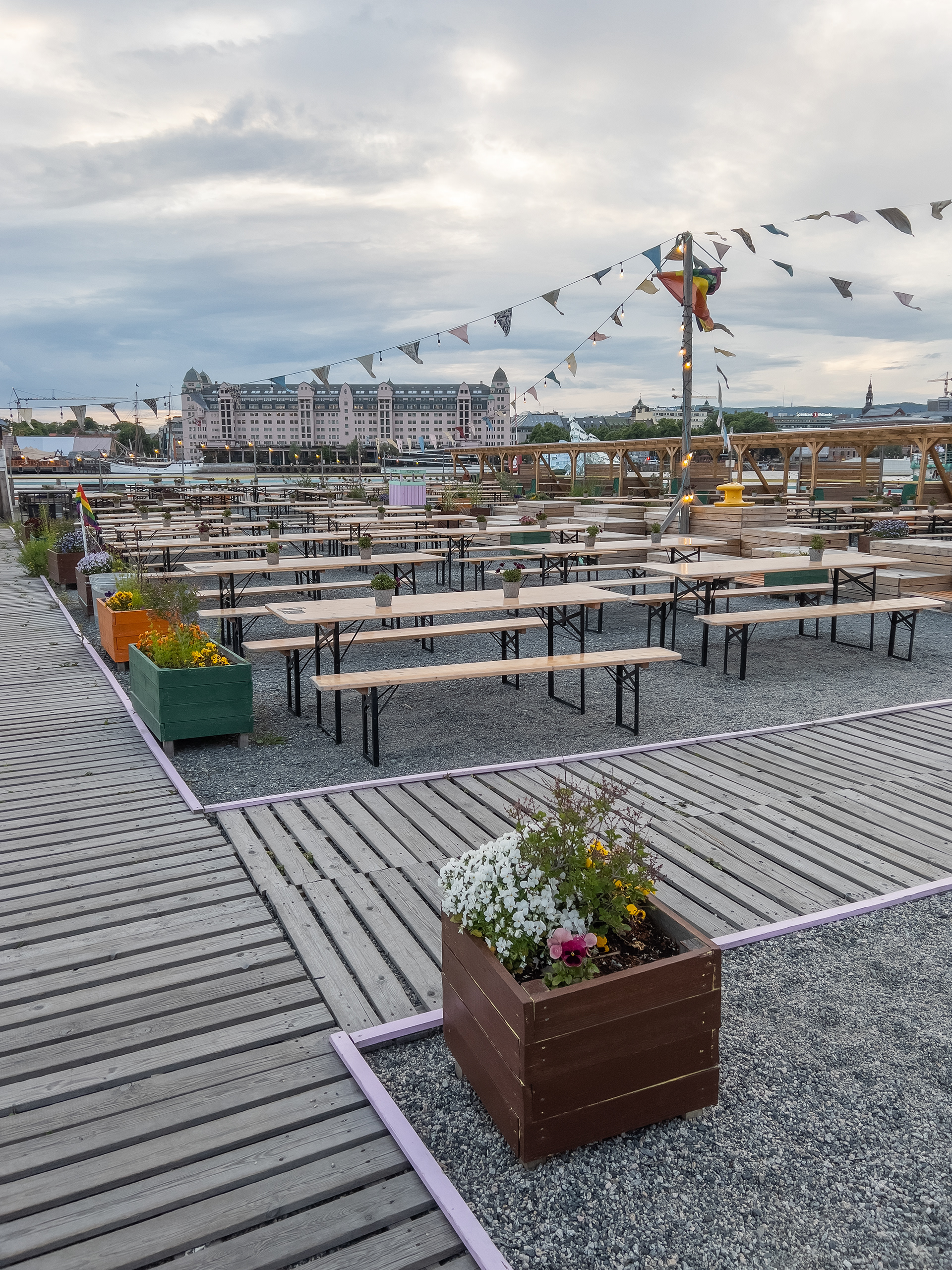
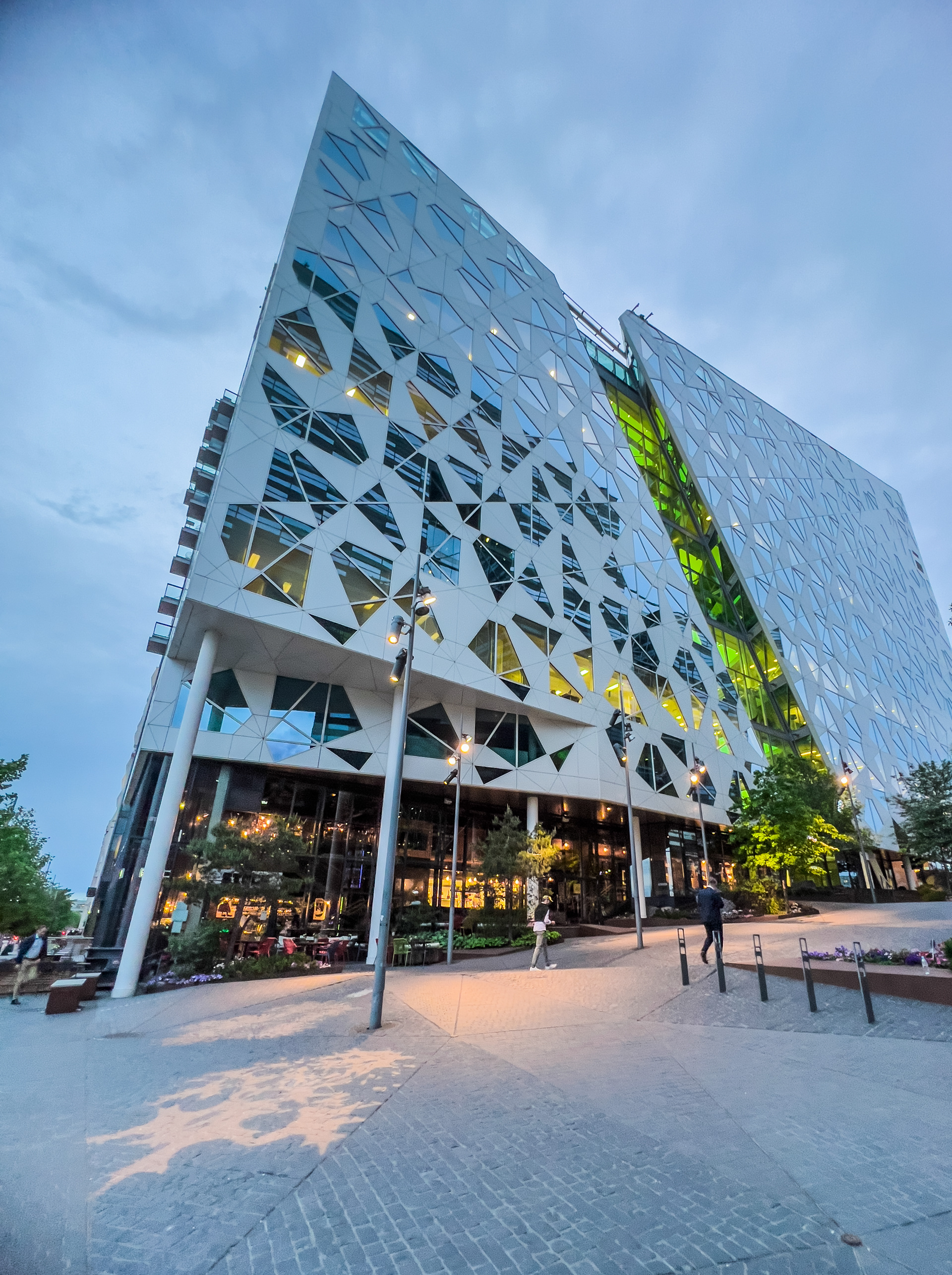
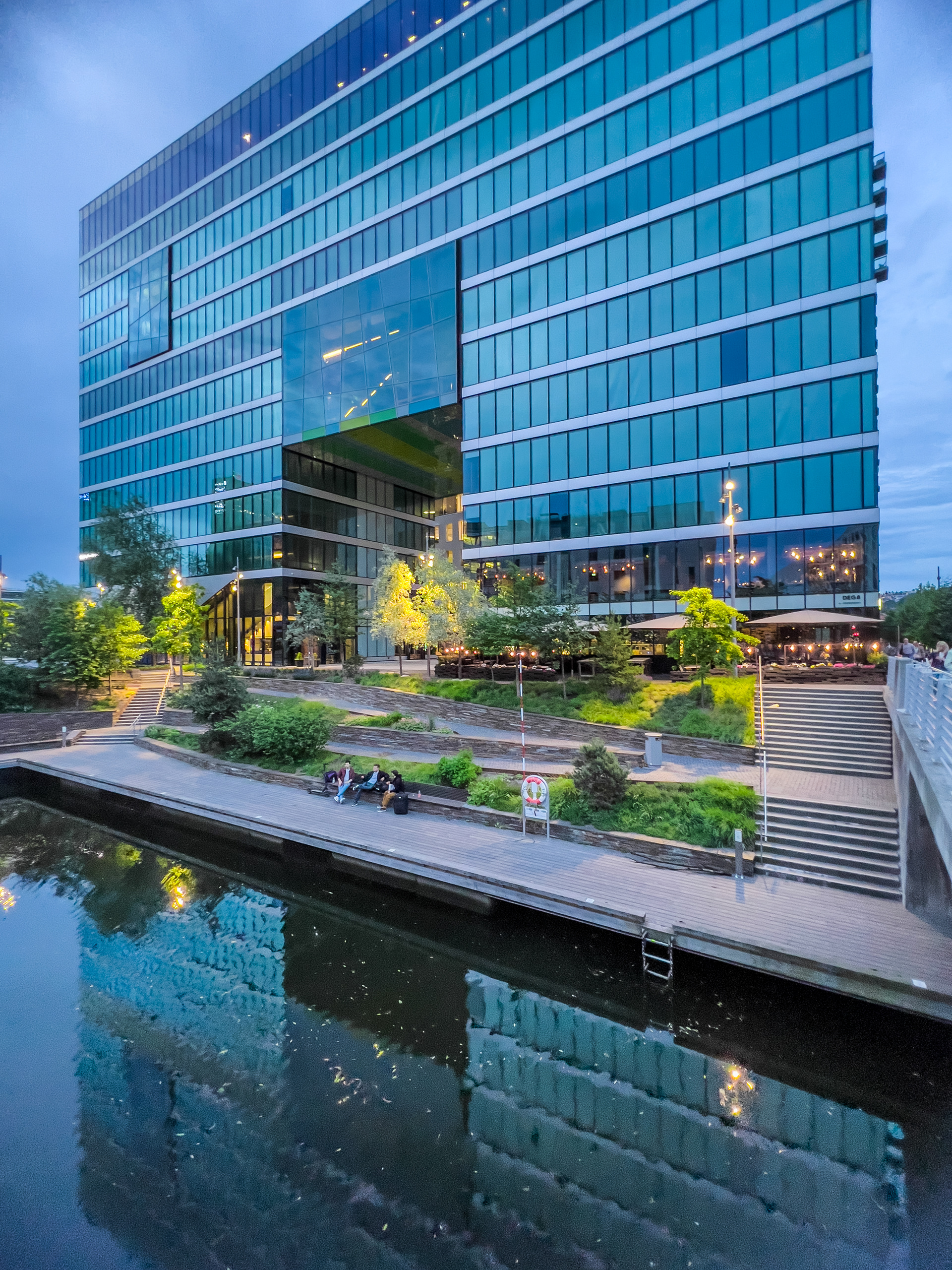
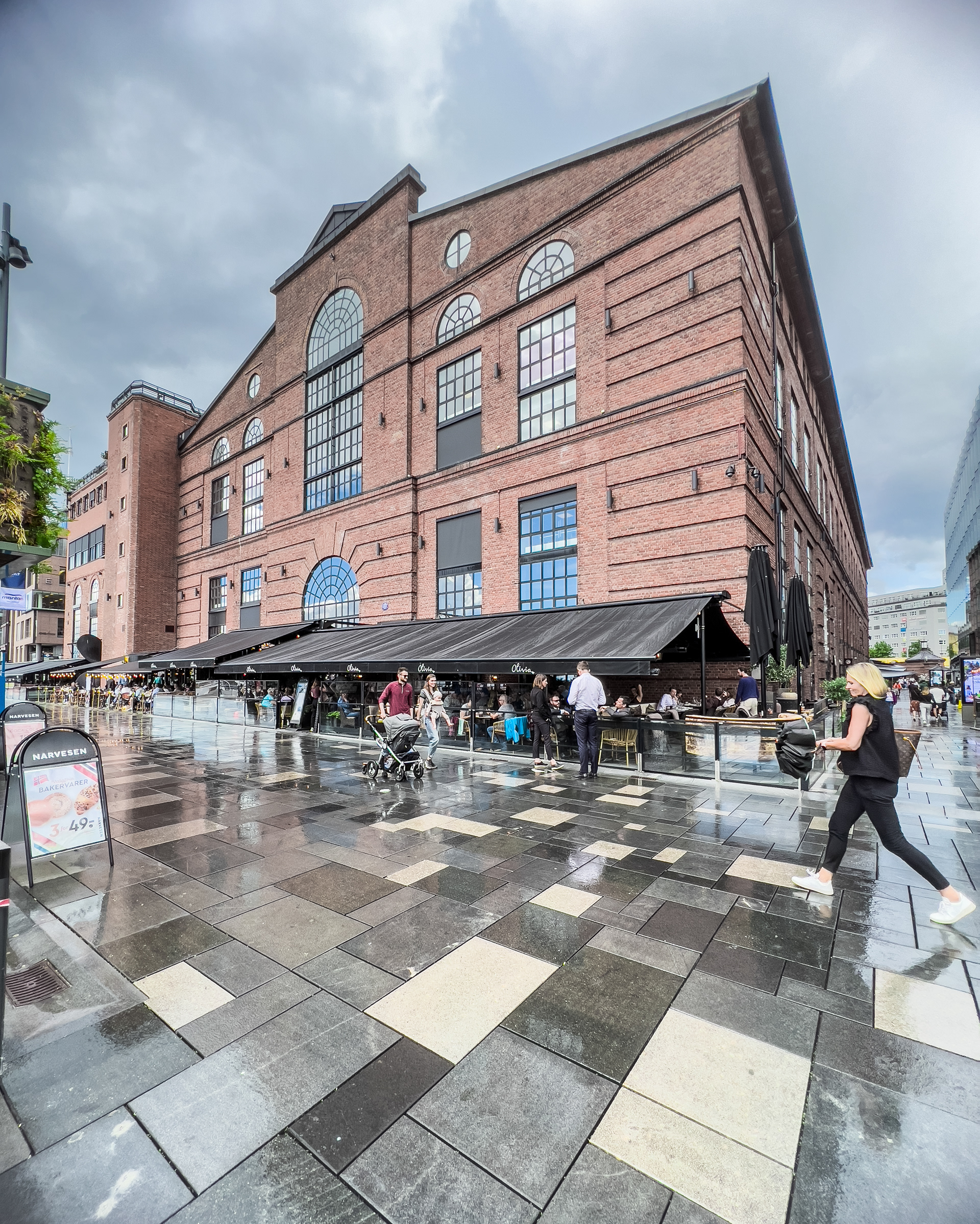
Oslo is the blossoming capital of Norway. I really liked the contrast of old and modern here as well. The Operakvarteret and Tjuvholmen districts are great examples of modern urban planning and a pleasure to wander around. We stayed in a hotel somewhere on the outskirts but there was a great tram connection that easily brought us into the city. There also seems to be an interesting food scene. On the first night we grabbed something to eat in some kind of food hall with all types of different stands. We really enjoyed our time in Oslo, I think 1.5 days was quite sufficient if you're not planning to tour any museums etc.
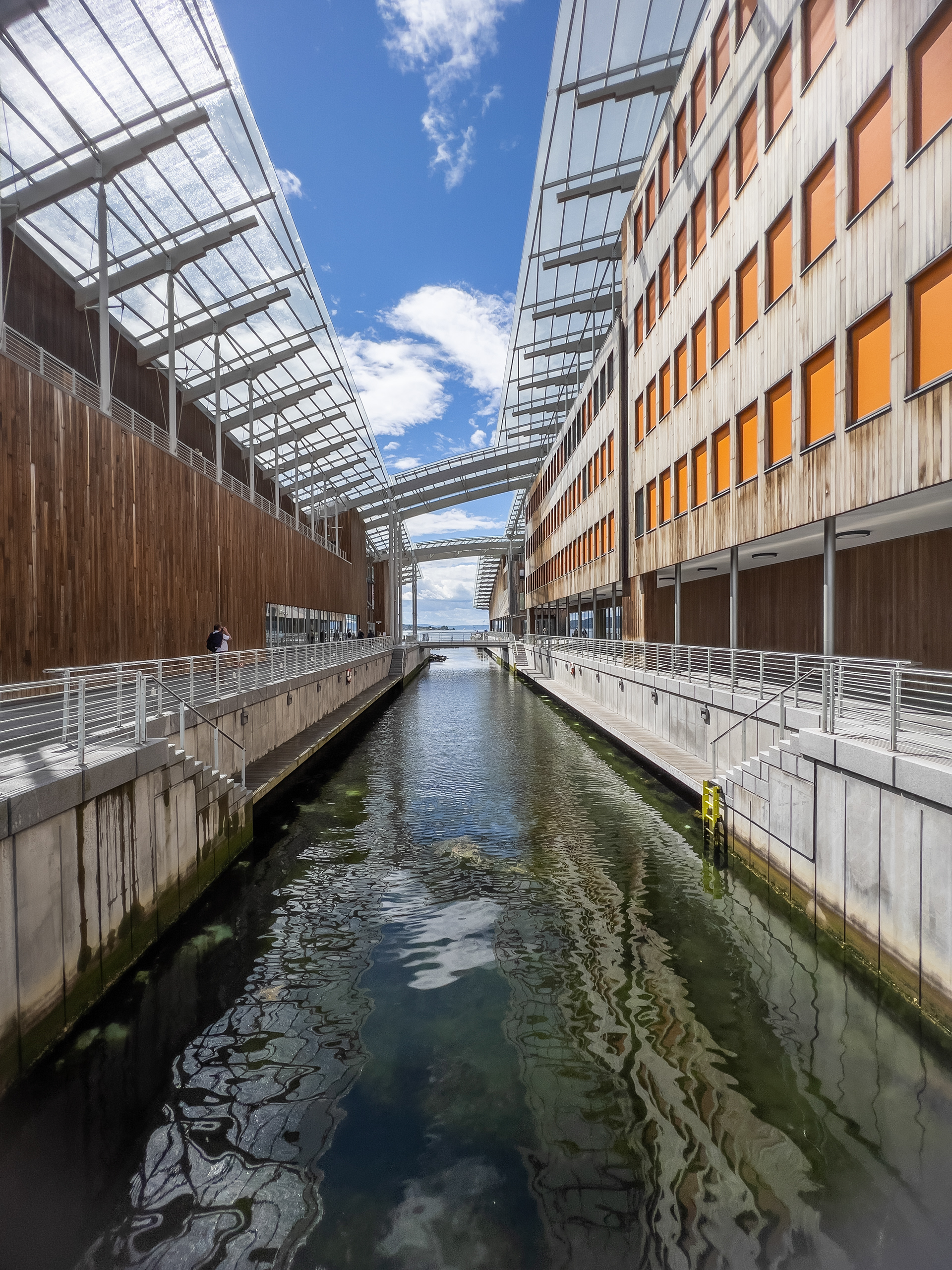
Operahuset
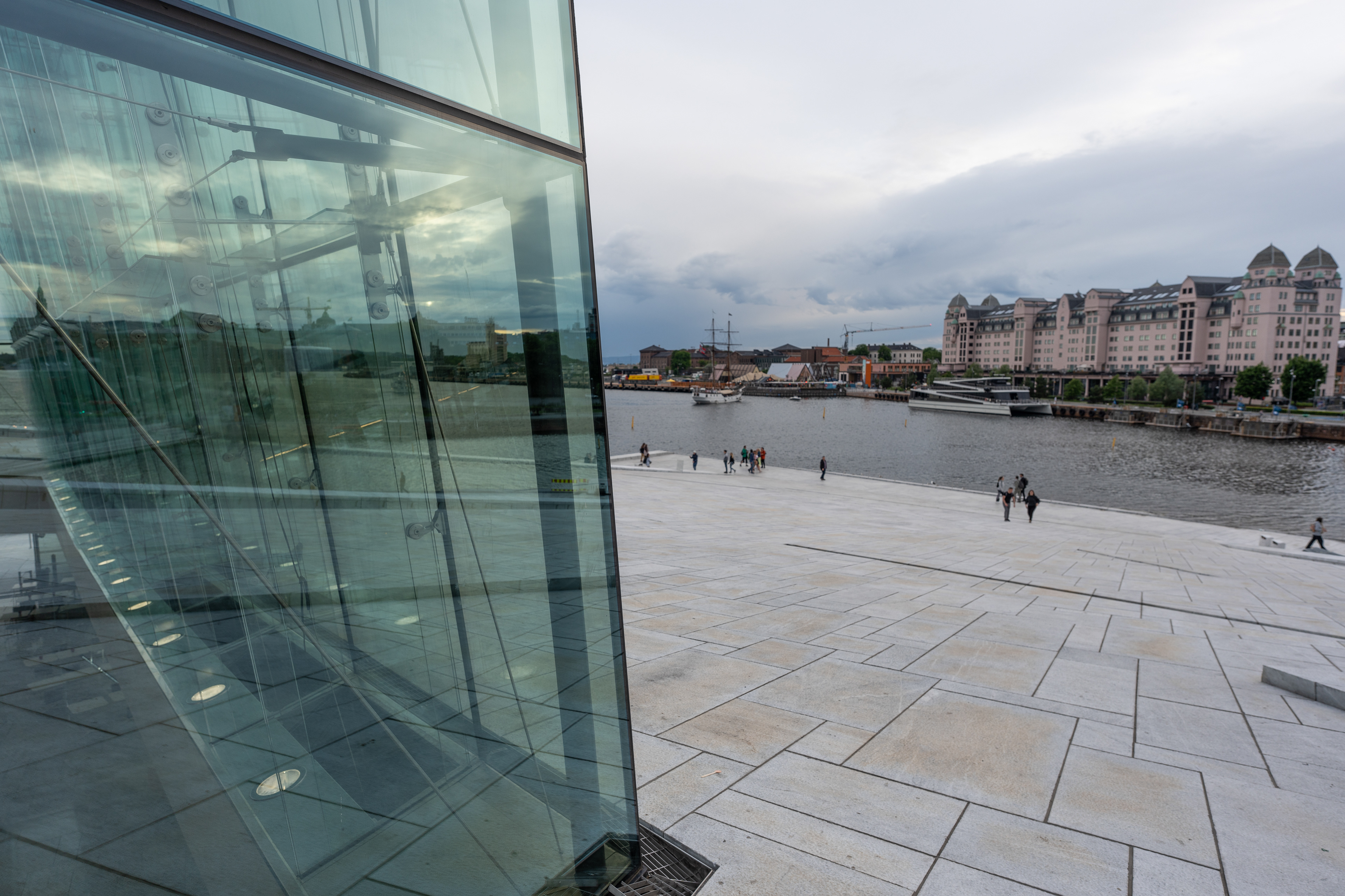
Operahuset
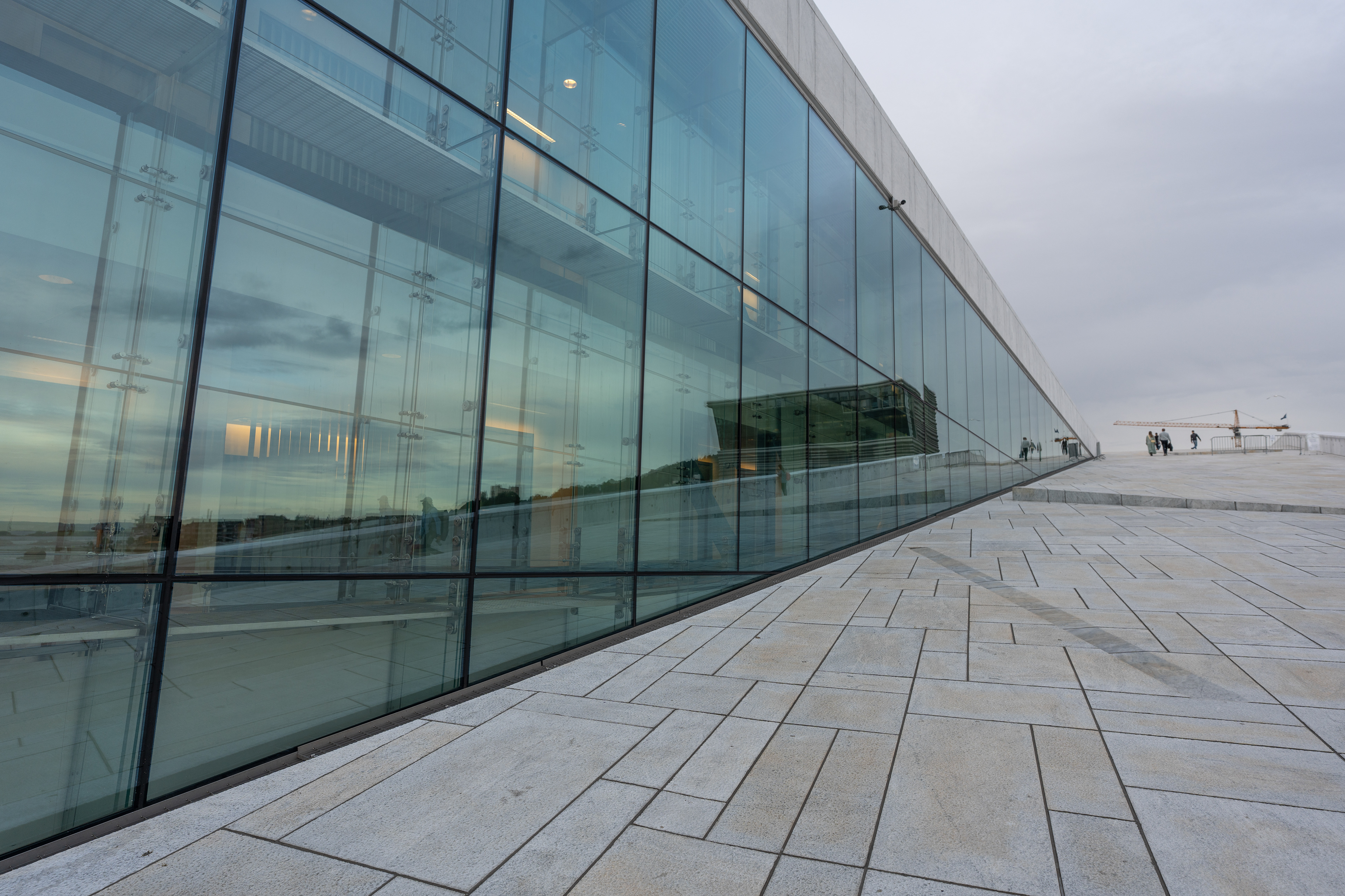
Operahuset
Operahuset view
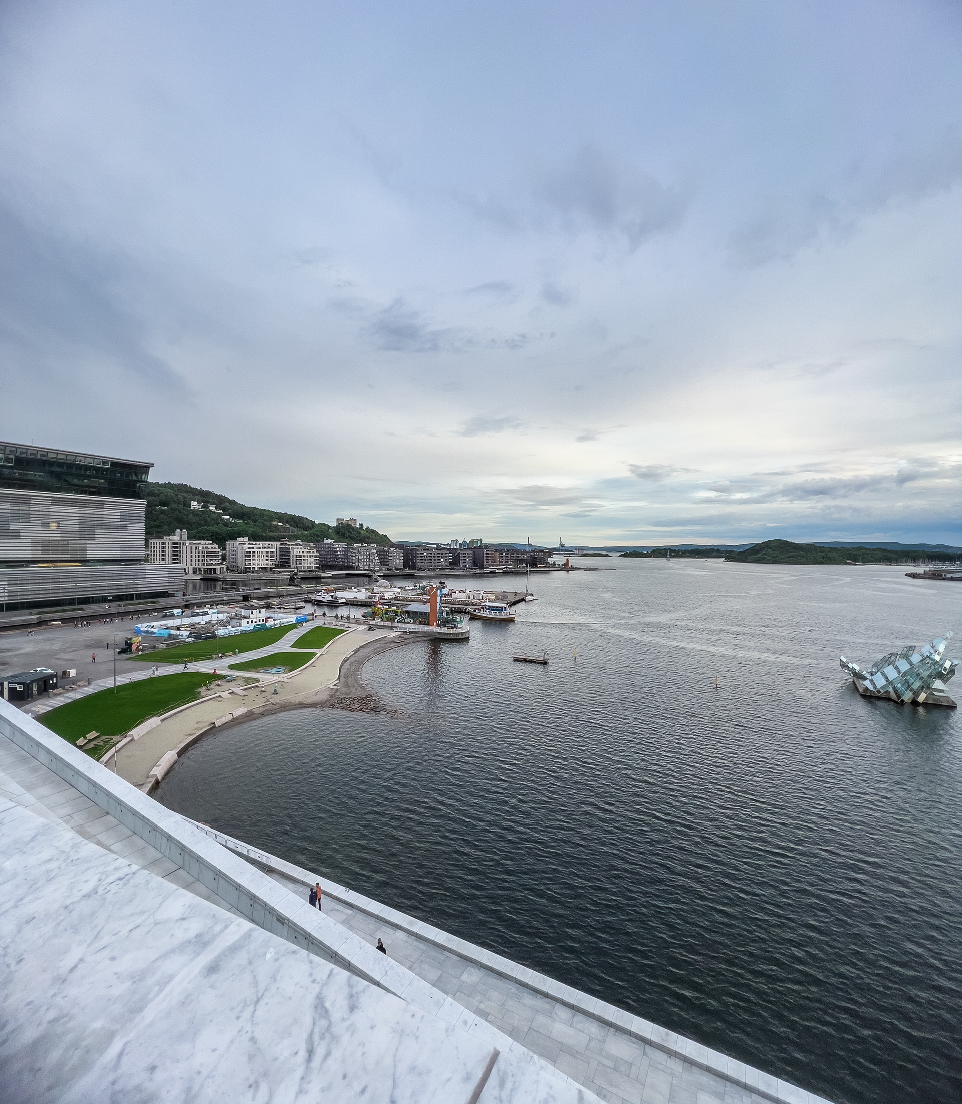
Operahuset view
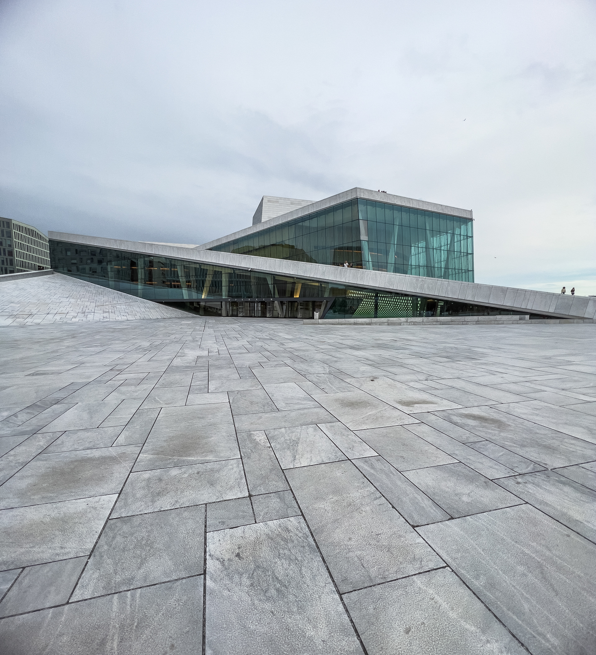
Operahuset
Oslo
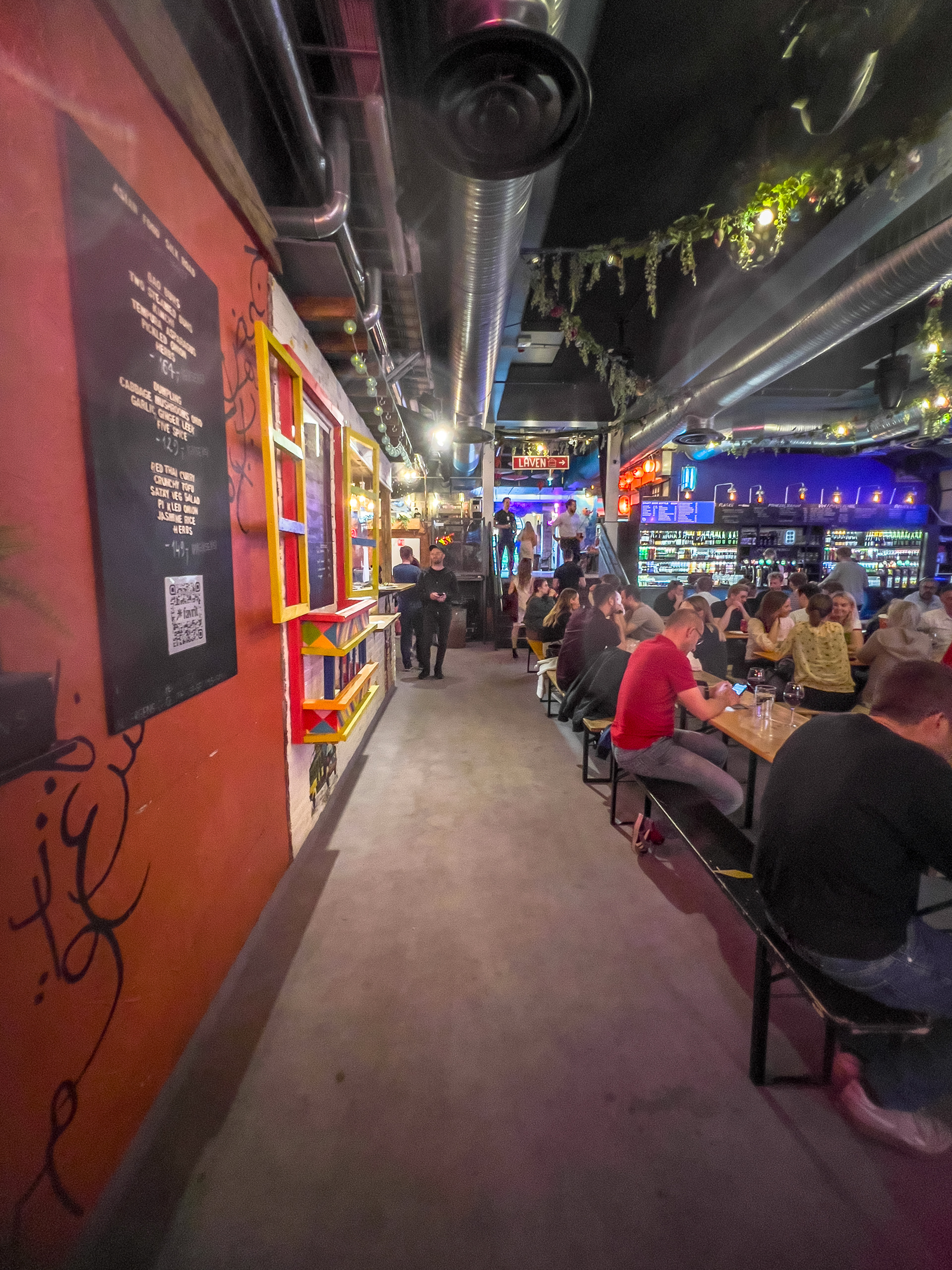
Oslo Food Hall
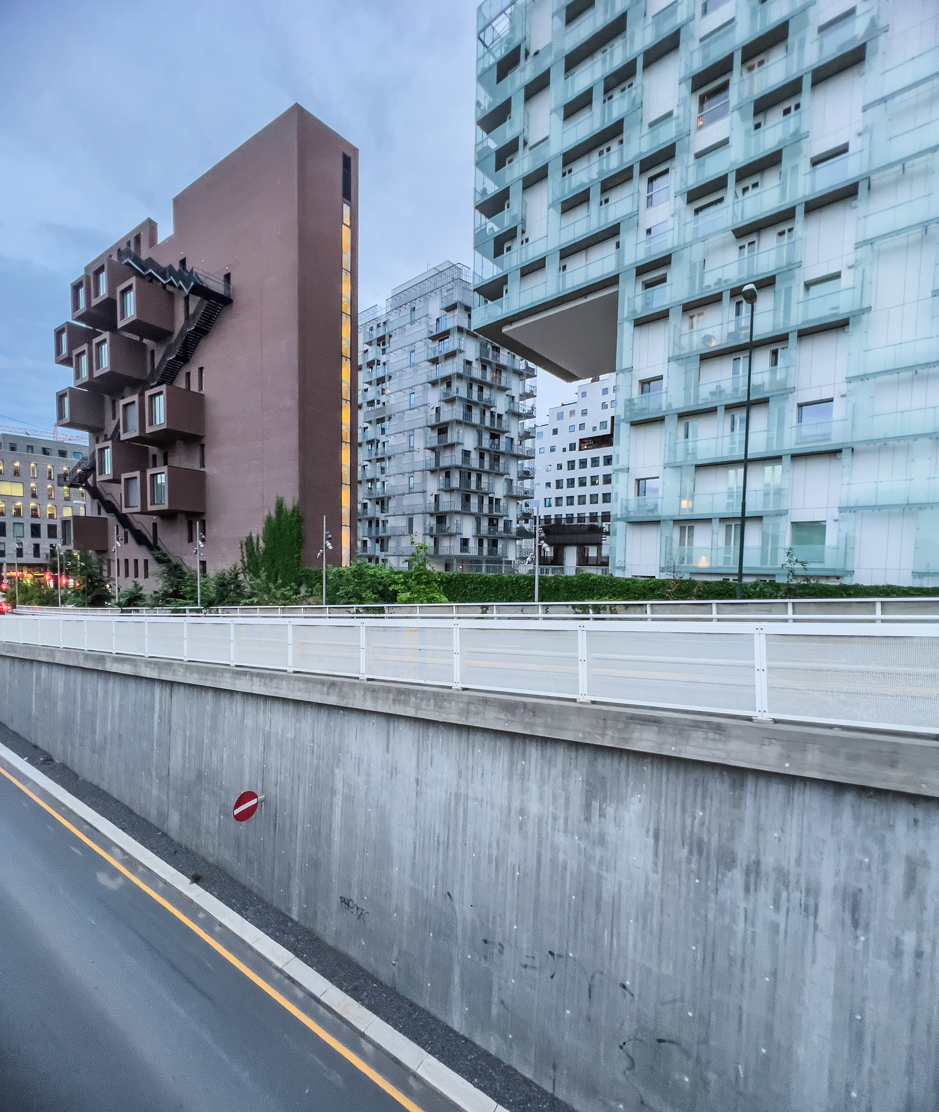
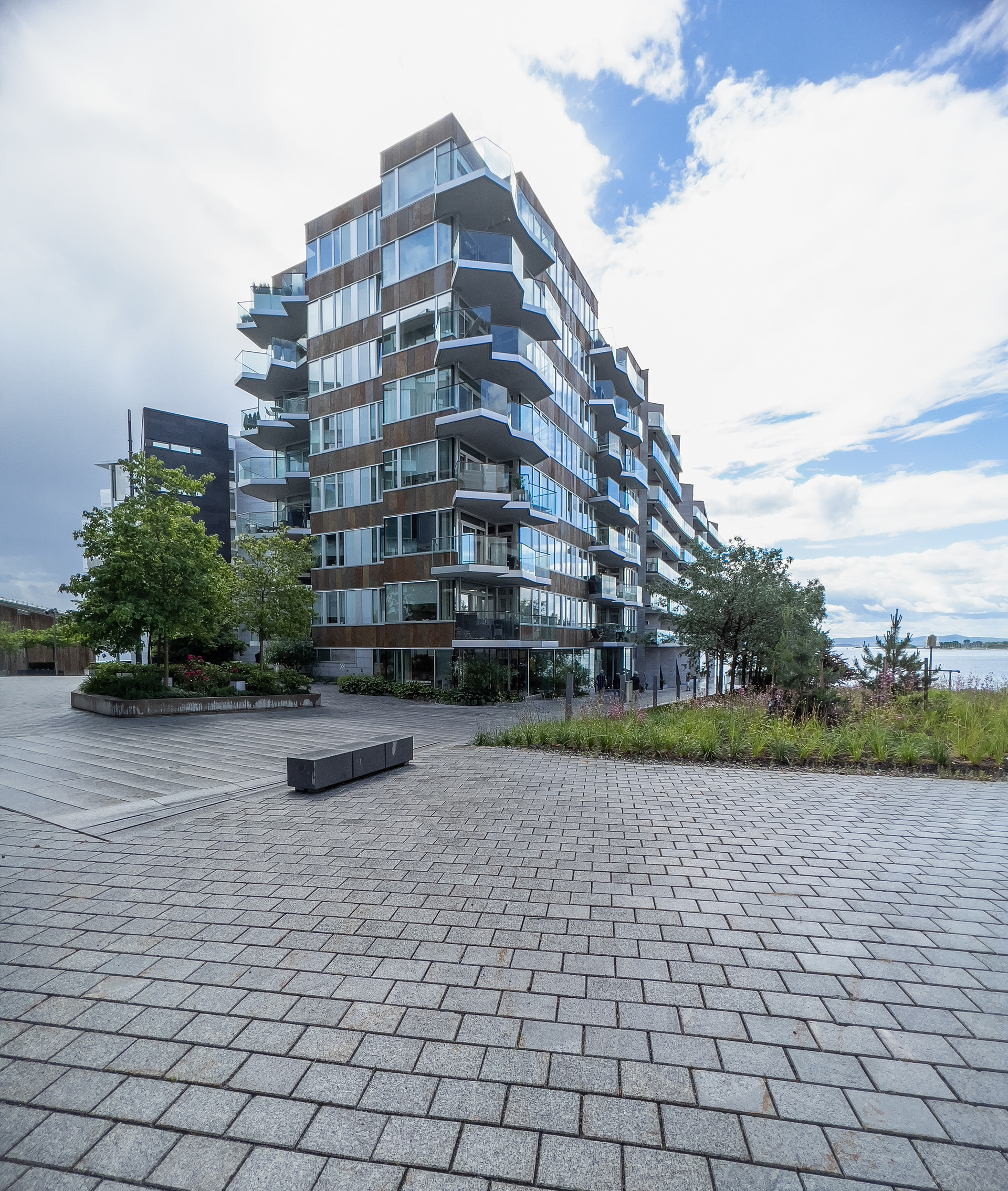
Operakvarteret
Oslo
Operakvarteret
Operakvarteret
Operakvarteret
Operakvarteret
Aker Brygge
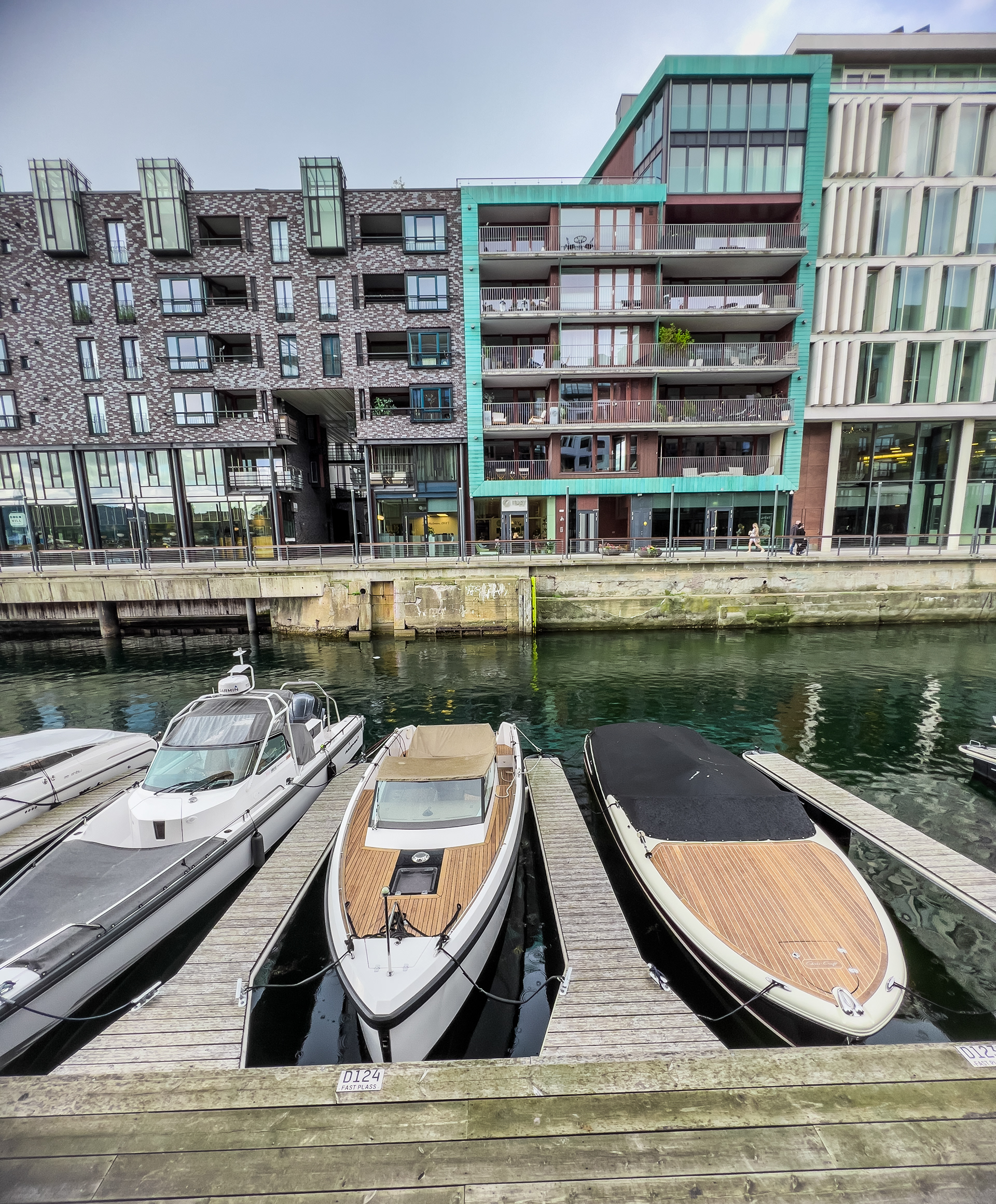
Tjuvholmen
Tjuvholmen
Tjuvholmen
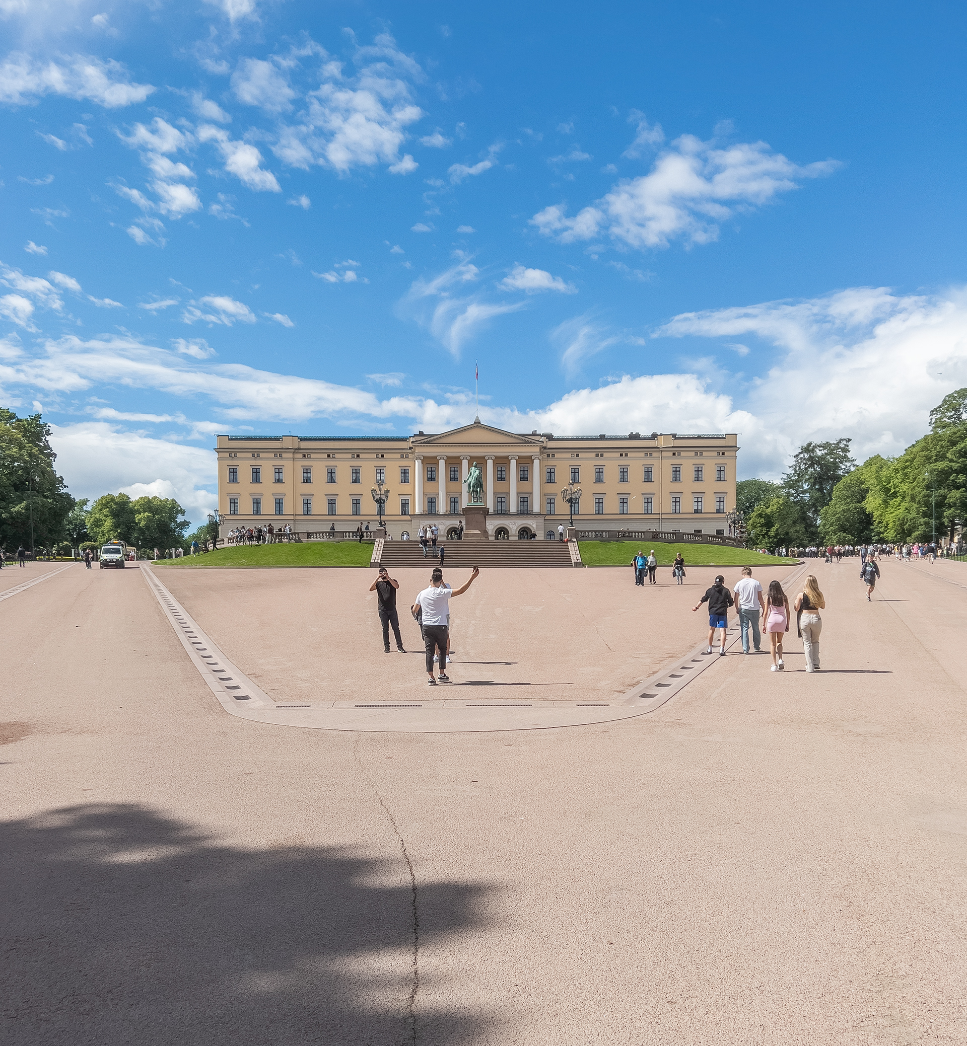
Oslo Palace
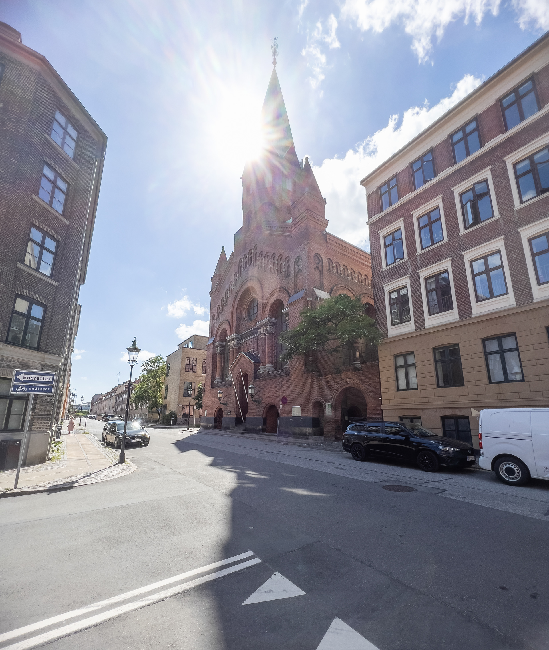
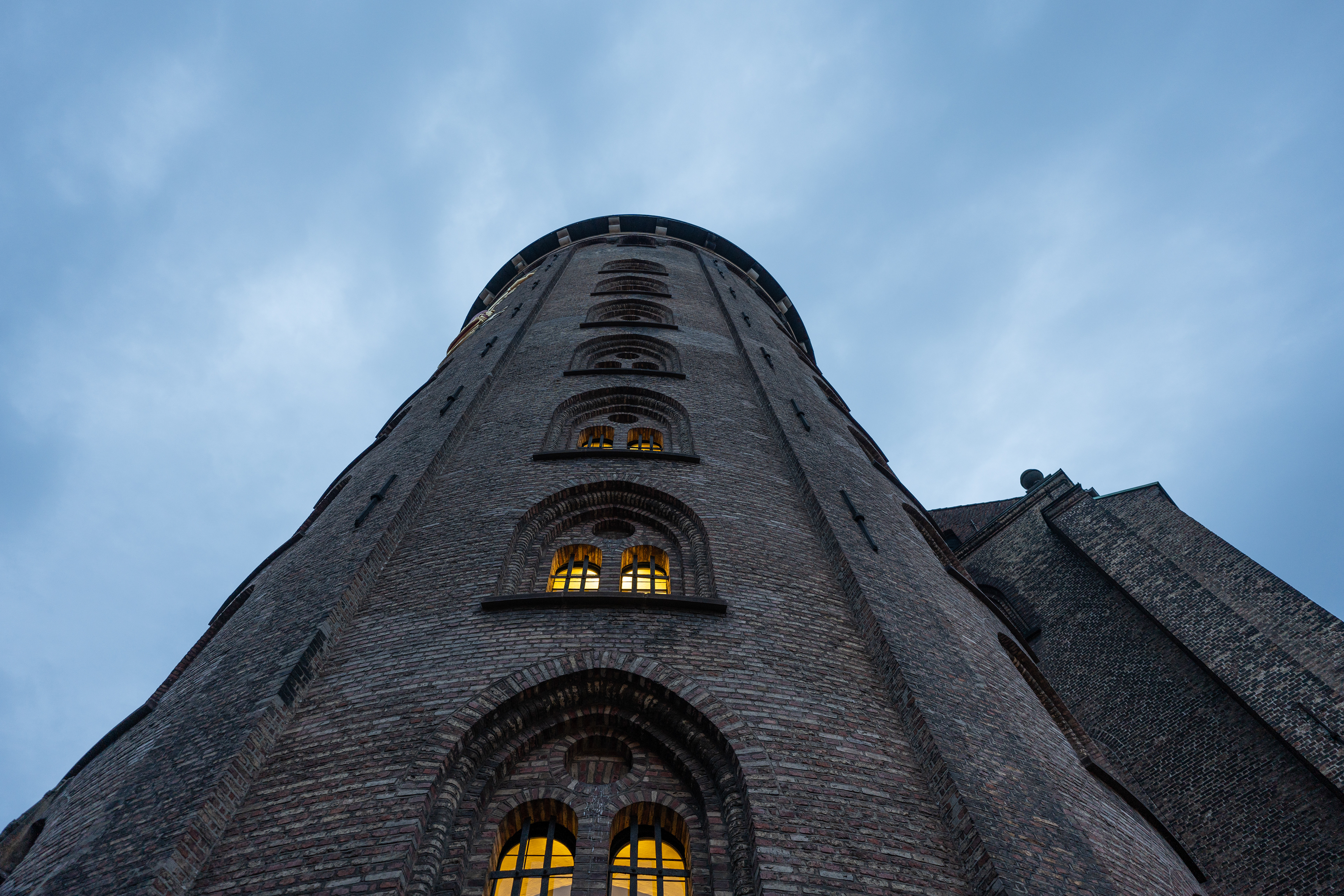
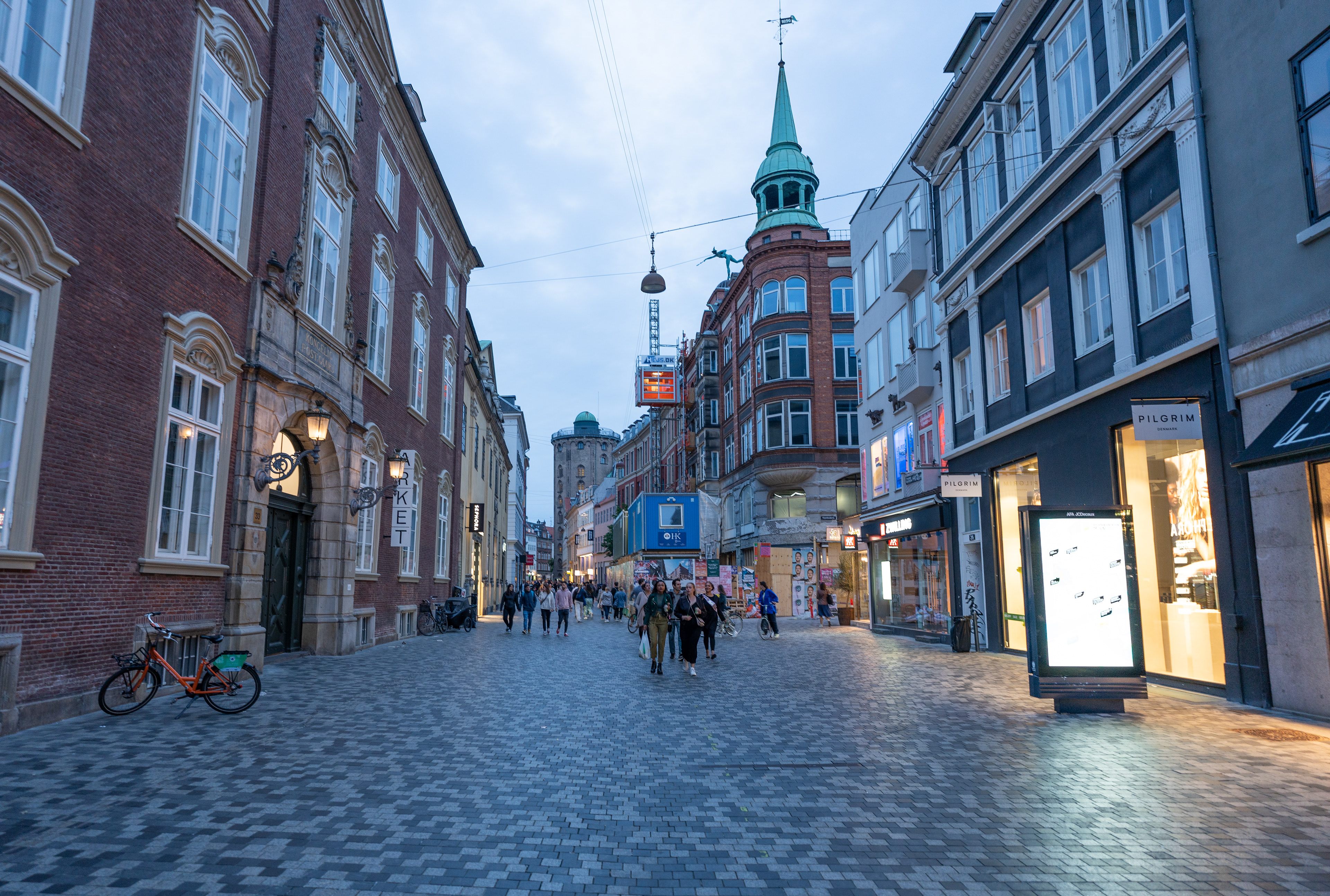
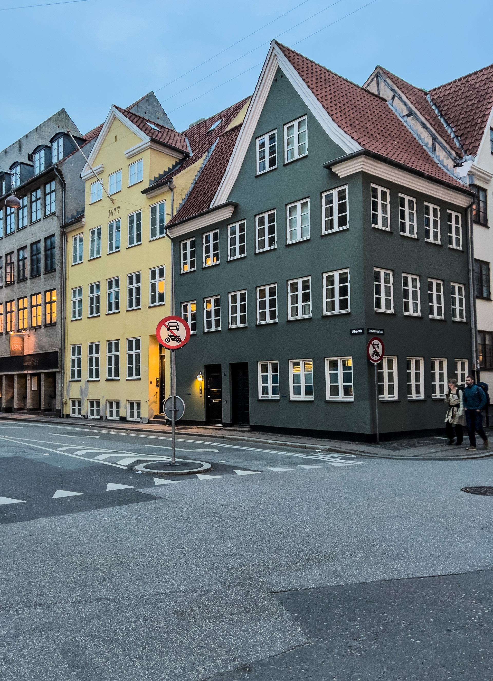
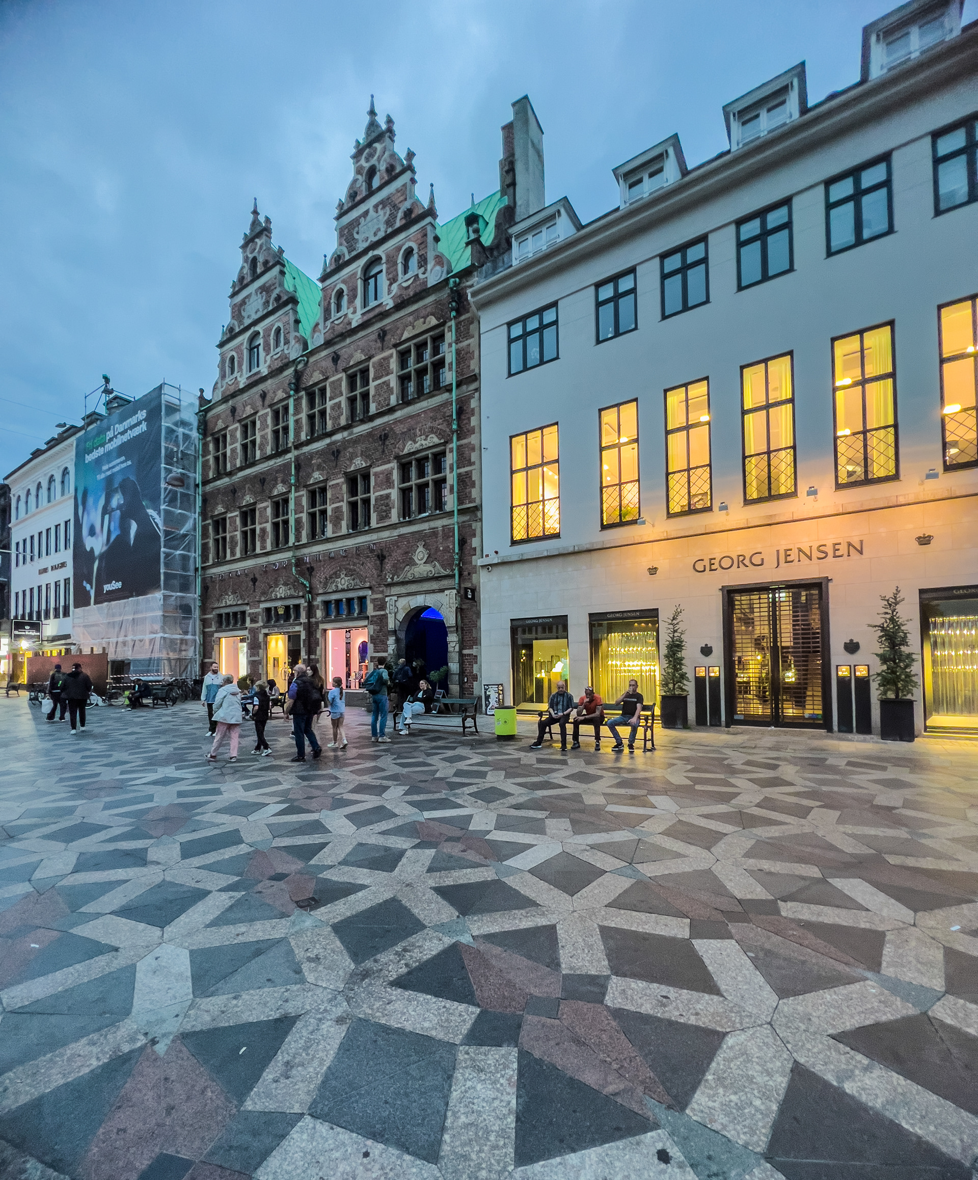
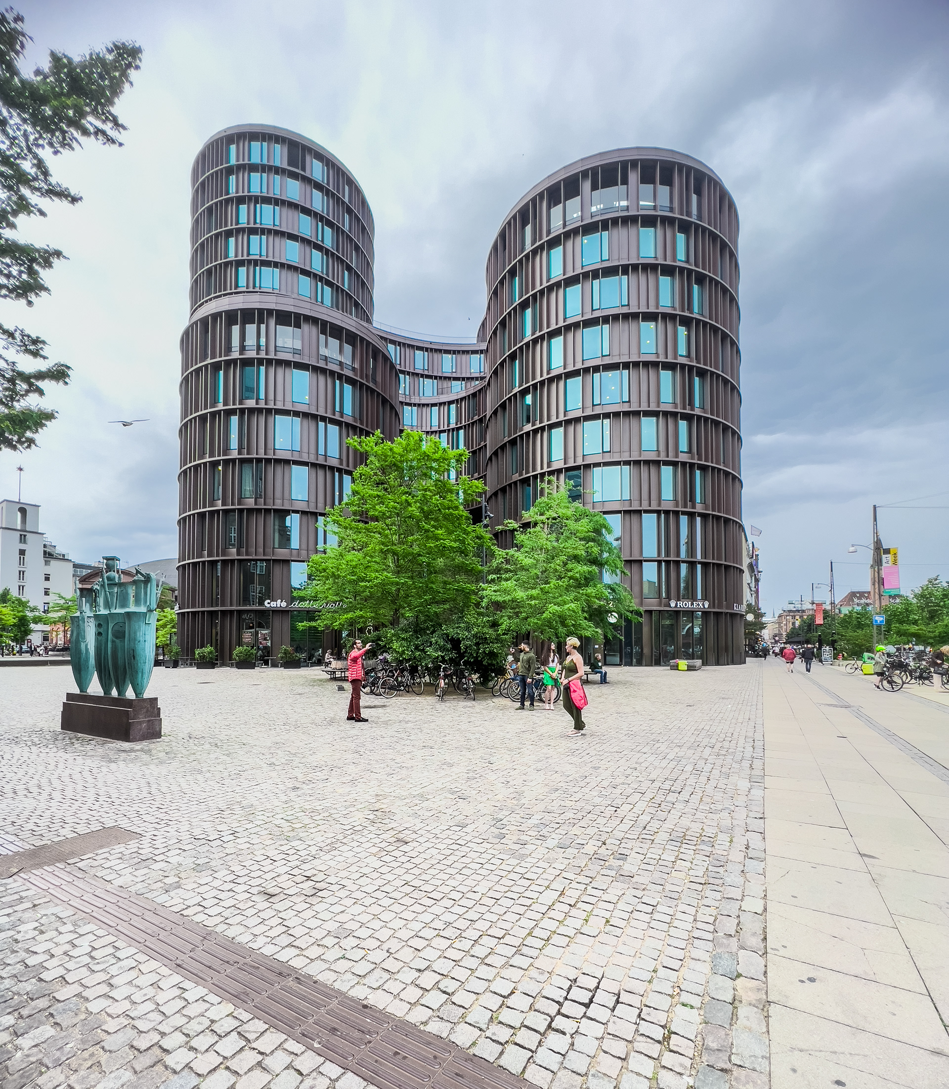
Copenhagen
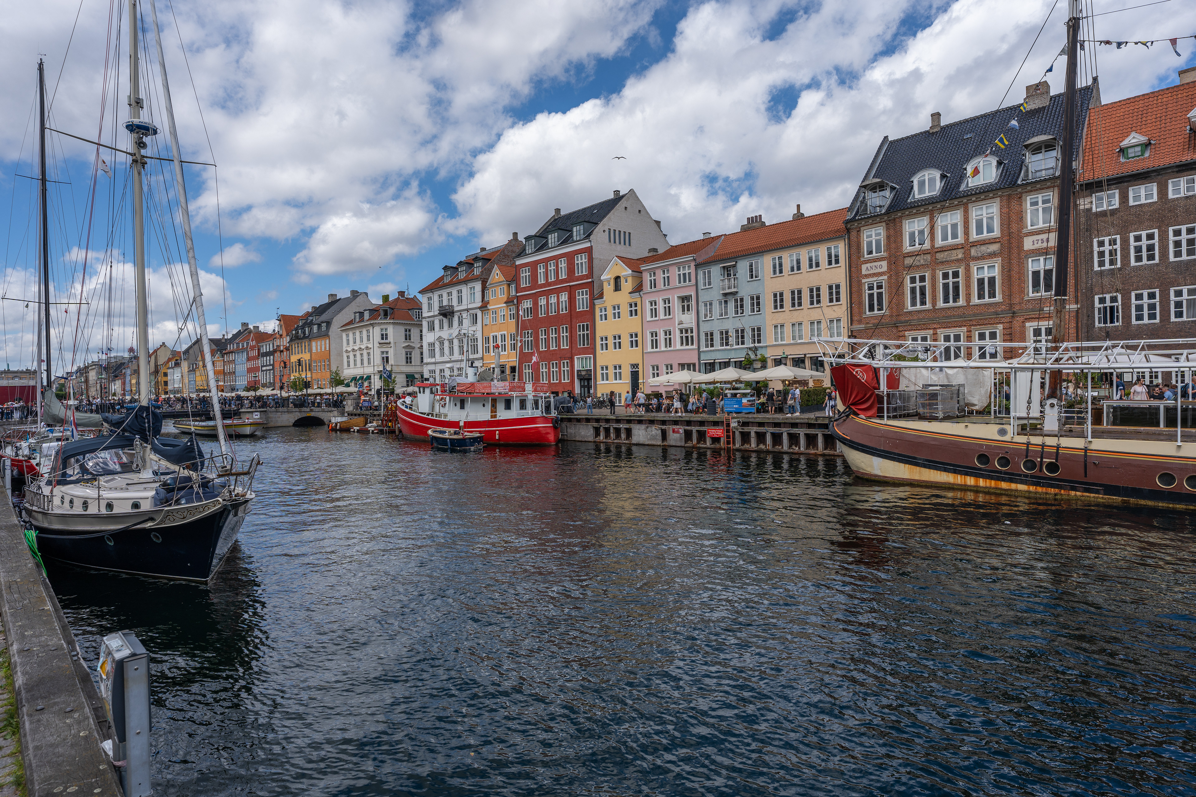
Copenhagen's Nyhavn district
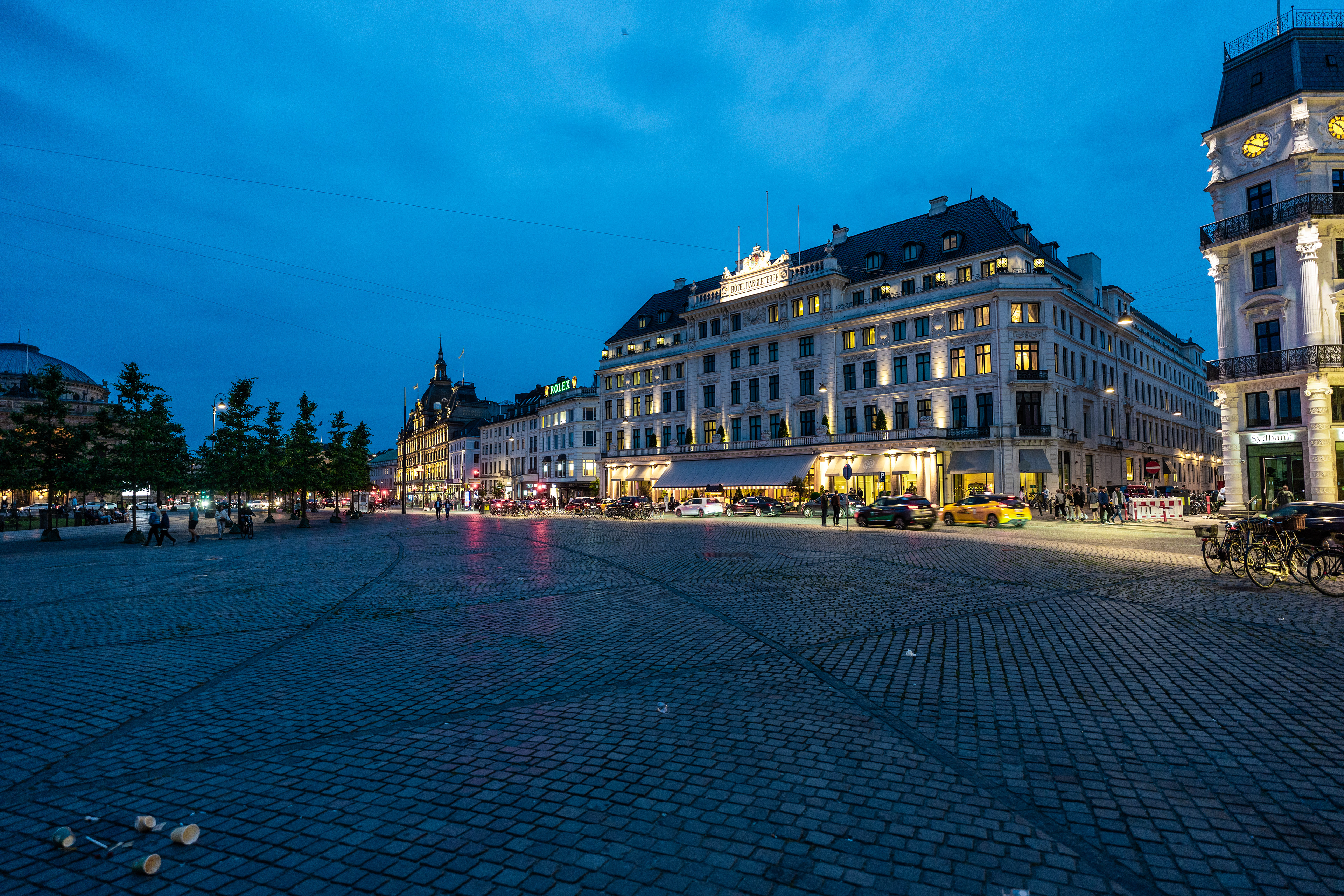
This was my first time visiting Denmark and we figured our time would be best spent seeing something of the capital. I had heard good things about it and it didn't disappoint. For us it was a mix between a stop-over and a citytrip, knowing that we had to drive home to southern Germany in one leg from here. It was therefore quite an exhausting weekend but we did see a lot. From the strange Freetown Christiania to the many historic buildings in the city like the Rosenborg Slot. We walked a lot and had nice sunny weather along with it. So much so, that we ended up getting a sunstroke. Not great having to still drive over a 1.000 kilometers home... But we managed and looked back at a great weekend in Copenhagen nonetheless.
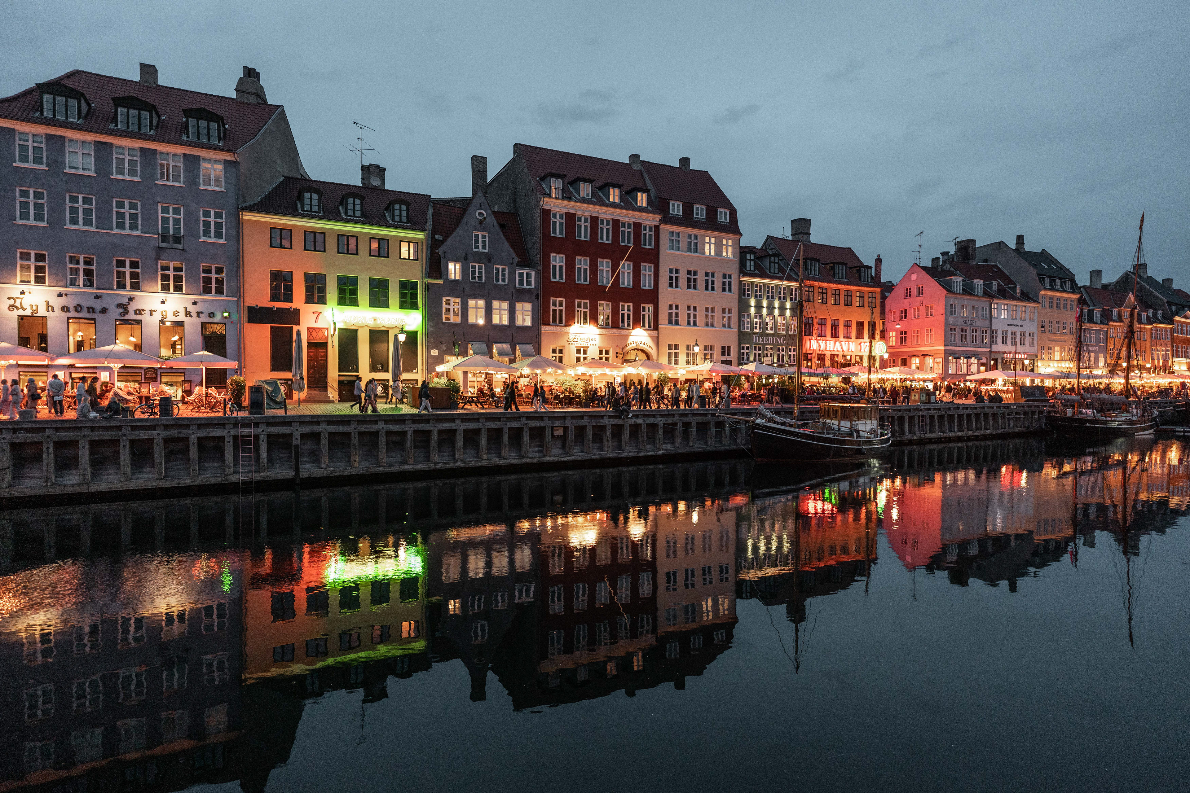
Nyhavn
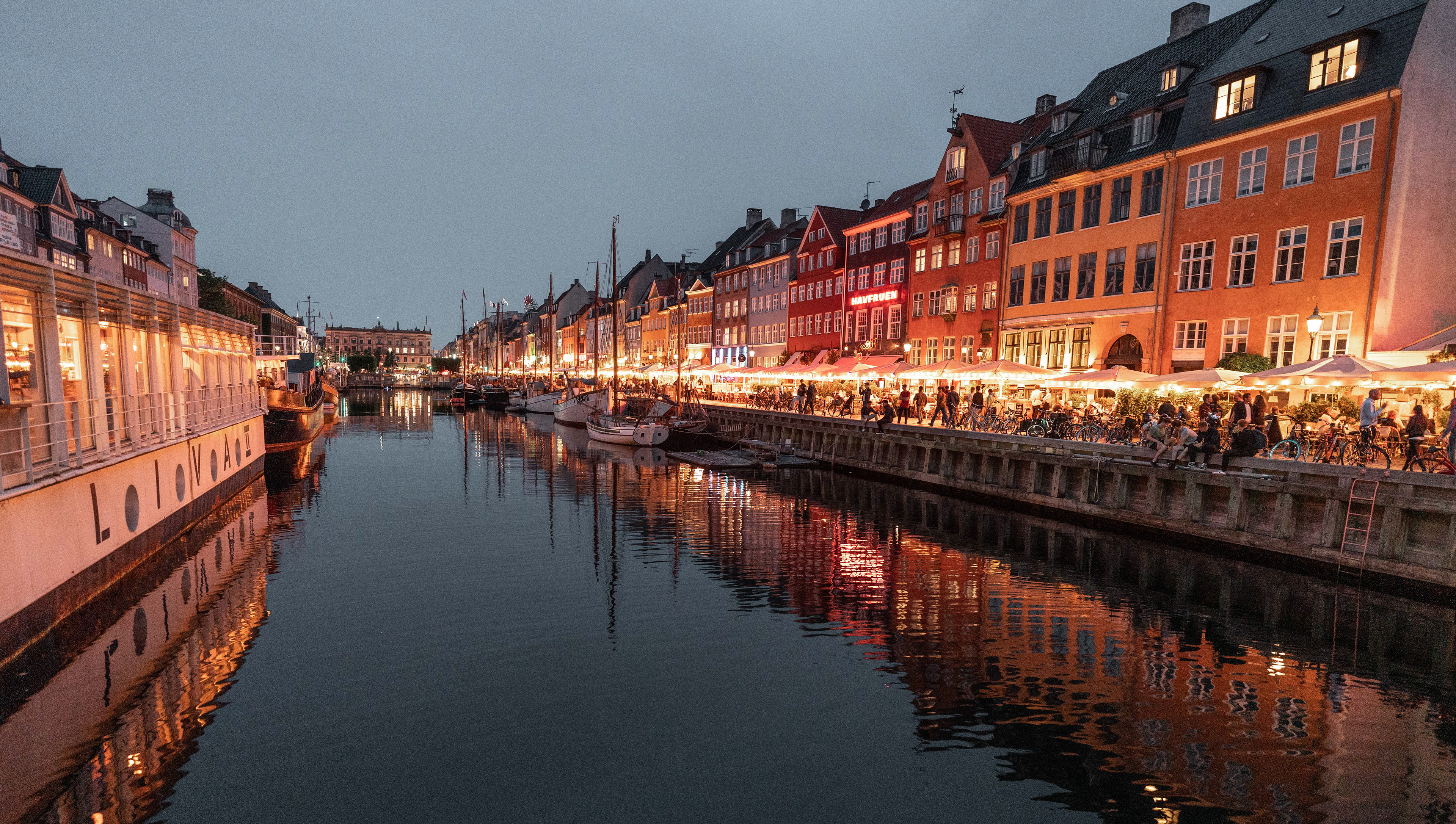
Nyhavn
Rosenborg Slot
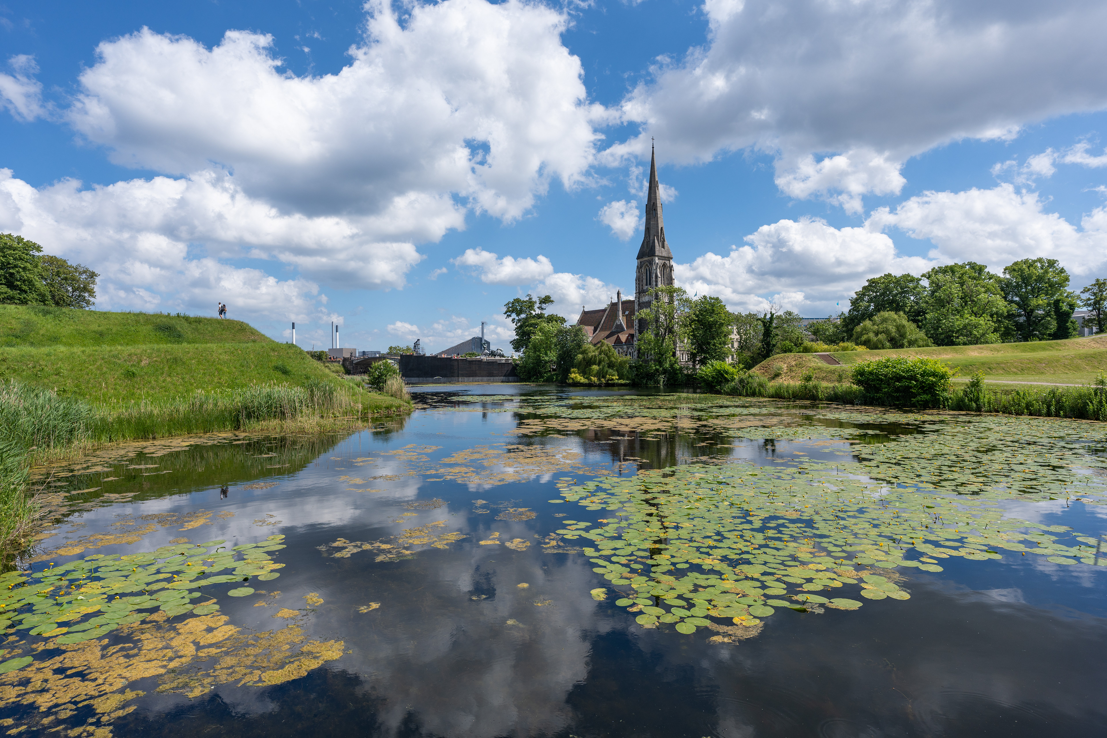
Frederiks Kirke
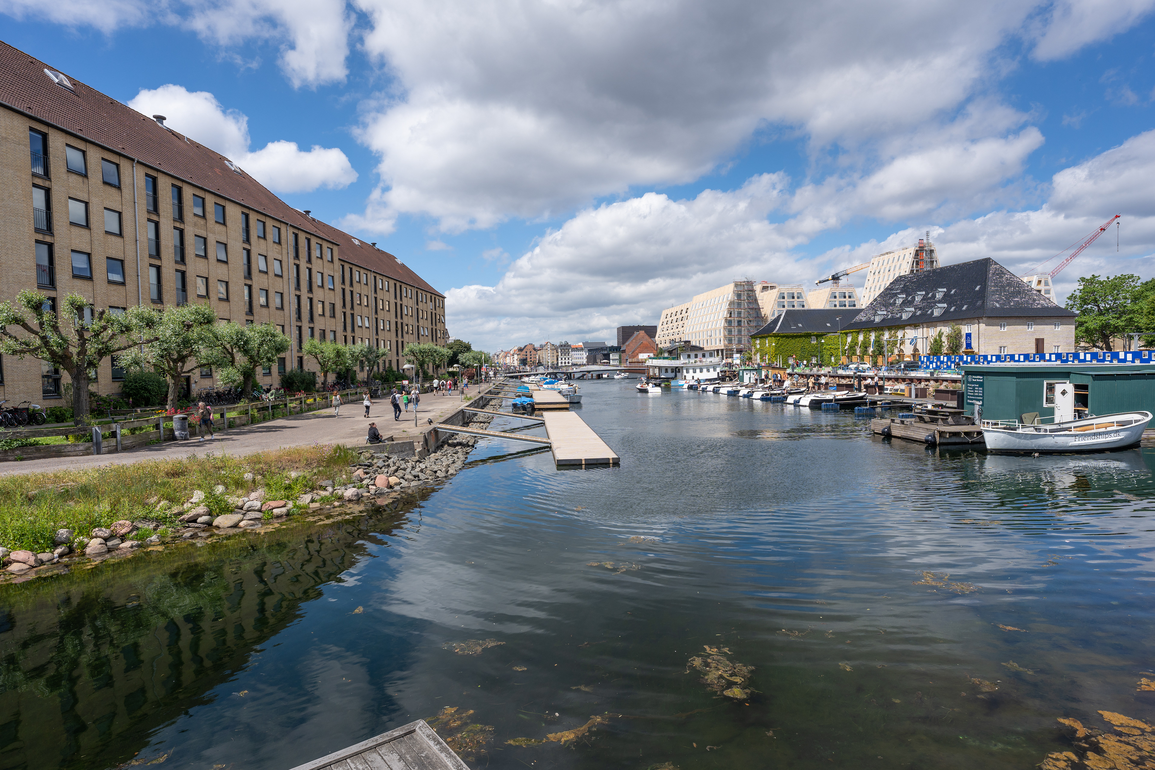
Christianshavn
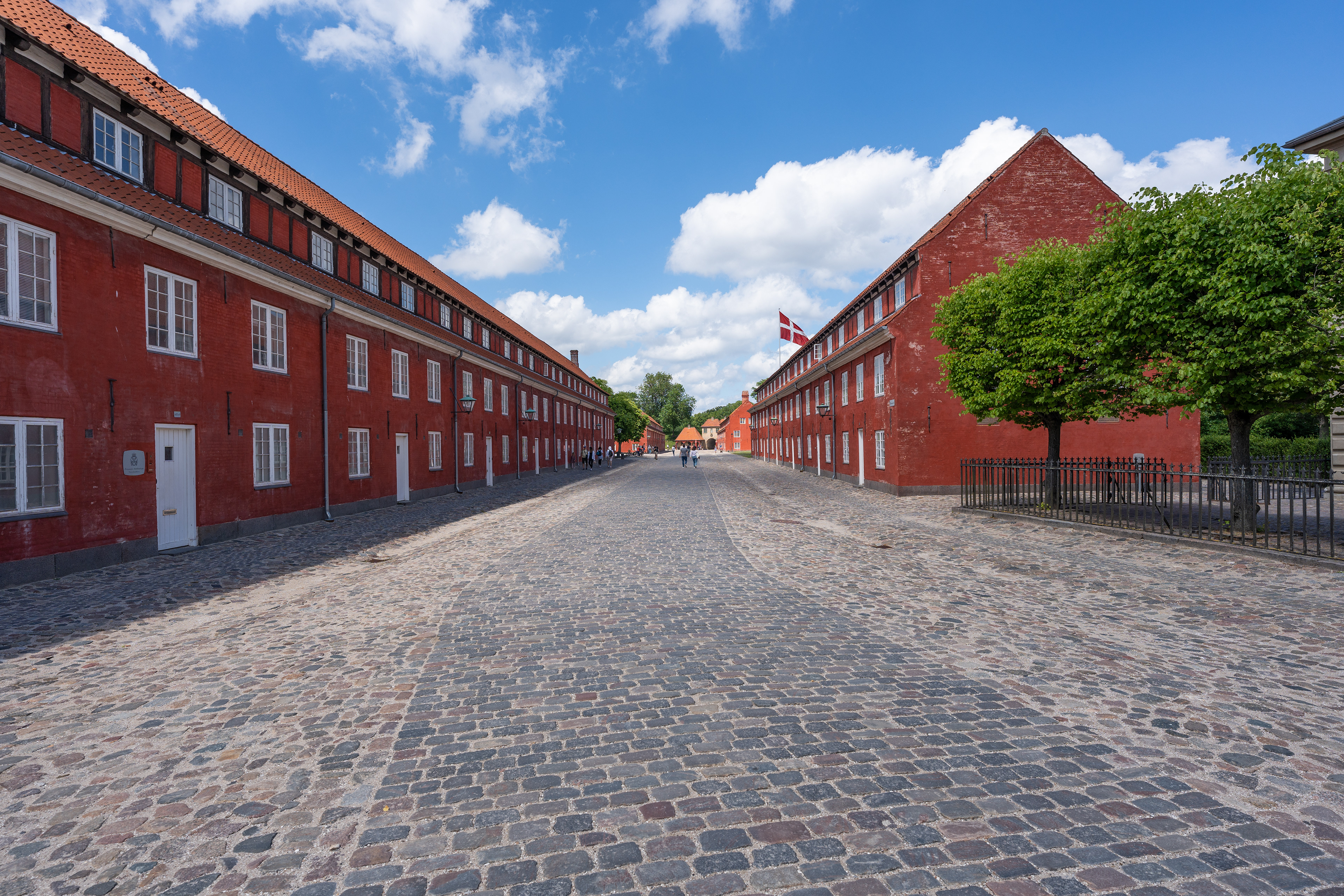
Kastellet
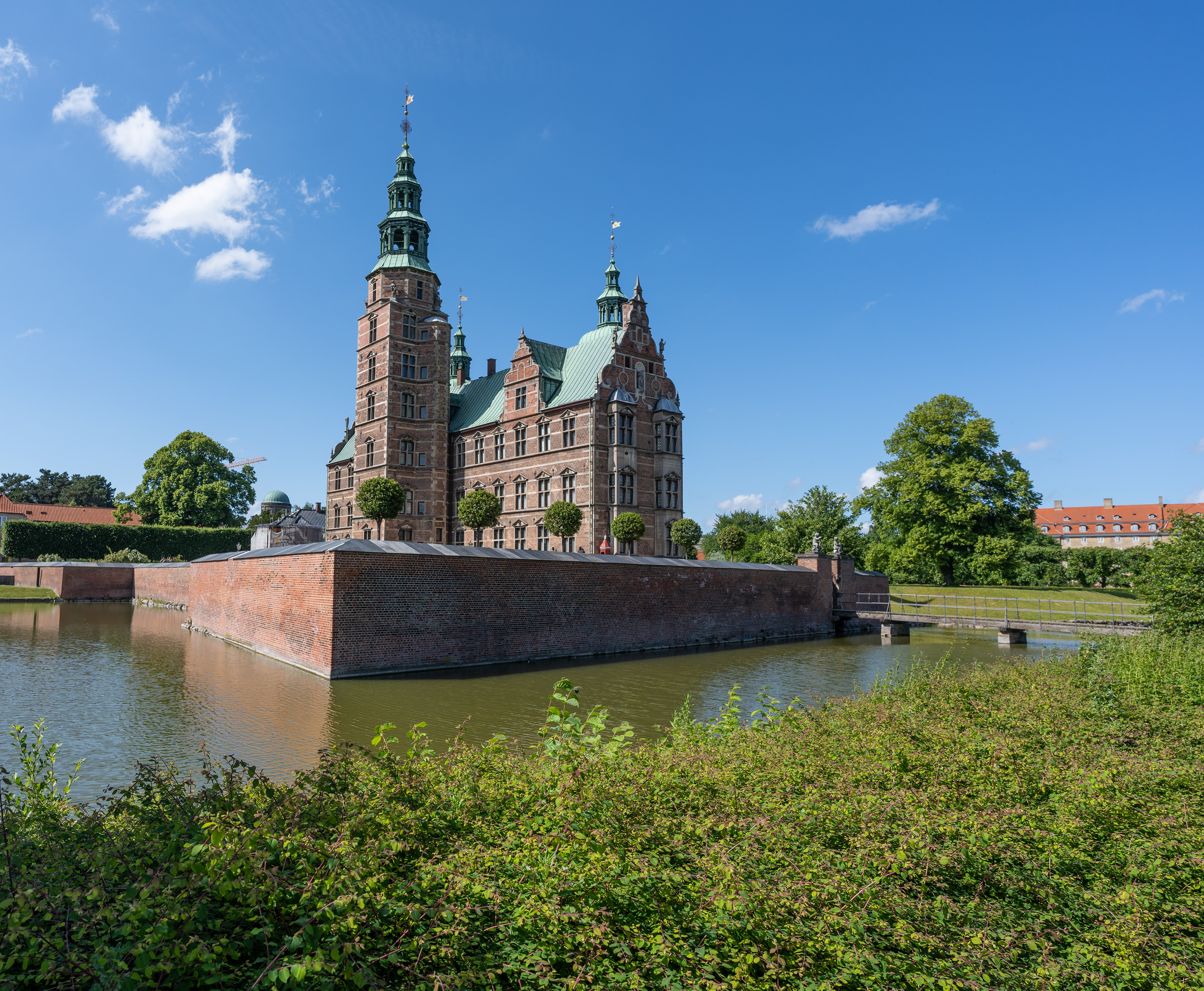
Rosenborg Slot
Copenhagen
Copenhagen
Copenhagen
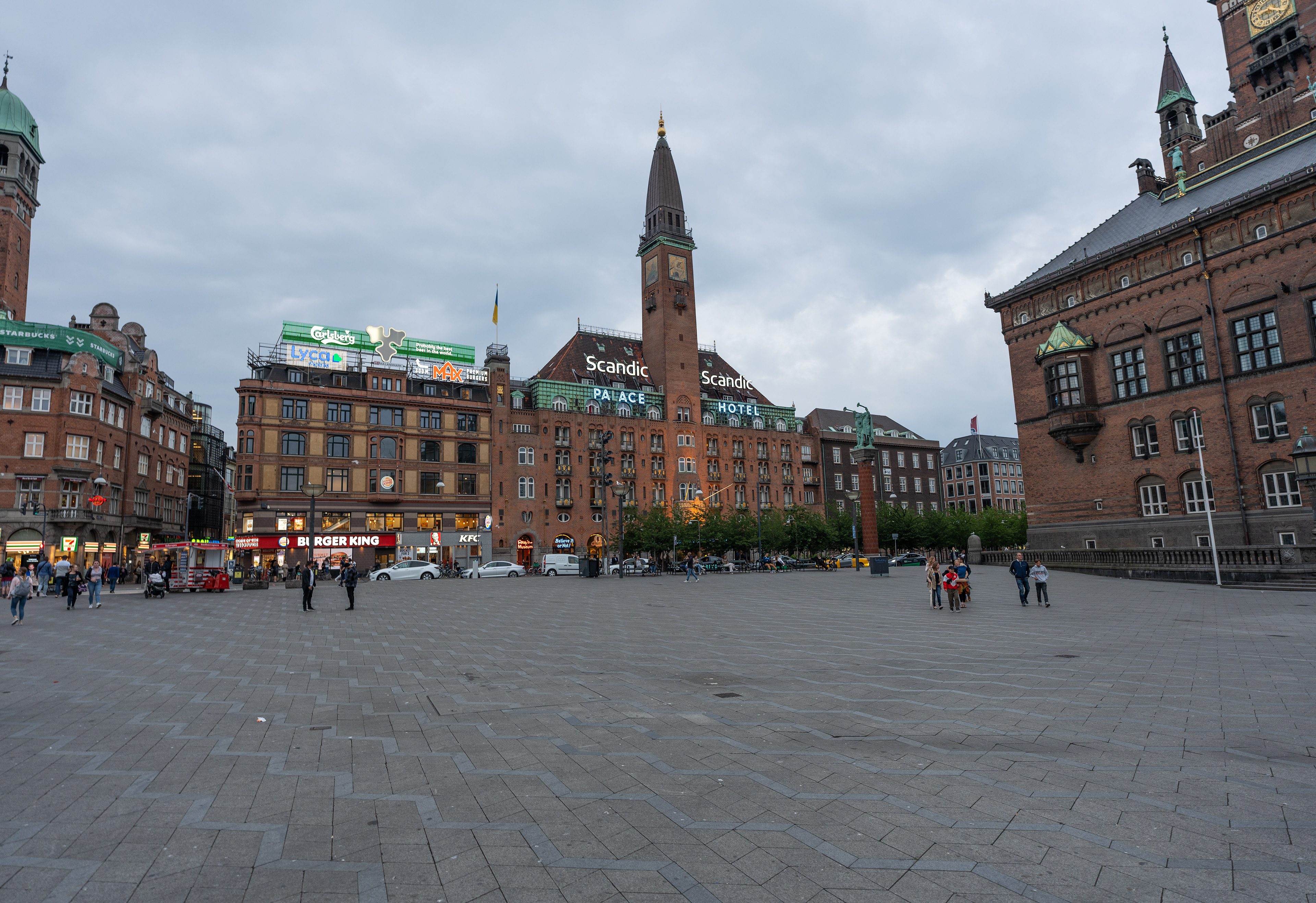
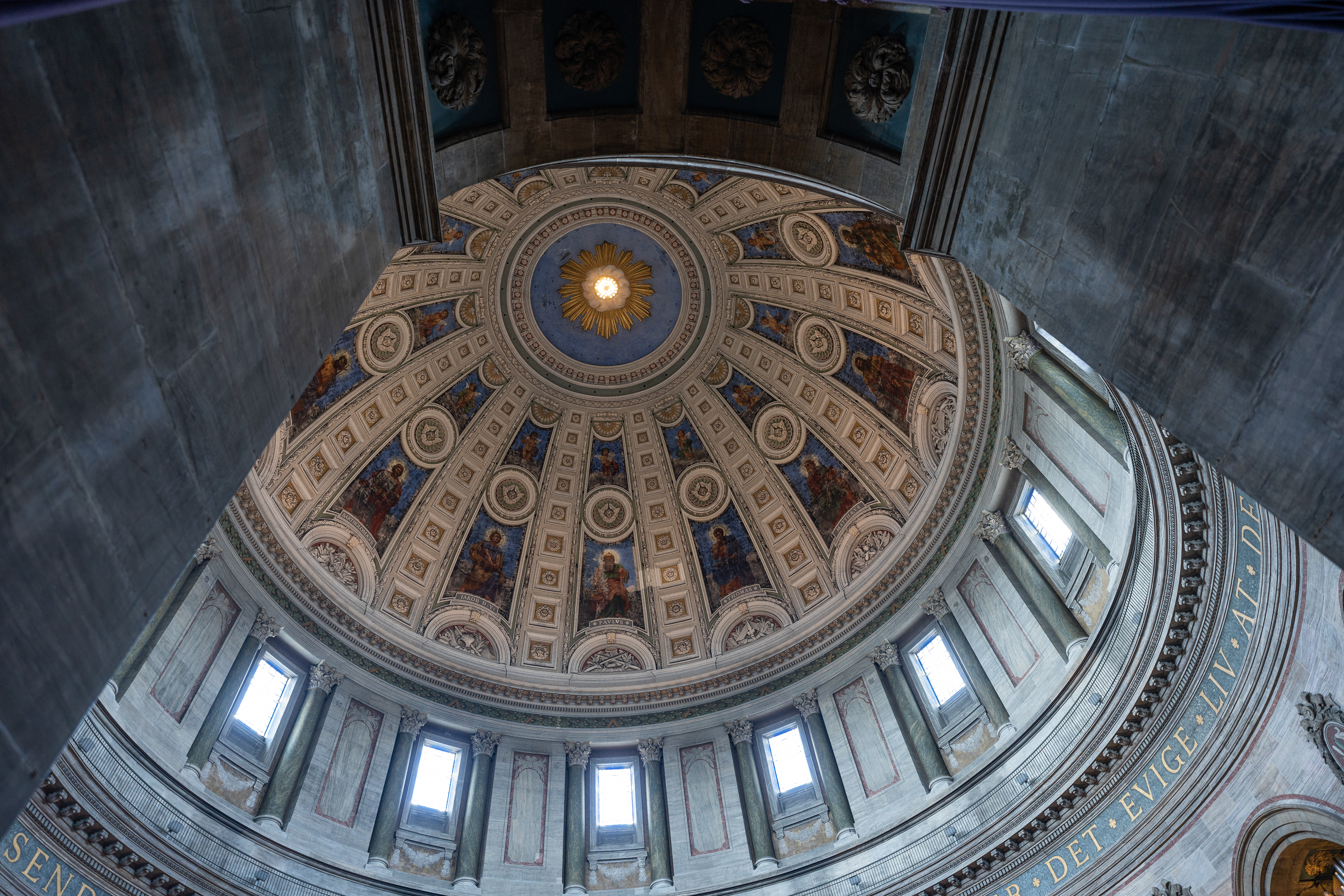
Rådhus
Copenhagen
Copenhagen
Copenhagen
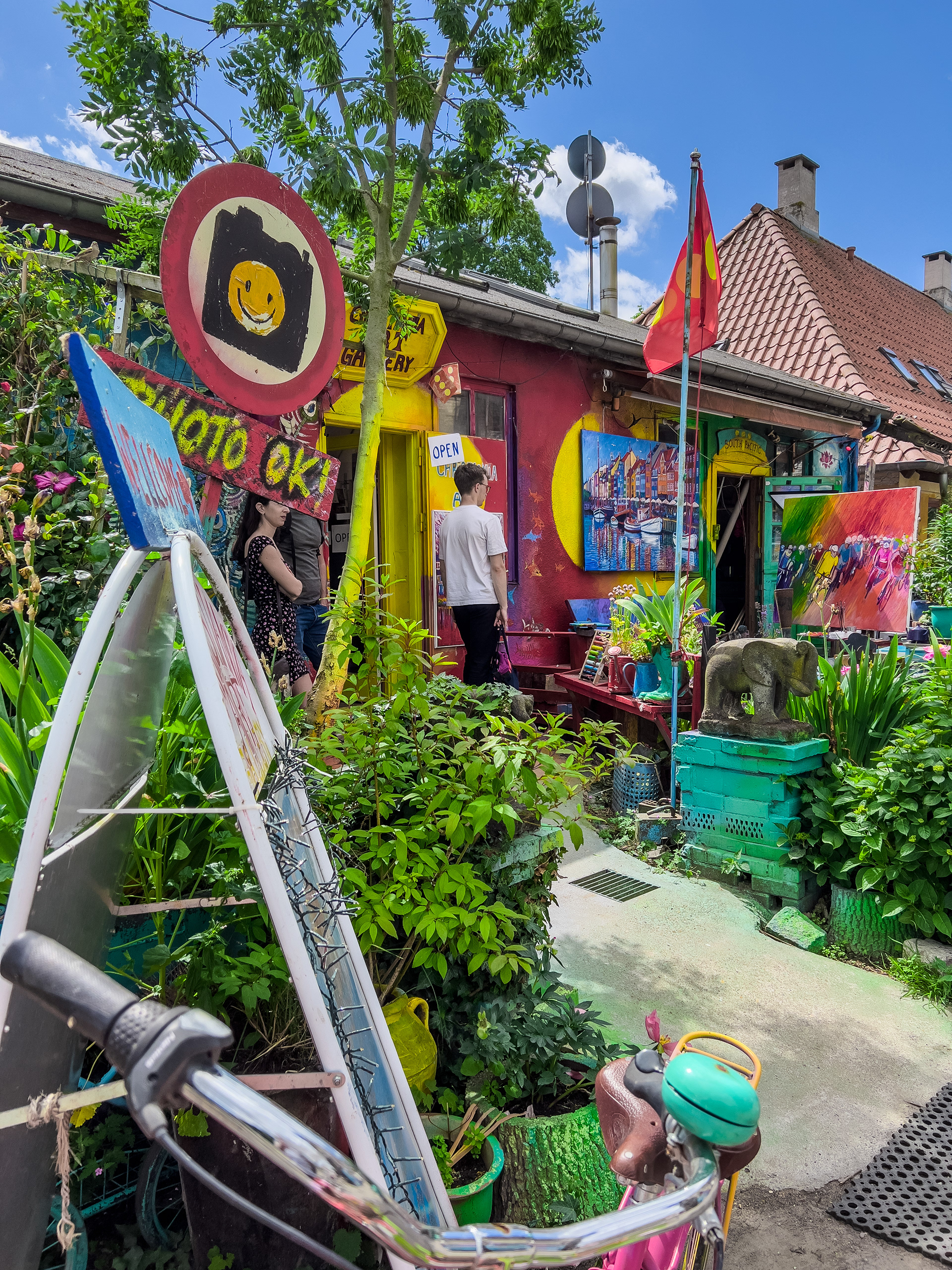
Freetown Christiania